
- Forecast
- Maps
- Live
- Weather State
- Spot Information
Coos Bay-South Jetty Surf Forecast
/ Oregon South (25 breaks) / Oregon (49 breaks) /Surf Forecasts:

Coos Bay-South Jetty surfForecast / Oregon South / USA
Forecast update in hr min s Forecast update imminent
Coos Bay-South Jetty surf forecast is for near shore open water. Breaking waves will often be smaller at less exposed spots.
Today's Coos Bay-South Jetty sea temperature is
12.0° C
(Which is slightly warmer than usual)How big are the waves at Coos Bay-South Jetty today?
The current surf forecast for Coos Bay-South Jetty at 9PM is: 1.8m 8s primary swell from a Northwest direction and 0.8m 11s secondary swell from a West-northwest direction, 0.4m 19s secondary swell from a West-northwest direction (forecast issued at 04:00pm May 02). The wind direction is predicted to be cross-onshore.
| Time (PDT) & Date | Wave Height | Wave Period |
|---|---|---|
| Morning (02 May) | - | - |
| Afternoon (02 May) | 6ft (1.8m) | 8s |
| Evening (02 May) | 6ft (1.8m) | 8s |
Table - waves today at Coos Bay-South Jetty. (Swell directed towards the surf break)
Updates in hr min s Forecast update imminent
Short Range ForecastMostly dry. Very mild (max 14°C on Sun afternoon, min 10°C on Sat night). Wind will be generally light. | ||||||||||||||||||||||||
Sat 2 | Sunday 3 | Monday 4 | Tue 5 | |||||||||||||||||||||
2 PM | 5 PM | 8 PM | 11 PM | 2 AM | 5 AM | 8 AM | 11 AM | 2 PM | 5 PM | 8 PM | 11 PM | 2 AM | 5 AM | 8 AM | 11 AM | 2 PM | 5 PM | 8 PM | 11 PM | 2 AM | 5 AM | 8 AM | 11 AM | |
Swell Height Map |    |    |    | 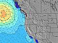 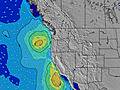 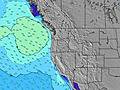 | ||||||||||||||||||||
NW 8 | NW 8 | NW 8 | NW 8 | WNW 18 | WNW 17 | WNW 16 | WNW 16 | WNW 16 | WNW 15 | WNW 14 | WNW 14 | WNW 14 | WNW 14 | WNW 13 | WNW 13 | WNW 13 | WNW 13 | WNW 13 | WNW 12 | WNW 12 | WNW 12 | WNW 12 | WNW 12 | |
449 | 449 | 482 | 479 | 398 | 419 | 457 | 679 | 914 | 983 | 1061 | 1784 | 1475 | 1214 | 998 | 865 | 816 | 816 | 688 | 645 | 522 | 514 | 444 | 437 | |
Wind (km/h) | ||||||||||||||||||||||||
cross-on | cross-on | cross-on | cross-on | cross | cross-off | cross-off | cross | cross | cross | cross-off | cross-off | cross-off | cross-off | cross-off | cross | cross | cross | cross | cross-off | cross-off | cross-off | glassy | cross-on | |
High Tide | 2:10PM1.92m | 1:13AM2.34m | 2:50PM1.89m | 1:43AM2.29m | 3:31PM1.83m | 2:16AM2.23m | ||||||||||||||||||
Low Tide | 7:22PM0.89m | 8:11AM-0.20m | 7:55PM0.98m | 8:46AM-0.16m | 8:29PM1.05m | 9:25AM-0.08m | ||||||||||||||||||
— | — | — | — | — | 6:07 | — | — | — | — | — | — | — | 6:05 | — | — | — | — | — | — | — | 6:05 | — | — | |
— | — | 8:19 | — | — | — | — | — | — | — | 8:21 | — | — | — | — | — | — | — | 8:22 | — | — | — | — | 8:22 | |
— | — | — | — | — | — | — | — | — | — | — | — | — | — | — | — | — | — | — | — | — | — | — | — | |
Temp °C | 12 | 12 | 11 | 10 | 11 | 11 | 12 | 13 | 14 | 12 | 11 | 11 | 11 | 11 | 12 | 12 | 13 | 13 | 12 | 11 | 11 | 11 | 11 | 13 |
7 | 7 | 8 | 8 | 10 | 10 | 11 | 11 | 11 | 9 | 7 | 8 | 8 | 9 | 10 | 8 | 9 | 10 | 9 | 8 | 9 | 9 | 10 | 11 | |
Swell 1 Height (m) Direction Period (s) | WNW 11 | WNW 11 | WNW 11 | NW 8 | NW 8 | NW 8 | NW 8 | NW 8 | NW 8 | WNW 15 | WNW 14 | WNW 14 | WNW 14 | WNW 14 | WNW 13 | WNW 13 | WNW 13 | WNW 13 | WNW 13 | WNW 12 | WNW 12 | WNW 12 | WNW 12 | WNW 12 |
204 | 143 | 140 | 479 | 398 | 398 | 335 | 306 | 313 | 983 | 1061 | 1784 | 1475 | 1214 | 998 | 865 | 816 | 816 | 688 | 645 | 522 | 514 | 444 | 437 | |
Swell 2 Height (m) Direction Period (s) | WNW 21 | WNW 20 | WNW 19 | WNW 11 | WNW 18 | WNW 17 | WNW 16 | WNW 16 | WNW 16 | NW 8 | NW 8 | SW 16 | NNW 8 | NNW 8 | NW 8 | NNW 8 | NNW 8 | NNW 8 | NW 8 | NNW 9 | NNW 9 | NNW 9 | NNW 9 | NNW 9 |
42 | 75 | 125 | 95 | 356 | 419 | 457 | 679 | 914 | 270 | 216 | 10 | 69 | 114 | 122 | 103 | 109 | 76 | 91 | 99 | 94 | 101 | 101 | 103 | |
Swell 3 Height (m) Direction Period (s) | WSW 13 | WSW 13 | SW 13 | WNW 18 | WNW 11 | WNW 11 | WNW 11 | WNW 12 | SW 16 | SW 16 | WSW 16 | SW 12 | SW 17 | SW 17 | SW 18 | SSW 15 | SW 15 | SW 15 | SW 15 | SW 15 | SW 16 | SW 16 | SW 16 | SW 16 |
17 | 17 | 6 | 251 | 105 | 107 | 113 | 158 | 10 | 10 | 26 | 6 | 11 | 12 | 49 | 21 | 33 | 33 | 56 | 37 | 39 | 40 | 40 | 41 | |
Wind waves Height (m) Direction Period (s) | NW 8 | NW 8 | NW 8 | — | — | — | — | — | — | — | SW 3 | SW 4 | — | — | — | SW 4 | SW 4 | SW 4 | SW 4 | SW 4 | SW 4 | — | — | — |
449 | 449 | 482 | — | — | — | — | — | — | — | 9 | 11 | — | — | — | 7 | 16 | 25 | 17 | 9 | 4 | — | — | — | |
Nearest Offshore or Glassy | ||||||||||||||||||||||||
Distance (km) | 176 | 176 | 115 | 115 | 30 | 1 | 1 | 175 | 175 | 160 | 160 | 1 | 1 | 1 | 1 | 175 | 175 | 175 | 160 | 1 | 1 | 1 | 1 | 396 |
Best forecast wave conditions in South Oregon | ||||||||||||||||||||||||
Best forecast wave conditions in United States | ||||||||||||||||||||||||
Header Global | ||||||||||||||||||||||||
- Map Icons:
 Break
Break Live Wave Height (m)
 Live Wind Speed (km/h)
 Surf Rating (10 Max)
 Ocean Swells (m)
- Wind Speed (km/h)


FREE! Surf-Forecast.com widget for your website
The surf report / weather widget below is available to embed on third party websites free of charge and provides a summary of our Coos Bay-South Jetty surf forecast. Simply grab the html code snippet that we provide and paste it into your own site. You can choose your preferred language and metric/imperial units for the surf forecast feed to suit users of your site. Click here to get the code.
 Nearest