

Surf Forecasts:

Cabarete surf forecast from 3 Aug 2026:
- Best quality surf: Saturday 8 Aug, 8AM (local time) - 3.5ft (1.0m), 8s period, ENE swell with cross-offshore winds.
- Most powerful swell: Friday 7 Aug, 5PM (local time) - 4ft (1.2m), 8s period, ENE swell with 183 kJ wave energy.
- Next surfable swell (1★+): Saturday 8 Aug, 8AM (local time) - 3.5ft (1.0m), 8s period with ENE swell.
Best Forecast Surf Conditions for Cabarete this week:
The surf forecast for Cabarete over the next 16 days: The first swell (rated 1 star or higher) is forecast to arrive on Saturday (Aug 08) at 8AM. The primary swell is predicted to be 1.0m and 8s period with a secondary swell of 0.3m and 9s. The wind is predicted to be cross-offshore as the swell arrives.
The most powerful waves expected at Cabarete in the next 16 days are 1.2m 8s and forecast to arrive on Friday (Aug 07) at 5PM. Winds are predicted to be cross-onshore at the time the swell arrives.
| Wave Type | Time (AST) & Date | Wave Height & Period |
|---|---|---|
| Next good surf (1 star+) | 8AM (Sat 8th Aug) | 3.5ft (1.0m) 8s |
| Best Surf | 8AM (Sat 8th Aug) | 3.5ft (1.0m) 8s |
| Most Powerful | 5PM (Fri 7th Aug) | 4ft (1.2m) 8s |
Table - best surf conditions forecast for Cabarete over the next 16 days.
The Lowdown
Alright folks, Rusty here. Let’s get real about what’s on the cards for the next couple of weeks.
Well, I gotta be straight with you – this outlook is a tough one. We’re looking at a solid 16 days of onshore, choppy, cross-on wind patterns hammering the coast. The swell is showing up, but the wind is just ruining it, making everything a choppy, lumpy mess. There’s not a single decent window for a clean, surfable wave anywhere in the forecast. The first solid swell pulses come in around the 14th of August, with waves pushing 5 feet from the east, but with that fresh cross-on breeze, it’s just going to be a battleground. The energy builds, hitting 338 (moderate wave energy) by the 16th, and even 427 (moderate to strong) by the 17th of August, but the wind is locked in from the east, straight cross-on.
For the whole 16 days, the story is the same: the wind is from the east, never less than 12 mph, and often pushing 19 to 22 mph. That’s cross-on for Cabarete, which is a reef break, and it needs southwest winds to be clean. The local water temp is sitting around 84°, which is pretty average for this time of year, so no surprises there.
Because of the constant poor conditions, I can’t honestly point you to a single standout break. Cabarete is the only spot in the forecast, and it’s a no-go. The consistent swell is there, but the wind state is just a dealbreaker. For a reef break like this, you need clean, glassy conditions, and we’re getting the opposite. If you’re a kiter, this setup is actually looking interesting, with that steady cross-on wind and moderate swell. For us paddle surfers, it’s a blank run. This kind of extended poor stretch isn’t unusual for the area. Sometimes you just have to let the forecast change before you get excited.
Stay patient, and keep an eye on the charts. The swell is there, waiting for the wind to turn.
Rusty.
Short Range ForecastSome drizzle, heaviest during Tue night. Warm (max 30°C on Tue afternoon, min 25°C on Mon night). Winds decreasing (fresh winds from the ENE on Mon afternoon, light winds from the SE by Tue night). | Days 4-6 Weather SummaryMostly dry. Warm (max 29°C on Thu morning, min 25°C on Thu night). Winds decreasing (fresh winds from the ENE on Thu afternoon, light winds from the SSE by Sat morning). | ||||||||||||||||||||
Monday 3 | Tuesday 4 | Wednesday 5 | Thursday 6 | Friday 7 | Saturday 8 | Sunday 9 | |||||||||||||||
AM | PM | Night | AM | PM | Night | AM | PM | Night | AM | PM | Night | AM | PM | Night | AM | PM | Night | AM | PM | Night | |
Swell Height Map |  |  |  | 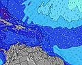 | 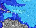 | 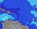 | 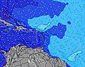 | ||||||||||||||
Wave Height (m) Direction Period (s) | E 7 | E 7 | E 7 | E 7 | E 7 | E 7 | ENE 7 | ENE 7 | ENE 7 | ENE 6 | ENE 7 | ENE 7 | ENE 7 | ENE 8 | ENE 8 | ENE 7 | ENE 6 | NE 7 | ENE 7 | ENE 7 | E 6 |
Wave Graph | |||||||||||||||||||||
156 | 173 | 114 | 94 | 128 | 89 | 58 | 73 | 58 | 70 | 135 | 137 | 135 | 183 | 120 | 104 | 130 | 75 | 96 | 131 | 84 | |
Wind (km/h) | |||||||||||||||||||||
Wind State on-shore cross-onshore cross-shore cross-offshore off-shore glassy | cross-on | cross-on | cross | cross-on | cross-on | cross | cross-on | cross-on | cross | cross-on | cross-on | cross | cross-on | cross-on | cross | cross-on | cross-on | cross | cross-on | cross-on | cross |
High Tide | 12:07PM0.60m | 00:04AM0.56m | 12:58PM0.62m | 00:45AM0.52m | 1:53PM0.64m | 1:32AM0.48m | 2:54PM0.67m | 2:26AM0.44m | 3:58PM0.69m | 3:29AM0.42m | 5:03PM0.72m | 4:39AM0.42m | 6:05PM0.75m | ||||||||
Low Tide | 6:12PM0.20m | 6:23AM0.11m | 7:12PM0.22m | 7:04AM0.09m | 8:18PM0.23m | 7:52AM0.06m | 9:28PM0.23m | 8:47AM0.04m | 10:39PM0.23m | 9:48AM0.03m | 11:44PM0.21m | 10:52AM0.01m | 00:43AM0.19m | ||||||||
6:16 | — | — | 6:18 | — | — | 6:18 | — | — | 6:18 | — | — | 6:18 | — | — | 6:18 | — | — | 6:18 | — | — | |
— | 7:16 | — | — | 7:15 | — | — | 7:15 | — | — | 7:15 | — | — | 7:15 | — | — | 7:14 | — | — | 7:14 | — | |
mm | — | — | — | — | — | 1 | — | — | — | — | — | — | — | — | — | — | — | — | — | — | — |
Temp °C | 29 | 29 | 27 | 29 | 30 | 27 | 28 | 28 | 27 | 29 | 29 | 28 | 29 | 28 | 27 | 29 | 29 | 27 | 29 | 28 | 27 |
Feels °C | 29 | 29 | 28 | 30 | 29 | 28 | 29 | 27 | 28 | 30 | 27 | 28 | 30 | 27 | 29 | 30 | 28 | 28 | 29 | 26 | 28 |
Swell 1 Height (m) Direction Period (s) | — | — | E 7 | — | — | E 7 | ENE 7 | N 9 | ENE 7 | E 11 | E 11 | ENE 7 | ENE 7 | NNE 10 | ENE 8 | ENE 7 | NE 9 | NE 7 | NE 9 | NE 9 | E 6 |
— | — | 114 | — | — | 89 | 58 | 2 | 58 | 2 | 2 | 137 | 135 | 10 | 120 | 104 | 12 | 75 | 13 | 12 | 84 | |
Swell 2 Height (m) Direction Period (s) | — | — | — | — | — | — | N 10 | — | E 12 | NE 11 | — | E 10 | E 9 | — | NE 9 | NE 9 | — | NNE 9 | N 12 | — | NE 9 |
— | — | — | — | — | — | 2 | — | 3 | 4 | — | 8 | 2 | — | 13 | 13 | — | 8 | 3 | — | 12 | |
Swell 3 Height (m) Direction Period (s) | — | — | — | — | — | — | N 10 | — | N 11 | — | — | — | — | — | — | — | — | — | — | — | NE 11 |
— | — | — | — | — | — | 2 | — | 2 | — | — | — | — | — | — | — | — | — | — | — | 5 | |
Wind waves Height (m) Direction Period (s) | E 7 | E 7 | — | E 7 | E 7 | — | — | ENE 7 | — | ENE 6 | ENE 7 | — | — | ENE 8 | — | — | ENE 6 | E 6 | ENE 7 | ENE 7 | — |
156 | 173 | — | 94 | 128 | — | — | 73 | — | 70 | 135 | — | — | 183 | — | — | 130 | 27 | 96 | 131 | — | |
Nearest Offshore or Glassy | |||||||||||||||||||||
Distance (km) | 368 | 364 | 5 | 679 | 824 | 14 | 637 | 368 | 14 | 368 | 619 | 14 | 282 | 915 | 14 | 368 | 824 | 32 | 684 | 1005 | 14 |
Best forecast wave conditions in Amber Coast | |||||||||||||||||||||
Best forecast wave conditions in Dominican Republic | |||||||||||||||||||||
Header Global | |||||||||||||||||||||
- Map Icons:
 Break
Break Live Wave Height (m)
 Live Wind Speed (km/h)
 Surf Rating (10 Max)
 Ocean Swells (m)
- Wind Speed (km/h)
Latest Updates


FREE! Surf-Forecast.com widget for your website
The surf report / weather widget below is available to embed on third party websites free of charge and provides a summary of our Cabarete surf forecast. Simply grab the html code snippet that we provide and paste it into your own site. You can choose your preferred language and metric/imperial units for the surf forecast feed to suit users of your site. Click here to get the code.
Information about the Cabarete Surf forecast
The above surf forecast table for Cabarete provides essential information for determining whether the surfing conditions will be good over the next 16 days. A general guide to surfing at Cabarete can be found by selecting the local surf guide option on the grey menu. Our Cabarete surf forecast is unique since it includes wave energy (power) that defines the real feel of the surf rather than just the height or the period. If you surf the same spot (Cabarete) regularly then make a mental note of the wave energy from the surf forecast table each time you go. Very soon you may start to choose your surf days based on the wave energy alone combined with our forecast of favourable offshore wind conditions. Our star ratings will help here and of course you will also find the usual wave height and period predictions on our surf forecasts as well as a full break down of the swell components under our advanced users option (to reveal that, click the little Einstein character under the tide times).
Further information to help with frequently asked questions about our surf forecast for Cabarete may be found under the help tab on the top menu and also by moving your mouse over the question marks on the surf forecast table itself. Please always bear in mind that the forecast is for near-shore open water and local factors at each surf break influence the actual breaking wave height, such as the beach / reef profile, water depths offshore and shelter.
Cabarete is 32 km (20 miles) from Puerto Plata. If you plan a holiday in Amber Coast, look for hotels and other accommodation in Puerto Plata. Puerto Plata has rooms for a wide range of budgets as well as car hire and transport links.
 Nearest