

Surf Forecasts:

How big are the waves at Berwick-Upon-Tweed today (03 Aug):
- Morning surf: Morning surf (03 Aug, local time) - 1ft (0.3m), 8s period with N swell.
- Afternoon surf: Afternoon surf (03 Aug, local time) - 1ft (0.3m), 9s period with N swell.
- Evening surf: Evening surf (03 Aug, local time) - 1ft (0.3m), 9s period with N swell.
The current surf forecast for Berwick-Upon-Tweed at 9AM is: 0.3m 8s primary swell from a North direction and 0.1m 8s secondary swell from a North direction, 0.3m 3s secondary swell from a Southeast direction (forecast issued at 12:00am August 03). The wind direction is predicted to be cross-onshore.
| Time (BST) & Date | Wave Height | Wave Period |
|---|---|---|
| Morning (03 Aug) | 1ft (0.3m) | 8s |
| Afternoon (03 Aug) | 1ft (0.3m) | 9s |
| Evening (03 Aug) | 1ft (0.3m) | 9s |
Table - waves today at Berwick-Upon-Tweed. (Swell directed towards the surf break)
Short Range ForecastLight rain (total 5mm), mostly falling on Mon night. Very mild (max 19°C on Tue afternoon, min 15°C on Sun night). Winds increasing (calm on Tue afternoon, fresh winds from the SW by Wed morning). | ||||||||||||||||||||||||
Monday 3 | Tuesday 4 | Wednesday 5 | ||||||||||||||||||||||
1 AM | 4 AM | 7 AM | 10 AM | 1 PM | 4 PM | 7 PM | 10 PM | 1 AM | 4 AM | 7 AM | 10 AM | 1 PM | 4 PM | 7 PM | 10 PM | 1 AM | 4 AM | 7 AM | 10 AM | 1 PM | 4 PM | 7 PM | 10 PM | |
Swell Height Map |  | 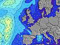 |  |  |  |  |  |  |  | |||||||||||||||
Wave Height (m) Direction Period (s) | N 8 | N 8 | N 8 | N 8 | N 9 | N 9 | N 9 | N 9 | ESE 5 | ESE 6 | ESE 6 | E 7 | E 7 | E 7 | E 7 | E 6 | ENE 6 | NE 7 | NE 7 | NE 7 | NE 7 | NNE 8 | NE 6 | NNE 7 |
Wave Graph | ||||||||||||||||||||||||
5 | 5 | 12 | 12 | 14 | 15 | 15 | 15 | 22 | 69 | 119 | 206 | 179 | 153 | 128 | 104 | 82 | 46 | 47 | 36 | 36 | 19 | 19 | 29 | |
Wind (km/h) | ||||||||||||||||||||||||
Wind State on-shore cross-onshore cross-shore cross-offshore off-shore glassy | cross-on | cross-on | cross-on | on | on | on | on | on | on | on | on | on | on | on | glassy | cross | cross-off | cross-off | cross-off | cross-off | cross-off | cross-off | cross-off | off |
High Tide | 6:05AM4.35m | 6:38PM3.94m | 6:42AM4.21m | 7:18PM3.82m | 7:25AM4.02m | 8:04PM3.67m | ||||||||||||||||||
Low Tide | 11:54PM0.77m | 12:23PM0.39m | 00:30AM0.86m | 1:00PM0.54m | 1:10AM0.99m | 1:42PM0.75m | ||||||||||||||||||
— | 5:15 | — | — | — | — | — | — | — | 5:16 | — | — | — | — | — | — | — | 5:18 | — | — | — | — | — | — | |
— | — | — | — | — | — | 9:10 | — | — | — | — | — | — | — | 9:08 | — | — | — | — | — | — | — | 9:07 | — | |
mm | — | — | — | — | — | — | — | — | — | 2 | 1 | — | — | — | 1 | 1 | — | — | — | — | — | — | — | — |
Temp °C | 15 | 15 | 15 | 15 | 15 | 16 | 16 | 15 | 15 | 15 | 15 | 16 | 16 | 18 | 19 | 17 | 17 | 15 | 15 | 16 | 19 | 16 | 15 | 15 |
Feels °C | 13 | 13 | 13 | 13 | 13 | 13 | 13 | 12 | 12 | 13 | 12 | 14 | 15 | 19 | 20 | 17 | 17 | 14 | 13 | 11 | 13 | 10 | 11 | 12 |
Swell 1 Height (m) Direction Period (s) | N 8 | N 8 | N 8 | N 8 | N 9 | N 9 | N 9 | N 9 | N 9 | N 9 | N 9 | E 7 | E 7 | E 7 | E 7 | E 6 | ENE 6 | NE 7 | NE 7 | NE 7 | NE 7 | NE 6 | NE 6 | NNE 7 |
5 | 5 | 12 | 12 | 14 | 15 | 15 | 15 | 15 | 14 | 14 | 152 | 179 | 153 | 128 | 104 | 82 | 46 | 47 | 36 | 36 | 19 | 19 | 29 | |
Swell 2 Height (m) Direction Period (s) | N 8 | N 8 | N 8 | SE 3 | SE 3 | — | — | — | — | — | — | N 9 | N 8 | NNE 8 | NNE 8 | NNE 8 | NNE 8 | E 6 | E 6 | E 6 | E 6 | ESE 6 | SSE 5 | SE 6 |
5 | 1 | 1 | 2 | 2 | — | — | — | — | — | — | 13 | 13 | 14 | 14 | 22 | 20 | 36 | 25 | 16 | 16 | 10 | 9 | 8 | |
Swell 3 Height (m) Direction Period (s) | N 8 | — | — | — | — | — | — | — | — | — | — | — | — | N 8 | N 8 | — | N 8 | NNE 8 | NNE 8 | NNE 8 | NNE 8 | NNE 8 | NNE 8 | E 5 |
1 | — | — | — | — | — | — | — | — | — | — | — | — | 5 | 1 | — | 30 | 20 | 21 | 21 | 20 | 19 | 11 | 5 | |
Wind waves Height (m) Direction Period (s) | SE 3 | SE 3 | SE 3 | — | ESE 3 | E 3 | ESE 3 | E 4 | ESE 5 | ESE 6 | ESE 6 | E 7 | — | — | — | — | — | — | — | — | SW 2 | SSW 3 | SW 3 | SW 3 |
1 | 1 | 1 | — | 1 | 1 | 3 | 7 | 22 | 69 | 119 | 206 | — | — | — | — | — | — | — | — | 1 | 9 | 7 | 6 | |
Nearest Offshore or Glassy | ||||||||||||||||||||||||
Distance (km) | 293 | 210 | 210 | 314 | 319 | 212 | 334 | 328 | 335 | 335 | 148 | 85 | 85 | 38 | 0 | 13 | 0 | 0 | 0 | 28 | 90 | 151 | 156 | 846 |
Best forecast wave conditions in North East England | ||||||||||||||||||||||||
Best forecast wave conditions in United Kingdom | ||||||||||||||||||||||||
Header Global | ||||||||||||||||||||||||
- Map Icons:
 Break
Break Live Wave Height (m)
 Live Wind Speed (km/h)
 Surf Rating (10 Max)
 Ocean Swells (m)
- Wind Speed (km/h)
Latest Updates


FREE! Surf-Forecast.com widget for your website
The surf report / weather widget below is available to embed on third party websites free of charge and provides a summary of our Berwick-Upon-Tweed surf forecast. Simply grab the html code snippet that we provide and paste it into your own site. You can choose your preferred language and metric/imperial units for the surf forecast feed to suit users of your site. Click here to get the code.
 Nearest