

Surf Forecasts:

How big are the waves at Ballyconnell today (30 Jul):
- Morning surf: Morning surf (30 Jul, local time) - 4ft (1.2m), 8s period with WNW swell.
- Afternoon surf: Afternoon surf (30 Jul, local time) - 3.5ft (1.0m), 7s period with WNW swell.
- Evening surf: Evening surf (30 Jul, local time) - 3.5ft (1.0m), 7s period with WNW swell.
The current surf forecast for Ballyconnell at 8AM is: 1.1m 8s primary swell from a West-northwest direction and 0.5m 9s secondary swell from a North direction (forecast issued at 12:00am July 30). The wind direction is predicted to be cross-onshore.
| Time (IST) & Date | Wave Height | Wave Period |
|---|---|---|
| Morning (30 Jul) | 4ft (1.2m) | 8s |
| Afternoon (30 Jul) | 3.5ft (1.0m) | 7s |
| Evening (30 Jul) | 3.5ft (1.0m) | 7s |
Table - waves today at Ballyconnell. (Swell directed towards the surf break)
Short Range ForecastLight rain (total 5mm), mostly falling on Wed night. Very mild (max 15°C on Thu morning, min 12°C on Thu night). Wind will be generally light. | ||||||||||||||||||||||||
Thursday 30 | Friday 31 | Saturday 1 | ||||||||||||||||||||||
1 AM | 4 AM | 7 AM | 10 AM | 1 PM | 4 PM | 7 PM | 10 PM | 1 AM | 4 AM | 7 AM | 10 AM | 1 PM | 4 PM | 7 PM | 10 PM | 1 AM | 4 AM | 7 AM | 10 AM | 1 PM | 4 PM | 7 PM | 10 PM | |
Swell Height Map |  | 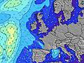 |  |  |  |  |  |  |  | |||||||||||||||
Wave Height (m) Direction Period (s) | W 7 | WNW 7 | WNW 8 | WNW 8 | WNW 8 | W 7 | WNW 7 | W 7 | W 7 | W 7 | W 7 | W 7 | W 7 | W 7 | W 7 | WNW 7 | WNW 7 | WNW 6 | WNW 6 | WNW 6 | WNW 6 | WNW 7 | NW 7 | NW 7 |
Wave Graph | ||||||||||||||||||||||||
112 | 117 | 135 | 155 | 120 | 112 | 102 | 107 | 107 | 128 | 111 | 131 | 113 | 94 | 92 | 73 | 58 | 51 | 59 | 59 | 60 | 76 | 88 | 91 | |
Wind (km/h) | ||||||||||||||||||||||||
Wind State on-shore cross-onshore cross-shore cross-offshore off-shore glassy | cross-on | cross-on | cross-on | cross-on | cross-on | cross-on | cross-on | cross-on | cross | cross | cross | cross-on | cross-on | on | on | cross-on | cross-on | cross-on | cross | cross-on | on | on | on | on |
High Tide | 7:09AM2.95m | 7:28PM3.48m | 7:42AM3.00m | 7:59PM3.54m | 8:15AM3.02m | 8:31PM3.54m | ||||||||||||||||||
Low Tide | 1:05AM0.48m | 1:02PM0.37m | 1:38AM0.39m | 1:33PM0.31m | 2:09AM0.34m | 2:04PM0.32m | ||||||||||||||||||
— | 5:41 | — | — | — | — | — | — | — | 5:43 | — | — | — | — | — | — | — | 5:45 | — | — | — | — | — | — | |
— | — | — | — | — | — | 9:38 | — | — | — | — | — | — | — | 9:37 | — | — | — | — | — | — | — | 9:35 | — | |
mm | — | 1 | — | — | — | 1 | 1 | — | 1 | — | 1 | — | — | — | — | — | — | — | — | — | — | — | — | — |
Temp °C | 13 | 13 | 13 | 14 | 15 | 15 | 15 | 13 | 12 | 12 | 12 | 14 | 15 | 15 | 15 | 14 | 13 | 12 | 12 | 14 | 15 | 14 | 14 | 14 |
Feels °C | 10 | 10 | 9 | 10 | 11 | 10 | 10 | 9 | 8 | 8 | 8 | 10 | 11 | 10 | 11 | 11 | 10 | 9 | 9 | 11 | 12 | 11 | 12 | 13 |
Swell 1 Height (m) Direction Period (s) | NNW 9 | N 9 | N 9 | NW 8 | NW 7 | NNW 8 | NNW 8 | N 8 | N 7 | NNW 7 | NNW 7 | NNW 8 | NNW 8 | N 8 | N 8 | N 8 | N 8 | NW 7 | N 7 | W 9 | W 9 | W 9 | NW 7 | NW 7 |
48 | 41 | 39 | 29 | 26 | 50 | 35 | 29 | 27 | 18 | 18 | 19 | 19 | 10 | 10 | 10 | 10 | 7 | 4 | 14 | 14 | 14 | 88 | 91 | |
Swell 2 Height (m) Direction Period (s) | NNW 9 | NNW 9 | — | N 9 | NNW 9 | — | — | — | — | — | — | W 12 | W 11 | W 11 | W 11 | W 10 | W 10 | N 7 | W 9 | N 7 | N 7 | WNW 8 | W 9 | W 9 |
9 | 8 | — | 40 | 25 | — | — | — | — | — | — | 3 | 3 | 2 | 2 | 2 | 8 | 10 | 7 | 4 | 4 | 7 | 14 | 13 | |
Swell 3 Height (m) Direction Period (s) | — | — | — | — | — | — | — | — | — | — | — | — | — | — | — | — | — | W 10 | — | NW 8 | NNW 7 | N 7 | — | N 10 |
— | — | — | — | — | — | — | — | — | — | — | — | — | — | — | — | — | 8 | — | 2 | 5 | 4 | — | 2 | |
Wind waves Height (m) Direction Period (s) | W 7 | WNW 7 | WNW 8 | WNW 8 | WNW 8 | W 7 | WNW 7 | W 7 | W 7 | W 7 | W 7 | W 7 | W 7 | W 7 | W 7 | WNW 7 | WNW 7 | WNW 6 | WNW 6 | WNW 6 | WNW 6 | WNW 7 | — | — |
112 | 117 | 135 | 155 | 120 | 112 | 102 | 107 | 107 | 128 | 111 | 131 | 113 | 94 | 92 | 73 | 58 | 51 | 59 | 59 | 60 | 76 | — | — | |
Nearest Offshore or Glassy | ||||||||||||||||||||||||
Distance (km) | 12 | 39 | 39 | 526 | 526 | 570 | 118 | 118 | 37 | 39 | 22 | 12 | 265 | 523 | 1396 | 39 | 22 | 22 | 22 | 254 | 269 | 269 | 269 | 39 |
Best forecast wave conditions in Sligo | ||||||||||||||||||||||||
Best forecast wave conditions in Ireland | ||||||||||||||||||||||||
Header Global | ||||||||||||||||||||||||
- Map Icons:
 Break
Break Live Wave Height (m)
 Live Wind Speed (km/h)
 Surf Rating (10 Max)
 Ocean Swells (m)
- Wind Speed (km/h)


FREE! Surf-Forecast.com widget for your website
The surf report / weather widget below is available to embed on third party websites free of charge and provides a summary of our Ballyconnell surf forecast. Simply grab the html code snippet that we provide and paste it into your own site. You can choose your preferred language and metric/imperial units for the surf forecast feed to suit users of your site. Click here to get the code.
 Nearest