

Surf Forecasts:

Ambatia Beach surf forecast from 2 Aug 2026:
- Most powerful swell: Sunday 9 Aug, 6AM (local time) - 2.5ft (0.7m), 7s period, WNW swell with 48 kJ wave energy.
Best Forecast Surf Conditions for Ambatia Beach this week:
The most powerful waves expected at Ambatia Beach in the next 16 days are 0.7m 7s and forecast to arrive on Sunday (Aug 09) at 6AM. Winds are predicted to be cross-shore at the time the swell arrives. The largest open ocean swell (not directed at the beach) is 0.6m 4s period and expected on Monday (Aug 03) at 9AM.
| Wave Type | Time (IDT) & Date | Wave Height & Period |
|---|---|---|
| Next good surf (1 star+) | - | - |
| Best Surf | - | - |
| Most Powerful | 6AM (Sun 9th Aug) | 2.5ft (0.7m) 7s |
Table - best surf conditions forecast for Ambatia Beach over the next 16 days.
The Lowdown
Alright, I’ve stared at these charts for a while now, and I gotta be straight with you – this is a tough stretch we’re looking at. The whole 16-day window is basically a write-off for surf. There’s just nothing good on offer for Ambatia Beach.
This spot is a sheltered beach and reef setup that rarely breaks to begin with, and the whole forecast period is a mess of weak, short-period swell and poor wind. The water is sitting at 85°, which is a touch warmer than what’s normal for this time of year, but that’s the only interesting thing going on.
From the start on Sunday, August 2nd, right through the middle of the month, we’re looking at tiny swell – mostly 1 ft to 2 ft – with period barely scratching 6 or 7 seconds. That’s just windswill, no power behind it. The combined energy is weak, often in the teens or low thirties (34, 19, 17), so there’s no grunt to push a wave. Winds are mostly cross-on or onshore, chopping everything up. Even the few glassy moments, like Monday morning August 10th, only have 2 ft of swell – not enough to paddle for.
Things pick up a little around the second week, starting Friday morning August 14th, with swell bumping to 4 ft, then 5 ft by Saturday morning August 15th, and the energy jumps into the hundreds (128, 330, 280). But it’s still short period – 7 to 8 seconds – and the winds stay cross or cross-on, keeping the surface messy. Even with a bit more size, it’s still tagged as poor surf conditions. Nothing cleans up.
For beginners, the swell never gets above 5 ft until the 15th, and even then it’s small enough, but the quality is just not there. For experts, the 5 ft on the 15th could be ridden, but with the onshore chop and short period, it’s not going to be worth the paddle out. Honestly, this setup looks more interesting for kite surfing than paddle surfing when the wind kicks up.
There are no good surf options in this 16-day window. It’s a blank run for Ambatia Beach, which is a bit more normal for a spot that rarely breaks. Forecasts can change, but right now, there’s nothing to get excited about.
Rusty
Short Range ForecastMostly dry. Warm (max 31°C on Sun afternoon, min 25°C on Tue night). Wind will be generally light. | Days 5-7 Weather SummaryMostly dry. Warm (max 29°C on Wed afternoon, min 25°C on Fri night). Wind will be generally light. | |||||||||||||||||||
Sun 2 | Monday 3 | Tuesday 4 | Wednesday 5 | Thursday 6 | Friday 7 | Saturday 8 | ||||||||||||||
PM | Night | AM | PM | Night | AM | PM | Night | AM | PM | Night | AM | PM | Night | AM | PM | Night | AM | PM | Night | |
Swell Height Map | 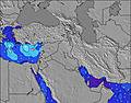 | 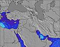 | 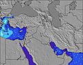 | 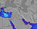 | 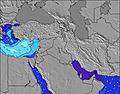 | 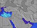 | 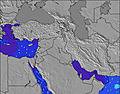 | |||||||||||||
Wave Height (m) Direction Period (s) | NW 6 | NNW 4 | WNW 6 | NW 5 | NW 4 | WNW 5 | NW 6 | WNW 6 | WNW 6 | WNW 6 | WNW 6 | WNW 6 | WNW 6 | WNW 6 | WNW 6 | WNW 6 | WNW 6 | WNW 7 | WNW 7 | WNW 7 |
Wave Graph | ||||||||||||||||||||
34 | 15 | 7 | 19 | 12 | 17 | 32 | 34 | 35 | 37 | 37 | 30 | 29 | 33 | 22 | 21 | 15 | 36 | 26 | 47 | |
Wind (km/h) | ||||||||||||||||||||
Wind State on-shore cross-onshore cross-shore cross-offshore off-shore glassy | cross-on | cross | cross-on | cross-on | cross-on | on | on | glassy | cross | on | glassy | cross | on | glassy | cross-on | on | cross-on | cross-on | cross-on | cross |
High Tide | 1:24AM0.34m | 1:28PM0.34m | 1:58AM0.33m | 2:06PM0.30m | 2:39AM0.32m | 2:55PM0.26m | 3:35AM0.30m | 4:22PM0.22m | 5:09AM0.29m | 7:16PM0.22m | 7:08AM0.30m | 8:51PM0.25m | ||||||||
Low Tide | 7:13PM0.03m | 7:24AM0.07m | 7:42PM0.06m | 8:06AM0.09m | 8:15PM0.09m | 9:00AM0.11m | 8:55PM0.12m | 10:27AM0.13m | 10:00PM0.15m | 12:49PM0.13m | 00:18AM0.17m | 2:27PM0.09m | 2:06AM0.15m | |||||||
— | — | 5:56 | — | — | 5:56 | — | — | 5:56 | — | — | 5:58 | — | — | 5:58 | — | — | 5:58 | — | — | |
7:37 | — | — | 7:37 | — | — | 7:36 | — | — | 7:35 | — | — | 7:34 | — | — | 7:32 | — | — | 7:31 | — | |
mm | — | — | — | — | — | — | — | — | — | — | — | — | — | — | — | — | — | — | — | — |
Temp °C | 31 | 28 | 30 | 30 | 27 | 29 | 29 | 27 | 28 | 29 | 27 | 29 | 29 | 27 | 29 | 29 | 27 | 28 | 28 | 27 |
Feels °C | 29 | 28 | 29 | 28 | 28 | 30 | 29 | 29 | 30 | 30 | 31 | 30 | 29 | 29 | 29 | 28 | 29 | 28 | 28 | 30 |
Swell 1 Height (m) Direction Period (s) | — | WNW 6 | NW 4 | — | NW 4 | WNW 5 | — | WNW 6 | WNW 6 | WNW 6 | WNW 6 | WNW 6 | — | WNW 6 | WNW 6 | — | WNW 6 | WNW 7 | WNW 7 | WNW 7 |
— | 8 | 16 | — | 12 | 17 | — | 34 | 35 | 37 | 37 | 30 | — | 33 | 22 | — | 15 | 36 | 26 | 47 | |
Swell 2 Height (m) Direction Period (s) | — | — | WNW 6 | — | WNW 6 | — | — | — | — | — | — | — | — | — | — | — | WNW 7 | — | — | — |
— | — | 7 | — | 3 | — | — | — | — | — | — | — | — | — | — | — | 11 | — | — | — | |
Swell 3 Height (m) Direction Period (s) | — | — | — | — | — | — | — | — | — | — | — | — | — | — | — | — | — | — | — | — |
— | — | — | — | — | — | — | — | — | — | — | — | — | — | — | — | — | — | — | — | |
Wind waves Height (m) Direction Period (s) | NW 6 | NNW 4 | — | NW 5 | — | — | NW 6 | — | — | — | — | — | WNW 6 | — | — | WNW 6 | — | — | W 3 | — |
34 | 15 | — | 19 | — | — | 32 | — | — | — | — | — | 29 | — | — | 21 | — | — | 1 | — | |
Nearest Offshore or Glassy | ||||||||||||||||||||
Distance (km) | 2224 | 2224 | 2224 | 3744 | 2224 | 2224 | 2224 | 25 | 2710 | 2224 | 98 | 3387 | 2224 | 2224 | 2224 | 2224 | 2224 | 2224 | 3634 | 3 |
Best forecast wave conditions in Tel Aviv and South | ||||||||||||||||||||
Best forecast wave conditions in Israel | ||||||||||||||||||||
Header Global | ||||||||||||||||||||
- Map Icons:
 Break
Break Live Wave Height (m)
 Live Wind Speed (km/h)
 Surf Rating (10 Max)
 Ocean Swells (m)
- Wind Speed (km/h)
Latest Updates


FREE! Surf-Forecast.com widget for your website
The surf report / weather widget below is available to embed on third party websites free of charge and provides a summary of our Ambatia Beach surf forecast. Simply grab the html code snippet that we provide and paste it into your own site. You can choose your preferred language and metric/imperial units for the surf forecast feed to suit users of your site. Click here to get the code.
Information about the Ambatia Beach Surf forecast
The above surf forecast table for Ambatia Beach provides essential information for determining whether the surfing conditions will be good over the next 16 days. A general guide to surfing at Ambatia Beach can be found by selecting the local surf guide option on the grey menu. Our Ambatia Beach surf forecast is unique since it includes wave energy (power) that defines the real feel of the surf rather than just the height or the period. If you surf the same spot (Ambatia Beach) regularly then make a mental note of the wave energy from the surf forecast table each time you go. Very soon you may start to choose your surf days based on the wave energy alone combined with our forecast of favourable offshore wind conditions. Our star ratings will help here and of course you will also find the usual wave height and period predictions on our surf forecasts as well as a full break down of the swell components under our advanced users option (to reveal that, click the little Einstein character under the tide times).
Further information to help with frequently asked questions about our surf forecast for Ambatia Beach may be found under the help tab on the top menu and also by moving your mouse over the question marks on the surf forecast table itself. Please always bear in mind that the forecast is for near-shore open water and local factors at each surf break influence the actual breaking wave height, such as the beach / reef profile, water depths offshore and shelter.
Ambatia Beach is 0 km (0 miles) from the city of Netanya. If you plan a holiday in Tel Aviv and South, look for hotels and other accommodation in Netanya. Netanya has rooms for a wide range of budgets as well as car hire and transport links.
 Nearest