

Surf Forecasts:

Alize surf forecast from 2 Aug 2026:
- Most powerful swell: Sunday 2 Aug, 11AM (local time) - 5ft (1.6m), 7s period, E swell with 260 kJ wave energy.
Best Forecast Surf Conditions for Alize this week:
The most powerful waves expected at Alize in the next 16 days are 1.6m 7s and forecast to arrive on Sunday (Aug 02) at 11AM. Winds are predicted to be cross-shore at the time the swell arrives. The largest open ocean swell (not directed at the beach) is 0.7m 5s period and expected on Wednesday (Aug 05) at 5PM.
| Wave Type | Time (AST) & Date | Wave Height & Period |
|---|---|---|
| Next good surf (1 star+) | - | - |
| Best Surf | - | - |
| Most Powerful | 11AM (Sun 2nd Aug) | 5ft (1.6m) 7s |
Table - best surf conditions forecast for Alize over the next 16 days.
The Lowdown
Alright, folks, Rusty here. Let’s get stuck into what’s on the table for the next couple of weeks.
Well, I’ll be honest with you, it’s a pretty grim stretch ahead. We’re looking at a solid 16-day window with no real standout sessions to get excited about. The forecast is basically a long, drawn-out run of lumpy, cross-shore junk. The water is sitting at 84° – that’s about normal for this time of year, so at least you won’t be freezing your toes off while you’re getting frustrated.
For the first week, from Sunday the 2nd right through to Saturday the 8th, it’s all poor surf conditions. We’ve got a constant easterly wind, mostly fresh, blowing cross-shore or cross-onshore, churning up a lumpy cross-chop. Swell heights bounce around from 2 ft to 5 ft, but that short period of 6 to 7 seconds means no power and no shape. Wave energy is weak to moderate at best, like 51 (weak) on Thursday morning up to 268 (moderate) on Sunday the 9th, but it’s all blown out. On Wednesday morning the 5th, it goes clean with a cross-offshore breeze, but the swell is a tiny 2 ft – barely a ripple.
The second week doesn’t get any better. From Sunday the 9th through to Saturday the 16th, the story is the same: easterly winds, cross-shore or cross-onshore, creating lumpy, choppy conditions. Swell builds a bit, hitting 7 ft by Thursday the 13th and Saturday the 16th, but that period only stretches to 8 seconds. The wave energy gets stronger – 624 (strong) on the 16th – but with that short period and wind, it’s just a messy, chunky wall of water. This is strictly for the experts, and even then, it’s not going to be pretty. The only break on the map is Alize (Alize), a beach and reef setup, which is normally a good beginner-friendly spot. But with this wind and swell, it’s honestly looking more interesting for the kite surfers than for paddle surfers.
There’s a big gap of about 16 days with no good recommendations. It’s a blank run, but Alize is usually consistent, so don’t lose hope – forecasts can change, and it tends not to stay this poor for long.
Rusty.
Short Range ForecastLight rain (total 3mm), mostly falling on Sun morning. Warm (max 28°C on Sun afternoon, min 26°C on Mon night). Mainly fresh winds. | Days 4-6 Weather SummaryLight rain (total 4mm), mostly falling on Thu night. Warm (max 28°C on Fri afternoon, min 26°C on Wed night). Mainly fresh winds. | ||||||||||||||||||||
Sunday 2 | Monday 3 | Tuesday 4 | Wednesday 5 | Thursday 6 | Friday 7 | Saturday 8 | |||||||||||||||
AM | PM | Night | AM | PM | Night | AM | PM | Night | AM | PM | Night | AM | PM | Night | AM | PM | Night | AM | PM | Night | |
Swell Height Map |  |  |  | 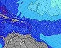 | 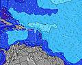 | 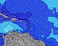 | 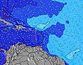 | ||||||||||||||
Wave Height (m) Direction Period (s) | E 7 | E 7 | E 7 | E 7 | E 7 | ENE 7 | E 7 | SE 7 | SE 6 | NE 7 | NE 6 | NE 8 | ESE 5 | ESE 6 | E 6 | SE 7 | E 7 | ESE 8 | E 7 | E 7 | ENE 7 |
Wave Graph | |||||||||||||||||||||
260 | 229 | 200 | 163 | 139 | 77 | 92 | 36 | 43 | 28 | 20 | 35 | 60 | 83 | 157 | 91 | 161 | 98 | 183 | 210 | 99 | |
Wind (km/h) | |||||||||||||||||||||
Wind State on-shore cross-onshore cross-shore cross-offshore off-shore glassy | cross | cross | cross | cross | cross | cross | cross | cross | cross | cross-off | cross-off | cross | cross | cross | cross-on | cross | cross-on | cross-on | cross | cross | cross-on |
High Tide | 6:24PM0.38m | 6:11AM0.35m | 6:43PM0.39m | 7:13AM0.31m | 7:08PM0.40m | 8:45AM0.28m | 7:41PM0.41m | 8:25PM0.41m | 9:27PM0.41m | 10:48PM0.42m | |||||||||||
Low Tide | 11:59AM0.17m | 00:36AM0.23m | 12:17PM0.20m | 1:37AM0.20m | 12:29PM0.23m | 2:48AM0.16m | 12:24PM0.26m | 4:08AM0.13m | 5:27AM0.09m | 6:38AM0.05m | |||||||||||
5:46 | — | — | 5:46 | — | — | 5:46 | — | — | 5:46 | — | — | 5:47 | — | — | 5:47 | — | — | 5:47 | — | — | |
— | 6:36 | — | — | 6:36 | — | — | 6:35 | — | — | 6:35 | — | — | 6:34 | — | — | 6:34 | — | — | 6:32 | — | |
mm | 1 | — | — | — | — | — | — | 1 | 1 | — | — | — | — | — | 2 | — | — | 2 | — | — | — |
Temp °C | 27 | 28 | 28 | 27 | 27 | 27 | 27 | 27 | 27 | 27 | 27 | 27 | 27 | 27 | 27 | 27 | 28 | 27 | 27 | 28 | 28 |
Feels °C | 26 | 28 | 27 | 26 | 28 | 28 | 29 | 29 | 29 | 29 | 27 | 29 | 27 | 26 | 28 | 25 | 26 | 27 | 26 | 27 | 29 |
Swell 1 Height (m) Direction Period (s) | E 12 | E 12 | N 11 | N 11 | N 10 | SE 7 | E 7 | SE 7 | SE 6 | NE 7 | NE 6 | NE 8 | NE 7 | NE 7 | SE 9 | SE 7 | NE 7 | ESE 8 | NNE 9 | NNE 9 | ESE 7 |
3 | 3 | 2 | 2 | 2 | 42 | 92 | 36 | 21 | 28 | 20 | 35 | 23 | 25 | 21 | 91 | 12 | 98 | 15 | 15 | 86 | |
Swell 2 Height (m) Direction Period (s) | — | — | N 11 | E 11 | — | N 10 | E 11 | E 7 | NE 7 | E 6 | E 10 | ENE 9 | ENE 9 | ENE 9 | ENE 8 | NE 7 | NE 9 | NNE 9 | E 12 | SE 12 | NNE 9 |
— | — | 2 | 2 | — | 2 | 2 | 22 | 21 | 7 | 17 | 17 | 16 | 15 | 14 | 14 | 23 | 8 | 3 | 6 | 15 | |
Swell 3 Height (m) Direction Period (s) | — | — | — | — | — | — | N 10 | NE 6 | E 7 | E 10 | E 7 | ESE 8 | ESE 10 | SE 10 | NNE 10 | NNE 10 | — | — | — | — | NE 12 |
— | — | — | — | — | — | 2 | 21 | 8 | 8 | 4 | 6 | 9 | 14 | 9 | 9 | — | — | — | — | 6 | |
Wind waves Height (m) Direction Period (s) | E 7 | E 7 | E 7 | E 7 | E 7 | ENE 7 | — | — | SE 6 | ESE 6 | ESE 5 | ESE 5 | ESE 5 | ESE 6 | E 6 | ENE 6 | E 7 | ENE 7 | E 7 | E 7 | ENE 7 |
260 | 229 | 200 | 163 | 139 | 77 | — | — | 43 | 24 | 23 | 35 | 60 | 83 | 157 | 80 | 161 | 85 | 183 | 210 | 99 | |
Nearest Offshore or Glassy | |||||||||||||||||||||
Distance (km) | 531 | 476 | 561 | 531 | 865 | 429 | 113 | 177 | 113 | 241 | 429 | 550 | 668 | 429 | 550 | 671 | 476 | 31 | 885 | 241 | 476 |
Best forecast wave conditions in Guadeloupe - Grande Terre | |||||||||||||||||||||
Best forecast wave conditions in Guadeloupe | |||||||||||||||||||||
Header Global | |||||||||||||||||||||
- Map Icons:
 Break
Break Live Wave Height (m)
 Live Wind Speed (km/h)
 Surf Rating (10 Max)
 Ocean Swells (m)
- Wind Speed (km/h)
Latest Updates


FREE! Surf-Forecast.com widget for your website
The surf report / weather widget below is available to embed on third party websites free of charge and provides a summary of our Alize surf forecast. Simply grab the html code snippet that we provide and paste it into your own site. You can choose your preferred language and metric/imperial units for the surf forecast feed to suit users of your site. Click here to get the code.
Information about the Alize Surf forecast
The above surf forecast table for Alize provides essential information for determining whether the surfing conditions will be good over the next 16 days. A general guide to surfing at Alize can be found by selecting the local surf guide option on the grey menu. Our Alize surf forecast is unique since it includes wave energy (power) that defines the real feel of the surf rather than just the height or the period. If you surf the same spot (Alize) regularly then make a mental note of the wave energy from the surf forecast table each time you go. Very soon you may start to choose your surf days based on the wave energy alone combined with our forecast of favourable offshore wind conditions. Our star ratings will help here and of course you will also find the usual wave height and period predictions on our surf forecasts as well as a full break down of the swell components under our advanced users option (to reveal that, click the little Einstein character under the tide times).
Further information to help with frequently asked questions about our surf forecast for Alize may be found under the help tab on the top menu and also by moving your mouse over the question marks on the surf forecast table itself. Please always bear in mind that the forecast is for near-shore open water and local factors at each surf break influence the actual breaking wave height, such as the beach / reef profile, water depths offshore and shelter.
Alize is 7 km (4 miles) from Le Moule. If you plan a holiday in Guadeloupe - Grande Terre, look for hotels and other accommodation in Le Moule. Le Moule has rooms for a wide range of budgets as well as car hire and transport links.
 Nearest