

Surf Forecasts:

Bagasse surf forecast from 3 Aug 2026:
- Best quality surf: Tuesday 4 Aug, 2PM (local time) - 2.5ft (0.8m), 7s period, ENE swell with cross-offshore winds.
- Most powerful swell: Saturday 8 Aug, 2PM (local time) - 5ft (1.6m), 7s period, ENE swell with 212 kJ wave energy.
- Next surfable swell (1★+): Tuesday 4 Aug, 2PM (local time) - 2.5ft (0.8m), 7s period with ENE swell.
Best Forecast Surf Conditions for Bagasse this week:
The surf forecast for Bagasse over the next 16 days: The first swell (rated 1 star or higher) is forecast to arrive on Tuesday (Aug 04) at 2PM. The primary swell is predicted to be 0.8m and 7s period with a secondary swell of 0.1m and 10s. The wind is predicted to be cross-offshore as the swell arrives.
The most powerful waves expected at Bagasse in the next 16 days are 1.6m 7s and forecast to arrive on Saturday (Aug 08) at 2PM. Winds are predicted to be cross-offshore at the time the swell arrives. The largest open ocean swell (not directed at the beach) is 1.2m 6s period and expected on Thursday (Aug 06) at 2PM.
| Wave Type | Time (AST) & Date | Wave Height & Period |
|---|---|---|
| Next good surf (1 star+) | 2PM (Tue 4th Aug) | 2.5ft (0.8m) 7s |
| Best Surf | 2PM (Tue 4th Aug) | 2.5ft (0.8m) 7s |
| Most Powerful | 2PM (Sat 8th Aug) | 5ft (1.6m) 7s |
Table - best surf conditions forecast for Bagasse over the next 16 days.
The Lowdown
Alright, Rusty here. Let’s have a look at what’s on the cards for Bagasse over the next couple of weeks.
Straight up, I’m gonna be honest with you – this outlook is a bit of a rough one. For the first ten days or so, the surf is just not cooperating. We’ve got a lot of weak, short-period windswell rolling in, mostly from the ENE, and the wind is stuck in a cross-off or cross pattern. That clean-ish look is nice, but with swell heights hovering around 2 ft to 5 ft and periods between 6 and 7 seconds, the waves are just gutless and messy. The combined energy is weak to moderate (41 to 225), and the wave comment across the board is “poor surf conditions.” Honestly, there’s nothing to get excited about. The water is sitting at 84°F, which is pretty normal for this time of year.
Now, let’s talk about the one window that might be worth your time. It’s all the way out on the 13th of August. Thursday morning, the swell jumps up to 7 ft from the E, with a period of 8 seconds. The combined energy spikes to 636 (moderate strength), and the wind is a cross-off from the E at 19 mph. This is the closest we get to a standout. The wave comment is “marginal,” but that’s the best we’re going to see. This is a reef break, so a longer-period swell like this should hold its shape better than at a beach break. Still, 7 ft is getting into expert-only territory. It’s not perfect, but it’s the best on offer.
The 15th and 16th of August see similar sizes – 7 ft to 8 ft – but the wind turns more cross, and the energy is higher (516 to 978). The wave comments are still “marginal” or “poor.” The 8 ft on the 16th is big, but with a short period of 9 seconds and cross-shore winds, it’s going to be lumpy and messy. That’s more of a kite-surfing setup than a clean paddle session.
So, to sum it up: we’ve got a long stretch of flat or poor conditions, then a brief window of bigger, marginal swell that’s best left to the experts. The 13th of August (Thursday morning) is your best bet, but don’t expect perfection. Keep an eye on the forecasts, because a run this quiet rarely lasts forever.
Rusty.
Short Range ForecastMostly dry. Warm (max 29°C on Mon morning, min 26°C on Tue night). Wind will be generally light. | Days 4-6 Weather SummarySome drizzle, heaviest during Thu morning. Warm (max 28°C on Thu afternoon, min 26°C on Thu night). Mainly fresh winds. | ||||||||||||||||||||
Monday 3 | Tuesday 4 | Wednesday 5 | Thursday 6 | Friday 7 | Saturday 8 | Sunday 9 | |||||||||||||||
AM | PM | Night | AM | PM | Night | AM | PM | Night | AM | PM | Night | AM | PM | Night | AM | PM | Night | AM | PM | Night | |
Swell Height Map |  |  |  | 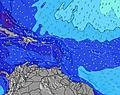 | 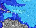 | 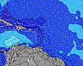 | 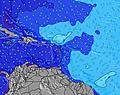 | ||||||||||||||
Wave Height (m) Direction Period (s) | ENE 7 | ENE 7 | E 7 | ENE 7 | ENE 7 | E 7 | ENE 7 | ENE 6 | NE 6 | NE 7 | ENE 6 | E 6 | E 6 | E 6 | ENE 7 | ENE 7 | ENE 7 | ENE 7 | ENE 7 | ENE 7 | ENE 7 |
Wave Graph | |||||||||||||||||||||
171 | 143 | 94 | 75 | 60 | 32 | 58 | 56 | 18 | 25 | 112 | 65 | 91 | 100 | 144 | 206 | 192 | 192 | 141 | 121 | 99 | |
Wind (km/h) | |||||||||||||||||||||
Wind State on-shore cross-onshore cross-shore cross-offshore off-shore glassy | cross-off | cross | cross-off | cross-off | cross-off | cross-off | cross-off | cross-off | cross-off | cross-off | cross-off | cross-off | cross-off | cross | cross | cross-off | cross | cross | cross-off | cross | cross-off |
High Tide | 6:39PM0.40m | 6:53AM0.31m | 7:09PM0.41m | 7:59AM0.27m | 7:45PM0.43m | 9:33AM0.23m | 8:29PM0.43m | 9:23PM0.44m | 10:29PM0.45m | 11:43PM0.46m | |||||||||||
Low Tide | 11:58AM0.18m | 1:29AM0.20m | 12:06PM0.20m | 2:46AM0.16m | 12:06PM0.22m | 4:01AM0.12m | 11:47AM0.22m | 5:12AM0.08m | 6:17AM0.04m | 7:16AM0.01m | |||||||||||
5:48 | — | — | 5:48 | — | — | 5:48 | — | — | 5:48 | — | — | 5:48 | — | — | 5:48 | — | — | 5:48 | — | — | |
— | 6:32 | — | — | 6:32 | — | — | 6:31 | — | — | 6:31 | — | — | 6:31 | — | — | 6:30 | — | — | 6:30 | — | |
mm | — | — | — | — | — | — | — | — | — | 1 | — | — | — | — | — | — | — | — | — | — | 3 |
Temp °C | 29 | 29 | 27 | 28 | 28 | 27 | 28 | 29 | 27 | 27 | 28 | 27 | 28 | 28 | 27 | 28 | 28 | 27 | 29 | 29 | 28 |
Feels °C | 28 | 29 | 28 | 29 | 30 | 29 | 29 | 31 | 29 | 28 | 28 | 26 | 26 | 27 | 27 | 27 | 28 | 28 | 29 | 29 | 30 |
Swell 1 Height (m) Direction Period (s) | N 11 | N 11 | N 10 | ENE 7 | E 12 | NE 6 | E 10 | ENE 10 | NE 6 | NE 7 | ENE 9 | NNE 7 | NE 7 | NE 7 | NNE 9 | NNE 9 | NE 9 | NE 9 | NE 8 | NE 8 | NNE 8 |
2 | 2 | 2 | 75 | 3 | 25 | 9 | 20 | 18 | 25 | 16 | 36 | 13 | 14 | 17 | 16 | 20 | 19 | 18 | 18 | 28 | |
Swell 2 Height (m) Direction Period (s) | SE 4 | SE 4 | — | N 10 | N 10 | E 11 | E 10 | E 10 | ENE 9 | ENE 9 | NNE 11 | ENE 8 | ENE 8 | NNE 10 | SE 8 | E 12 | — | N 12 | NE 12 | NE 11 | NE 9 |
1 | 1 | — | 2 | 2 | 2 | 2 | 2 | 17 | 16 | 11 | 14 | 12 | 9 | 3 | 3 | — | 3 | 6 | 5 | 19 | |
Swell 3 Height (m) Direction Period (s) | — | — | — | — | E 12 | E 10 | N 12 | N 12 | NNE 8 | SE 9 | SE 9 | NNE 9 | NNE 10 | ESE 9 | S 5 | — | SE 4 | SE 4 | E 11 | E 11 | — |
— | — | — | — | 3 | 2 | 3 | 3 | 6 | 3 | 3 | 15 | 10 | 8 | 1 | — | 1 | 1 | 2 | 2 | — | |
Wind waves Height (m) Direction Period (s) | ENE 7 | ENE 7 | E 7 | — | ENE 7 | E 7 | ENE 7 | ENE 6 | E 4 | E 5 | ENE 6 | E 6 | E 6 | E 6 | ENE 7 | ENE 7 | ENE 7 | ENE 7 | ENE 7 | ENE 7 | ENE 7 |
171 | 143 | 94 | — | 60 | 32 | 58 | 56 | 25 | 47 | 112 | 65 | 91 | 100 | 144 | 206 | 192 | 192 | 141 | 121 | 99 | |
Nearest Offshore or Glassy | |||||||||||||||||||||
Distance (km) | 551 | 178 | 239 | 6 | 380 | 239 | 380 | 380 | 645 | 380 | 541 | 670 | 380 | 319 | 178 | 541 | 380 | 178 | 178 | 178 | 178 |
Best forecast wave conditions in Martinique | |||||||||||||||||||||
Best forecast wave conditions in Martinique | |||||||||||||||||||||
Header Global | |||||||||||||||||||||
- Map Icons:
 Break
Break Live Wave Height (m)
 Live Wind Speed (km/h)
 Surf Rating (10 Max)
 Ocean Swells (m)
- Wind Speed (km/h)
Latest Updates


FREE! Surf-Forecast.com widget for your website
The surf report / weather widget below is available to embed on third party websites free of charge and provides a summary of our Bagasse surf forecast. Simply grab the html code snippet that we provide and paste it into your own site. You can choose your preferred language and metric/imperial units for the surf forecast feed to suit users of your site. Click here to get the code.
Information about the Bagasse Surf forecast
The above surf forecast table for Bagasse provides essential information for determining whether the surfing conditions will be good over the next 16 days. A general guide to surfing at Bagasse can be found by selecting the local surf guide option on the grey menu. Our Bagasse surf forecast is unique since it includes wave energy (power) that defines the real feel of the surf rather than just the height or the period. If you surf the same spot (Bagasse) regularly then make a mental note of the wave energy from the surf forecast table each time you go. Very soon you may start to choose your surf days based on the wave energy alone combined with our forecast of favourable offshore wind conditions. Our star ratings will help here and of course you will also find the usual wave height and period predictions on our surf forecasts as well as a full break down of the swell components under our advanced users option (to reveal that, click the little Einstein character under the tide times).
Further information to help with frequently asked questions about our surf forecast for Bagasse may be found under the help tab on the top menu and also by moving your mouse over the question marks on the surf forecast table itself. Please always bear in mind that the forecast is for near-shore open water and local factors at each surf break influence the actual breaking wave height, such as the beach / reef profile, water depths offshore and shelter.
Bagasse is 24 km (15 miles) from Sainte-Marie. If you plan a holiday in Martinique, look for hotels and other accommodation in Sainte-Marie. Sainte-Marie has rooms for a wide range of budgets as well as car hire and transport links.
 Nearest