

Surf Forecasts:

Ala Moana surf forecast from 24 Jul 2026:
- Best quality surf: Thursday 23 Jul, 10PM (local time) - 2.5ft (0.7m), 21s period, SW swell with cross-offshore winds.
- Most powerful swell: Monday 27 Jul, 4PM (local time) - 5ft (1.5m), 16s period, SW swell with 1,151 kJ wave energy.
- Next surfable swell (1★+): Thursday 23 Jul, 10PM (local time) - 2.5ft (0.7m), 21s period with SW swell.
Best Forecast Surf Conditions for Ala Moana this week:
The surf forecast for Ala Moana over the next 16 days: The first swell (rated 1 star or higher) is forecast to arrive on Thursday (Jul 23) at 10PM. The primary swell is predicted to be 0.7m and 21s period with a secondary swell of 1.0m and 7s. Another secondary swell of 1.0m and 10s is also forecast. The wind is predicted to be cross-offshore as the swell arrives.
The most powerful waves expected at Ala Moana in the next 16 days are 1.5m 16s and forecast to arrive on Monday (Jul 27) at 4PM. Winds are predicted to be cross-onshore at the time the swell arrives.
| Wave Type | Time (-05) & Date | Wave Height & Period |
|---|---|---|
| Next good surf (1 star+) | 10PM (Thu 23rd Jul) | 2.5ft (0.7m) 21s |
| Best Surf | 10PM (Thu 23rd Jul) | 2.5ft (0.7m) 21s |
| Most Powerful | 4PM (Mon 27th Jul) | 5ft (1.5m) 16s |
Table - best surf conditions forecast for Ala Moana over the next 16 days.
The Lowdown
Alright, Rusty here again.
Let's be straight with you – this is a grim stretch at Ala Moana. The water is a balmy 72°, which is a massive 9° warmer than usual, so it's like a warm bath. But the surf? It's a whole lot of nothing special. The combined wave energy gets up to a solid 1195 (moderate to strong energy) on the 27th, but the quality is just not there.
It all starts Thursday, July 23rd, with a tiny 2ft swell from the SW, a 24-second period, and a cross-on breeze. Energy is moderate at 649, but it's called marginal. Friday the 24th is a bit bigger at 2ft, clean onshore wind, but still marginal. Saturday the 25th is the same story: 3ft to 4ft, clean wind, but the period drops to 12 seconds. Sunday the 26th is 3ft with a cross-shore breeze, but still a marginal call.
The best chance of anything decent is Monday, July 27th, and Tuesday, the 28th. We get 4ft to 5ft from the SW with strong energy – 1038 to 1195. The period is 15 seconds, which is a long groundswell, but it's a beach break so that long period can make it break too straight. The downside is the wind is cross-onshore, keeping it choppy. Monday afternoon with 5ft and that strong energy is the best of the bunch, but the wind is only a light breeze, not perfectly glassy.
After that, it fades out. Wednesday the 29th through Friday the 1st of August is all 3ft to 4ft, with onshore or cross-onshore wind. The energy drops to moderate. The 1st of August has a 4ft swell with a short 7-second period and onshore wind – a real mess. Sunday the 3rd of August is a total write-off. The last shot comes on Wednesday the 6th of August, with 5ft from the SW and energy back to 1081, but again, cross-onshore wind.
There's no standout session here. The most you can hope for is Monday afternoon, July 27th, with 5ft and some punch, but the wind will be messing it up. It's a very consistent spot, so something will turn around eventually, but this forecast is a long, slow dud.
Rusty.
Short Range ForecastMostly dry. Warm (max 21°C on Fri morning, min 19°C on Thu morning). Wind will be generally light. | Days 4-6 Weather SummaryMostly dry. Warm (max 21°C on Sun morning, min 19°C on Sun night). Wind will be generally light. | ||||||||||||||||||||
Thursday 23 | Friday 24 | Saturday 25 | Sunday 26 | Monday 27 | Tuesday 28 | Wednesday 29 | |||||||||||||||
AM | PM | Night | AM | PM | Night | AM | PM | Night | AM | PM | Night | AM | PM | Night | AM | PM | Night | AM | PM | Night | |
Swell Height Map | 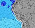 | 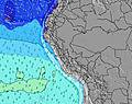 | 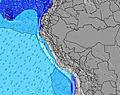 | 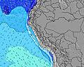 | 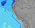 | 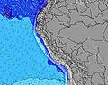 | 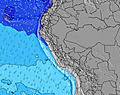 | ||||||||||||||
Wave Height (m) Direction Period (s) | SW 24 | SW 23 | SW 21 | SW 20 | SW 19 | SW 19 | SW 18 | SSW 12 | SW 16 | SW 15 | SW 19 | SW 18 | SW 17 | SW 16 | SW 16 | SW 15 | SW 15 | SW 14 | SW 13 | SW 13 | SW 13 |
Wave Graph | |||||||||||||||||||||
273 | 266 | 467 | 318 | 450 | 299 | 375 | 371 | 366 | 318 | 423 | 528 | 962 | 1151 | 1109 | 962 | 924 | 813 | 694 | 673 | 537 | |
Wind (km/h) | |||||||||||||||||||||
Wind State on-shore cross-onshore cross-shore cross-offshore off-shore glassy | cross-on | cross-on | cross | on | on | glassy | on | on | cross | cross | cross | cross | cross-on | cross-on | cross | cross-on | cross | cross-on | cross-on | cross-on | cross-on |
High Tide | 12:41PM0.53m | 3:15AM0.75m | 1:46PM0.49m | 4:01AM0.78m | 2:47PM0.47m | 4:41AM0.82m | 3:38PM0.48m | 5:16AM0.85m | 4:20PM0.49m | 5:49AM0.88m | 4:59PM0.51m | 6:20AM0.91m | 5:36PM0.52m | ||||||||
Low Tide | 7:39PM0.20m | 9:57AM0.42m | 8:27PM0.19m | 10:45AM0.39m | 9:12PM0.16m | 11:22AM0.36m | 9:52PM0.13m | 11:54AM0.34m | 10:30PM0.11m | 12:25PM0.33m | 11:05PM0.10m | 12:55PM0.32m | 11:38PM0.10m | ||||||||
6:28 | — | — | 6:28 | — | — | 6:28 | — | — | 6:28 | — | — | 6:28 | — | — | 6:28 | — | — | 6:26 | — | — | |
— | 6:00 | — | — | 6:00 | — | — | 6:00 | — | — | 6:00 | — | — | 6:00 | — | — | 6:00 | — | — | 6:00 | — | |
mm | — | — | — | — | — | — | — | — | — | — | — | — | — | — | — | — | — | — | — | — | — |
Temp °C | 20 | 20 | 19 | 21 | 21 | 19 | 21 | 21 | 20 | 21 | 21 | 19 | 21 | 20 | 19 | 20 | 20 | 20 | 21 | 21 | 19 |
Feels °C | 19 | 20 | 19 | 21 | 21 | 20 | 22 | 22 | 21 | 21 | 21 | 19 | 21 | 20 | 19 | 20 | 18 | 21 | 21 | 21 | 20 |
Swell 1 Height (m) Direction Period (s) | S 8 | S 8 | S 7 | S 7 | SSW 10 | SSW 9 | SW 13 | SSW 12 | SW 11 | SSW 11 | SW 19 | SW 18 | SW 17 | SW 16 | SW 16 | SW 15 | SW 15 | SW 14 | SW 13 | SW 13 | SW 13 |
172 | 157 | 108 | 112 | 275 | 158 | 273 | 371 | 202 | 196 | 423 | 528 | 962 | 1151 | 1109 | 962 | 924 | 813 | 694 | 673 | 537 | |
Swell 2 Height (m) Direction Period (s) | SW 10 | SW 10 | SW 10 | SW 10 | SW 19 | SW 19 | SSW 9 | SW 17 | SW 16 | SW 15 | SW 10 | SW 14 | S 6 | S 6 | S 7 | S 7 | S 11 | S 7 | S 7 | S 7 | S 7 |
204 | 204 | 204 | 145 | 450 | 299 | 101 | 297 | 366 | 318 | 100 | 238 | 31 | 30 | 48 | 62 | 9 | 59 | 61 | 59 | 47 | |
Swell 3 Height (m) Direction Period (s) | SW 24 | SW 23 | SW 21 | SW 20 | SSW 14 | SSW 13 | SW 18 | SW 21 | S 7 | SW 20 | SW 14 | SW 10 | SW 10 | SSW 8 | S 12 | S 11 | WNW 13 | S 10 | S 10 | WNW 13 | SSW 12 |
273 | 266 | 467 | 318 | 75 | 120 | 375 | 220 | 33 | 306 | 248 | 77 | 45 | 14 | 3 | 10 | 17 | 18 | 18 | 17 | 50 | |
Wind waves Height (m) Direction Period (s) | — | — | — | — | — | — | — | — | — | — | — | — | — | — | — | — | S 7 | — | — | — | — |
— | — | — | — | — | — | — | — | — | — | — | — | — | — | — | — | 61 | — | — | — | — | |
Nearest Offshore or Glassy | |||||||||||||||||||||
Distance (km) | 3 | 3 | 1 | 3 | 3 | 1 | 3 | 3 | 1 | 3 | 3 | 1 | 3 | 3 | 1 | 3 | 3 | 3 | 3 | 3 | 3 |
Best forecast wave conditions in Lima | |||||||||||||||||||||
Best forecast wave conditions in Peru | |||||||||||||||||||||
Header Global | |||||||||||||||||||||
- Map Icons:
 Break
Break Live Wave Height (m)
 Live Wind Speed (km/h)
 Surf Rating (10 Max)
 Ocean Swells (m)
- Wind Speed (km/h)


FREE! Surf-Forecast.com widget for your website
The surf report / weather widget below is available to embed on third party websites free of charge and provides a summary of our Ala Moana surf forecast. Simply grab the html code snippet that we provide and paste it into your own site. You can choose your preferred language and metric/imperial units for the surf forecast feed to suit users of your site. Click here to get the code.
Information about the Ala Moana Surf forecast
The above surf forecast table for Ala Moana provides essential information for determining whether the surfing conditions will be good over the next 16 days. A general guide to surfing at Ala Moana can be found by selecting the local surf guide option on the grey menu. Our Ala Moana surf forecast is unique since it includes wave energy (power) that defines the real feel of the surf rather than just the height or the period. If you surf the same spot (Ala Moana) regularly then make a mental note of the wave energy from the surf forecast table each time you go. Very soon you may start to choose your surf days based on the wave energy alone combined with our forecast of favourable offshore wind conditions. Our star ratings will help here and of course you will also find the usual wave height and period predictions on our surf forecasts as well as a full break down of the swell components under our advanced users option (to reveal that, click the little Einstein character under the tide times).
Further information to help with frequently asked questions about our surf forecast for Ala Moana may be found under the help tab on the top menu and also by moving your mouse over the question marks on the surf forecast table itself. Please always bear in mind that the forecast is for near-shore open water and local factors at each surf break influence the actual breaking wave height, such as the beach / reef profile, water depths offshore and shelter.
Ala Moana is 6 km (4 miles) from the city of Lima. If you plan a holiday in Lima, look for hotels and other accommodation in Lima. Lima has rooms for a wide range of budgets as well as car hire and transport links.
 Nearest