

Surf Forecasts:

Waikiki surf forecast from 13 Jul 2026:
- Best quality surf: Sunday 19 Jul, 7AM (local time) - 4.5ft (1.3m), 12s period, SW swell with glassy winds.
- Most powerful swell: Tuesday 14 Jul, 1AM (local time) - 4.5ft (1.4m), 14s period, SSW swell with 799 kJ wave energy.
- Next surfable swell (1★+): Sunday 19 Jul, 7AM (local time) - 4.5ft (1.3m), 12s period with SW swell.
Best Forecast Surf Conditions for Waikiki this week:
The surf forecast for Waikiki over the next 16 days: The first swell (rated 1 star or higher) is forecast to arrive on Sunday (Jul 19) at 7AM. The primary swell is predicted to be 1.3m and 12s period with a secondary swell of 0.6m and 14s. The wind is predicted to be glassy as the swell arrives.
The most powerful waves expected at Waikiki in the next 16 days are 1.4m 14s and forecast to arrive on Tuesday (Jul 14) at 1AM. Winds are predicted to be cross-onshore at the time the swell arrives.
| Wave Type | Time (-05) & Date | Wave Height & Period |
|---|---|---|
| Next good surf (1 star+) | 7AM (Sun 19th Jul) | 4.5ft (1.3m) 12s |
| Best Surf | 7AM (Sun 19th Jul) | 4.5ft (1.3m) 12s |
| Most Powerful | 1AM (Tue 14th Jul) | 4.5ft (1.4m) 14s |
Table - best surf conditions forecast for Waikiki over the next 16 days.
The Lowdown
Alright, let’s get into it. This is Rusty, and here’s the outlook for the home break.
Alright, so we’ve got a stretch ahead that’s a bit of a mixed bag – some promising pulses, but a lot of marginal, onshore conditions to work through. The first real shot at something decent is early on Monday, July 13th, but it’s not a world-beater by any stretch. The water is sitting at 69.1° – that’s much warmer than we’d expect for this time of year, around 5.9° above average, which feels weird but isn’t a bad thing for a dawn session.
Kicking it off Monday, July 13th, at Waikiki. The morning is the pick of the day. We’ve got a 3-foot SSW groundswell rolling in with a long 15-second period. That slow, powerful pulse will wrap in nicely, but the wind is a light cross-on from the south. It’s not glassy, but with a light breeze and the long period, expect some clean, lined-up walls. The combined energy is moderate at 709. Crowds are sometimes a thing here, so expect some company. Monday afternoon drops off quickly – the score falls to zero, so don’t waste the afternoon.
Tuesday, July 14th, holds a little more size – 4-foot SSW in the morning with a 13-second period and a light cross-on. The combined energy is solid at 744. Still, the wind is a bit of a spoiler, keeping it from being truly clean. The afternoon sees the wind pick up to 9 mph, making it a bit choppy. Worth a paddle in the morning, but not a standout.
Wednesday, July 15th, offers a similar story: 4.6-foot SW swell, 13-second period, light cross-on breeze. The combined energy actually dips a bit in the morning to 584 but picks up to 708 in the afternoon. Still, the wind keeps it from being special. It’s just okay.
Thursday, July 16th, is probably the best of this first week. The morning swell ticks up to 5-foot from the SSW, 13-second period, with a light south cross-on. The combined energy hits 808 – the strongest we see for a while. The wind is light, so the conditions are better than the previous days. This is the session to aim for if you’ve got a window. The afternoon wind picks up to 9 mph, making it choppier, so go early.
Then we hit a long, dry stretch. From Friday, July 17th, right through to Thursday, July 23rd, the conditions are consistently poor. The swell stays around 3.3 to 4.6 feet, but the wind is persistently cross-on, and the wave quality is labelled as poor or marginal. The combined energy drops from 564 down to 197. It’s not worth the paddle. There’s a five-day gap here where you’re better off doing something else.
There’s a tiny flicker of life on Friday, July 24th, with a 3.3-foot S swell, but the period drops to a short 7 seconds and the combined energy is a weak 210. That’s a windswell – short, weak, and messy. Not your friend.
The next real chance comes on Saturday, July 25th. The morning is a small 2.3-foot SW swell, 10-second period, with a light onshore wind from the WSW. The combined energy is a weak 289. It’s marginal at best. The afternoon improves slightly to 2.6-foot SSW with a 12-second period and 369 energy. Still, it’s not great.
Sunday, July 26th, is a write-off – poor conditions all day.
Now, here’s the interesting one. Monday, July 27th, shows a building swell. The morning is a 2.6-foot SW swell, but the period jumps to 16 seconds – that’s a long-period groundswell. The combined energy is 504. The wind is still cross-on, but that long period will push some clean, powerful lines through, especially on the reef. By the afternoon, the swell bumps to 3.6-foot SW, 15-second period, and the combined energy hits 688. It’s still marginal due to the wind, but it’s the most interesting we’ve seen in a week.
The best of the entire forecast is Tuesday, July 28th. The morning delivers 4.3-foot SW swell, 13-second period, with a light cross-on from the SSW. The combined energy is a solid 775. The wind is light, the swell is decent, and the period is solid. This is the standout. The afternoon holds up with 3.6-foot SW, 12-second period, and 670 energy. If you only get one session in the next two weeks, make it Tuesday, July 28th, morning. Crowds are possible, so bring your patience.
Bottom line: The first week is a grind with a few okay mornings, but Thursday, July 16th, and Tuesday, July 28th, are the real standouts. The long period swells will be best at the reef, so stick to the inside peaks. The water is unusually warm, so that’s a bonus. Stay patient.
Short Range ForecastMostly dry. Very mild (max 19°C on Mon morning, min 17°C on Mon night). Wind will be generally light. | Days 4-6 Weather SummaryMostly dry. Very mild (max 19°C on Thu morning, min 17°C on Thu night). Wind will be generally light. | ||||||||||||||||||||
Monday 13 | Tuesday 14 | Wednesday 15 | Thursday 16 | Friday 17 | Saturday 18 | Sunday 19 | |||||||||||||||
AM | PM | Night | AM | PM | Night | AM | PM | Night | AM | PM | Night | AM | PM | Night | AM | PM | Night | AM | PM | Night | |
Swell Height Map | 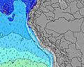 | 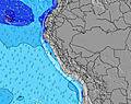 | 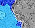 | 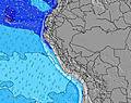 | 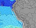 | 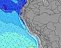 | 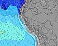 | ||||||||||||||
Wave Height (m) Direction Period (s) | SSW 15 | SSW 15 | SSW 14 | SSW 13 | SSW 13 | SW 13 | SW 13 | SW 13 | SW 13 | SSW 13 | SSW 13 | SSW 12 | SSW 13 | SSW 12 | SSW 12 | SSW 12 | SSW 11 | SW 12 | SSW 13 | SW 12 | SW 11 |
Wave Graph | |||||||||||||||||||||
372 | 334 | 799 | 454 | 350 | 711 | 576 | 689 | 711 | 784 | 772 | 668 | 560 | 419 | 365 | 371 | 418 | 488 | 351 | 524 | 488 | |
Wind (km/h) | |||||||||||||||||||||
Wind State on-shore cross-onshore cross-shore cross-offshore off-shore glassy | cross-on | cross-on | cross-on | cross-on | cross-on | cross | cross-on | cross-on | cross-on | cross-on | cross-on | cross-on | cross-on | cross-on | cross-on | cross-on | cross-on | cross | on | cross-on | cross |
High Tide | 4:21PM0.56m | 5:54AM1.06m | 5:22PM0.57m | 6:43AM1.09m | 6:21PM0.58m | 7:30AM1.08m | 7:21PM0.59m | 8:15AM1.04m | 8:22PM0.60m | 8:58AM0.97m | 9:26PM0.61m | 9:39AM0.88m | 10:35PM0.63m | ||||||||
Low Tide | 11:41AM0.29m | 10:38PM-0.04m | 12:32PM0.26m | 11:29PM-0.05m | 1:22PM0.23m | 00:20AM-0.02m | 2:10PM0.21m | 1:10AM0.04m | 2:57PM0.20m | 2:02AM0.13m | 3:43PM0.20m | 2:56AM0.24m | 4:29PM0.20m | 3:59AM0.34m | |||||||
6:28 | — | — | 6:28 | — | — | 6:28 | — | — | 6:28 | — | — | 6:28 | — | — | 6:28 | — | — | 6:28 | — | — | |
— | 5:57 | — | — | 5:58 | — | — | 5:58 | — | — | 5:58 | — | — | 5:58 | — | — | 5:59 | — | — | 5:59 | — | |
mm | — | — | — | — | — | — | — | — | — | — | — | — | — | — | — | — | — | — | — | — | — |
Temp °C | 19 | 19 | 18 | 19 | 19 | 18 | 19 | 19 | 18 | 19 | 19 | 18 | 19 | 19 | 18 | 19 | 19 | 18 | 19 | 19 | 18 |
Feels °C | 19 | 19 | 18 | 18 | 18 | 18 | 18 | 19 | 18 | 18 | 18 | 18 | 18 | 18 | 17 | 19 | 19 | 18 | 19 | 18 | 17 |
Swell 1 Height (m) Direction Period (s) | SSW 12 | SSW 15 | SSW 14 | SSW 13 | SSW 13 | SW 13 | SW 13 | SW 13 | SW 13 | SSW 13 | SSW 13 | SSW 12 | SSW 13 | SSW 12 | SSW 12 | SSW 12 | SSW 11 | SW 12 | SW 11 | SW 12 | SW 11 |
333 | 334 | 799 | 454 | 350 | 711 | 576 | 689 | 711 | 784 | 772 | 668 | 560 | 419 | 365 | 371 | 418 | 488 | 308 | 524 | 488 | |
Swell 2 Height (m) Direction Period (s) | SSW 15 | SSW 12 | W 13 | SW 16 | SW 14 | S 12 | W 12 | W 12 | W 12 | SW 22 | SSW 16 | SW 20 | W 11 | SSW 19 | W 11 | SW 16 | SSW 15 | S 6 | SSW 13 | S 6 | SW 15 |
372 | 180 | 3 | 287 | 317 | 228 | 3 | 3 | 3 | 18 | 86 | 16 | 2 | 35 | 2 | 67 | 148 | 35 | 351 | 22 | 55 | |
Swell 3 Height (m) Direction Period (s) | W 14 | S 8 | NW 13 | W 13 | WSW 9 | WSW 9 | — | SW 20 | — | NW 12 | SW 21 | W 11 | — | W 11 | — | WSW 15 | W 10 | SSW 15 | S 6 | WSW 16 | S 15 |
4 | 46 | 7 | 3 | 8 | 7 | — | 16 | — | 6 | 17 | 2 | — | 2 | — | 21 | 2 | 84 | 29 | 26 | 17 | |
Wind waves Height (m) Direction Period (s) | — | — | — | — | — | — | S 4 | — | — | — | S 7 | S 3 | S 4 | S 4 | S 5 | S 6 | S 6 | — | — | — | S 5 |
— | — | — | — | — | — | 5 | — | — | — | 8 | 1 | 2 | 4 | 15 | 30 | 46 | — | — | — | 13 | |
Nearest Offshore or Glassy | |||||||||||||||||||||
Distance (km) | 7 | 7 | 5 | 7 | 7 | 5 | 7 | 7 | 5 | 7 | 7 | 5 | 5 | 7 | 5 | 7 | 7 | 5 | 7 | 5 | 5 |
Best forecast wave conditions in Lima | |||||||||||||||||||||
Best forecast wave conditions in Peru | |||||||||||||||||||||
Header Global | |||||||||||||||||||||
- Map Icons:
 Break
Break Live Wave Height (m)
 Live Wind Speed (km/h)
 Surf Rating (10 Max)
 Ocean Swells (m)
- Wind Speed (km/h)


FREE! Surf-Forecast.com widget for your website
The surf report / weather widget below is available to embed on third party websites free of charge and provides a summary of our Waikiki surf forecast. Simply grab the html code snippet that we provide and paste it into your own site. You can choose your preferred language and metric/imperial units for the surf forecast feed to suit users of your site. Click here to get the code.
Information about the Waikiki Surf forecast
The above surf forecast table for Waikiki provides essential information for determining whether the surfing conditions will be good over the next 16 days. A general guide to surfing at Waikiki can be found by selecting the local surf guide option on the grey menu. Our Waikiki surf forecast is unique since it includes wave energy (power) that defines the real feel of the surf rather than just the height or the period. If you surf the same spot (Waikiki) regularly then make a mental note of the wave energy from the surf forecast table each time you go. Very soon you may start to choose your surf days based on the wave energy alone combined with our forecast of favourable offshore wind conditions. Our star ratings will help here and of course you will also find the usual wave height and period predictions on our surf forecasts as well as a full break down of the swell components under our advanced users option (to reveal that, click the little Einstein character under the tide times).
Further information to help with frequently asked questions about our surf forecast for Waikiki may be found under the help tab on the top menu and also by moving your mouse over the question marks on the surf forecast table itself. Please always bear in mind that the forecast is for near-shore open water and local factors at each surf break influence the actual breaking wave height, such as the beach / reef profile, water depths offshore and shelter.
Waikiki is 2 km (1 miles) from the city of Lima. If you plan a holiday in Lima, look for hotels and other accommodation in Lima. Lima has rooms for a wide range of budgets as well as car hire and transport links.
 Nearest