

Surf Forecasts:

How big are the waves at Utulei today (03 Aug):
- Morning surf: Morning surf (03 Aug, local time) - 3ft (0.9m), 13s period with SW swell.
- Afternoon surf: Afternoon surf (03 Aug, local time) - 3ft (0.9m), 13s period with SW swell.
- Evening surf: Evening surf (03 Aug, local time) - 3ft (0.9m), 13s period with SW swell.
The current surf forecast for Utulei at 3AM is: 0.8m 14s primary swell from a Southwest direction and 0.9m 11s secondary swell from a South-southeast direction, 0.9m 8s secondary swell from a East direction (forecast issued at 12:00am August 03). The wind direction is predicted to be cross-offshore and the swell rating is 3.
| Time (SST) & Date | Wave Height | Wave Period |
|---|---|---|
| Morning (03 Aug) | 3ft (0.9m) | 13s |
| Afternoon (03 Aug) | 3ft (0.9m) | 13s |
| Evening (03 Aug) | 3ft (0.9m) | 13s |
Table - waves today at Utulei. (Swell directed towards the surf break)
Short Range ForecastLight rain (total 2mm), mostly falling on Sun night. Warm (max 27°C on Sun night, min 24°C on Tue night). Winds increasing (calm on Mon morning, fresh winds from the SSE by Tue night). | ||||||||||||||||||||||||
Monday 3 | Tuesday 4 | Wednesday 5 | ||||||||||||||||||||||
1 AM | 4 AM | 7 AM | 10 AM | 1 PM | 4 PM | 7 PM | 10 PM | 1 AM | 4 AM | 7 AM | 10 AM | 1 PM | 4 PM | 7 PM | 10 PM | 1 AM | 4 AM | 7 AM | 10 AM | 1 PM | 4 PM | 7 PM | 10 PM | |
Swell Height Map | 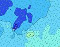 | 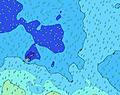 |  | 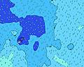 | 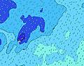 |  | 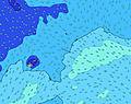 |  | 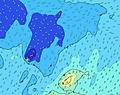 | |||||||||||||||
Wave Height (m) Direction Period (s) | SW 14 | SW 14 | SW 13 | SW 13 | SW 13 | SW 13 | SW 13 | SW 13 | SW 13 | SSW 14 | SSW 14 | S 13 | SSW 13 | SSW 13 | SSW 12 | SSW 12 | SSW 12 | SSW 12 | S 12 | SW 17 | S 10 | S 11 | SSE 11 | SSE 7 |
Wave Graph | ||||||||||||||||||||||||
241 | 227 | 257 | 286 | 286 | 286 | 286 | 282 | 315 | 280 | 317 | 361 | 444 | 484 | 439 | 494 | 486 | 550 | 456 | 374 | 506 | 804 | 862 | 401 | |
Wind (km/h) | ||||||||||||||||||||||||
Wind State on-shore cross-onshore cross-shore cross-offshore off-shore glassy | cross-off | cross-off | glassy | glassy | cross-on | cross-on | cross-on | on | on | on | on | on | on | on | on | on | cross-on | cross-on | cross-on | on | on | on | on | on |
High Tide | 10:13PM0.75m | 10:30AM0.75m | 11:06PM0.76m | 11:27AM0.72m | 00:05AM0.78m | 12:30PM0.70m | ||||||||||||||||||
Low Tide | 4:19AM0.11m | 4:42PM0.09m | 5:18AM0.12m | 5:35PM0.09m | 6:23AM0.10m | 6:35PM0.09m | ||||||||||||||||||
— | 6:43 | — | — | — | — | — | — | — | 6:43 | — | — | — | — | — | — | — | 6:43 | — | — | — | — | — | — | |
— | — | — | — | — | 6:14 | — | — | — | — | — | — | — | 6:14 | — | — | — | — | — | — | — | 6:14 | — | — | |
mm | 1 | 1 | — | — | — | — | — | — | — | — | — | — | — | — | — | — | — | — | — | — | — | — | — | — |
Temp °C | 26 | 26 | 26 | 26 | 26 | 26 | 25 | 25 | 25 | 25 | 25 | 25 | 25 | 25 | 25 | 25 | 25 | 24 | 24 | 24 | 24 | 24 | 24 | 24 |
Feels °C | 29 | 30 | 30 | 30 | 29 | 28 | 26 | 25 | 26 | 25 | 25 | 25 | 25 | 24 | 24 | 24 | 24 | 21 | 21 | 21 | 21 | 21 | 21 | 20 |
Swell 1 Height (m) Direction Period (s) | SSE 11 | SSE 11 | SE 12 | SW 13 | SW 13 | SW 13 | SW 13 | SW 13 | SW 13 | SW 12 | SW 12 | S 13 | SSW 13 | SSW 13 | SSW 12 | SSW 12 | SSW 12 | SSW 12 | S 12 | S 10 | S 10 | E 8 | SW 16 | SW 16 |
219 | 227 | 195 | 286 | 286 | 286 | 286 | 282 | 315 | 256 | 252 | 361 | 444 | 484 | 439 | 494 | 486 | 550 | 456 | 374 | 506 | 80 | 318 | 310 | |
Swell 2 Height (m) Direction Period (s) | E 8 | E 8 | E 8 | E 8 | E 8 | SSE 10 | E 8 | E 8 | S 15 | SSW 14 | SSW 14 | SW 12 | SW 12 | E 8 | SW 12 | SW 12 | SW 18 | SW 18 | SW 18 | SW 17 | SW 17 | SW 16 | ENE 8 | S 16 |
90 | 93 | 95 | 78 | 78 | 138 | 74 | 60 | 275 | 280 | 317 | 252 | 203 | 45 | 187 | 224 | 260 | 307 | 366 | 354 | 338 | 326 | 63 | 318 | |
Swell 3 Height (m) Direction Period (s) | SW 14 | SW 14 | SW 13 | SSE 10 | SSE 10 | E 8 | SSE 10 | SE 10 | E 8 | E 8 | E 8 | SW 20 | E 8 | SW 19 | E 8 | SW 18 | SW 11 | SW 11 | ENE 8 | ENE 8 | S 16 | SSW 18 | S 14 | NE 13 |
241 | 224 | 257 | 86 | 86 | 78 | 138 | 110 | 60 | 58 | 61 | 136 | 74 | 184 | 44 | 269 | 123 | 77 | 51 | 51 | 135 | 103 | 153 | 42 | |
Wind waves Height (m) Direction Period (s) | — | — | — | — | — | — | SSE 4 | SSE 4 | SSE 4 | SSE 5 | SSE 5 | SE 8 | SSE 6 | — | SSE 5 | SSE 5 | SSE 5 | SSE 5 | SSE 6 | SSE 6 | ESE 6 | S 11 | SSE 11 | SSE 7 |
— | — | — | — | — | — | 7 | 11 | 19 | 31 | 45 | 182 | 52 | — | 44 | 61 | 74 | 80 | 122 | 128 | 136 | 804 | 862 | 401 | |
Nearest Offshore or Glassy | ||||||||||||||||||||||||
Distance (km) | 0 | 0 | 0 | 0 | 18 | 18 | 18 | 18 | 18 | 1352 | 18 | 898 | 18 | 898 | 1394 | 1394 | 1394 | 1394 | 1394 | 1394 | 1352 | 2071 | 2071 | 2071 |
Best forecast wave conditions in American-Samoa - Tutuila | ||||||||||||||||||||||||
Best forecast wave conditions in American Samoa | ||||||||||||||||||||||||
Header Global | ||||||||||||||||||||||||
- Map Icons:
 Break
Break Live Wave Height (m)
 Live Wind Speed (km/h)
 Surf Rating (10 Max)
 Ocean Swells (m)
- Wind Speed (km/h)
Latest Updates


FREE! Surf-Forecast.com widget for your website
The surf report / weather widget below is available to embed on third party websites free of charge and provides a summary of our Utulei surf forecast. Simply grab the html code snippet that we provide and paste it into your own site. You can choose your preferred language and metric/imperial units for the surf forecast feed to suit users of your site. Click here to get the code.
 Nearest