

Surf Forecasts:

How big are the waves at Trocones today (25 Jun):
- Morning surf: Morning surf (25 Jun, local time) - 5ft (1.5m), 15s period with SSW swell.
- Afternoon surf: Afternoon surf (25 Jun, local time) - 4.5ft (1.3m), 15s period with SSW swell.
- Evening surf: Evening surf (25 Jun, local time) - 5ft (1.5m), 15s period with SSW swell.
The current surf forecast for Trocones at 7AM is: 1.5m 15s primary swell from a South-southwest direction and 0.5m 8s secondary swell from a South direction (forecast issued at 11:00pm June 24). The wind direction is predicted to be cross-offshore and the swell rating is 4.
| Time (CST) & Date | Wave Height | Wave Period |
|---|---|---|
| Morning (25 Jun) | 5ft (1.5m) | 15s |
| Afternoon (25 Jun) | 4.5ft (1.3m) | 15s |
| Evening (25 Jun) | 5ft (1.5m) | 15s |
Table - waves today at Trocones. (Swell directed towards the surf break)
Updates in hr min s Forecast update imminent
Short Range ForecastModerate rain (total 14mm), heaviest on Wed night. Warm (max 30°C on Thu morning, min 26°C on Wed night). Wind will be generally light. | ||||||||||||||||||||||||
Thursday 25 | Friday 26 | Saturday 27 | ||||||||||||||||||||||
9 PM | 12 AM | 3 AM | 6 AM | 9 AM | 12 PM | 3 PM | 6 PM | 9 PM | 12 AM | 3 AM | 6 AM | 9 AM | 12 PM | 3 PM | 6 PM | 9 PM | 12 AM | 3 AM | 6 AM | 9 AM | 12 PM | 3 PM | 6 PM | |
Swell Height Map |  |  |  |  |  |  |  | 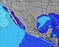 |  | |||||||||||||||
Wave Height (m) Direction Period (s) | SSW 16 | SSW 16 | SSW 16 | SSW 15 | SSW 15 | SSW 15 | SSW 15 | SSW 15 | SSW 15 | SSW 15 | SSW 17 | SSW 17 | SW 18 | SSW 15 | SSW 17 | SSW 17 | SSW 16 | SSW 16 | SSW 16 | SSW 16 | SSW 16 | SSW 16 | SSW 16 | SSW 15 |
Wave Graph | ||||||||||||||||||||||||
1257 | 1241 | 1098 | 1083 | 1028 | 693 | 702 | 851 | 936 | 740 | 1352 | 1383 | 703 | 616 | 1133 | 1094 | 1030 | 1005 | 1261 | 1245 | 1230 | 1081 | 933 | 897 | |
Wind (km/h) | ||||||||||||||||||||||||
Wind State on-shore cross-onshore cross-shore cross-offshore off-shore glassy | cross | glassy | glassy | cross-off | cross-off | cross | on | cross-on | glassy | glassy | cross-off | cross-off | glassy | on | on | cross-on | glassy | glassy | glassy | glassy | glassy | cross-on | on | cross-on |
High Tide | 7:55PM0.52m | 10:46AM0.68m | 7:39PM0.51m | 11:24AM0.68m | 7:05PM0.51m | 12:05PM0.66m | ||||||||||||||||||
Low Tide | 2:57AM0.11m | 4:31PM0.48m | 3:17AM0.10m | 5:21PM0.50m | 3:38AM0.09m | |||||||||||||||||||
— | — | — | 6:13 | — | — | — | — | — | — | — | 6:13 | — | — | — | — | — | — | — | 6:13 | — | — | — | — | |
— | — | — | — | — | — | — | 7:24 | — | — | — | — | — | — | — | 7:24 | — | — | — | — | — | — | — | 7:24 | |
mm | — | 1 | 4 | 5 | — | — | — | — | — | — | 2 | — | — | — | — | — | — | — | — | 1 | — | — | — | 1 |
Temp °C | 29 | 29 | 28 | 26 | 27 | 30 | 30 | 30 | 29 | 29 | 28 | 27 | 28 | 30 | 30 | 29 | 29 | 28 | 28 | 28 | 28 | 30 | 30 | 30 |
Feels °C | 33 | 35 | 33 | 28 | 30 | 33 | 32 | 34 | 34 | 35 | 33 | 31 | 32 | 33 | 33 | 33 | 34 | 33 | 33 | 33 | 33 | 34 | 32 | 34 |
Swell 1 Height (m) Direction Period (s) | SSW 16 | SSW 16 | SSW 16 | SSW 15 | SSW 15 | SSW 15 | SSW 15 | SSW 15 | SSW 15 | SSW 15 | SSW 17 | SSW 17 | SW 18 | SSW 15 | SSW 17 | SSW 17 | SSW 16 | SSW 16 | SSW 16 | SSW 16 | SSW 16 | SSW 16 | SSW 16 | SSW 15 |
1257 | 1241 | 1098 | 1083 | 1028 | 693 | 702 | 851 | 936 | 740 | 1352 | 1383 | 703 | 616 | 1133 | 1094 | 1030 | 1005 | 1261 | 1245 | 1230 | 1081 | 933 | 897 | |
Swell 2 Height (m) Direction Period (s) | S 9 | S 9 | S 9 | S 8 | S 8 | SW 19 | SSW 19 | S 8 | S 8 | SSW 19 | SSE 8 | SSE 8 | SSW 14 | SSW 18 | S 8 | S 8 | S 8 | S 8 | S 13 | S 13 | S 13 | S 13 | SSE 13 | S 8 |
39 | 39 | 37 | 35 | 33 | 368 | 329 | 31 | 31 | 319 | 20 | 21 | 437 | 404 | 34 | 33 | 33 | 31 | 4 | 14 | 3 | 14 | 33 | 33 | |
Swell 3 Height (m) Direction Period (s) | S 18 | S 18 | S 18 | S 17 | S 16 | S 8 | S 8 | SW 20 | S 16 | SSE 8 | S 15 | S 15 | SSE 8 | SSE 8 | S 14 | S 14 | S 14 | S 14 | S 13 | S 13 | S 13 | S 21 | S 13 | S 13 |
6 | 6 | 6 | 23 | 5 | 32 | 32 | 188 | 5 | 20 | 4 | 4 | 22 | 26 | 4 | 4 | 4 | 4 | 14 | 14 | 13 | 9 | 13 | 13 | |
Wind waves Height (m) Direction Period (s) | — | — | — | — | — | — | — | — | — | — | — | — | — | — | — | — | — | — | — | — | — | — | — | — |
— | — | — | — | — | — | — | — | — | — | — | — | — | — | — | — | — | — | — | — | — | — | — | — | |
Nearest Offshore or Glassy | ||||||||||||||||||||||||
Distance (km) | 13 | 0 | 0 | 9 | 0 | 10 | 170 | 225 | 0 | 0 | 0 | 0 | 0 | 513 | 671 | 513 | 0 | 0 | 0 | 0 | 0 | 202 | 699 | 513 |
Best forecast wave conditions in Guerrero | ||||||||||||||||||||||||
Best forecast wave conditions in Mexico | ||||||||||||||||||||||||
Header Global | ||||||||||||||||||||||||
- Map Icons:
 Break
Break Live Wave Height (m)
 Live Wind Speed (km/h)
 Surf Rating (10 Max)
 Ocean Swells (m)
- Wind Speed (km/h)


FREE! Surf-Forecast.com widget for your website
The surf report / weather widget below is available to embed on third party websites free of charge and provides a summary of our Trocones surf forecast. Simply grab the html code snippet that we provide and paste it into your own site. You can choose your preferred language and metric/imperial units for the surf forecast feed to suit users of your site. Click here to get the code.
 Nearest