

Surf Forecasts:

Tres Picos surf forecast from 2 Aug 2026:
- Best quality surf: Tuesday 4 Aug, 7AM (local time) - 3ft (0.9m), 12s period, SSW swell with glassy winds.
- Most powerful swell: Thursday 6 Aug, 7PM (local time) - 5ft (1.5m), 16s period, SW swell with 1,109 kJ wave energy.
- Next surfable swell (1★+): Tuesday 4 Aug, 7AM (local time) - 3ft (0.9m), 12s period with SSW swell.
Best Forecast Surf Conditions for Tres Picos this week:
The surf forecast for Tres Picos over the next 16 days: The first swell (rated 1 star or higher) is forecast to arrive on Tuesday (Aug 04) at 7AM. The primary swell is predicted to be 0.9m and 12s period with a secondary swell of 1.2m and 8s. The wind is predicted to be glassy as the swell arrives.
The most powerful waves expected at Tres Picos in the next 16 days are 1.5m 16s and forecast to arrive on Thursday (Aug 06) at 7PM. Winds are predicted to be cross-onshore at the time the swell arrives.
| Wave Type | Time (-05) & Date | Wave Height & Period |
|---|---|---|
| Next good surf (1 star+) | 7AM (Tue 4th Aug) | 3ft (0.9m) 12s |
| Best Surf | 7AM (Tue 4th Aug) | 3ft (0.9m) 12s |
| Most Powerful | 7PM (Thu 6th Aug) | 5ft (1.5m) 16s |
Table - best surf conditions forecast for Tres Picos over the next 16 days.
The Lowdown
Alright, Rusty here with the lowdown.
To be straight with you, Tres Picos is looking pretty slow to start. This is a consistent beginner-friendly spot, fairly exposed to the swell. The water’s sitting at a very unusual 72°, way warmer than normal for this time of year, so the wetsuit can be thin.
We kick off on Sunday, August 2nd, but it’s rough. A weak 4ft south swell with a short 8-second period and a cross-onshore breeze makes for messy, choppy conditions. The combined energy is moderate at 412, but it’s not worth paddling out. This poor run with persistent onshore or cross-onshore wind lasts through the first week.
Things start to look slightly better around Tuesday, August 4th. The swell drops to 3ft but switches to a longer-period SSW groundswell at 12 seconds. The combined energy jumps to 436, but it’s still light cross-onshore. It’s a tease. Real potential shows on Thursday, August 6th, when a SW groundswell with a very long 17-second period and combined energy at a strong 901 arrives. Even at just 3ft, that long period means proper push, but the wind is still cross-on, so it’s only marginal.
The standout window is Monday, August 10th, and Tuesday, August 11th. On Monday morning, we get a solid 8ft SSW swell, with combined energy at a very strong 1344. The wind is light and onshore, so it might hold shape. Tuesday the 11th looks even bigger, with 8ft SSW swell and a strong 12-second period, pushing the energy to a massive 1671. This is expert-only territory. The wind is still light cross-onshore, so it won’t be glassy, but the power is huge. For experienced surfers, Tuesday morning is the best bet.
After that, the pulses settle down but don’t stop. We see another smaller 5ft to 6ft SW swell on Monday, August 17th, with combined energy back over 1500 and a long 15-16 second period. It’s still cross-onshore, so it stays marginal.
So, the first week is mostly a loss. The real action is in the second week, especially around August 10th and 11th for the biggest, most powerful swell. Keep an eye on it – things can change.
Rusty.
Short Range ForecastMostly dry. Warm (max 20°C on Sun afternoon, min 18°C on Sun night). Wind will be generally light. | Days 4-6 Weather SummaryMostly dry. Warm (max 21°C on Wed morning, min 18°C on Wed night). Wind will be generally light. | ||||||||||||||||||||
Sunday 2 | Monday 3 | Tuesday 4 | Wednesday 5 | Thursday 6 | Friday 7 | Saturday 8 | |||||||||||||||
AM | PM | Night | AM | PM | Night | AM | PM | Night | AM | PM | Night | AM | PM | Night | AM | PM | Night | AM | PM | Night | |
Swell Height Map | 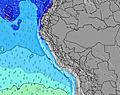 | 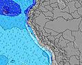 | 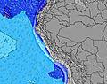 | 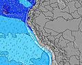 | 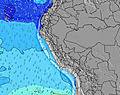 | 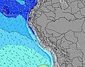 | 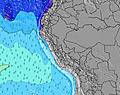 | ||||||||||||||
Wave Height (m) Direction Period (s) | S 8 | S 8 | SW 13 | WSW 13 | S 8 | SSW 8 | SSW 12 | SW 11 | SW 12 | SW 13 | SW 12 | SW 12 | SW 17 | SW 16 | SW 16 | SW 14 | SW 14 | SW 13 | SW 13 | SW 13 | S 8 |
Wave Graph | |||||||||||||||||||||
163 | 196 | 205 | 134 | 145 | 178 | 255 | 189 | 449 | 424 | 437 | 349 | 505 | 653 | 1082 | 746 | 667 | 458 | 326 | 269 | 223 | |
Wind (km/h) | |||||||||||||||||||||
Wind State on-shore cross-onshore cross-shore cross-offshore off-shore glassy | cross-on | cross-on | cross | cross-on | cross-on | cross | on | cross-on | cross-on | cross-on | cross-on | cross-on | cross-on | cross-on | cross-on | cross-on | cross-on | cross | on | on | cross-on |
High Tide | 8:22PM0.59m | 8:30AM0.82m | 9:14PM0.61m | 8:58AM0.76m | 10:16PM0.64m | 9:31AM0.70m | 11:28PM0.67m | 10:17AM0.63m | 00:49AM0.72m | 11:22AM0.56m | 2:06AM0.79m | 12:49PM0.52m | 3:11AM0.87m | ||||||||
Low Tide | 2:45PM0.26m | 1:52AM0.28m | 3:13PM0.24m | 2:35AM0.34m | 3:45PM0.22m | 3:33AM0.41m | 4:26PM0.20m | 5:00AM0.46m | 5:19PM0.18m | 7:10AM0.47m | 6:27PM0.15m | 8:53AM0.43m | 7:38PM0.11m | ||||||||
6:26 | — | — | 6:26 | — | — | 6:26 | — | — | 6:24 | — | — | 6:24 | — | — | 6:24 | — | — | 6:24 | — | — | |
— | 6:01 | — | — | 6:01 | — | — | 6:01 | — | — | 6:01 | — | — | 6:01 | — | — | 6:02 | — | — | 6:02 | — | |
mm | — | — | — | — | — | — | — | — | — | — | — | — | — | — | — | — | — | — | — | — | — |
Temp °C | 19 | 20 | 19 | 20 | 20 | 19 | 20 | 20 | 19 | 21 | 20 | 19 | 20 | 20 | 19 | 20 | 20 | 18 | 20 | 19 | 18 |
Feels °C | 18 | 20 | 19 | 19 | 20 | 20 | 20 | 20 | 19 | 21 | 19 | 19 | 19 | 19 | 18 | 19 | 19 | 17 | 20 | 19 | 17 |
Swell 1 Height (m) Direction Period (s) | S 8 | S 8 | SSW 8 | S 7 | S 8 | SSW 8 | SSW 8 | SSW 8 | SW 12 | SW 13 | SW 12 | SW 12 | SW 12 | SW 16 | SW 16 | SW 14 | SW 14 | SW 13 | S 8 | S 8 | S 8 |
163 | 196 | 173 | 134 | 145 | 178 | 178 | 183 | 449 | 424 | 437 | 349 | 314 | 653 | 1082 | 746 | 667 | 458 | 118 | 149 | 223 | |
Swell 2 Height (m) Direction Period (s) | SW 10 | SW 10 | SW 13 | SSW 12 | SSW 12 | SSW 11 | SSW 12 | SW 11 | S 8 | S 7 | S 7 | S 8 | SW 17 | SW 12 | S 8 | S 8 | S 8 | S 7 | SW 13 | SW 13 | SW 12 |
100 | 98 | 205 | 111 | 107 | 97 | 255 | 189 | 118 | 88 | 88 | 95 | 505 | 268 | 61 | 82 | 19 | 112 | 326 | 269 | 169 | |
Swell 3 Height (m) Direction Period (s) | SW 14 | SW 13 | SSW 13 | WSW 13 | SW 12 | SW 14 | W 12 | SW 14 | SW 20 | SW 20 | SW 19 | SW 18 | S 8 | S 8 | — | NW 10 | NW 11 | — | SSW 18 | SW 17 | SW 16 |
149 | 142 | 57 | 108 | 92 | 91 | 3 | 189 | 16 | 97 | 131 | 157 | 82 | 84 | — | 4 | 5 | — | 31 | 47 | 93 | |
Wind waves Height (m) Direction Period (s) | — | — | S 7 | — | — | — | — | — | — | — | — | — | — | — | — | — | S 6 | — | — | — | — |
— | — | 177 | — | — | — | — | — | — | — | — | — | — | — | — | — | 39 | — | — | — | — | |
Nearest Offshore or Glassy | |||||||||||||||||||||
Distance (km) | 6 | 6 | 5 | 6 | 6 | 5 | 6 | 6 | 5 | 6 | 6 | 5 | 6 | 6 | 5 | 6 | 6 | 33 | 6 | 6 | 6 |
Best forecast wave conditions in Lima | |||||||||||||||||||||
Best forecast wave conditions in Peru | |||||||||||||||||||||
Header Global | |||||||||||||||||||||
- Map Icons:
 Break
Break Live Wave Height (m)
 Live Wind Speed (km/h)
 Surf Rating (10 Max)
 Ocean Swells (m)
- Wind Speed (km/h)
Latest Updates


FREE! Surf-Forecast.com widget for your website
The surf report / weather widget below is available to embed on third party websites free of charge and provides a summary of our Tres Picos surf forecast. Simply grab the html code snippet that we provide and paste it into your own site. You can choose your preferred language and metric/imperial units for the surf forecast feed to suit users of your site. Click here to get the code.
Information about the Tres Picos Surf forecast
The above surf forecast table for Tres Picos provides essential information for determining whether the surfing conditions will be good over the next 16 days. A general guide to surfing at Tres Picos can be found by selecting the local surf guide option on the grey menu. Our Tres Picos surf forecast is unique since it includes wave energy (power) that defines the real feel of the surf rather than just the height or the period. If you surf the same spot (Tres Picos) regularly then make a mental note of the wave energy from the surf forecast table each time you go. Very soon you may start to choose your surf days based on the wave energy alone combined with our forecast of favourable offshore wind conditions. Our star ratings will help here and of course you will also find the usual wave height and period predictions on our surf forecasts as well as a full break down of the swell components under our advanced users option (to reveal that, click the little Einstein character under the tide times).
Further information to help with frequently asked questions about our surf forecast for Tres Picos may be found under the help tab on the top menu and also by moving your mouse over the question marks on the surf forecast table itself. Please always bear in mind that the forecast is for near-shore open water and local factors at each surf break influence the actual breaking wave height, such as the beach / reef profile, water depths offshore and shelter.
Tres Picos is 3 km (2 miles) from the city of Lima. If you plan a holiday in Lima, look for hotels and other accommodation in Lima. Lima has rooms for a wide range of budgets as well as car hire and transport links.
 Nearest