

Surf Forecasts:

How big are the waves at Titiana today (01 Aug):
- Morning surf: Morning surf (01 Aug, local time) - 7ft (2.2m), 8s period with SSE swell.
- Afternoon surf: Afternoon surf (01 Aug, local time) - 7.5ft (2.3m), 8s period with SSE swell.
- Evening surf: Evening surf (01 Aug, local time) - 8ft (2.4m), 8s period with SSE swell.
The current surf forecast for Titiana at 3PM is: 2.3m 8s primary swell from a South-southeast direction and 0.4m 13s secondary swell from a Southeast direction, 0.1m 14s secondary swell from a South direction (forecast issued at 10:00am August 01). The wind direction is predicted to be cross-onshore.
| Time (+11) & Date | Wave Height | Wave Period |
|---|---|---|
| Morning (01 Aug) | 7ft (2.2m) | 8s |
| Afternoon (01 Aug) | 7.5ft (2.3m) | 8s |
| Evening (01 Aug) | 8ft (2.4m) | 8s |
Table - waves today at Titiana. (Swell directed towards the surf break)
Short Range ForecastHeavy rain (total 90mm), heaviest during Mon night. Warm (max 26°C on Sat morning, min 25°C on Sun morning). Mainly fresh winds. | ||||||||||||||||||||||
Saturday 1 | Sunday 2 | Monday 3 | ||||||||||||||||||||
8 AM | 11 AM | 2 PM | 5 PM | 8 PM | 11 PM | 2 AM | 5 AM | 8 AM | 11 AM | 2 PM | 5 PM | 8 PM | 11 PM | 2 AM | 5 AM | 8 AM | 11 AM | 2 PM | 5 PM | 8 PM | 11 PM | |
Swell Height Map | 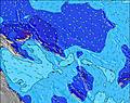 | 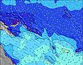 | 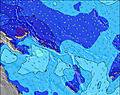 | 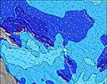 | 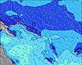 | 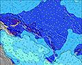 | 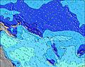 | 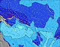 | ||||||||||||||
Wave Height (m) Direction Period (s) | SSE 8 | SSE 8 | SSE 8 | SSE 8 | SSE 8 | SSE 8 | SSE 8 | SSE 9 | SSE 9 | SSE 10 | SSE 10 | SSE 10 | SSE 10 | SSE 10 | SSE 10 | SSE 10 | SSE 10 | SSE 10 | SSE 10 | SSE 10 | SSE 10 | SSE 10 |
Wave Graph | ||||||||||||||||||||||
540 | 600 | 652 | 725 | 763 | 845 | 977 | 1121 | 1172 | 1467 | 1699 | 1733 | 1620 | 1839 | 1883 | 1856 | 1712 | 1657 | 1378 | 1280 | 1412 | 1492 | |
Wind (km/h) | ||||||||||||||||||||||
Wind State on-shore cross-onshore cross-shore cross-offshore off-shore glassy | cross-on | cross-on | cross-on | cross-on | cross-on | cross-on | cross-on | cross-on | cross-on | cross | cross-on | cross-on | cross-on | cross-on | cross | cross | cross | cross | cross | cross-on | cross-on | cross |
High Tide | 4:57AM0.71m | 9:07PM0.60m | 5:10AM0.64m | 8:32PM0.63m | ||||||||||||||||||
Low Tide | 1:15PM0.19m | 1:12PM0.25m | 00:18AM0.57m | 12:55PM0.30m | ||||||||||||||||||
6:46 | — | — | — | — | — | — | 6:46 | — | — | — | — | — | — | — | 6:45 | — | — | — | — | — | — | |
— | — | — | 6:30 | — | — | — | — | — | — | — | 6:31 | — | — | — | — | — | — | — | 6:31 | — | — | |
mm | 3 | 2 | 2 | 2 | 1 | 1 | 3 | 5 | 8 | 5 | 2 | 2 | 3 | 4 | 6 | 3 | 5 | 4 | 4 | 5 | 3 | 3 |
Temp °C | 26 | 26 | 26 | 26 | 26 | 26 | 26 | 26 | 25 | 26 | 26 | 26 | 26 | 26 | 26 | 26 | 26 | 26 | 26 | 25 | 26 | 26 |
Feels °C | 25 | 25 | 24 | 25 | 25 | 25 | 25 | 26 | 24 | 25 | 26 | 26 | 26 | 26 | 26 | 26 | 26 | 25 | 26 | 25 | 26 | 26 |
Swell 1 Height (m) Direction Period (s) | SE 14 | SE 14 | SE 14 | SE 13 | SE 13 | S 16 | SSE 13 | S 15 | S 15 | — | — | — | — | — | S 10 | SSE 10 | SSE 10 | SSE 10 | S 10 | S 10 | S 10 | S 18 |
50 | 49 | 46 | 45 | 7 | 5 | 17 | 4 | 4 | — | — | — | — | — | 1280 | 1510 | 1348 | 1378 | 900 | 834 | 932 | 6 | |
Swell 2 Height (m) Direction Period (s) | S 16 | S 14 | S 14 | S 14 | S 14 | S 16 | S 15 | — | — | — | — | — | — | — | — | — | — | — | — | — | — | — |
5 | 4 | 4 | 4 | 4 | 5 | 4 | — | — | — | — | — | — | — | — | — | — | — | — | — | — | — | |
Swell 3 Height (m) Direction Period (s) | S 13 | — | — | — | — | — | — | — | — | — | — | — | — | — | — | — | — | — | — | — | — | — |
3 | — | — | — | — | — | — | — | — | — | — | — | — | — | — | — | — | — | — | — | — | — | |
Wind waves Height (m) Direction Period (s) | SSE 8 | SSE 8 | SSE 8 | SSE 8 | SSE 8 | SSE 8 | SSE 8 | SSE 9 | SSE 9 | SSE 10 | SSE 10 | SSE 10 | SSE 10 | SSE 10 | SSE 10 | SSE 10 | SSE 10 | SSE 10 | SSE 10 | SSE 10 | SSE 10 | SSE 10 |
540 | 600 | 652 | 725 | 763 | 845 | 977 | 1121 | 1172 | 1467 | 1699 | 1733 | 1620 | 1839 | 1883 | 1856 | 1712 | 1657 | 1378 | 1280 | 1412 | 1492 | |
Nearest Offshore or Glassy | ||||||||||||||||||||||
Distance (km) | 907 | 813 | 813 | 813 | 909 | 907 | 907 | 813 | 813 | 813 | 813 | 813 | 813 | 813 | 813 | 909 | 813 | 813 | 813 | 727 | 909 | 1597 |
Best forecast wave conditions in New Georgia | ||||||||||||||||||||||
Best forecast wave conditions in Solomon Islands | ||||||||||||||||||||||
Header Global | ||||||||||||||||||||||
- Map Icons:
 Break
Break Live Wave Height (m)
 Live Wind Speed (km/h)
 Surf Rating (10 Max)
 Ocean Swells (m)
- Wind Speed (km/h)
Latest Updates


FREE! Surf-Forecast.com widget for your website
The surf report / weather widget below is available to embed on third party websites free of charge and provides a summary of our Titiana surf forecast. Simply grab the html code snippet that we provide and paste it into your own site. You can choose your preferred language and metric/imperial units for the surf forecast feed to suit users of your site. Click here to get the code.
 Nearest