

Surf Forecasts:

The Reef (Culebra) surf forecast from 3 Aug 2026:
- Most powerful swell: Friday 7 Aug, 8AM (local time) - 4.5ft (1.3m), 8s period, E swell with 193 kJ wave energy.
Best Forecast Surf Conditions for The Reef (Culebra) this week:
The most powerful waves expected at The Reef (Culebra) in the next 16 days are 1.3m 8s and forecast to arrive on Friday (Aug 07) at 8AM. Winds are predicted to be cross-shore at the time the swell arrives. The largest open ocean swell (not directed at the beach) is 1.3m 6s period and expected on Monday (Aug 03) at 5AM.
| Wave Type | Time (AST) & Date | Wave Height & Period |
|---|---|---|
| Next good surf (1 star+) | - | - |
| Best Surf | - | - |
| Most Powerful | 8AM (Fri 7th Aug) | 4.5ft (1.3m) 8s |
Table - best surf conditions forecast for The Reef (Culebra) over the next 16 days.
The Lowdown
Right then, let’s have a look at what’s on offer for the next couple of weeks here in Culebra.
To be straight with you, it’s a tough run. The Reef (Culebra) is our only real option in the guidance, and it’s a very consistent reef setup that’s exposed to the north, which is the direction we want to see. But the wind is just not playing ball. For the first week and a half, we’ve got a constant easterly breeze, mostly cross or cross-off, which isn’t giving us that clean, glassy face we crave. The swell is small and weak, with combined energy readings mostly under 100 (like 92, 95, 27) – that’s just not enough grunt to push through the chop.
The water temperature anomaly is about average for the time of year, so no surprises there.
We do see a notable uptick in swell size from the 13th of August onwards, with heights pushing 6 ft to 6 ft and combined energy climbing into the 200s and 400s (like 247, 397, 420). That’s moderate wave energy, and it’s coming from the east. But here’s the kicker: the wind is still a strong cross-shore, 18 to 22 mph, which is going to turn that bump into a lumpy, messy, cross-chop. For a reef break, that’s a real shame. The swell direction is east, which is not the optimum north swell direction for this spot, so the waves won’t be wrapping in perfectly.
Honestly, the whole 16-day window looks poor for a proper paddle session. The 6 ft bump on the 14th and 15th August is the biggest swell, but with that tearing cross-wind, it’s more of a blown-out mess than a classic wave. It’s not a total loss – if you’re a strong intermediate, you might find a few close-outs, but it’s not the kind of day you’d be telling your mates about. For a beginner, those 5 ft plus days are too big and messy anyway.
Given the persistent cross-wind and the size, this setup actually looks more interesting for kite surfing than paddle surfing. The wind is there, the swell has some push, but for a surfboard, it’s a real struggle. There’s no standout session in this forecast. It’s a poor run, and we just have to wait for the next change in the weather pattern.
Rusty.
Short Range ForecastLight rain (total 6mm), mostly falling on Sun night. Warm (max 28°C on Sun night, min 27°C on Tue morning). Mainly fresh winds. | Days 5-7 Weather SummaryModerate rain (total 11mm), heaviest on Wed night. Warm (max 28°C on Wed night, min 27°C on Wed night). Mainly fresh winds. | ||||||||||||||||||
Monday 3 | Tuesday 4 | Wednesday 5 | Thursday 6 | Friday 7 | Saturday 8 | ||||||||||||||
Night | AM | PM | Night | AM | PM | Night | AM | PM | Night | AM | PM | Night | AM | PM | Night | AM | PM | Night | |
Swell Height Map |  |  |  |  | 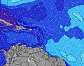 | 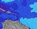 | 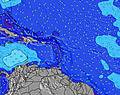 | ||||||||||||
Wave Height (m) Direction Period (s) | E 5 | E 6 | E 6 | N 10 | ENE 6 | ENE 7 | E 4 | ENE 7 | E 6 | NE 7 | NE 7 | NE 9 | NE 8 | ENE 8 | ENE 8 | E 5 | E 6 | E 6 | E 6 |
Wave Graph | |||||||||||||||||||
93 | 92 | 95 | 2 | 27 | 29 | 25 | 38 | 54 | 37 | 44 | 12 | 97 | 98 | 98 | 76 | 98 | 102 | 106 | |
Wind (km/h) | |||||||||||||||||||
Wind State on-shore cross-onshore cross-shore cross-offshore off-shore glassy | cross-off | cross-off | cross | cross | cross | cross | cross | cross-off | cross-off | cross-off | cross-off | cross-off | cross | cross | cross | cross | cross | cross | cross |
High Tide | 11:16PM0.33m | 12:07PM0.28m | 11:42PM0.30m | 1:09PM0.30m | 00:11AM0.27m | 2:15PM0.33m | 00:43AM0.23m | 3:24PM0.35m | 1:22AM0.21m | 4:34PM0.37m | 2:17AM0.19m | 5:41PM0.39m | 3:32AM0.18m | ||||||
Low Tide | 5:55AM0.07m | 5:50PM0.13m | 6:22AM0.04m | 7:02PM0.16m | 6:57AM0.01m | 8:31PM0.18m | 7:40AM-0.02m | 10:16PM0.18m | 8:33AM-0.04m | 11:53PM0.18m | 9:35AM-0.05m | 1:02AM0.17m | |||||||
— | 5:58 | — | — | 6:00 | — | — | 6:00 | — | — | 6:00 | — | — | 6:00 | — | — | 6:01 | — | — | |
6:54 | — | 6:54 | — | — | 6:53 | — | — | 6:53 | — | — | 6:52 | — | — | 6:52 | — | — | 6:52 | — | |
mm | 1 | — | — | — | 1 | 1 | 3 | — | — | 3 | 2 | 1 | 3 | — | — | 1 | — | 1 | 1 |
Temp °C | 28 | 28 | 28 | 28 | 28 | 28 | 28 | 28 | 28 | 28 | 28 | 28 | 27 | 27 | 27 | 27 | 28 | 28 | 28 |
Feels °C | 27 | 28 | 28 | 28 | 29 | 29 | 29 | 29 | 29 | 29 | 28 | 28 | 28 | 27 | 27 | 26 | 28 | 29 | 28 |
Swell 1 Height (m) Direction Period (s) | — | — | SSE 6 | S 8 | SE 6 | SE 6 | ENE 7 | ENE 7 | N 11 | NE 7 | NE 7 | NE 9 | NE 8 | ENE 8 | SSE 6 | NE 9 | NE 9 | NE 9 | NE 9 |
— | — | 21 | 1 | 15 | 15 | 15 | 38 | 2 | 37 | 44 | 12 | 97 | 98 | 26 | 20 | 20 | 19 | 20 | |
Swell 2 Height (m) Direction Period (s) | — | — | — | N 10 | ESE 7 | ESE 7 | N 9 | N 9 | N 9 | E 10 | NE 10 | E 9 | E 9 | NE 9 | NE 9 | E 9 | NNE 9 | — | NE 12 |
— | — | — | 2 | 5 | 5 | 2 | 2 | 2 | 2 | 4 | 2 | 2 | 22 | 22 | 2 | 8 | — | 6 | |
Swell 3 Height (m) Direction Period (s) | — | — | — | — | — | — | — | N 12 | E 11 | NE 11 | E 10 | E 9 | E 9 | E 9 | — | — | — | — | — |
— | — | — | — | — | — | — | 3 | 2 | 5 | 8 | 2 | 2 | 2 | — | — | — | — | — | |
Wind waves Height (m) Direction Period (s) | E 5 | E 6 | E 6 | E 5 | ENE 6 | ENE 7 | E 4 | SE 5 | E 6 | ESE 4 | SE 5 | E 5 | SE 6 | SE 6 | ENE 8 | E 5 | E 6 | E 6 | E 6 |
93 | 92 | 95 | 52 | 27 | 29 | 25 | 7 | 54 | 17 | 24 | 56 | 36 | 35 | 98 | 76 | 98 | 102 | 106 | |
Nearest Offshore or Glassy | |||||||||||||||||||
Distance (km) | 98 | 79 | 105 | 74 | 796 | 871 | 82 | 105 | 105 | 68 | 193 | 878 | 74 | 69 | 796 | 98 | 878 | 270 | 98 |
Best forecast wave conditions in Puerto Rico | |||||||||||||||||||
Best forecast wave conditions in Puerto Rico | |||||||||||||||||||
Header Global | |||||||||||||||||||
- Map Icons:
 Break
Break Live Wave Height (m)
 Live Wind Speed (km/h)
 Surf Rating (10 Max)
 Ocean Swells (m)
- Wind Speed (km/h)
Latest Updates


FREE! Surf-Forecast.com widget for your website
The surf report / weather widget below is available to embed on third party websites free of charge and provides a summary of our The Reef (Culebra) surf forecast. Simply grab the html code snippet that we provide and paste it into your own site. You can choose your preferred language and metric/imperial units for the surf forecast feed to suit users of your site. Click here to get the code.
Information about the The Reef (Culebra) Surf forecast
The above surf forecast table for The Reef (Culebra) provides essential information for determining whether the surfing conditions will be good over the next 16 days. A general guide to surfing at The Reef (Culebra) can be found by selecting the local surf guide option on the grey menu. Our The Reef (Culebra) surf forecast is unique since it includes wave energy (power) that defines the real feel of the surf rather than just the height or the period. If you surf the same spot (The Reef (Culebra)) regularly then make a mental note of the wave energy from the surf forecast table each time you go. Very soon you may start to choose your surf days based on the wave energy alone combined with our forecast of favourable offshore wind conditions. Our star ratings will help here and of course you will also find the usual wave height and period predictions on our surf forecasts as well as a full break down of the swell components under our advanced users option (to reveal that, click the little Einstein character under the tide times).
Further information to help with frequently asked questions about our surf forecast for The Reef (Culebra) may be found under the help tab on the top menu and also by moving your mouse over the question marks on the surf forecast table itself. Please always bear in mind that the forecast is for near-shore open water and local factors at each surf break influence the actual breaking wave height, such as the beach / reef profile, water depths offshore and shelter.
 Nearest