

Surf Forecasts:

Saaga surf forecast from 3 Aug 2026:
- Best quality surf: Monday 3 Aug, 10PM (local time) - 3.5ft (1.0m), 14s period, SW swell with cross-offshore winds.
- Most powerful swell: Monday 10 Aug, 1PM (local time) - 7.5ft (2.3m), 16s period, S swell with 2,594 kJ wave energy.
- Next surfable swell (1★+): Monday 3 Aug, 10PM (local time) - 3.5ft (1.0m), 14s period with SW swell.
Best Forecast Surf Conditions for Saaga this week:
The surf forecast for Saaga over the next 16 days: The first swell (rated 1 star or higher) is forecast to arrive on Monday (Aug 03) at 10PM. The primary swell is predicted to be 1.0m and 14s period with a secondary swell of 1.1m and 11s. The wind is predicted to be cross-offshore as the swell arrives.
The most powerful waves expected at Saaga in the next 16 days are 2.3m 16s and forecast to arrive on Monday (Aug 10) at 1PM. Winds are predicted to be cross-shore at the time the swell arrives.
| Wave Type | Time (+13) & Date | Wave Height & Period |
|---|---|---|
| Next good surf (1 star+) | 10PM (Mon 3rd Aug) | 3.5ft (1.0m) 14s |
| Best Surf | 10PM (Mon 3rd Aug) | 3.5ft (1.0m) 14s |
| Most Powerful | 1PM (Mon 10th Aug) | 7.5ft (2.3m) 16s |
Table - best surf conditions forecast for Saaga over the next 16 days.
The Lowdown
G’day, Rusty here. Look, I’m gonna be straight with you – this is a tough stretch for Saaga. We’ve got a promising little window right at the start, but after that, the wind turns nasty and it’s a long, grinding wait for anything decent again. The water’s sitting at 81°, which is pretty much bang on average for this time of year.
The only real highlight is Monday afternoon, August 3rd at Saaga. It’s a proper reef setup, so it handles swell well, and we’ve got a clean 3ft SW groundswell pushing through with a solid 14-second period. The wind is a light cross-offshore breeze from the NE at 9 mph, which is going to leave the surface glassy. The combined energy is moderate (773), but the conditions are set to be clean and fun. This is the one to paddle out for. Keep in mind it’s an advanced wave and it can get crowded sometimes, so pick your peak.
Tuesday the 4th starts with some onshore wind and a marginal tide, and it only gets worse from there. By Wednesday the 5th, the wind is up to 16 mph from the SE, and the swell jumps to 4-4ft, but it’s cross-on and choppy. The energy is getting serious (909 on Wednesday morning, 1304 on Wednesday afternoon), but the quality is gone.
We hit a real rough patch from Thursday, August 6th, through to Friday, August 14th. The wind just doesn’t let up. It’s blowing 22-34 mph from the SE, making it a cross-on mess. The swell gets big – we’re talking 7ft to 10ft throughout – but it’s blown out, lumpy, and ugly. The energy is strong to very strong, hitting as high as 2226, but with that near-gale wind, it’s only going to appeal to the foilers or kite crew. For a paddle surfer, it’s a write-off.
There’s a glimmer on Saturday, August 15th, with a 4ft SW groundswell and a very long 16-second period, but the wind is still 19 mph from the ENE, cross-off but fresh. The conditions are clean, but the tide looks questionable. That long period will make it wall up at this reef, which is a good thing, but the energy is moderate (1214). It’s a maybe, not a guarantee.
The following Monday, August 17th, sees a drop in wind to 16 mph from the ESE, with a 4-5ft SE swell and a period of 10-11 seconds. The energy is moderate (822-867), but it’s still cross-shore, so it’s lumpy and marginal. Not a standout.
Then Tuesday, August 18th, the swell jacks up to 10ft from the SE with a 10-second period, and the energy is strong (1688-1832). But the wind is back onshore and the surf is poor. That’s a lot of water moving around, but with the onshore slop, it’s not for the average surfer.
So, bottom line: get it on Monday afternoon, August 3rd, because after that, it’s a long dry spell of strong wind and blown-out conditions until the second week, where we get a few marginal, lumpy days. The long-range stuff on the 18th is big but messy. I’d be checking the forecast again in a few days, because this run of poor conditions won’t last forever.
Rusty.
Short Range ForecastModerate rain (total 12mm), heaviest on Wed night. Warm (max 27°C on Mon afternoon, min 24°C on Wed night). Winds increasing (calm on Mon night, fresh winds from the SSE by Wed night). | Days 5-7 Weather SummaryLight rain (total 8mm), mostly falling on Thu night. Warm (max 24°C on Thu afternoon, min 24°C on Thu afternoon). Mainly near gales. | |||||||||||||||||||
Mon 3 | Tuesday 4 | Wednesday 5 | Thursday 6 | Friday 7 | Saturday 8 | Sunday 9 | ||||||||||||||
PM | Night | AM | PM | Night | AM | PM | Night | AM | PM | Night | AM | PM | Night | AM | PM | Night | AM | PM | Night | |
Swell Height Map |  |  |  | 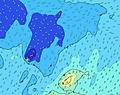 | 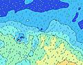 | 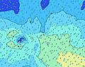 | 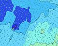 | |||||||||||||
Wave Height (m) Direction Period (s) | SSE 11 | SW 14 | SW 13 | SW 13 | SW 13 | S 13 | SSW 12 | S 12 | SW 17 | SSE 11 | SSE 8 | SSE 8 | SSE 8 | SE 9 | S 9 | ESE 8 | SE 9 | SE 9 | ESE 9 | S 18 |
Wave Graph | ||||||||||||||||||||
346 | 390 | 444 | 437 | 459 | 427 | 461 | 537 | 745 | 954 | 679 | 904 | 691 | 1263 | 1005 | 1056 | 1755 | 1647 | 1320 | 1579 | |
Wind (km/h) | ||||||||||||||||||||
Wind State on-shore cross-onshore cross-shore cross-offshore off-shore glassy | cross-off | off | on | on | cross-on | cross-on | cross-on | cross-on | cross-on | cross-on | cross-on | cross-on | cross-on | cross-on | cross-on | cross-on | cross-on | cross-on | cross-on | cross-on |
High Tide | 10:02PM0.97m | 10:18AM0.94m | 10:53PM0.98m | 11:15AM0.91m | 11:50PM0.99m | 12:20PM0.89m | 00:53AM1.01m | 1:29PM0.89m | 1:58AM1.06m | 2:37PM0.92m | 3:01AM1.11m | 3:39PM0.97m | 4:00AM1.17m | |||||||
Low Tide | 4:07AM0.28m | 4:28PM0.24m | 5:04AM0.28m | 5:21PM0.26m | 6:09AM0.27m | 6:22PM0.26m | 7:19AM0.24m | 7:29PM0.24m | 8:28AM0.18m | 8:35PM0.20m | 9:31AM0.12m | 9:38PM0.15m | ||||||||
— | — | 6:47 | — | — | 6:47 | — | — | 6:47 | — | — | 6:46 | — | — | 6:46 | — | — | 6:45 | — | — | |
6:19 | — | — | 6:19 | — | — | 6:19 | — | — | 6:19 | — | — | 6:19 | — | — | 6:19 | — | — | 6:20 | — | |
mm | 2 | — | — | — | 1 | 2 | 2 | 5 | — | — | 3 | — | — | 1 | 1 | — | 3 | — | — | — |
Temp °C | 27 | 27 | 26 | 26 | 25 | 25 | 25 | 25 | 24 | 24 | 24 | 24 | 24 | 24 | 24 | 24 | 24 | 24 | 25 | 25 |
Feels °C | 30 | 30 | 29 | 28 | 26 | 25 | 25 | 24 | 21 | 22 | 21 | 19 | 20 | 19 | 17 | 18 | 17 | 17 | 20 | 20 |
Swell 1 Height (m) Direction Period (s) | SSE 11 | SE 11 | SW 13 | SW 13 | SW 13 | SW 12 | SSW 12 | S 12 | S 10 | SW 16 | SW 16 | S 15 | S 15 | SSW 13 | S 9 | S 10 | S 13 | S 12 | S 12 | S 18 |
335 | 288 | 444 | 437 | 459 | 341 | 461 | 537 | 361 | 534 | 496 | 453 | 537 | 860 | 1005 | 983 | 483 | 418 | 403 | 1579 | |
Swell 2 Height (m) Direction Period (s) | E 8 | SW 14 | SE 10 | SE 11 | SSW 15 | S 13 | SW 12 | SW 11 | SW 17 | S 18 | S 11 | SW 16 | SW 15 | S 16 | SW 14 | SW 14 | SW 13 | SW 13 | S 20 | S 11 |
92 | 390 | 106 | 163 | 284 | 427 | 409 | 273 | 745 | 158 | 121 | 362 | 269 | 334 | 99 | 65 | 42 | 43 | 477 | 389 | |
Swell 3 Height (m) Direction Period (s) | SW 14 | E 8 | E 8 | E 8 | SE 10 | E 8 | SW 19 | SW 18 | SW 12 | SW 12 | S 16 | ENE 12 | ENE 12 | SW 15 | NE 11 | SW 21 | SW 20 | S 21 | SW 13 | SSW 18 |
346 | 72 | 58 | 41 | 108 | 43 | 384 | 465 | 84 | 68 | 190 | 15 | 14 | 171 | 5 | 18 | 16 | 79 | 26 | 31 | |
Wind waves Height (m) Direction Period (s) | — | — | — | SSE 3 | SE 4 | SSE 6 | SSE 5 | SE 5 | SSE 6 | SSE 11 | SSE 8 | SSE 8 | SSE 8 | SE 9 | ESE 8 | ESE 8 | SE 9 | SE 9 | ESE 9 | ESE 9 |
— | — | — | 3 | 11 | 98 | 50 | 53 | 136 | 954 | 679 | 904 | 691 | 1263 | 832 | 1056 | 1755 | 1647 | 1320 | 1118 | |
Nearest Offshore or Glassy | ||||||||||||||||||||
Distance (km) | 0 | 0 | 20 | 20 | 1250 | 109 | 867 | 1510 | 2199 | 2195 | 2199 | 2199 | 2247 | 1243 | 1243 | 2492 | 1243 | 1243 | 1243 | 1243 |
Best forecast wave conditions in Upolu | ||||||||||||||||||||
Best forecast wave conditions in Samoa | ||||||||||||||||||||
Header Global | ||||||||||||||||||||
- Map Icons:
 Break
Break Live Wave Height (m)
 Live Wind Speed (km/h)
 Surf Rating (10 Max)
 Ocean Swells (m)
- Wind Speed (km/h)
Latest Updates


FREE! Surf-Forecast.com widget for your website
The surf report / weather widget below is available to embed on third party websites free of charge and provides a summary of our Saaga surf forecast. Simply grab the html code snippet that we provide and paste it into your own site. You can choose your preferred language and metric/imperial units for the surf forecast feed to suit users of your site. Click here to get the code.
Information about the Saaga Surf forecast
The above surf forecast table for Saaga provides essential information for determining whether the surfing conditions will be good over the next 16 days. A general guide to surfing at Saaga can be found by selecting the local surf guide option on the grey menu. Our Saaga surf forecast is unique since it includes wave energy (power) that defines the real feel of the surf rather than just the height or the period. If you surf the same spot (Saaga) regularly then make a mental note of the wave energy from the surf forecast table each time you go. Very soon you may start to choose your surf days based on the wave energy alone combined with our forecast of favourable offshore wind conditions. Our star ratings will help here and of course you will also find the usual wave height and period predictions on our surf forecasts as well as a full break down of the swell components under our advanced users option (to reveal that, click the little Einstein character under the tide times).
Further information to help with frequently asked questions about our surf forecast for Saaga may be found under the help tab on the top menu and also by moving your mouse over the question marks on the surf forecast table itself. Please always bear in mind that the forecast is for near-shore open water and local factors at each surf break influence the actual breaking wave height, such as the beach / reef profile, water depths offshore and shelter.
Are you planning a holiday in Sardinia? If you are looking for accommodation near Sa Mesa Longa ( laguna), camping, hotels and holiday cottages in Sardinia, consider staying in Oristano which is 23 km (14 miles) away. Other places in and around Sardinia where you can find information about places to rent, and car hire include Alghero which is 57 km (35 miles) away, Sassari, Iglesias and Nuoro.
 Nearest