

Surf Forecasts:

Playa Langosta surf forecast from 16 Jul 2026:
- Best quality surf: Thursday 16 Jul, 3PM (local time) - 3.5ft (1.0m), 13s period, SSW swell with offshore winds.
- Most powerful swell: Tuesday 21 Jul, 3AM (local time) - 3.5ft (1.0m), 15s period, SW swell with 415 kJ wave energy.
- Next surfable swell (1★+): Thursday 16 Jul, 3PM (local time) - 3.5ft (1.0m), 13s period with SSW swell.
Best Forecast Surf Conditions for Playa Langosta this week:
The surf forecast for Playa Langosta over the next 16 days: The first swell (rated 1 star or higher) is forecast to arrive on Thursday (Jul 16) at 3PM. The primary swell is predicted to be 1.0m and 13s period with a secondary swell of 0.4m and 5s. The wind is predicted to be offshore as the swell arrives.
The most powerful waves expected at Playa Langosta in the next 16 days are 1.0m 15s and forecast to arrive on Tuesday (Jul 21) at 3AM. Winds are predicted to be cross-offshore at the time the swell arrives. The largest open ocean swell (not directed at the beach) is 1.1m 4s period and expected on Friday (Jul 17) at 9AM.
| Wave Type | Time (CST) & Date | Wave Height & Period |
|---|---|---|
| Next good surf (1 star+) | 3PM (Thu 16th Jul) | 3.5ft (1.0m) 13s |
| Best Surf | 3PM (Thu 16th Jul) | 3.5ft (1.0m) 13s |
| Most Powerful | 3AM (Tue 21st Jul) | 3.5ft (1.0m) 15s |
Table - best surf conditions forecast for Playa Langosta over the next 16 days.
The Lowdown
Alright, mate, Rusty here. Let’s have a look at what’s on the cards for the next couple of weeks. We’ve only got one spot to focus on, so let’s get into it.
Playa Langosta is your only play, and it’s a real mixed bag. We start off with a bit of a slow patch, but there are a couple of windows that look proper tidy if you’re patient.
The first real chance to get wet is this Wednesday, the 15th. We’ve got a clean 2ft swell rolling in from the SSW, with a decent 13-second period. The wind is a moderate offshore from the ENE, keeping things tidy. The water is a touch warmer than normal at 86°, and the combined energy is moderate (453). It’s not massive, but it’s clean and fun. Wednesday afternoon goes glassy with a light SSW breeze and a 2ft SW swell at 16 seconds, which is proper silky. Expect some good, clean waves.
Thursday the 16th has a bit more push in the afternoon with a clean 3ft SSW swell, 13-second period, and offshore ENE winds. That’s a nice little window, offering moderate energy (374). It’s worth a look.
Things get a bit more interesting on Saturday the 18th. The morning is so-so, but Saturday afternoon the wind drops to glassy with a calm from the NNW, and we’ve got a clean 3ft SSW swell at 12 seconds. The energy is still moderate (305), and the glassy conditions will make it feel a lot better than the size suggests.
Now, if you can wait, the real standout is coming up in the second week, around Friday the 24th through to Monday the 27th. This is the one. The swell builds and gets longer in period. Friday the 24th morning shows a 3ft SW swell with a very long 24-second period and strong energy (780). That’s groundswell territory – think long, clean lines, perfect for this point break setup. The wind is a moderate cross-offshore, so it’ll be clean. Friday afternoon stays clean with a light breeze. Saturday the 25th is a stunner. Morning has a 3ft SW swell, 21-second period, and strong energy (747). Glassy conditions in the afternoon. This is the best of the run. Sunday the 26th keeps it going with 4ft SW swell, 19-second period, and very strong energy (879). Another day of glassy or near-glassy conditions.
Monday the 27th morning is the biggest, with 4ft SW swell, 17-second period, and very strong energy (1060). That’s excellent for experienced surfers, but it’s getting a bit solid for beginners. The wind is a gentle cross-offshore, so it’s clean.
Keep in mind that the very long period swells (over 15 seconds) can make beach breaks a bit wonky, but for a point break like Langosta, it’s a dream. Also, Langosta can get crowded sometimes, so get there early on those standout days if you want a clean lineup.
The last few days of the month still offer fun, clean surf in the mornings, with the wind staying favourable on Wednesday the 29th and Thursday the 30th, but the energy drops off.
So, the pick of the crop is Saturday the 25th and Sunday the 26th. Clean, glassy, consistent groundswell. Don’t sleep on it.
Rusty.
Short Range ForecastSome drizzle, heaviest during Fri afternoon. Warm (max 31°C on Wed morning, min 25°C on Wed night). Winds increasing (calm on Wed afternoon, fresh winds from the ENE by Thu night). | Days 4-6 Weather SummaryLight rain (total 2mm), mostly falling on Sat afternoon. Warm (max 31°C on Sat morning, min 25°C on Sun night). Winds increasing (calm on Sat afternoon, fresh winds from the NE by Mon morning). | ||||||||||||||||||||
Wednesday 15 | Thursday 16 | Friday 17 | Saturday 18 | Sunday 19 | Monday 20 | Tuesday 21 | |||||||||||||||
AM | PM | Night | AM | PM | Night | AM | PM | Night | AM | PM | Night | AM | PM | Night | AM | PM | Night | AM | PM | Night | |
Swell Height Map |  |  |  | 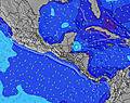 | 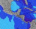 | 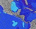 | 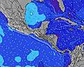 | ||||||||||||||
Wave Height (m) Direction Period (s) | SSW 13 | SW 16 | SW 16 | SW 12 | SSW 13 | SW 14 | SW 15 | SSW 13 | SW 13 | SSW 12 | SSW 12 | SSW 13 | SSW 13 | SSW 12 | SSW 12 | SW 16 | SW 16 | SW 15 | SW 15 | SW 14 | SW 13 |
Wave Graph | |||||||||||||||||||||
181 | 196 | 206 | 157 | 326 | 103 | 75 | 178 | 178 | 192 | 164 | 286 | 286 | 248 | 252 | 366 | 361 | 313 | 305 | 297 | 250 | |
Wind (km/h) | |||||||||||||||||||||
Wind State on-shore cross-onshore cross-shore cross-offshore off-shore glassy | off | glassy | cross-off | cross-off | off | cross-off | cross-off | cross-off | cross-off | cross-off | glassy | cross-off | cross-off | cross-off | cross-off | cross-off | cross-off | cross-off | cross-off | cross-off | cross-off |
High Tide | 3:12PM2.63m | 3:48AM2.52m | 4:04PM2.62m | 4:39AM2.59m | 4:53PM2.56m | 5:27AM2.59m | 5:42PM2.45m | 6:14AM2.54m | 6:31PM2.31m | 7:01AM2.44m | 7:20PM2.15m | 7:48AM2.32m | 8:11PM1.99m | ||||||||
Low Tide | 9:33PM-0.03m | 9:54AM0.15m | 10:22PM-0.04m | 10:47AM0.16m | 11:09PM0.01m | 11:38AM0.21m | 11:55PM0.11m | 12:28PM0.30m | 00:41AM0.25m | 1:18PM0.40m | 1:27AM0.41m | 2:10PM0.51m | 2:15AM0.56m | ||||||||
5:28 | — | — | 5:28 | — | — | 5:28 | — | — | 5:30 | — | — | 5:30 | — | — | 5:30 | — | — | 5:30 | — | — | |
— | 6:08 | — | — | 6:08 | — | — | 6:08 | — | — | 6:08 | — | — | 6:08 | — | — | 6:08 | — | — | 6:07 | — | |
mm | — | — | — | — | — | — | — | 1 | — | — | 1 | — | — | 1 | — | — | — | — | — | — | — |
Temp °C | 31 | 31 | 27 | 31 | 31 | 27 | 31 | 31 | 28 | 31 | 30 | 27 | 31 | 31 | 27 | 30 | 30 | 27 | 29 | 29 | 27 |
Feels °C | 33 | 35 | 30 | 31 | 32 | 25 | 31 | 32 | 27 | 33 | 35 | 28 | 32 | 35 | 26 | 29 | 29 | 26 | 28 | 28 | 27 |
Swell 1 Height (m) Direction Period (s) | SSW 13 | SW 16 | SW 16 | SW 12 | SSW 13 | S 14 | S 14 | SSW 13 | S 13 | SSW 12 | SSW 12 | SSW 13 | SSW 13 | SSW 12 | SSW 12 | SW 16 | SW 16 | SW 15 | SW 15 | SSW 12 | SW 13 |
181 | 196 | 206 | 157 | 326 | 203 | 195 | 178 | 222 | 192 | 164 | 286 | 286 | 248 | 252 | 366 | 361 | 313 | 305 | 232 | 250 | |
Swell 2 Height (m) Direction Period (s) | SW 14 | SSW 13 | SW 13 | S 13 | N 5 | SW 12 | SW 12 | SW 15 | SW 13 | S 14 | S 14 | S 6 | S 7 | SW 18 | S 6 | S 13 | S 12 | SSW 7 | SSW 7 | SW 14 | SSW 7 |
164 | 129 | 80 | 89 | 8 | 68 | 67 | 76 | 178 | 150 | 146 | 12 | 21 | 194 | 20 | 212 | 146 | 54 | 42 | 297 | 49 | |
Swell 3 Height (m) Direction Period (s) | SW 18 | SSW 16 | S 12 | SW 16 | SW 16 | SW 14 | SW 15 | SW 12 | S 16 | SW 18 | SW 19 | SW 19 | SW 19 | S 6 | SW 18 | S 7 | SSW 7 | S 12 | S 12 | W 11 | S 11 |
108 | 86 | 72 | 91 | 40 | 103 | 75 | 52 | 81 | 113 | 129 | 96 | 170 | 29 | 192 | 33 | 52 | 144 | 101 | 10 | 93 | |
Wind waves Height (m) Direction Period (s) | NNE 3 | N 5 | N 5 | NNE 5 | — | NNE 5 | NNE 4 | N 5 | NNE 4 | NNE 5 | N 5 | NE 4 | NNE 5 | N 5 | NNE 5 | NNE 5 | N 5 | NE 4 | NNE 5 | NNE 5 | NNE 4 |
7 | 7 | 17 | 14 | — | 18 | 46 | 18 | 16 | 35 | 12 | 12 | 9 | 7 | 19 | 19 | 22 | 16 | 44 | 27 | 13 | |
Nearest Offshore or Glassy | |||||||||||||||||||||
Distance (km) | 3 | 0 | 23 | 19 | 0 | 19 | 23 | 10 | 19 | 16 | 0 | 23 | 23 | 0 | 23 | 23 | 23 | 19 | 23 | 23 | 3 |
Best forecast wave conditions in Guanacaste | |||||||||||||||||||||
Best forecast wave conditions in Costa Rica | |||||||||||||||||||||
Header Global | |||||||||||||||||||||
- Map Icons:
 Break
Break Live Wave Height (m)
 Live Wind Speed (km/h)
 Surf Rating (10 Max)
 Ocean Swells (m)
- Wind Speed (km/h)


FREE! Surf-Forecast.com widget for your website
The surf report / weather widget below is available to embed on third party websites free of charge and provides a summary of our Playa Langosta surf forecast. Simply grab the html code snippet that we provide and paste it into your own site. You can choose your preferred language and metric/imperial units for the surf forecast feed to suit users of your site. Click here to get the code.
Information about the Playa Langosta Surf forecast
The above surf forecast table for Playa Langosta provides essential information for determining whether the surfing conditions will be good over the next 16 days. A general guide to surfing at Playa Langosta can be found by selecting the local surf guide option on the grey menu. Our Playa Langosta surf forecast is unique since it includes wave energy (power) that defines the real feel of the surf rather than just the height or the period. If you surf the same spot (Playa Langosta) regularly then make a mental note of the wave energy from the surf forecast table each time you go. Very soon you may start to choose your surf days based on the wave energy alone combined with our forecast of favourable offshore wind conditions. Our star ratings will help here and of course you will also find the usual wave height and period predictions on our surf forecasts as well as a full break down of the swell components under our advanced users option (to reveal that, click the little Einstein character under the tide times).
Further information to help with frequently asked questions about our surf forecast for Playa Langosta may be found under the help tab on the top menu and also by moving your mouse over the question marks on the surf forecast table itself. Please always bear in mind that the forecast is for near-shore open water and local factors at each surf break influence the actual breaking wave height, such as the beach / reef profile, water depths offshore and shelter.
Playa Langosta is 46 km (29 miles) from Nicoya. If you plan a holiday in Guanacaste, look for hotels and other accommodation in Nicoya. Nicoya has rooms for a wide range of budgets as well as car hire and transport links.
 Nearest