

Surf Forecasts:

Langosta surf forecast from 2 Aug 2026:
- Best quality surf: Friday 7 Aug, 9PM (local time) - 3ft (0.9m), 16s period, SW swell with offshore winds.
- Most powerful swell: Saturday 8 Aug, 3PM (local time) - 3.5ft (1.1m), 15s period, SW swell with 566 kJ wave energy.
- Next surfable swell (1★+): Sunday 2 Aug, 3AM (local time) - 2.5ft (0.7m), 12s period with SW swell.
Best Forecast Surf Conditions for Langosta this week:
The surf forecast for Langosta over the next 16 days: The first swell (rated 1 star or higher) is forecast to arrive on Sunday (Aug 02) at 3AM. The primary swell is predicted to be 0.7m and 12s period with a secondary swell of 0.5m and 16s. The wind is predicted to be offshore as the swell arrives.
The most powerful waves expected at Langosta in the next 16 days are 1.1m 15s and forecast to arrive on Saturday (Aug 08) at 3PM. Winds are predicted to be onshore at the time the swell arrives. The largest open ocean swell (not directed at the beach) is 0.9m 9s period and expected on Tuesday (Aug 04) at 9AM.
| Wave Type | Time (CST) & Date | Wave Height & Period |
|---|---|---|
| Next good surf (1 star+) | 3AM (Sun 2nd Aug) | 2.5ft (0.7m) 12s |
| Best Surf | 9PM (Fri 7th Aug) | 3ft (0.9m) 16s |
| Most Powerful | 3PM (Sat 8th Aug) | 3.5ft (1.1m) 15s |
Table - best surf conditions forecast for Langosta over the next 16 days.
The Lowdown
Alright folks, Rusty here. Let’s have a look at what’s on the cards for Langosta over the next couple of weeks.
Right off the bat, the first few days are a bit of a write-off. We’ve got a small pulse of swell coming in on Saturday the 1st, but it’s messy and the wind is all wrong, giving us a light cross-shore that’s just chopping things up. There’s a little bit of energy in the water (241), but it’s not worth paddling out for. We’ll have to wait for things to clean up.
The real action starts to show on Sunday morning, the 2nd of August. The wind swings around to a gentle offshore from the ENE at 9 mph, and that’s going to clean things right up. We’re looking at a small but clean 2ft swell from the SW, with a long period of 12 seconds, giving it some real push for its size. The combined energy is moderate (212). It’s not a big day, but it’s a fun, clean little wave for beginners. The water temperature is a touch warmer than normal at 86°, which is a couple of degrees above average for this time of year, so it’s a bit of a bath.
The pattern for the next week or so is pretty consistent: small SW groundswells, with decent mornings and blown-out afternoons as the wind shifts onshore. Monday the 3rd and Tuesday the 4th both have clean mornings with cross-off winds and small, rideable swell. The energy picks up a bit on the 3rd (300), but it’s still small. Thursday the 6th sees a glassy morning, which is a rare treat, but the swell is tiny at 2ft.
Now, the standout window is the weekend of the 8th and 9th. Saturday the 8th of August is the pick of the bunch. The morning brings a moderate offshore breeze from the ENE at 12 mph, cleaning up a 3ft SSW groundswell with a very long period of 16 seconds. The combined energy is strong (580), so there’s plenty of power. This is a long-period groundswell, so at Langosta, which is a beach, reef, and rivermouth setup, it might break a little straight, but a clean 3ft wave with that much energy is going to be fun. The crowds are listed as often, so expect company. The morning session on Sunday the 9th is also solid, with a 3ft swell and clean offshore winds.
There’s a gap in the middle of the second week before another promising run. The 14th of August, a Friday, has a very good afternoon session. The wind drops to a light offshore from the E at 3 mph, and the swell is 4ft from the SW with a very long period of 18 seconds. The combined energy is very strong at 795. This is a powerful, clean groundswell that will be a treat for anyone who can handle the long-period sets. The morning of the 15th has a bigger 4ft swell, but a fresh 19 mph cross-off wind makes it tricky. The 14th afternoon is the better call.
The long-range forecast for the 16th shows a clean 3ft swell but with a cross-off wind, so it’s worth keeping an eye on, but it’s less certain.
So, if you’re looking for the best, nail the mornings of Saturday the 8th and Friday the 14th. The 8th looks cleaner, but the 14th has more power. Get out there.
Rusty.
Short Range ForecastLight rain (total 5mm), mostly falling on Sun night. Warm (max 31°C on Sun morning, min 25°C on Sat night). Wind will be generally light. | Days 5-7 Weather SummaryHeavy rain (total 47mm), heaviest during Thu night. Warm (max 31°C on Wed morning, min 24°C on Thu night). Wind will be generally light. | ||||||||||||||||||
Sunday 2 | Monday 3 | Tuesday 4 | Wednesday 5 | Thursday 6 | Friday 7 | ||||||||||||||
Night | AM | PM | Night | AM | PM | Night | AM | PM | Night | AM | PM | Night | AM | PM | Night | AM | PM | Night | |
Swell Height Map |  |  |  | 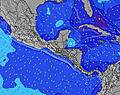 | 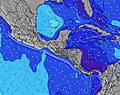 | 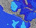 | 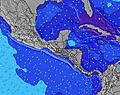 | ||||||||||||
Wave Height (m) Direction Period (s) | SW 12 | SW 15 | SW 15 | SW 14 | SW 14 | SW 13 | SW 13 | SW 13 | SSW 8 | SSW 8 | SW 15 | SW 15 | SW 14 | SW 14 | SW 13 | SW 13 | SSW 18 | SW 17 | SW 16 |
Wave Graph | |||||||||||||||||||
147 | 108 | 171 | 167 | 231 | 208 | 86 | 83 | 120 | 109 | 54 | 55 | 74 | 125 | 113 | 212 | 209 | 305 | 376 | |
Wind (km/h) | |||||||||||||||||||
Wind State on-shore cross-onshore cross-shore cross-offshore off-shore glassy | off | cross-off | cross-on | off | cross-off | cross-on | cross-off | cross-off | cross-on | off | cross-off | cross-on | off | glassy | cross-on | cross-off | cross-off | cross-on | cross-off |
High Tide | 5:01AM2.35m | 5:11PM2.25m | 5:36AM2.38m | 5:49PM2.19m | 6:13AM2.38m | 6:30PM2.12m | 6:55AM2.36m | 7:16PM2.04m | 7:43AM2.32m | 8:10PM1.96m | 8:39AM2.27m | 9:15PM1.90m | |||||||
Low Tide | 10:45PM0.29m | 11:08AM0.42m | 11:19PM0.31m | 11:47AM0.42m | 11:54PM0.35m | 12:29PM0.43m | 00:34AM0.40m | 1:15PM0.46m | 1:19AM0.46m | 2:09PM0.49m | 2:13AM0.52m | 3:11PM0.52m | |||||||
— | 5:31 | — | — | 5:31 | — | — | 5:33 | — | — | 5:33 | — | — | 5:33 | — | — | 5:33 | — | — | |
— | — | 6:06 | — | — | 6:06 | — | — | 6:05 | — | — | 6:05 | — | — | 6:05 | — | — | 6:04 | — | |
mm | — | — | — | 2 | — | — | 1 | — | 2 | 1 | — | 2 | 4 | 3 | 7 | 27 | — | 3 | — |
Temp °C | 28 | 31 | 29 | 28 | 31 | 29 | 27 | 31 | 30 | 27 | 31 | 29 | 27 | 28 | 28 | 24 | 30 | 28 | 27 |
Feels °C | 31 | 34 | 32 | 32 | 34 | 31 | 30 | 34 | 33 | 30 | 34 | 31 | 31 | 32 | 31 | 28 | 33 | 31 | 31 |
Swell 1 Height (m) Direction Period (s) | SW 12 | SW 12 | SW 15 | SW 14 | S 7 | SSW 7 | SSW 7 | S 9 | SSW 8 | SSW 8 | S 8 | S 8 | S 8 | S 8 | S 8 | S 8 | SSW 7 | SW 17 | SW 16 |
147 | 108 | 171 | 167 | 68 | 69 | 86 | 125 | 120 | 109 | 80 | 61 | 66 | 63 | 78 | 72 | 77 | 305 | 376 | |
Swell 2 Height (m) Direction Period (s) | SW 16 | S 7 | SSW 11 | S 7 | SW 14 | SW 13 | SW 13 | SW 13 | SW 12 | SW 12 | SW 12 | SW 12 | SW 14 | SW 14 | SW 13 | SW 13 | SW 13 | SW 12 | SW 12 |
124 | 23 | 85 | 36 | 231 | 208 | 82 | 83 | 73 | 93 | 50 | 49 | 74 | 125 | 113 | 212 | 168 | 151 | 144 | |
Swell 3 Height (m) Direction Period (s) | S 7 | SW 15 | S 7 | SW 12 | WSW 13 | SW 16 | SW 13 | SW 16 | SW 16 | SW 12 | SW 15 | SW 15 | SW 6 | S 13 | S 12 | SW 18 | SSW 18 | S 8 | S 9 |
14 | 104 | 22 | 116 | 69 | 66 | 84 | 64 | 61 | 36 | 54 | 55 | 6 | 31 | 25 | 159 | 209 | 68 | 53 | |
Wind waves Height (m) Direction Period (s) | NE 4 | NNE 4 | — | — | — | — | — | — | WSW 2 | NE 4 | NE 2 | WSW 6 | N 5 | — | — | NNE 6 | NNE 3 | N 4 | N 5 |
5 | 8 | — | — | — | — | — | — | 1 | 4 | 1 | 16 | 11 | — | — | 10 | 2 | 9 | 16 | |
Nearest Offshore or Glassy | |||||||||||||||||||
Distance (km) | 5 | 0 | 0 | 4 | 0 | 0 | 4 | 0 | 0 | 4 | 0 | 0 | 62 | 0 | 0 | 4 | 0 | 23 | 4 |
Best forecast wave conditions in Guanacaste | |||||||||||||||||||
Best forecast wave conditions in Costa Rica | |||||||||||||||||||
Header Global | |||||||||||||||||||
- Map Icons:
 Break
Break Live Wave Height (m)
 Live Wind Speed (km/h)
 Surf Rating (10 Max)
 Ocean Swells (m)
- Wind Speed (km/h)
Latest Updates


FREE! Surf-Forecast.com widget for your website
The surf report / weather widget below is available to embed on third party websites free of charge and provides a summary of our Langosta surf forecast. Simply grab the html code snippet that we provide and paste it into your own site. You can choose your preferred language and metric/imperial units for the surf forecast feed to suit users of your site. Click here to get the code.
Information about the Langosta Surf forecast
The above surf forecast table for Langosta provides essential information for determining whether the surfing conditions will be good over the next 16 days. A general guide to surfing at Langosta can be found by selecting the local surf guide option on the grey menu. Our Langosta surf forecast is unique since it includes wave energy (power) that defines the real feel of the surf rather than just the height or the period. If you surf the same spot (Langosta) regularly then make a mental note of the wave energy from the surf forecast table each time you go. Very soon you may start to choose your surf days based on the wave energy alone combined with our forecast of favourable offshore wind conditions. Our star ratings will help here and of course you will also find the usual wave height and period predictions on our surf forecasts as well as a full break down of the swell components under our advanced users option (to reveal that, click the little Einstein character under the tide times).
Further information to help with frequently asked questions about our surf forecast for Langosta may be found under the help tab on the top menu and also by moving your mouse over the question marks on the surf forecast table itself. Please always bear in mind that the forecast is for near-shore open water and local factors at each surf break influence the actual breaking wave height, such as the beach / reef profile, water depths offshore and shelter.
Langosta is 46 km (29 miles) from Nicoya. If you plan a holiday in Guanacaste, look for hotels and other accommodation in Nicoya. Nicoya has rooms for a wide range of budgets as well as car hire and transport links.
 Nearest