

Surf Forecasts:

Periscope Point surf forecast from 2 Aug 2026:
- Best quality surf: Thursday 6 Aug, 2AM (local time) - 6ft (1.8m), 19s period, SW swell with offshore winds.
- Most powerful swell: Friday 7 Aug, 11PM (local time) - 8ft (2.5m), 16s period, SSW swell with 3,881 kJ wave energy.
- Next surfable swell (1★+): Monday 3 Aug, 8AM (local time) - 5.5ft (1.7m), 16s period with SSW swell.
Best Forecast Surf Conditions for Periscope Point this week:
The surf forecast for Periscope Point over the next 16 days: The first swell (rated 1 star or higher) is forecast to arrive on Monday (Aug 03) at 8AM. The primary swell is predicted to be 1.7m and 16s period with a secondary swell of 0.8m and 7s. The wind is predicted to be offshore as the swell arrives.
The most powerful waves expected at Periscope Point in the next 16 days are 2.5m 16s and forecast to arrive on Friday (Aug 07) at 11PM. Winds are predicted to be cross-offshore at the time the swell arrives. The largest open ocean swell (not directed at the beach) is 1.2m 5s period and expected on Monday (Aug 03) at 2PM.
| Wave Type | Time (WITA) & Date | Wave Height & Period |
|---|---|---|
| Next good surf (1 star+) | 8AM (Mon 3rd Aug) | 5.5ft (1.7m) 16s |
| Best Surf | 2AM (Thu 6th Aug) | 6ft (1.8m) 19s |
| Most Powerful | 11PM (Fri 7th Aug) | 8ft (2.5m) 16s |
Table - best surf conditions forecast for Periscope Point over the next 16 days.
The Lowdown
Alright folks, Rusty here. We’ve got a solid run of surf on the way, so let’s get into it.
The first real action kicks off Monday, August 3rd, with a consistent SSW groundswell building. Periscope Point is the only spot on the menu, and it’s looking like a proper reef setup for the advanced crew. This place is inconsistent, but when it fires, it’s special. The swell is a solid 6ft from the SSW, with a 15-second period – that’s long-period groundswell energy, perfect for a reef like this. The water temp is about average for the time of year. We’re seeing clean conditions with a light cross-off ESE breeze, making for some very good surf. The combined energy reading is a strong 1268, so there’s plenty of grunt in the water.
Tuesday the 4th keeps the momentum going, with 5ft to 5ft SSW swell and a 14-second period. Still clean, still cross-off winds. Wednesday the 5th is a real standout early on. The swell sits at 5ft but the afternoon pushes the period to 15 seconds, and the combined energy jumps to 1392. The wind is light and cross-off, promising glassy, very good conditions. This is the pick of the first week.
Now, a heads up for Thursday the 6th and Friday the 7th: the swell pushes up to 7ft and even 8ft, but the tide conditions look questionable on Thursday, and Friday morning has excellent surf for experienced surfers with 8ft and a 17-second period, combined energy of 3171. That’s a lot of power. This is expert territory. The winds stay clean, but the crowd factor is "sometimes" – so you might have some company, but it’ll be worth it if you’ve got the skills.
The second week kicks off with a bang. Monday, August 10th, has a late afternoon upgrade: 8ft SSW swell, 17-second period, and a combined energy of 3602. Conditions are excellent. Then Tuesday the 11th follows suit with similar numbers. The real standout of the entire 16-day window, though, is Saturday, August 15th. We’re looking at 8ft of SSW swell with a 21-second period – that’s a very long-period groundswell. The energy reading is a massive 6298. This is a special, powerful swell. For a reef like Periscope Point, this is a dream setup. It’s pushing the limits for experts only.
Sunday the 16th sees the biggest swell of the run, 12ft in the morning and 10ft in the afternoon, with 18-second periods. The energy is off the charts (7227 in the morning). This is pure, raw power. Only for the most experienced. The run then tapers off into the following week, with Monday the 17th still offering 8ft swell, and Tuesday the 18th backing down to a more manageable 6ft.
There are no gaps without surf here – it’s a continuous 16-day run at Periscope Point. The long-period swells (over 15 seconds) are a big plus for this reef, giving the waves shape and power. Just remember the crowds are possible, and this is not a beginner’s wave, especially when it’s over 8ft. The standout is clearly Saturday, August 15th, with that incredible period and energy.
Stay safe out there.
Rusty.
Short Range ForecastMostly dry. Warm (max 28°C on Mon morning, min 22°C on Mon night). Wind will be generally light. | Days 4-6 Weather SummaryMostly dry. Warm (max 29°C on Thu afternoon, min 22°C on Sat night). Wind will be generally light. | ||||||||||||||||||||
Monday 3 | Tuesday 4 | Wednesday 5 | Thursday 6 | Friday 7 | Saturday 8 | Sunday 9 | |||||||||||||||
AM | PM | Night | AM | PM | Night | AM | PM | Night | AM | PM | Night | AM | PM | Night | AM | PM | Night | AM | PM | Night | |
Swell Height Map |  |  |  | 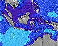 | 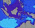 | 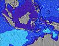 | 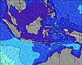 | ||||||||||||||
Wave Height (m) Direction Period (s) | SSW 15 | SSW 15 | SSW 15 | SSW 14 | SW 14 | SW 16 | SW 14 | SW 15 | SW 19 | SSW 18 | SW 17 | SSW 16 | SSW 17 | SSW 16 | SSW 16 | SSW 16 | SSW 16 | SSW 16 | SSW 16 | SSW 16 | SSW 15 |
Wave Graph | |||||||||||||||||||||
1206 | 1158 | 1174 | 961 | 988 | 610 | 1016 | 1074 | 2349 | 2462 | 2652 | 2206 | 3046 | 3593 | 3543 | 3100 | 3113 | 2472 | 2359 | 2096 | 1907 | |
Wind (km/h) | |||||||||||||||||||||
Wind State on-shore cross-onshore cross-shore cross-offshore off-shore glassy | cross-off | cross-off | off | cross-off | cross-off | off | cross-off | cross-off | off | cross-off | cross-off | off | cross-off | cross-off | off | cross-off | cross-off | off | cross-off | cross-off | off |
High Tide | 12:45PM2.70m | 1:14AM2.79m | 1:17PM2.54m | 1:42AM2.79m | 1:52PM2.32m | 2:14AM2.74m | 2:33PM2.07m | 2:54AM2.64m | 3:29PM1.79m | 3:50AM2.51m | 5:17PM1.57m | 5:21AM2.40m | 8:02PM1.63m | ||||||||
Low Tide | 6:59PM0.37m | 7:24AM0.60m | 7:25PM0.49m | 8:02AM0.64m | 7:52PM0.66m | 8:47AM0.73m | 8:22PM0.85m | 9:46AM0.85m | 8:58PM1.06m | 11:15AM0.95m | 9:55PM1.28m | 1:22PM0.88m | 00:10AM1.42m | ||||||||
6:20 | — | — | 6:20 | — | — | 6:20 | — | — | 6:18 | — | — | 6:18 | — | — | 6:18 | — | — | 6:18 | — | — | |
— | 6:05 | — | — | 6:05 | — | — | 6:05 | — | — | 6:05 | — | — | 6:05 | — | — | 6:05 | — | — | 6:05 | — | |
mm | — | — | — | — | — | — | — | — | — | — | — | — | — | — | — | — | — | — | — | — | — |
Temp °C | 28 | 28 | 24 | 28 | 28 | 24 | 27 | 28 | 24 | 27 | 29 | 24 | 27 | 28 | 24 | 27 | 28 | 23 | 26 | 27 | 23 |
Feels °C | 30 | 29 | 27 | 29 | 30 | 27 | 28 | 29 | 26 | 28 | 29 | 26 | 28 | 29 | 26 | 28 | 28 | 25 | 26 | 27 | 25 |
Swell 1 Height (m) Direction Period (s) | SSW 15 | SSW 15 | SSW 15 | SSW 14 | SW 14 | SW 13 | SW 14 | SW 15 | SW 19 | SSW 18 | SW 17 | SSW 16 | SSW 17 | SSW 16 | SSW 16 | SSW 16 | SSW 16 | SSW 16 | SSW 16 | SSW 16 | SSW 15 |
1206 | 1158 | 1174 | 961 | 988 | 525 | 1016 | 1074 | 2349 | 2462 | 2652 | 2206 | 3046 | 3593 | 3543 | 3100 | 3113 | 2472 | 2359 | 2096 | 1907 | |
Swell 2 Height (m) Direction Period (s) | SSE 7 | SE 7 | SE 6 | SSE 6 | SSE 6 | SW 16 | SSE 6 | SSW 21 | SE 6 | SE 6 | E 5 | SE 6 | SSE 5 | — | SE 6 | SSE 5 | WSW 20 | SE 5 | SSE 5 | — | SE 5 |
35 | 23 | 43 | 11 | 6 | 610 | 12 | 300 | 61 | 32 | 14 | 75 | 19 | — | 77 | 17 | 38 | 20 | 24 | — | 50 | |
Swell 3 Height (m) Direction Period (s) | — | — | — | E 5 | SSE 6 | SE 6 | ESE 5 | SSE 5 | — | E 5 | — | — | E 5 | — | — | E 5 | — | — | E 5 | — | ENE 6 |
— | — | — | 11 | 15 | 32 | 8 | 11 | — | 13 | — | — | 18 | — | — | 14 | — | — | 12 | — | 10 | |
Wind waves Height (m) Direction Period (s) | ESE 6 | ESE 5 | ESE 6 | SE 6 | SE 6 | — | — | — | ESE 6 | ESE 5 | SE 5 | ESE 6 | ESE 5 | — | — | — | — | — | SE 5 | ESE 5 | E 6 |
69 | 64 | 73 | 46 | 44 | — | — | — | 100 | 49 | 41 | 167 | 34 | — | — | — | — | — | 38 | 20 | 22 | |
Nearest Offshore or Glassy | |||||||||||||||||||||
Distance (km) | 0 | 0 | 0 | 0 | 0 | 0 | 0 | 0 | 0 | 2 | 2 | 0 | 2 | 0 | 0 | 0 | 0 | 0 | 0 | 0 | 0 |
Best forecast wave conditions in Sumbawa | |||||||||||||||||||||
Best forecast wave conditions in Indonesia | |||||||||||||||||||||
Header Global | |||||||||||||||||||||
- Map Icons:
 Break
Break Live Wave Height (m)
 Live Wind Speed (km/h)
 Surf Rating (10 Max)
 Ocean Swells (m)
- Wind Speed (km/h)
Latest Updates


FREE! Surf-Forecast.com widget for your website
The surf report / weather widget below is available to embed on third party websites free of charge and provides a summary of our Periscope Point surf forecast. Simply grab the html code snippet that we provide and paste it into your own site. You can choose your preferred language and metric/imperial units for the surf forecast feed to suit users of your site. Click here to get the code.
Information about the Periscope Point Surf forecast
The above surf forecast table for Periscope Point provides essential information for determining whether the surfing conditions will be good over the next 16 days. A general guide to surfing at Periscope Point can be found by selecting the local surf guide option on the grey menu. Our Periscope Point surf forecast is unique since it includes wave energy (power) that defines the real feel of the surf rather than just the height or the period. If you surf the same spot (Periscope Point) regularly then make a mental note of the wave energy from the surf forecast table each time you go. Very soon you may start to choose your surf days based on the wave energy alone combined with our forecast of favourable offshore wind conditions. Our star ratings will help here and of course you will also find the usual wave height and period predictions on our surf forecasts as well as a full break down of the swell components under our advanced users option (to reveal that, click the little Einstein character under the tide times).
Further information to help with frequently asked questions about our surf forecast for Periscope Point may be found under the help tab on the top menu and also by moving your mouse over the question marks on the surf forecast table itself. Please always bear in mind that the forecast is for near-shore open water and local factors at each surf break influence the actual breaking wave height, such as the beach / reef profile, water depths offshore and shelter.
Are you planning a holiday in Sumbawa? If you are looking for accommodation near Periscope Point, camping, hotels and holiday cottages in Sumbawa, consider staying in Bima which is 52 km (32 miles) away. Alternatively, find information about places to stay and car hire in Raba which is 56 km (35 miles) away
 Nearest