

Surf Forecasts:

Lighthouse Right surf forecast from 3 Aug 2026:
- Most powerful swell: Tuesday 4 Aug, 2PM (local time) - 4.5ft (1.3m), 18s period, SSW swell with 1,118 kJ wave energy.
Best Forecast Surf Conditions for Lighthouse Right this week:
The most powerful waves expected at Lighthouse Right in the next 16 days are 1.3m 18s and forecast to arrive on Tuesday (Aug 04) at 2PM. Winds are predicted to be cross-shore at the time the swell arrives. The largest open ocean swell (not directed at the beach) is 3.0m 11s period and expected on Monday (Aug 03) at 11PM.
| Wave Type | Time (+11) & Date | Wave Height & Period |
|---|---|---|
| Next good surf (1 star+) | - | - |
| Best Surf | - | - |
| Most Powerful | 2PM (Tue 4th Aug) | 4.5ft (1.3m) 18s |
Table - best surf conditions forecast for Lighthouse Right over the next 16 days.
The Lowdown
Righto, Rusty here. Let’s be straight with you: the next 16 days are a flat spell for Lighthouse Right (Noumea-Pass) with a couple of barely-there pulses that won’t get anyone excited. The water is sitting at 72°F, which is bang on average for this time of year – nothing to write home about.
We start off with a bit of a tease on Monday the 3rd – a 2ft SSW swell rolls in, but it’s coming from the ESE at 25 mph, cross-on and messy. The combined energy is a weak 305, and the whole thing’s just poor. Forget it. Tuesday the 4th bumps up to 4ft SSW, but the wind is still cross-shore from the east at 16–22 mph, and the score is a 1 at best – marginal, choppy, nothing to paddle for.
Wednesday the 5th through to the 10th is a total write-off. Swell drops to 0.7ft–1ft, energy values are in the single digits to low 20s, and the wind is either cross, cross-off, or glassy at times – but the swell is too small to do anything. The morning of the 9th is glassy, calm, and dead flat. That’s a blank stretch of about 6 days with no real surf.
From the 11th to the 12th, the swell picks up a tiny bit – 1ft SSW – but the wind is cross-on from the SE at 13–16 mph, and the energy is only 108–149. Still poor. Then on the 13th, there’s a brief hint of something: 3ft SSW, 16-second period, 440 combined energy, but the wind is cross-shore from the ESE. The morning is marginal, the afternoon is messy. Not worth rushing.
The 14th offers the cleanest conditions of the whole run: cross-off wind from the WNW at 13–19 mph, 3–3ft SSW, energy around 468. The morning is clean, but the swell is tiny and the period is 16–17 seconds – that’s a long groundswell for a reef break, so it might be a bit too straight and gutless. Still, if you’re desperate, it’s the best of a bad lot.
The 15th and 16th slide back into poor, with 1–2ft, cross-on winds, and energy in the 80–138 range. The 17th morning shows a 3ft SW with a 9-second period and light onshore wind – marginal – but the afternoon is 2ft with a longer 13-second period and 324 energy. Still, not great.
The 18th finishes the run with 4ft SW, 11-second period, 526 energy, but the wind is cross-on from the SE at 13–16 mph – choppy and poor. No standout days here, folks. The best I can say is the 14th morning is clean, but it’s not worth a trip.
Rusty.
Short Range ForecastLight rain (total 5mm), mostly falling on Mon afternoon. Warm (max 21°C on Thu morning, min 18°C on Tue night). Mainly strong winds. | Days 5-7 Weather SummaryLight rain (total 6mm), mostly falling on Thu night. Warm (max 22°C on Sat afternoon, min 19°C on Thu night). Winds decreasing (strong winds from the E on Fri morning, calm by Sun morning). | |||||||||||||||||||
Mon 3 | Tuesday 4 | Wednesday 5 | Thursday 6 | Friday 7 | Saturday 8 | Sunday 9 | ||||||||||||||
PM | Night | AM | PM | Night | AM | PM | Night | AM | PM | Night | AM | PM | Night | AM | PM | Night | AM | PM | Night | |
Swell Height Map |  | 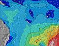 | 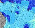 | 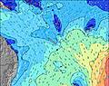 | 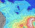 | 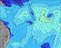 | 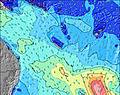 | |||||||||||||
Wave Height (m) Direction Period (s) | SSW 21 | SSW 20 | SSW 18 | SSW 17 | SSW 16 | SSW 16 | SSW 15 | SSW 14 | SSW 13 | SSW 13 | SSW 13 | SW 12 | SSW 19 | SSW 18 | SSW 15 | SSW 15 | ESE 9 | SSW 10 | SW 10 | SW 9 |
Wave Graph | ||||||||||||||||||||
305 | 848 | 1020 | 1069 | 828 | 627 | 0 | 394 | 201 | 114 | 65 | 38 | 35 | 30 | 22 | 21 | 0 | 10 | 24 | 21 | |
Wind (km/h) | ||||||||||||||||||||
Wind State on-shore cross-onshore cross-shore cross-offshore off-shore glassy | cross-on | cross-on | cross | cross | cross | cross | cross | cross | cross | cross | cross-off | cross | cross | cross-off | cross-off | cross-off | cross-off | glassy | on | on |
High Tide | 11:06PM1.29m | 11:31AM1.06m | 11:40PM1.22m | 12:24PM1.03m | 00:19AM1.14m | 1:29PM1.01m | 1:07AM1.05m | 2:51PM1.01m | 2:10AM0.97m | 4:22PM1.05m | 3:34AM0.92m | 5:40PM1.14m | 4:59AM0.93m | |||||||
Low Tide | 5:32AM0.25m | 5:23PM0.33m | 6:12AM0.25m | 6:09PM0.43m | 6:59AM0.25m | 7:10PM0.54m | 7:57AM0.26m | 8:35PM0.62m | 9:09AM0.25m | 10:23PM0.64m | 10:26AM0.21m | 11:53PM0.58m | ||||||||
— | — | 6:26 | — | — | 6:24 | — | — | 6:24 | — | — | 6:24 | — | — | 6:24 | — | — | 6:22 | — | — | |
5:32 | — | — | 5:34 | — | — | 5:34 | — | — | 5:35 | — | — | 5:35 | — | — | 5:35 | — | — | 5:36 | — | |
mm | 1 | 1 | — | — | 1 | 1 | 1 | — | — | — | 3 | 3 | — | — | — | — | — | — | — | — |
Temp °C | 19 | 20 | 20 | 20 | 20 | 20 | 19 | 20 | 21 | 21 | 20 | 20 | 20 | 20 | 21 | 22 | 21 | 21 | 21 | 21 |
Feels °C | 12 | 13 | 14 | 14 | 14 | 13 | 12 | 13 | 14 | 15 | 14 | 13 | 13 | 13 | 16 | 17 | 18 | 23 | 20 | 21 |
Swell 1 Height (m) Direction Period (s) | SSW 21 | SSW 20 | SE 10 | SE 10 | SSW 16 | SSW 16 | SSW 15 | SSW 14 | SSW 13 | S 15 | S 14 | S 12 | S 12 | SSW 11 | ESE 9 | ESE 9 | ESE 9 | ESE 9 | ESE 9 | ESE 9 |
305 | 848 | 627 | 489 | 828 | 627 | 525 | 394 | 201 | 161 | 142 | 76 | 72 | 42 | 396 | 258 | 186 | 180 | 176 | 147 | |
Swell 2 Height (m) Direction Period (s) | E 14 | — | SSW 18 | SSW 17 | S 9 | S 9 | S 9 | S 9 | S 16 | SSW 13 | SSW 13 | SW 12 | SSW 19 | SSW 18 | SSW 11 | SSW 11 | SSW 13 | SE 14 | SW 10 | SW 9 |
4 | — | 1020 | 1069 | 38 | 6 | 2 | 6 | 20 | 114 | 65 | 37 | 35 | 30 | 24 | 23 | 35 | 31 | 24 | 21 | |
Swell 3 Height (m) Direction Period (s) | — | S 21 | SSW 10 | SSW 10 | E 12 | E 12 | S 9 | E 15 | SSW 18 | SW 23 | SSW 16 | SSW 20 | SW 15 | SE 16 | SSW 15 | SSW 15 | SE 14 | SSW 10 | SE 13 | SE 13 |
— | 9 | 139 | 102 | 3 | 3 | 6 | 4 | 31 | 20 | 25 | 38 | 8 | 10 | 22 | 21 | 29 | 10 | 28 | 44 | |
Wind waves Height (m) Direction Period (s) | SSE 12 | SSE 10 | SE 10 | SE 10 | SE 9 | SE 8 | SE 8 | ESE 7 | ESE 7 | ESE 7 | ESE 8 | ESE 9 | ESE 9 | ESE 9 | NNE 4 | ENE 4 | NE 4 | — | — | — |
2388 | 1461 | 913 | 768 | 461 | 388 | 416 | 243 | 193 | 208 | 319 | 747 | 898 | 708 | 7 | 14 | 8 | — | — | — | |
Nearest Offshore or Glassy | ||||||||||||||||||||
Distance (km) | 1401 | 741 | 741 | 1401 | 72 | 94 | 103 | 72 | 94 | 103 | 72 | 97 | 103 | 72 | 25 | 25 | 25 | 1 | 1227 | 72 |
Best forecast wave conditions in New Caledonia | ||||||||||||||||||||
Best forecast wave conditions in New Caledonia | ||||||||||||||||||||
Header Global | ||||||||||||||||||||
- Map Icons:
 Break
Break Live Wave Height (m)
 Live Wind Speed (km/h)
 Surf Rating (10 Max)
 Ocean Swells (m)
- Wind Speed (km/h)
Latest Updates


FREE! Surf-Forecast.com widget for your website
The surf report / weather widget below is available to embed on third party websites free of charge and provides a summary of our Lighthouse Right surf forecast. Simply grab the html code snippet that we provide and paste it into your own site. You can choose your preferred language and metric/imperial units for the surf forecast feed to suit users of your site. Click here to get the code.
Information about the Lighthouse Right Surf forecast
The above surf forecast table for Lighthouse Right provides essential information for determining whether the surfing conditions will be good over the next 16 days. A general guide to surfing at Lighthouse Right can be found by selecting the local surf guide option on the grey menu. Our Lighthouse Right surf forecast is unique since it includes wave energy (power) that defines the real feel of the surf rather than just the height or the period. If you surf the same spot (Lighthouse Right) regularly then make a mental note of the wave energy from the surf forecast table each time you go. Very soon you may start to choose your surf days based on the wave energy alone combined with our forecast of favourable offshore wind conditions. Our star ratings will help here and of course you will also find the usual wave height and period predictions on our surf forecasts as well as a full break down of the swell components under our advanced users option (to reveal that, click the little Einstein character under the tide times).
Further information to help with frequently asked questions about our surf forecast for Lighthouse Right may be found under the help tab on the top menu and also by moving your mouse over the question marks on the surf forecast table itself. Please always bear in mind that the forecast is for near-shore open water and local factors at each surf break influence the actual breaking wave height, such as the beach / reef profile, water depths offshore and shelter.
Are you planning a holiday in New Caledonia? If you are looking for accommodation near Lighthouse Right, camping, hotels and holiday cottages in New Caledonia, consider staying in Noumea which is 24 km (15 miles) away. Other places in and around New Caledonia where you can find information about places to rent, and car hire include Mont-Dore which is 25 km (16 miles) away, Dumbea and Thio.
 Nearest