

Surf Forecasts:

My Khe / Da Nang surf forecast from 3 Aug 2026:
- Best quality surf: Friday 7 Aug, 10PM (local time) - 4.5ft (1.3m), 18s period, ENE swell with cross-offshore winds.
- Most powerful swell: Saturday 8 Aug, 1AM (local time) - 4.5ft (1.3m), 18s period, ENE swell with 1,054 kJ wave energy.
- Next surfable swell (1★+): Wednesday 5 Aug, 10AM (local time) - 1.5ft (0.4m), 16s period with ENE swell.
Best Forecast Surf Conditions for My Khe / Da Nang this week:
The surf forecast for My Khe / Da Nang over the next 16 days: The first swell (rated 1 star or higher) is forecast to arrive on Wednesday (Aug 05) at 10AM. The primary swell is predicted to be 0.4m and 16s period with a secondary swell of 0.1m and 9s. The wind is predicted to be cross-offshore as the swell arrives.
The most powerful waves expected at My Khe / Da Nang in the next 16 days are 1.3m 18s and forecast to arrive on Saturday (Aug 08) at 1AM. Winds are predicted to be offshore at the time the swell arrives. The largest open ocean swell (not directed at the beach) is 0.8m 6s period and expected on Sunday (Aug 09) at 4PM.
| Wave Type | Time (+07) & Date | Wave Height & Period |
|---|---|---|
| Next good surf (1 star+) | 10AM (Wed 5th Aug) | 1.5ft (0.4m) 16s |
| Best Surf | 10PM (Fri 7th Aug) | 4.5ft (1.3m) 18s |
| Most Powerful | 1AM (Sat 8th Aug) | 4.5ft (1.3m) 18s |
Table - best surf conditions forecast for My Khe / Da Nang over the next 16 days.
The Lowdown
Righto, gather 'round. Rusty here, and we're looking at a sixteen-day window for our local stretch. The short story? We've got a classic slow start, a true standout window of proper groundswell, and then it all fizzles out again. Let's get into it.
The first few days are a write-off. Monday and Tuesday have next to nothing in the water, and what little there is has no energy. Honestly, it's a bit of a flat spell to kick things off. We're talking about a couple of days of waiting before anything shows up.
Things start to stir a bit on Wednesday the 5th. We see some tiny lines from the east-northeast, just 1 ft, but with a very long 16-17 second period. That's a proper groundswell signal, even if it's tiny. The wave energy is still weak (111-194), but you can see the potential. The winds are clean, mostly light and offshore, so if you're desperate for a longboard or a foily, you could get a slide, but it's hardly worth jumping up and down for.
Now, Thursday the 6th is where it gets interesting. That east-northeast swell starts to fill in properly, hitting 3 ft with an 18-second pulse. The wave energy jumps to a solid moderate level (384). The morning is the pick with light northwesterlies, making it clean. This is the start of the main event.
But the real standout, the one you've been waiting for, is Friday the 7th. This is the absolute pick of the forecast. We get a solid 4 ft of east-northeast groundswell with that dreamy 18-second period. The wave energy is strong (918). The morning has light offshore winds, and then in the afternoon it goes dead glassy. This is about as good as it gets around here. My Khe will be clean, lined up, and have proper push. Get out there early or stay late for the glass-off. Saturday the 8th is almost as good, with similar 4 ft to 4 ft swell and more glassy conditions in the afternoon. This Friday-Saturday window is the call.
However, a word to the wise for the beginners: that 4 ft swell with that long period (over 15 seconds) packs a lot more punch than the height suggests. It might be a bit much if you're just starting out. For the experienced crew, this is going to be a blast.
Sadly, that's the peak. From Sunday the 9th onwards, the party is over. The swell drops away fast. We go from strong energy back to weak readings (less than 100) and tiny waves for the next week and a half. The rest of the second week into the middle of August is just small, weak, and poor. There's nothing worth paddling out for. A long, flat gap opens up after that Saturday.
So, to sum it up: a couple of days of nothing, then a promising build-up, followed by a killer two-day window of clean, powerful groundswell at My Khe from Friday the 7th through Saturday the 8th. After that, save your energy. The water temperature is sitting at 86°F, which is bang on average for this time of year, so at least you'll be warm while you're sitting out there waiting.
Rusty.
Short Range ForecastLight rain (total 3mm), mostly falling on Mon afternoon. Warm (max 31°C on Mon morning, min 26°C on Tue night). Wind will be generally light. | Days 4-6 Weather SummaryMostly dry. Warm (max 31°C on Thu morning, min 27°C on Thu night). Wind will be generally light. | ||||||||||||||||||||
Monday 3 | Tuesday 4 | Wednesday 5 | Thursday 6 | Friday 7 | Saturday 8 | Sunday 9 | |||||||||||||||
AM | PM | Night | AM | PM | Night | AM | PM | Night | AM | PM | Night | AM | PM | Night | AM | PM | Night | AM | PM | Night | |
Swell Height Map | 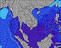 | 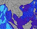 | 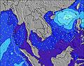 | 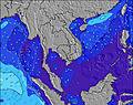 | 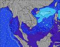 | 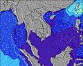 | 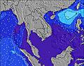 | ||||||||||||||
Wave Height (m) Direction Period (s) | E 4 | E 4 | E 18 | ENE 18 | ENE 17 | ENE 17 | ENE 16 | ENE 17 | ENE 18 | ENE 18 | ENE 18 | ENE 18 | ENE 18 | ENE 18 | ENE 18 | ENE 18 | ENE 17 | ENE 15 | NE 13 | NW 6 | NW 5 |
Wave Graph | |||||||||||||||||||||
1 | 2 | 6 | 30 | 29 | 55 | 107 | 111 | 273 | 356 | 486 | 745 | 907 | 917 | 1054 | 877 | 673 | 209 | 46 | 15 | 6 | |
Wind (km/h) | |||||||||||||||||||||
Wind State on-shore cross-onshore cross-shore cross-offshore off-shore glassy | glassy | cross-on | cross-off | cross-off | cross-off | cross-off | cross-off | off | cross-off | cross-off | cross-on | cross-off | off | glassy | off | off | glassy | cross-off | cross-off | cross-off | cross-off |
High Tide | 12:36PM1.10m | 2:03AM1.08m | 1:25PM1.02m | 2:26AM1.12m | 2:27PM0.93m | 2:53AM1.17m | 4:15PM0.85m | 3:28AM1.21m | 4:16AM1.24m | 5:23AM1.27m | |||||||||||
Low Tide | 7:28PM0.55m | 8:08AM0.77m | 7:49PM0.63m | 9:15AM0.70m | 8:09PM0.71m | 10:24AM0.63m | 8:25PM0.79m | 11:37AM0.56m | 12:54PM0.49m | 2:07PM0.42m | |||||||||||
5:28 | — | — | 5:28 | — | — | 5:28 | — | — | 5:28 | — | — | 5:28 | — | — | 5:28 | — | — | 5:28 | — | — | |
— | 6:16 | — | — | 6:16 | — | — | 6:15 | — | — | 6:15 | — | — | 6:15 | — | — | 6:15 | — | — | 6:15 | — | |
mm | — | 2 | — | — | — | — | — | 1 | — | — | — | — | — | — | — | — | — | — | — | — | — |
Temp °C | 31 | 30 | 28 | 31 | 29 | 27 | 31 | 28 | 28 | 31 | 30 | 28 | 30 | 30 | 30 | 31 | 30 | 29 | 29 | 29 | 30 |
Feels °C | 35 | 31 | 32 | 35 | 32 | 28 | 33 | 31 | 31 | 35 | 32 | 32 | 33 | 34 | 32 | 33 | 34 | 31 | 31 | 32 | 32 |
Swell 1 Height (m) Direction Period (s) | E 4 | E 4 | ESE 5 | ESE 4 | WNW 4 | ENE 17 | ENE 16 | ENE 17 | ENE 18 | ENE 18 | ENE 18 | ENE 18 | ENE 18 | ENE 18 | ENE 18 | ENE 18 | ENE 17 | ENE 15 | NW 6 | NW 6 | NW 5 |
1 | 2 | 2 | 2 | 1 | 55 | 107 | 111 | 273 | 356 | 486 | 745 | 907 | 917 | 1054 | 877 | 673 | 209 | 15 | 15 | 6 | |
Swell 2 Height (m) Direction Period (s) | SE 5 | SE 5 | E 18 | ENE 18 | ESE 5 | SSE 5 | NE 9 | ENE 20 | ENE 7 | ENE 7 | ENE 7 | NE 7 | E 6 | NW 5 | NW 4 | NW 5 | NW 5 | NW 5 | NE 13 | ENE 12 | SE 6 |
1 | 1 | 6 | 30 | 2 | 2 | 3 | 75 | 11 | 9 | 9 | 12 | 7 | 6 | 7 | 4 | 10 | 5 | 46 | 15 | 1 | |
Swell 3 Height (m) Direction Period (s) | E 6 | E 7 | E 9 | E 9 | ENE 17 | E 9 | SE 4 | E 8 | SE 6 | SSE 6 | NW 5 | — | ENE 6 | E 6 | SE 7 | NW 5 | SE 7 | SE 6 | ESE 7 | SE 6 | NE 11 |
1 | 1 | 2 | 2 | 29 | 2 | 1 | 6 | 5 | 6 | 3 | — | 4 | 3 | 11 | 9 | 18 | 2 | 5 | 2 | 5 | |
Wind waves Height (m) Direction Period (s) | — | — | — | — | NNW 2 | SSE 5 | SW 2 | S 3 | W 5 | ESE 7 | — | SE 7 | — | — | — | — | — | NW 6 | — | NW 6 | — |
— | — | — | — | 1 | 9 | 1 | 2 | 4 | 19 | — | 23 | — | — | — | — | — | 8 | — | 47 | — | |
Nearest Offshore or Glassy | |||||||||||||||||||||
Distance (km) | 282 | 1400 | 282 | 1285 | 927 | 5 | 0 | 0 | 0 | 0 | 353 | 0 | 0 | 0 | 0 | 0 | 0 | 5 | 5 | 24 | 435 |
Best forecast wave conditions in Da Nang | |||||||||||||||||||||
Best forecast wave conditions in Vietnam | |||||||||||||||||||||
Header Global | |||||||||||||||||||||
- Map Icons:
 Break
Break Live Wave Height (m)
 Live Wind Speed (km/h)
 Surf Rating (10 Max)
 Ocean Swells (m)
- Wind Speed (km/h)
Latest Updates


FREE! Surf-Forecast.com widget for your website
The surf report / weather widget below is available to embed on third party websites free of charge and provides a summary of our My Khe / Da Nang surf forecast. Simply grab the html code snippet that we provide and paste it into your own site. You can choose your preferred language and metric/imperial units for the surf forecast feed to suit users of your site. Click here to get the code.
Information about the My Khe / Da Nang Surf forecast
The above surf forecast table for My Khe / Da Nang provides essential information for determining whether the surfing conditions will be good over the next 16 days. A general guide to surfing at My Khe / Da Nang can be found by selecting the local surf guide option on the grey menu. Our My Khe / Da Nang surf forecast is unique since it includes wave energy (power) that defines the real feel of the surf rather than just the height or the period. If you surf the same spot (My Khe / Da Nang) regularly then make a mental note of the wave energy from the surf forecast table each time you go. Very soon you may start to choose your surf days based on the wave energy alone combined with our forecast of favourable offshore wind conditions. Our star ratings will help here and of course you will also find the usual wave height and period predictions on our surf forecasts as well as a full break down of the swell components under our advanced users option (to reveal that, click the little Einstein character under the tide times).
Further information to help with frequently asked questions about our surf forecast for My Khe / Da Nang may be found under the help tab on the top menu and also by moving your mouse over the question marks on the surf forecast table itself. Please always bear in mind that the forecast is for near-shore open water and local factors at each surf break influence the actual breaking wave height, such as the beach / reef profile, water depths offshore and shelter.
My Khe / Da Nang is 1 km (1 miles) from Da Nang. If you plan a holiday in Da Nang, look for hotels and other accommodation in Da Nang. Da Nang has rooms for a wide range of budgets as well as car hire and transport links.
 Nearest