

Surf Forecasts:

Middles surf forecast from 15 Jul 2026:
- Best quality surf: Friday 17 Jul, 8AM (local time) - 3.5ft (1.1m), 6s period, E swell with cross-offshore winds.
- Most powerful swell: Monday 20 Jul, 5PM (local time) - 7.5ft (2.3m), 7s period, ENE swell with 458 kJ wave energy.
- Next surfable swell (1★+): Friday 17 Jul, 8AM (local time) - 3.5ft (1.1m), 6s period with E swell.
Best Forecast Surf Conditions for Middles this week:
The surf forecast for Middles over the next 16 days: The first swell (rated 1 star or higher) is forecast to arrive on Friday (Jul 17) at 8AM. The primary swell is predicted to be 1.1m and 6s period with a secondary swell of 0.2m and 7s. Another secondary swell of 0.2m and 8s is also forecast. The wind is predicted to be cross-offshore as the swell arrives.
The most powerful waves expected at Middles in the next 16 days are 2.3m 7s and forecast to arrive on Monday (Jul 20) at 5PM. Winds are predicted to be cross-onshore at the time the swell arrives.
| Wave Type | Time (AST) & Date | Wave Height & Period |
|---|---|---|
| Next good surf (1 star+) | 8AM (Fri 17th Jul) | 3.5ft (1.1m) 6s |
| Best Surf | 8AM (Fri 17th Jul) | 3.5ft (1.1m) 6s |
| Most Powerful | 5PM (Mon 20th Jul) | 7.5ft (2.3m) 7s |
Table - best surf conditions forecast for Middles over the next 16 days.
The Lowdown
Middles, mate. I’ve gotta be straight with you—this outlook is a tough one. The whole 16-day window is a bit of a grind. The wind is relentless from the east-northeast or east, hammering this spot day after day. It’s a beach and reef setup, which normally handles swell okay, but the constant cross-onshore and cross-shore winds are making a mess of things. The swell is coming from the ENE and E, and while it’s not tiny, the energy is mostly weak to moderate at best, with the combined energy readings between 59 and 458. The water temperature is sitting at 83°—that’s about normal for the time of year, no anomaly there to get excited about. For the first week and a half, it’s just poor surf conditions—choppy, lumpy, and messy. There’s a massive gap with no real hope until a brief window on Wednesday, 22 July.
On Wednesday, 22 July, the afternoon finally shows a glimmer. The wind swings to the WSW at just 3 mph, going glassy. The swell is 6 ft from the ENE with a period of 6 seconds, and the combined energy hits 207 (moderate). It’s described as “surfable waves but very ordinary conditions.” For me, this is the only standout in the whole run, but it’s a short-lived moment. The waves are okay, but the period is short, so it’s a bit choppy and won’t have much push. That said, glassy conditions are rare here, so if you’re keen, you’ve got to be on it. After that, it’s back to the same old story—cross-onshore winds, lumpy surf, and poor conditions right through to the end of the month. The swell does get bigger at times, hitting 8 ft on Monday, 20 July afternoon, but with the wind ruining it, it’s not worth paddling out. For anyone who’s not an expert, those bigger days over 5 ft are too much, and the constant wind is just a buzzkill. Honestly, this stretch looks more interesting for kite surfing than paddle surfing, given the consistent wind and messy waves.
The only real shout is Wednesday, 22 July afternoon, and even then, it’s nothing special. For the rest, it’s a waiting game.
Rusty
Short Range ForecastLight rain (total 5mm), mostly falling on Fri afternoon. Warm (max 30°C on Sat morning, min 24°C on Thu night). Mainly fresh winds. | Days 5-7 Weather SummaryLight rain (total 9mm), mostly falling on Mon afternoon. Warm (max 30°C on Sun morning, min 24°C on Sat night). Mainly fresh winds. | ||||||||||||||||||||
Wed 15 | Thursday 16 | Friday 17 | Saturday 18 | Sunday 19 | Monday 20 | Tuesday 21 | |||||||||||||||
PM | Night | AM | PM | Night | AM | PM | Night | AM | PM | Night | AM | PM | Night | AM | PM | Night | AM | PM | Night | AM | |
Swell Height Map |  |  |  |  |  |  |  | 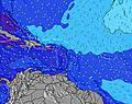 | |||||||||||||
Wave Height (m) Direction Period (s) | ENE 5 | E 5 | E 5 | E 5 | E 5 | E 6 | ENE 6 | E 6 | ENE 6 | ENE 6 | ENE 6 | ENE 6 | ENE 6 | E 6 | E 6 | ENE 7 | ENE 7 | ENE 7 | ENE 7 | ENE 6 | ENE 6 |
Wave Graph | |||||||||||||||||||||
80 | 57 | 59 | 129 | 69 | 85 | 248 | 103 | 159 | 198 | 117 | 126 | 299 | 200 | 267 | 458 | 188 | 162 | 172 | 97 | 93 | |
Wind (km/h) | |||||||||||||||||||||
Wind State on-shore cross-onshore cross-shore cross-offshore off-shore glassy | cross-on | cross-off | cross-on | cross-on | cross | cross-on | cross | cross | cross-on | cross-on | cross | cross-on | cross-on | cross | cross-on | cross-on | cross-off | cross-on | cross-on | cross | cross-on |
High Tide | 10:01PM0.65m | 9:52AM0.41m | 10:48PM0.62m | 10:54AM0.44m | 11:31PM0.58m | 11:55AM0.47m | 00:13AM0.52m | 12:56PM0.48m | 00:52AM0.47m | 1:57PM0.49m | 1:30AM0.41m | 2:57PM0.50m | 2:09AM0.37m | ||||||||
Low Tide | 2:50PM-0.00m | 4:34AM0.16m | 3:49PM0.04m | 5:16AM0.15m | 4:50PM0.09m | 5:58AM0.14m | 5:52PM0.14m | 6:39AM0.12m | 6:59PM0.19m | 7:20AM0.11m | 8:09PM0.22m | 8:01AM0.10m | 9:21PM0.24m | 8:43AM0.09m | |||||||
— | — | 6:00 | — | — | 6:00 | — | — | 6:00 | — | — | 6:01 | — | — | 6:01 | — | — | 6:01 | — | — | 6:01 | |
7:07 | — | — | 7:07 | — | — | 7:07 | — | — | 7:07 | — | — | 7:07 | — | — | 7:07 | — | — | 7:07 | — | 7:06 | |
mm | — | — | — | 1 | 1 | — | 3 | — | — | 3 | — | — | 1 | — | — | 4 | 1 | — | 3 | — | — |
Temp °C | 29 | 27 | 29 | 28 | 27 | 29 | 28 | 28 | 30 | 28 | 27 | 30 | 29 | 27 | 30 | 28 | 26 | 29 | 29 | 27 | 29 |
Feels °C | 27 | 27 | 27 | 26 | 25 | 29 | 27 | 28 | 29 | 27 | 25 | 29 | 28 | 25 | 28 | 27 | 25 | 28 | 28 | 28 | 30 |
Swell 1 Height (m) Direction Period (s) | NE 9 | N 8 | N 8 | N 7 | N 7 | NNE 7 | — | NE 8 | NE 7 | — | NE 7 | NE 8 | N 8 | NNE 9 | — | — | NNE 8 | NE 8 | NE 11 | NNE 6 | NE 9 |
3 | 6 | 10 | 10 | 4 | 9 | — | 11 | 14 | — | 13 | 23 | 1 | 8 | — | — | 7 | 3 | 5 | 17 | 3 | |
Swell 2 Height (m) Direction Period (s) | N 7 | N 9 | N 9 | — | NNE 8 | NE 9 | — | NNE 7 | — | — | NNE 10 | N 9 | — | N 8 | — | — | — | — | — | — | — |
1 | 2 | 2 | — | 6 | 3 | — | 9 | — | — | 9 | 2 | — | 1 | — | — | — | — | — | — | — | |
Swell 3 Height (m) Direction Period (s) | N 7 | N 6 | N 6 | — | N 7 | — | — | — | — | — | N 10 | — | — | N 8 | — | — | — | — | — | — | — |
1 | 1 | 1 | — | 1 | — | — | — | — | — | 2 | — | — | 1 | — | — | — | — | — | — | — | |
Wind waves Height (m) Direction Period (s) | ENE 5 | E 5 | E 5 | E 5 | E 5 | E 6 | ENE 6 | E 6 | ENE 6 | ENE 6 | ENE 6 | ENE 6 | ENE 6 | E 6 | E 6 | ENE 7 | ENE 7 | ENE 7 | ENE 7 | ENE 6 | ENE 6 |
80 | 57 | 59 | 129 | 69 | 85 | 248 | 103 | 159 | 198 | 117 | 126 | 299 | 200 | 267 | 458 | 188 | 162 | 172 | 97 | 93 | |
Nearest Offshore or Glassy | |||||||||||||||||||||
Distance (km) | 278 | 233 | 879 | 879 | 305 | 129 | 628 | 305 | 879 | 628 | 33 | 129 | 879 | 33 | 879 | 628 | 18 | 305 | 452 | 18 | 11 |
Best forecast wave conditions in Puerto Rico | |||||||||||||||||||||
Best forecast wave conditions in Puerto Rico | |||||||||||||||||||||
Header Global | |||||||||||||||||||||
- Map Icons:
 Break
Break Live Wave Height (m)
 Live Wind Speed (km/h)
 Surf Rating (10 Max)
 Ocean Swells (m)
- Wind Speed (km/h)


FREE! Surf-Forecast.com widget for your website
The surf report / weather widget below is available to embed on third party websites free of charge and provides a summary of our Middles surf forecast. Simply grab the html code snippet that we provide and paste it into your own site. You can choose your preferred language and metric/imperial units for the surf forecast feed to suit users of your site. Click here to get the code.
Information about the Middles Surf forecast
The above surf forecast table for Middles provides essential information for determining whether the surfing conditions will be good over the next 16 days. A general guide to surfing at Middles can be found by selecting the local surf guide option on the grey menu. Our Middles surf forecast is unique since it includes wave energy (power) that defines the real feel of the surf rather than just the height or the period. If you surf the same spot (Middles) regularly then make a mental note of the wave energy from the surf forecast table each time you go. Very soon you may start to choose your surf days based on the wave energy alone combined with our forecast of favourable offshore wind conditions. Our star ratings will help here and of course you will also find the usual wave height and period predictions on our surf forecasts as well as a full break down of the swell components under our advanced users option (to reveal that, click the little Einstein character under the tide times).
Further information to help with frequently asked questions about our surf forecast for Middles may be found under the help tab on the top menu and also by moving your mouse over the question marks on the surf forecast table itself. Please always bear in mind that the forecast is for near-shore open water and local factors at each surf break influence the actual breaking wave height, such as the beach / reef profile, water depths offshore and shelter.
 Nearest