

Surf Forecasts:

How big are the waves at Matelot today (05 Jul):
- Afternoon surf: Afternoon surf (05 Jul, local time) - 5ft (1.6m), 8s period with ENE swell.
- Evening surf: Evening surf (05 Jul, local time) - 5ft (1.6m), 8s period with ENE swell.
The current surf forecast for Matelot at 10PM is: 1.6m 8s primary swell from a East-northeast direction and 0.2m 10s secondary swell from a East-southeast direction (forecast issued at 07:00pm July 05). The wind direction is predicted to be cross-offshore and the swell rating is 2.
| Time (AST) & Date | Wave Height | Wave Period |
|---|---|---|
| Morning (05 Jul) | - | - |
| Afternoon (05 Jul) | 5ft (1.6m) | 8s |
| Evening (05 Jul) | 5ft (1.6m) | 8s |
Table - waves today at Matelot. (Swell directed towards the surf break)
Updates in hr min s Forecast update imminent
Short Range ForecastHeavy rain (total 30mm), heaviest during Sun night. Warm (max 28°C on Tue afternoon, min 24°C on Sun night). Wind will be generally light. | ||||||||||||||||||||||||
Sun 5 | Monday 6 | Tuesday 7 | Wed 8 | |||||||||||||||||||||
5 PM | 8 PM | 11 PM | 2 AM | 5 AM | 8 AM | 11 AM | 2 PM | 5 PM | 8 PM | 11 PM | 2 AM | 5 AM | 8 AM | 11 AM | 2 PM | 5 PM | 8 PM | 11 PM | 2 AM | 5 AM | 8 AM | 11 AM | 2 PM | |
Swell Height Map |  |  | 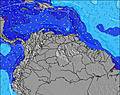 | 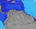 |  | 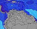 | 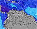 |  |  | |||||||||||||||
Wave Height (m) Direction Period (s) | ENE 8 | ENE 8 | ENE 8 | ENE 8 | ENE 8 | ENE 8 | ENE 8 | ENE 8 | ENE 8 | ENE 8 | ENE 8 | ENE 8 | ENE 8 | ENE 8 | ENE 8 | ENE 8 | ENE 8 | ENE 8 | ENE 8 | ENE 8 | ENE 8 | ENE 8 | ENE 8 | ENE 8 |
Wave Graph | ||||||||||||||||||||||||
318 | 318 | 310 | 270 | 238 | 238 | 238 | 206 | 192 | 192 | 197 | 306 | 270 | 264 | 307 | 284 | 257 | 257 | 330 | 370 | 392 | 461 | 473 | 460 | |
Wind (km/h) | ||||||||||||||||||||||||
Wind State on-shore cross-onshore cross-shore cross-offshore off-shore glassy | cross | cross | cross-off | cross-off | cross-off | cross-off | cross | cross-on | cross-on | cross-on | cross-on | cross | cross-on | cross | cross | cross | cross | cross | cross | cross | cross | cross | cross | cross |
High Tide | 7:19PM0.70m | 7:04AM0.67m | 7:57PM0.72m | 8:03AM0.62m | 8:42PM0.73m | 9:17AM0.57m | ||||||||||||||||||
Low Tide | 1:13AM0.37m | 1:23PM0.27m | 2:20AM0.34m | 2:03PM0.31m | 3:36AM0.30m | |||||||||||||||||||
— | — | — | — | 5:47 | — | — | — | — | — | — | — | 5:47 | — | — | — | — | — | — | — | 5:47 | — | — | — | |
6:30 | — | — | — | — | — | — | — | 6:30 | — | — | — | — | — | — | — | 6:30 | — | — | — | — | — | — | 6:30 | |
mm | 1 | 2 | 5 | 5 | 1 | — | — | — | — | — | — | — | — | 1 | 3 | 2 | — | — | — | 1 | 2 | 3 | 3 | 1 |
Temp °C | 26 | 25 | 25 | 24 | 24 | 24 | 25 | 26 | 25 | 25 | 25 | 25 | 25 | 26 | 27 | 28 | 27 | 25 | 25 | 25 | 25 | 26 | 26 | 27 |
Feels °C | 28 | 28 | 29 | 27 | 27 | 27 | 28 | 28 | 28 | 27 | 27 | 27 | 28 | 28 | 29 | 30 | 29 | 28 | 27 | 28 | 27 | 27 | 27 | 29 |
Swell 1 Height (m) Direction Period (s) | ESE 10 | ESE 9 | ENE 8 | ENE 8 | ENE 8 | ENE 8 | ENE 8 | ENE 8 | ENE 8 | ENE 8 | ENE 8 | ESE 9 | ESE 9 | ESE 9 | ESE 9 | ESE 10 | ENE 8 | ESE 9 | — | ESE 9 | — | — | N 13 | N 13 |
18 | 29 | 310 | 270 | 238 | 238 | 238 | 206 | 192 | 192 | 197 | 45 | 27 | 26 | 15 | 18 | 257 | 16 | — | 8 | — | — | 3 | 3 | |
Swell 2 Height (m) Direction Period (s) | — | ESE 9 | ESE 10 | ESE 9 | ESE 9 | ESE 9 | ESE 9 | ESE 9 | ESE 9 | ESE 9 | ESE 9 | — | — | — | — | — | ESE 9 | — | — | — | — | — | — | — |
— | 29 | 9 | 28 | 16 | 16 | 16 | 15 | 26 | 26 | 26 | — | — | — | — | — | 16 | — | — | — | — | — | — | — | |
Swell 3 Height (m) Direction Period (s) | — | — | — | — | — | — | — | — | — | — | — | — | — | — | — | — | — | — | — | — | — | — | — | — |
— | — | — | — | — | — | — | — | — | — | — | — | — | — | — | — | — | — | — | — | — | — | — | — | |
Wind waves Height (m) Direction Period (s) | ENE 8 | ENE 8 | — | — | — | — | — | — | — | — | — | ENE 8 | ENE 8 | ENE 8 | ENE 8 | ENE 8 | — | ENE 8 | ENE 8 | ENE 8 | ENE 8 | ENE 8 | ENE 8 | ENE 8 |
318 | 318 | — | — | — | — | — | — | — | — | — | 306 | 270 | 264 | 307 | 284 | — | 257 | 330 | 370 | 392 | 461 | 473 | 460 | |
Nearest Offshore or Glassy | ||||||||||||||||||||||||
Distance (km) | 154 | 18 | 0 | 0 | 0 | 0 | 18 | 47 | 154 | 154 | 551 | 154 | 154 | 127 | 640 | 640 | 18 | 18 | 18 | 232 | 232 | 232 | 640 | 640 |
Best forecast wave conditions in Tobago | ||||||||||||||||||||||||
Best forecast wave conditions in Trinidad and Tobago | ||||||||||||||||||||||||
Header Global | ||||||||||||||||||||||||
- Map Icons:
 Break
Break Live Wave Height (m)
 Live Wind Speed (km/h)
 Surf Rating (10 Max)
 Ocean Swells (m)
- Wind Speed (km/h)


FREE! Surf-Forecast.com widget for your website
The surf report / weather widget below is available to embed on third party websites free of charge and provides a summary of our Matelot surf forecast. Simply grab the html code snippet that we provide and paste it into your own site. You can choose your preferred language and metric/imperial units for the surf forecast feed to suit users of your site. Click here to get the code.
 Nearest