

Surf Forecasts:

How big are the waves at Maraa today (06 Jul):
- Morning surf: Morning surf (06 Jul, local time) - 4.5ft (1.4m), 14s period with SSW swell.
- Afternoon surf: Afternoon surf (06 Jul, local time) - 4.5ft (1.3m), 13s period with SSW swell.
- Evening surf: Evening surf (06 Jul, local time) - 4ft (1.2m), 14s period with SSW swell.
The current surf forecast for Maraa at 7PM is: 1.2m 14s primary swell from a South-southwest direction and 0.9m 11s secondary swell from a South-southeast direction, 1.0m 5s secondary swell from a Southwest direction (forecast issued at 01:00pm July 06). The wind direction is predicted to be cross-onshore.
| Time (-10) & Date | Wave Height | Wave Period |
|---|---|---|
| Morning (06 Jul) | 4.5ft (1.4m) | 14s |
| Afternoon (06 Jul) | 4.5ft (1.3m) | 13s |
| Evening (06 Jul) | 4ft (1.2m) | 14s |
Table - waves today at Maraa. (Swell directed towards the surf break)
Updates in hr min s Forecast update imminent
Short Range ForecastLight rain (total 2mm), mostly falling on Tue night. Warm (max 25°C on Mon night, min 23°C on Tue night). Mainly fresh winds. | ||||||||||||||||||||||||
Mon 6 | Tuesday 7 | Wednesday 8 | Thu 9 | |||||||||||||||||||||
11 AM | 2 PM | 5 PM | 8 PM | 11 PM | 2 AM | 5 AM | 8 AM | 11 AM | 2 PM | 5 PM | 8 PM | 11 PM | 2 AM | 5 AM | 8 AM | 11 AM | 2 PM | 5 PM | 8 PM | 11 PM | 2 AM | 5 AM | 8 AM | |
Swell Height Map |  |  |  |  |  |  |  | 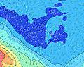 |  | |||||||||||||||
Wave Height (m) Direction Period (s) | SSW 13 | SSW 13 | SSW 13 | SSW 14 | SSW 14 | SSW 13 | SSW 13 | SSW 13 | SSW 13 | SSW 13 | SSE 11 | SSE 10 | SSE 10 | SSE 6 | SSE 6 | SSE 11 | SE 11 | SE 11 | SSE 11 | SW 19 | SW 19 | SW 18 | SW 18 | SSW 18 |
Wave Graph | ||||||||||||||||||||||||
595 | 595 | 514 | 553 | 253 | 330 | 307 | 261 | 261 | 261 | 214 | 166 | 198 | 253 | 226 | 540 | 166 | 467 | 480 | 384 | 376 | 475 | 460 | 547 | |
Wind (km/h) | ||||||||||||||||||||||||
Wind State on-shore cross-onshore cross-shore cross-offshore off-shore glassy | cross-on | cross-on | cross-on | cross-on | cross-on | cross-on | cross-on | cross | cross | cross | cross | cross-off | cross-off | cross-off | cross-off | cross-off | cross-off | cross-off | cross-off | cross-off | cross-off | cross-off | cross-off | cross-off |
High Tide | 4:01PM0.28m | 3:57AM0.26m | 5:07PM0.25m | 4:50AM0.25m | 7:35PM0.24m | 7:11AM0.23m | ||||||||||||||||||
Low Tide | 9:50AM0.11m | 10:17PM0.15m | 10:43AM0.12m | 11:15PM0.17m | 12:06PM0.13m | 1:02AM0.19m | ||||||||||||||||||
— | — | — | — | — | — | 6:28 | — | — | — | — | — | — | — | 6:28 | — | — | — | — | — | — | — | 6:28 | — | |
— | — | 5:36 | — | — | — | — | — | — | — | 5:36 | — | — | — | — | — | — | — | 5:36 | — | — | — | — | 5:37 | |
mm | 1 | — | — | — | — | — | — | — | — | — | — | — | — | 1 | — | — | — | — | — | — | — | — | — | — |
Temp °C | 25 | 24 | 24 | 25 | 24 | 24 | 24 | 24 | 24 | 24 | 24 | 23 | 23 | 23 | 23 | 23 | 24 | 24 | 24 | 24 | 24 | 24 | 24 | 25 |
Feels °C | 26 | 23 | 23 | 24 | 21 | 21 | 21 | 21 | 21 | 23 | 23 | 22 | 21 | 20 | 20 | 20 | 21 | 21 | 21 | 21 | 21 | 20 | 21 | 22 |
Swell 1 Height (m) Direction Period (s) | SSW 13 | SSW 13 | SSW 13 | SSW 14 | SSE 11 | SSW 13 | SSW 13 | SSE 11 | SSE 11 | SSW 7 | SSW 7 | SSW 7 | SSE 10 | SSW 12 | SSW 12 | SSW 12 | SE 11 | SW 20 | SW 20 | SW 19 | SW 19 | SW 18 | SW 18 | SSW 18 |
595 | 595 | 514 | 553 | 214 | 330 | 307 | 222 | 183 | 113 | 96 | 102 | 198 | 94 | 78 | 52 | 166 | 188 | 306 | 384 | 376 | 475 | 460 | 547 | |
Swell 2 Height (m) Direction Period (s) | SSE 11 | SSE 11 | SSE 11 | SSE 11 | SSW 12 | SSE 11 | SSE 11 | SSW 13 | SSW 13 | SSE 11 | SSE 11 | SSE 10 | SW 6 | SSW 17 | SW 21 | SW 6 | SSW 11 | SW 6 | SSW 11 | SSW 11 | SSW 10 | SW 10 | SW 10 | SSW 9 |
128 | 170 | 180 | 176 | 161 | 210 | 226 | 261 | 261 | 222 | 214 | 166 | 51 | 29 | 72 | 14 | 49 | 19 | 46 | 44 | 41 | 48 | 45 | 58 | |
Swell 3 Height (m) Direction Period (s) | NNE 9 | NNE 9 | NNE 9 | NNE 9 | SSW 14 | NNE 9 | NNE 9 | NNE 9 | NNE 9 | SSW 13 | SSW 12 | SSW 12 | SSW 12 | SSW 22 | SSW 17 | SW 21 | SW 6 | SSW 11 | SW 16 | SW 16 | NNE 10 | SE 11 | SW 19 | WSW 17 |
8 | 8 | 8 | 8 | 253 | 8 | 8 | 8 | 7 | 261 | 178 | 129 | 125 | 45 | 29 | 117 | 21 | 47 | 39 | 39 | 9 | 44 | 89 | 111 | |
Wind waves Height (m) Direction Period (s) | WSW 4 | SW 5 | SW 5 | SW 5 | SSW 5 | SSW 5 | SSW 6 | SSW 6 | SSW 6 | — | — | S 6 | SSE 5 | SSE 6 | SSE 6 | SSE 11 | SSE 6 | SE 11 | SSE 11 | SE 6 | SE 6 | SE 6 | SE 6 | SE 6 |
25 | 41 | 51 | 47 | 42 | 47 | 65 | 70 | 94 | — | — | 137 | 55 | 253 | 226 | 540 | 94 | 467 | 480 | 159 | 155 | 156 | 161 | 157 | |
Nearest Offshore or Glassy | ||||||||||||||||||||||||
Distance (km) | 1143 | 2582 | 2582 | 2582 | 1143 | 1143 | 1143 | 1143 | 1143 | 1142 | 1142 | 2278 | 1140 | 1140 | 1140 | 1140 | 1140 | 1142 | 194 | 1142 | 1140 | 1140 | 2407 | 2278 |
Best forecast wave conditions in Tahiti | ||||||||||||||||||||||||
Best forecast wave conditions in French Polynesia | ||||||||||||||||||||||||
Header Global | ||||||||||||||||||||||||
- Map Icons:
 Break
Break Live Wave Height (m)
 Live Wind Speed (km/h)
 Surf Rating (10 Max)
 Ocean Swells (m)
- Wind Speed (km/h)


FREE! Surf-Forecast.com widget for your website
The surf report / weather widget below is available to embed on third party websites free of charge and provides a summary of our Maraa surf forecast. Simply grab the html code snippet that we provide and paste it into your own site. You can choose your preferred language and metric/imperial units for the surf forecast feed to suit users of your site. Click here to get the code.
 Nearest