

Surf Forecasts:

Manglecito surf forecast from 3 Aug 2026:
- Most powerful swell: Monday 3 Aug, 9AM (local time) - 0.5ft (0.2m), 9s period, N swell with 6 kJ wave energy.
Best Forecast Surf Conditions for Manglecito this week:
The most powerful waves expected at Manglecito in the next 16 days are 0.2m 9s and forecast to arrive on Monday (Aug 03) at 9AM. Winds are predicted to be cross-offshore at the time the swell arrives. The largest open ocean swell (not directed at the beach) is 1.4m 8s period and expected on Monday (Aug 03) at 6AM.
| Wave Type | Time (-06) & Date | Wave Height & Period |
|---|---|---|
| Next good surf (1 star+) | - | - |
| Best Surf | - | - |
| Most Powerful | 9AM (Mon 3rd Aug) | 0.5ft (0.2m) 9s |
Table - best surf conditions forecast for Manglecito over the next 16 days.
The Lowdown
Alright folks, Rusty here. Let’s be straight with you – the 16-day outlook for Manglecito is a tough one to write. We’re looking at a long, dry spell with next to nothing in the water for the better part of two weeks.
The forecast period opens now, but the first real glimmer of surfable energy doesn’t show up until the morning of Friday, 14th August, and even then, it’s barely a whisper. Before that, we’ve got a solid 12 days of flat, poor surf conditions. From Sunday, 2nd August right through to Thursday afternoon, 13th August, the combined energy is virtually zero for most sessions, with a few fleeting moments of tiny, weak waves of 0.3 ft to 0.7 ft that are still classed as “poor surf conditions.” The wind is mostly a cross-off from the S or SSE, which is clean, but there’s simply no swell to work with. It’s a frustrating wait.
The standout, if you can call it that, is the morning of Friday, 14th August. Manglecito (reef and point) finally sees a tiny pulse of swell. We’re looking at a 1 ft wave from the N, with a period of 8 seconds, giving a combined energy of just 13 (weak). The wind is a gentle cross-shore from the SE, which will put a little texture on the surface. It’s small, but it’s the best we get. The afternoon of the 14th cleans up nicely with a cross-off breeze and a slight bump to 1 ft, 9-second period from the N, bumping the energy up to 28 (still weak). This is a beginner-friendly size, but don’t expect anything with punch.
Saturday morning, 15th August, offers a similar story: 1 ft from the NNE, 8 seconds, energy 22 (weak) with a light cross-off breeze. Again, tiny but clean. After that, the energy fades right back down into the single digits and low teens through to the end of the forecast period on Monday, 17th August.
The water temperature is worth noting. For the first mention on Sunday, 2nd August, the water is at a very warm 80°F, which is a whopping 10°F warmer than normal for this time of year. That’s incredibly unusual, so you’ll be in for a bath.
Honestly, if you’re desperate for a paddle, the 14th and 15th are your only realistic windows, and it’s strictly a longboard or foiling day. The setup is so weak and small that it might actually be more interesting for a kite surfer than a paddler, given the consistent cross-off breeze. Otherwise, it’s a waiting game. The break is fairly consistent, so it tends not to stay this poor for long, but this run is a real blank. Keep an eye on the charts, because things can change.
Rusty.
Short Range ForecastMostly dry. Warm (max 26°C on Sun afternoon, min 24°C on Sun night). Wind will be generally light. | Days 5-7 Weather SummaryMostly dry. Warm (max 25°C on Wed afternoon, min 24°C on Wed night). Wind will be generally light. | |||||||||||||||||||
Sun 2 | Monday 3 | Tuesday 4 | Wednesday 5 | Thursday 6 | Friday 7 | Saturday 8 | ||||||||||||||
PM | Night | AM | PM | Night | AM | PM | Night | AM | PM | Night | AM | PM | Night | AM | PM | Night | AM | PM | Night | |
Swell Height Map |  | 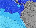 | 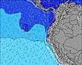 | 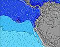 | 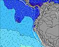 | 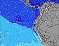 | 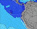 | |||||||||||||
Wave Height (m) Direction Period (s) | SSE 8 | SSE 8 | N 9 | N 8 | SSE 8 | SSE 8 | SSE 8 | SSE 8 | SW 14 | SSW 13 | SW 13 | SW 18 | SSW 17 | SSW 16 | SW 15 | SW 15 | SW 14 | SSW 14 | SSW 13 | SSW 13 |
Wave Graph | ||||||||||||||||||||
0 | 0 | 6 | 5 | 0 | 0 | 0 | 0 | 0 | 0 | 0 | 0 | 0 | 0 | 0 | 0 | 0 | 0 | 0 | 0 | |
Wind (km/h) | ||||||||||||||||||||
Wind State on-shore cross-onshore cross-shore cross-offshore off-shore glassy | cross-off | cross-off | cross-off | cross-off | cross-off | cross-off | cross-off | cross-off | cross-off | cross-off | cross-off | cross-off | cross-off | cross-off | cross-off | cross-off | cross-off | cross | cross-off | cross-off |
High Tide | 5:05PM1.87m | 5:29AM2.03m | 5:44PM1.82m | 6:05AM1.99m | 6:27PM1.76m | 6:47AM1.92m | 7:18PM1.68m | 7:37AM1.85m | 8:21PM1.62m | 8:40AM1.78m | 9:37PM1.60m | 9:55AM1.74m | 10:58PM1.65m | |||||||
Low Tide | 11:11PM0.29m | 11:43AM0.37m | 11:48PM0.36m | 12:24PM0.39m | 00:29AM0.44m | 1:11PM0.42m | 1:19AM0.53m | 2:08PM0.45m | 2:21AM0.61m | 3:16PM0.46m | 3:37AM0.65m | 4:32PM0.43m | ||||||||
— | — | 6:01 | — | — | 6:01 | — | — | 6:01 | — | — | 6:01 | — | — | 6:01 | — | — | 6:01 | — | — | |
6:06 | — | — | 6:06 | — | — | 6:06 | — | — | 6:06 | — | — | 6:06 | — | — | 6:06 | — | — | 6:06 | — | |
mm | — | — | — | — | — | — | — | — | — | — | — | — | — | — | — | — | — | — | — | — |
Temp °C | 26 | 25 | 25 | 25 | 24 | 25 | 25 | 24 | 25 | 25 | 24 | 25 | 25 | 24 | 25 | 25 | 24 | 25 | 26 | 24 |
Feels °C | 26 | 25 | 26 | 25 | 25 | 25 | 25 | 25 | 26 | 26 | 25 | 25 | 26 | 25 | 27 | 27 | 25 | 26 | 28 | 25 |
Swell 1 Height (m) Direction Period (s) | SW 13 | SW 12 | SW 12 | SW 12 | SW 12 | SW 11 | SW 14 | SSE 8 | SSE 8 | SSE 8 | SSE 8 | SW 12 | SSW 17 | SSW 16 | SW 15 | SW 15 | SW 14 | SSW 14 | SSW 13 | SSW 13 |
83 | 75 | 74 | 74 | 36 | 32 | 89 | 167 | 140 | 144 | 115 | 175 | 355 | 532 | 544 | 489 | 476 | 342 | 299 | 212 | |
Swell 2 Height (m) Direction Period (s) | SSW 10 | SW 16 | SW 15 | N 8 | SW 15 | SW 14 | S 12 | SSW 13 | SW 14 | SSW 13 | SW 13 | SW 18 | SSE 8 | SSE 8 | SSE 8 | SSE 8 | SSE 8 | S 10 | SSW 18 | SW 16 |
35 | 40 | 36 | 5 | 33 | 54 | 46 | 106 | 208 | 225 | 172 | 312 | 75 | 94 | 75 | 56 | 45 | 17 | 31 | 66 | |
Swell 3 Height (m) Direction Period (s) | SW 13 | SSW 9 | N 9 | SW 12 | WSW 12 | S 13 | SW 11 | S 12 | S 11 | S 12 | SSW 18 | S 11 | SSW 12 | SW 12 | SW 10 | S 11 | S 10 | SSW 18 | S 10 | S 10 |
28 | 16 | 6 | 6 | 13 | 28 | 5 | 71 | 64 | 43 | 130 | 39 | 94 | 112 | 28 | 20 | 8 | 31 | 8 | 16 | |
Wind waves Height (m) Direction Period (s) | SSE 8 | SSE 8 | SSE 8 | SSE 8 | SSE 8 | SSE 8 | SSE 8 | — | — | — | — | SSE 8 | S 4 | — | — | — | — | SSE 8 | SSE 8 | SSE 8 |
232 | 191 | 215 | 181 | 191 | 181 | 197 | — | — | — | — | 112 | 7 | — | — | — | — | 60 | 85 | 85 | |
Nearest Offshore or Glassy | ||||||||||||||||||||
Distance (km) | 1272 | 986 | 967 | 1271 | 970 | 967 | 1308 | 1042 | 967 | 1238 | 98 | 964 | 98 | 15 | 15 | 15 | 15 | 967 | 1256 | 15 |
Best forecast wave conditions in Galapagos - San Cristobal | ||||||||||||||||||||
Best forecast wave conditions in Ecuador | ||||||||||||||||||||
Header Global | ||||||||||||||||||||
- Map Icons:
 Break
Break Live Wave Height (m)
 Live Wind Speed (km/h)
 Surf Rating (10 Max)
 Ocean Swells (m)
- Wind Speed (km/h)
Latest Updates


FREE! Surf-Forecast.com widget for your website
The surf report / weather widget below is available to embed on third party websites free of charge and provides a summary of our Manglecito surf forecast. Simply grab the html code snippet that we provide and paste it into your own site. You can choose your preferred language and metric/imperial units for the surf forecast feed to suit users of your site. Click here to get the code.
Information about the Manglecito Surf forecast
The above surf forecast table for Manglecito provides essential information for determining whether the surfing conditions will be good over the next 16 days. A general guide to surfing at Manglecito can be found by selecting the local surf guide option on the grey menu. Our Manglecito surf forecast is unique since it includes wave energy (power) that defines the real feel of the surf rather than just the height or the period. If you surf the same spot (Manglecito) regularly then make a mental note of the wave energy from the surf forecast table each time you go. Very soon you may start to choose your surf days based on the wave energy alone combined with our forecast of favourable offshore wind conditions. Our star ratings will help here and of course you will also find the usual wave height and period predictions on our surf forecasts as well as a full break down of the swell components under our advanced users option (to reveal that, click the little Einstein character under the tide times).
Further information to help with frequently asked questions about our surf forecast for Manglecito may be found under the help tab on the top menu and also by moving your mouse over the question marks on the surf forecast table itself. Please always bear in mind that the forecast is for near-shore open water and local factors at each surf break influence the actual breaking wave height, such as the beach / reef profile, water depths offshore and shelter.
Are you planning a holiday in Galapagos - San Cristobal? If you are looking for accommodation near Manglecito, camping, hotels and holiday cottages in Galapagos - San Cristobal, consider staying in Galapagos Islands which is 12 km (7 miles) away. Other places in and around Galapagos - San Cristobal where you can find information about places to rent, and car hire include San Cristobal which is 44 km (27 miles) away and Bahia de la Academia, 89 km (55 miles) away.
 Nearest