

Surf Forecasts:

Makaha surf forecast from 3 Aug 2026:
- Best quality surf: Tuesday 4 Aug, 7AM (local time) - 3ft (0.9m), 12s period, SSW swell with glassy winds.
- Most powerful swell: Thursday 6 Aug, 10PM (local time) - 5ft (1.6m), 16s period, SW swell with 1,210 kJ wave energy.
- Next surfable swell (1★+): Tuesday 4 Aug, 7AM (local time) - 3ft (0.9m), 12s period with SSW swell.
Best Forecast Surf Conditions for Makaha this week:
The surf forecast for Makaha over the next 16 days: The first swell (rated 1 star or higher) is forecast to arrive on Tuesday (Aug 04) at 7AM. The primary swell is predicted to be 0.9m and 12s period with a secondary swell of 1.2m and 8s. The wind is predicted to be glassy as the swell arrives.
The most powerful waves expected at Makaha in the next 16 days are 1.6m 16s and forecast to arrive on Thursday (Aug 06) at 10PM. Winds are predicted to be cross-shore at the time the swell arrives.
| Wave Type | Time (-05) & Date | Wave Height & Period |
|---|---|---|
| Next good surf (1 star+) | 7AM (Tue 4th Aug) | 3ft (0.9m) 12s |
| Best Surf | 7AM (Tue 4th Aug) | 3ft (0.9m) 12s |
| Most Powerful | 10PM (Thu 6th Aug) | 5ft (1.6m) 16s |
Table - best surf conditions forecast for Makaha over the next 16 days.
The Lowdown
Alright folks, Rusty here. Let’s have a look at what’s cookin’ for the next couple of weeks.
Well, I gotta be straight with you – it’s a bit of a slow start. The first few days are looking pretty average, but don’t write it off just yet. The real story here is a building swell that looks like it could deliver some proper waves, especially for the more experienced crew.
The main spot on the menu is Makaha, a very consistent reef break. Now, the water is running at a balmy 72°, which is a whopping 9° warmer than normal for this time of year. That’s far warmer than usual, so you can leave the thick wetsuit at home.
The first proper surf we’ll see is on Sunday, August 2nd, but it’s a bit of a dud. We’re looking at a 4 ft SSW swell with a short period of 8 seconds. The wind is a cross-on from the SSW at 9 mph, making for some choppy, poor surf conditions. The combined energy is moderate at 436, but it’s just not happening. Monday and Tuesday are much the same – small, messy, and not worth paddling out for.
We start to see a glimmer of hope on Wednesday, August 5th. The swell drops a touch to 4 ft but the period stretches out to 13 seconds from the SW. That’s a proper groundswell, and the energy is building (646). The morning has a light cross-on breeze, so it’s not perfect, but it’s a step in the right direction. Still, the forecast calls it marginal.
The pattern keeps improving through the week. By Monday, August 10th, we’re looking at a 6 ft SSW swell with a 10-second period. The morning wind is light offshore from the WSW at just 3 mph. That’s clean! The combined energy is strong at 1001. This is the first real standout. For the more advanced surfers, this is your window. The size is pushing into the ‘too big for beginners’ territory, but for everyone else, this looks like the best we’ve got for a while.
The swell peaks around Tuesday, August 11th with a 7 ft S swell, 12-second period, and a very strong energy reading of 1578. Again, the morning has a light cross-on wind, but the size and power are there. This is definitely for the experienced crew only at that size.
After that, the swell eases back but stays in the 5 ft to 6 ft range for a few days, with the period staying long. The wind is a bit of a nuisance, mostly cross-on, but there are still windows of cleaner conditions. Keep an eye on Thursday, August 13th afternoon, where a 3 ft swell with a very long 18-second period arrives, but the moderate cross-shore wind will mess with the shape.
The second week is a bit more of a mixed bag. The swell drops back to around 4 ft from the SW, with long periods (14-16 seconds). The energy is moderate. The morning of Saturday, August 15th looks promising with a light cross-shore wind and a 4 ft SW swell at 15 seconds. It’s not the power of the first week, but it’s rideable. The real flurry in the second week comes on Monday, August 17th, with a 4 ft SW swell, a 16-second period, and strong energy of 1386. The wind is a moderate cross-shore, so it’ll be a bit lumpy, but the juice is there.
So, to wrap it up: the first few days are a write-off. The standout is definitely Monday, August 10th, through to Tuesday, August 11th, with building swell and a chance for clean conditions. If you’re an experienced surfer, that’s your call. The second week is smaller and more inconsistent, but not a total loss. It’s a waiting game, but there’s some good stuff on the horizon.
Stay salty,
Rusty.
Short Range ForecastMostly dry. Warm (max 21°C on Tue morning, min 18°C on Sun night). Wind will be generally light. | Days 5-7 Weather SummaryMostly dry. Warm (max 20°C on Wed afternoon, min 18°C on Thu night). Wind will be generally light. | |||||||||||||||||||
Sun 2 | Monday 3 | Tuesday 4 | Wednesday 5 | Thursday 6 | Friday 7 | Saturday 8 | ||||||||||||||
PM | Night | AM | PM | Night | AM | PM | Night | AM | PM | Night | AM | PM | Night | AM | PM | Night | AM | PM | Night | |
Swell Height Map |  | 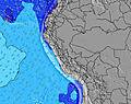 | 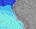 | 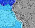 | 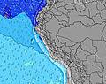 | 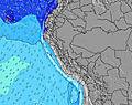 | 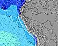 | |||||||||||||
Wave Height (m) Direction Period (s) | S 8 | S 7 | SSW 8 | SSW 8 | SSW 8 | SSW 12 | SW 11 | SW 12 | SW 13 | SW 12 | SW 12 | SW 17 | SW 16 | SW 16 | SW 14 | SW 14 | SW 13 | SW 13 | SW 13 | SW 12 |
Wave Graph | ||||||||||||||||||||
196 | 212 | 178 | 183 | 183 | 255 | 189 | 449 | 466 | 437 | 349 | 505 | 653 | 1082 | 746 | 667 | 458 | 326 | 273 | 223 | |
Wind (km/h) | ||||||||||||||||||||
Wind State on-shore cross-onshore cross-shore cross-offshore off-shore glassy | cross-on | cross | cross-on | cross-on | cross | on | cross-on | cross | cross-on | cross-on | cross | cross-on | cross | cross | cross | cross-on | cross | cross-on | cross-on | cross |
High Tide | 8:22PM0.59m | 8:30AM0.82m | 9:14PM0.61m | 8:58AM0.76m | 10:16PM0.64m | 9:31AM0.70m | 11:28PM0.67m | 10:17AM0.63m | 00:49AM0.72m | 11:22AM0.56m | 2:06AM0.79m | 12:49PM0.52m | 3:11AM0.87m | |||||||
Low Tide | 1:52AM0.28m | 3:13PM0.24m | 2:35AM0.34m | 3:45PM0.22m | 3:33AM0.41m | 4:26PM0.20m | 5:00AM0.46m | 5:19PM0.18m | 7:10AM0.47m | 6:27PM0.15m | 8:53AM0.43m | 7:38PM0.11m | ||||||||
— | — | 6:26 | — | — | 6:26 | — | — | 6:24 | — | — | 6:24 | — | — | 6:24 | — | — | 6:24 | — | — | |
6:01 | — | — | 6:01 | — | — | 6:01 | — | — | 6:01 | — | — | 6:01 | — | — | 6:02 | — | — | 6:02 | — | |
mm | — | — | — | — | — | — | — | — | — | — | — | — | — | — | — | — | — | — | — | — |
Temp °C | 20 | 19 | 20 | 20 | 19 | 21 | 20 | 19 | 21 | 20 | 19 | 20 | 20 | 19 | 20 | 20 | 19 | 20 | 20 | 18 |
Feels °C | 20 | 19 | 19 | 20 | 20 | 21 | 20 | 19 | 21 | 19 | 19 | 19 | 18 | 18 | 19 | 19 | 19 | 19 | 20 | 17 |
Swell 1 Height (m) Direction Period (s) | S 8 | S 8 | SSW 8 | SSW 8 | SSW 8 | SSW 8 | S 8 | SW 12 | SW 13 | SW 12 | SW 12 | SW 12 | SW 16 | SW 16 | SW 14 | SW 14 | S 8 | S 8 | S 8 | SW 12 |
196 | 135 | 178 | 183 | 183 | 178 | 177 | 449 | 466 | 437 | 349 | 314 | 653 | 1082 | 746 | 667 | 157 | 157 | 190 | 202 | |
Swell 2 Height (m) Direction Period (s) | SW 10 | SW 9 | SSW 12 | SSW 12 | SSW 11 | SSW 12 | SW 11 | S 8 | S 7 | SSW 8 | S 8 | SW 17 | SW 12 | S 9 | S 7 | S 7 | SW 13 | SW 13 | SW 13 | SW 16 |
98 | 71 | 125 | 104 | 97 | 255 | 189 | 118 | 83 | 94 | 95 | 505 | 268 | 16 | 86 | 109 | 458 | 326 | 273 | 129 | |
Swell 3 Height (m) Direction Period (s) | SW 13 | SW 13 | SW 13 | SW 12 | SW 14 | W 12 | SW 14 | SW 20 | SW 20 | SW 19 | SW 18 | S 8 | S 8 | NW 10 | S 9 | NW 11 | SW 20 | SSW 18 | SW 18 | SW 23 |
142 | 138 | 79 | 73 | 92 | 3 | 189 | 16 | 97 | 131 | 157 | 76 | 84 | 4 | 7 | 5 | 15 | 31 | 48 | 21 | |
Wind waves Height (m) Direction Period (s) | — | S 7 | — | — | — | — | — | — | — | — | — | — | — | S 8 | — | — | — | — | — | S 8 |
— | 212 | — | — | — | — | — | — | — | — | — | — | — | 78 | — | — | — | — | — | 223 | |
Nearest Offshore or Glassy | ||||||||||||||||||||
Distance (km) | 6 | 5 | 6 | 6 | 5 | 6 | 6 | 5 | 6 | 6 | 5 | 6 | 6 | 33 | 6 | 6 | 5 | 6 | 6 | 5 |
Best forecast wave conditions in Lima | ||||||||||||||||||||
Best forecast wave conditions in Peru | ||||||||||||||||||||
Header Global | ||||||||||||||||||||
- Map Icons:
 Break
Break Live Wave Height (m)
 Live Wind Speed (km/h)
 Surf Rating (10 Max)
 Ocean Swells (m)
- Wind Speed (km/h)
Latest Updates


FREE! Surf-Forecast.com widget for your website
The surf report / weather widget below is available to embed on third party websites free of charge and provides a summary of our Makaha surf forecast. Simply grab the html code snippet that we provide and paste it into your own site. You can choose your preferred language and metric/imperial units for the surf forecast feed to suit users of your site. Click here to get the code.
Information about the Makaha Surf forecast
The above surf forecast table for Makaha provides essential information for determining whether the surfing conditions will be good over the next 16 days. A general guide to surfing at Makaha can be found by selecting the local surf guide option on the grey menu. Our Makaha surf forecast is unique since it includes wave energy (power) that defines the real feel of the surf rather than just the height or the period. If you surf the same spot (Makaha) regularly then make a mental note of the wave energy from the surf forecast table each time you go. Very soon you may start to choose your surf days based on the wave energy alone combined with our forecast of favourable offshore wind conditions. Our star ratings will help here and of course you will also find the usual wave height and period predictions on our surf forecasts as well as a full break down of the swell components under our advanced users option (to reveal that, click the little Einstein character under the tide times).
Further information to help with frequently asked questions about our surf forecast for Makaha may be found under the help tab on the top menu and also by moving your mouse over the question marks on the surf forecast table itself. Please always bear in mind that the forecast is for near-shore open water and local factors at each surf break influence the actual breaking wave height, such as the beach / reef profile, water depths offshore and shelter.
Makaha is 2 km (1 miles) from the city of Lima. If you plan a holiday in Lima, look for hotels and other accommodation in Lima. Lima has rooms for a wide range of budgets as well as car hire and transport links.
 Nearest