

Surf Forecasts:

Lagundri - The Point surf forecast from 2 Aug 2026:
- Best quality surf: Friday 7 Aug, 10PM (local time) - 7.5ft (2.3m), 17s period, SSW swell with offshore winds.
- Most powerful swell: Friday 7 Aug, 4PM (local time) - 7.5ft (2.3m), 18s period, SSW swell with 3,286 kJ wave energy.
- Next surfable swell (1★+): Sunday 2 Aug, 1PM (local time) - 4.5ft (1.4m), 15s period with SW swell.
Best Forecast Surf Conditions for Lagundri - The Point this week:
The surf forecast for Lagundri - The Point over the next 16 days: The first swell (rated 1 star or higher) is forecast to arrive on Sunday (Aug 02) at 1PM. The primary swell is predicted to be 1.4m and 15s period with a secondary swell of 0.6m and 9s. Another secondary swell of 0.5m and 10s is also forecast. The wind is predicted to be cross-offshore as the swell arrives.
The most powerful waves expected at Lagundri - The Point in the next 16 days are 2.3m 18s and forecast to arrive on Friday (Aug 07) at 4PM. Winds are predicted to be offshore at the time the swell arrives. The largest open ocean swell (not directed at the beach) is 0.9m 5s period and expected on Wednesday (Aug 05) at 1AM.
| Wave Type | Time (WIB) & Date | Wave Height & Period |
|---|---|---|
| Next good surf (1 star+) | 1PM (Sun 2nd Aug) | 4.5ft (1.4m) 15s |
| Best Surf | 10PM (Fri 7th Aug) | 7.5ft (2.3m) 17s |
| Most Powerful | 4PM (Fri 7th Aug) | 7.5ft (2.3m) 18s |
Table - best surf conditions forecast for Lagundri - The Point over the next 16 days.
The Lowdown
Alright, this is Rusty, and I’m looking at the next 16 days for the wave at Lagundri - The Point.
We’re starting off with a solid run of surf, but it’s not all smooth sailing. The first week is a mixed bag of good energy and some tricky conditions, but the second week looks like it’s going to clean right up and serve up some proper glassy gems.
The run kicks off on Sunday the 2nd of August. The morning is a bit messy with a risk of thunderstorms and a light cross-shore breeze, but the swell is already here at 4ft from the SW with a long 16 second period. The combined wave energy is already pumping at 1115 (moderate to strong). The afternoon is where it gets interesting: the wind swings offshore from the WNW at 9 mph, the swell drops slightly to 3ft but the period stretches to 18 seconds, and the energy jumps to 1125. That’s clean, offshore, and glassy. This is a classic set-up for a reef point like this, with long-period groundswell wrapping in perfectly. It’s an advanced wave, so you need to earn your turns, but it’s a beautiful afternoon.
Monday the 3rd and Tuesday the 4th keep the offshore winds going, mainly from the NW and WNW. Monday stays around 5ft with a 15 second period, and the energy is still high at 952 (moderate). Tuesday morning is the real standout of the first week: the swell bumps up to 6ft from the W with a 10 second period, and the energy spikes to 1714 (strong). The wind is a gentle offshore breeze from the NW at 9 mph. The wave is a bit more powerful, but the quality is excellent for experienced surfers. That’s a session to circle on the calendar.
From Wednesday the 5th through to Friday the 7th, the swell hangs in, but the wind gets fresh. We’re looking at 19 mph offshore winds from the NW and WNW. The swell is solid, between 5ft and 8ft, and the energy is very strong, hitting 2651 on Friday morning. The wave will be powerful and clean, but that wind strength makes it a bit of a battle. This is expert territory, and the energy is massive (2651 to 3405). For the average surfer, you’ll be watching from the cliffs.
The weekend of the 8th and 9th of August is a sweet spot. The wind drops back to a gentle to moderate offshore breeze, the swell holds at 7ft to 8ft from the SSW, and the period is a long 16 seconds. The energy is still very strong (2283 to 2826), but the conditions are clean and the wave is lining up. This is the best window of the first week for a solid, clean, powerful session.
Now, the second week. From Monday the 10th, the wind turns onshore and the quality drops. The swell is still there, but it’s a messy, bumpy affair. This stretch from the 10th to the 13th is a write-off for paddle surfing. The wind is from the SE and SSE, straight onshore, and the wave is lumpy. If you’re into kite surfing, that onshore wind and solid swell (5ft to 7ft) might look interesting, but for a pointed reef, it’s not what we want.
Then, the magic returns. From Thursday the 13th afternoon right through to Monday the 17th of August, we get a run of glassy conditions. The wind goes light, variable, or dead calm. The swell drops to a more manageable 3ft to 4ft, but the period is still long (15 to 16 seconds) and the energy is moderate (585 to 991). The highlight of the entire forecast is the glassy, clean conditions. Thursday the 13th afternoon and Friday the 14th are looking particularly special with a glassy surface and a 3ft to 4ft SW groundswell. This is a long-period groundswell, so it will be a bit walled up at times, but on a point like this, it will offer long, peeling lines. The water temperature is about average for this time of year, so you’ll be comfortable in a spring suit.
So, the two standouts: Tuesday the 4th of August for the bigger, powerful surf with gentle offshore winds, and Friday the 14th of August for the absolutely glassy, clean conditions with a smaller, long-period swell. The second week is a gamble, but the glassy run at the end is the kind of surfing that makes you forget about the crowds (which can show up here sometimes).
Rusty.
Short Range ForecastHeavy rain (total 60mm), heaviest during Mon night. Warm (max 28°C on Sat night, min 25°C on Sun morning). Wind will be generally light. | Days 4-6 Weather SummaryHeavy rain (total 121mm), heaviest during Thu morning. Warm (max 27°C on Wed morning, min 24°C on Thu morning). Mainly fresh winds. | ||||||||||||||||||||
Sunday 2 | Monday 3 | Tuesday 4 | Wednesday 5 | Thursday 6 | Friday 7 | Saturday 8 | |||||||||||||||
AM | PM | Night | AM | PM | Night | AM | PM | Night | AM | PM | Night | AM | PM | Night | AM | PM | Night | AM | PM | Night | |
Swell Height Map |  |  |  | 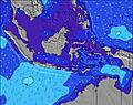 | 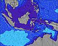 |  |  | ||||||||||||||
Wave Height (m) Direction Period (s) | SW 16 | SSW 18 | SSW 16 | SW 15 | SW 15 | SSW 14 | W 10 | SW 16 | SW 16 | SSW 15 | SW 15 | SW 19 | SSW 17 | SSW 16 | SSW 16 | SSW 15 | SSW 18 | SSW 16 | SSW 16 | SSW 16 | SSW 16 |
Wave Graph | |||||||||||||||||||||
783 | 596 | 1126 | 893 | 869 | 707 | 625 | 739 | 1208 | 1014 | 930 | 1282 | 2113 | 1855 | 1982 | 1786 | 3286 | 3042 | 2716 | 2164 | 1908 | |
Wind (km/h) | |||||||||||||||||||||
Wind State on-shore cross-onshore cross-shore cross-offshore off-shore glassy | cross | off | cross-off | off | off | cross-off | off | off | off | off | off | off | off | off | cross-off | off | off | cross-off | off | off | off |
High Tide | 8:01AM0.79m | 8:33PM0.66m | 8:30AM0.75m | 9:08PM0.67m | 9:00AM0.68m | 9:48PM0.68m | 9:34AM0.60m | 10:36PM0.67m | 10:15AM0.51m | 11:38PM0.66m | 11:14AM0.42m | 1:00AM0.66m | 1:01PM0.35m | 2:30AM0.69m | |||||||
Low Tide | 2:23PM0.05m | 2:15AM0.14m | 2:49PM0.05m | 2:56AM0.17m | 3:16PM0.06m | 3:42AM0.20m | 3:48PM0.08m | 4:41AM0.24m | 4:26PM0.10m | 6:08AM0.28m | 5:18PM0.14m | 8:26AM0.26m | 6:37PM0.16m | ||||||||
6:31 | — | — | 6:31 | — | — | 6:31 | — | — | 6:31 | — | — | 6:30 | — | — | 6:30 | — | — | 6:30 | — | — | |
— | 6:38 | — | — | 6:38 | — | — | 6:38 | — | — | 6:38 | — | — | 6:38 | — | — | 6:38 | — | — | 6:38 | — | |
mm | 10 | — | 3 | 2 | 2 | 15 | 11 | 9 | 7 | 4 | 6 | 21 | 46 | 21 | 6 | 4 | 6 | 3 | 2 | 1 | 2 |
Temp °C | 27 | 26 | 26 | 28 | 28 | 27 | 27 | 26 | 26 | 27 | 27 | 27 | 25 | 27 | 27 | 27 | 27 | 27 | 29 | 29 | 27 |
Feels °C | 31 | 29 | 30 | 31 | 30 | 28 | 30 | 27 | 26 | 27 | 27 | 26 | 27 | 25 | 26 | 26 | 27 | 28 | 31 | 30 | 31 |
Swell 1 Height (m) Direction Period (s) | SW 16 | SW 15 | SSW 16 | SW 15 | SW 15 | W 9 | W 10 | W 10 | WNW 10 | W 10 | W 9 | W 9 | SSW 17 | SSW 16 | SSW 16 | SSW 15 | SSW 18 | SSW 16 | SSW 16 | SSW 16 | SSW 16 |
783 | 472 | 1126 | 893 | 869 | 707 | 625 | 612 | 739 | 479 | 422 | 380 | 2113 | 1855 | 1982 | 1786 | 3286 | 3042 | 2716 | 2164 | 1908 | |
Swell 2 Height (m) Direction Period (s) | S 7 | SSW 18 | S 9 | S 8 | S 8 | SSW 14 | SSW 13 | SW 16 | SW 16 | SSW 15 | SW 15 | SW 19 | WNW 10 | WNW 9 | WNW 9 | SSW 19 | WNW 9 | WNW 9 | WNW 9 | WNW 9 | WNW 9 |
37 | 596 | 55 | 34 | 34 | 700 | 479 | 739 | 1208 | 1014 | 930 | 1282 | 327 | 211 | 181 | 716 | 119 | 108 | 110 | 119 | 92 | |
Swell 3 Height (m) Direction Period (s) | SSW 19 | S 9 | WNW 9 | WNW 9 | WNW 11 | SW 18 | SW 16 | SSW 13 | S 8 | SW 22 | SW 20 | SSW 14 | SW 7 | SW 7 | SSW 20 | WNW 9 | — | W 16 | — | — | W 14 |
295 | 57 | 26 | 25 | 37 | 194 | 610 | 295 | 5 | 118 | 400 | 413 | 73 | 86 | 232 | 149 | — | 5 | — | — | 4 | |
Wind waves Height (m) Direction Period (s) | — | — | — | — | — | — | — | N 4 | N 5 | N 5 | — | — | N 5 | — | — | — | — | — | — | — | — |
— | — | — | — | — | — | — | 10 | 43 | 15 | — | — | 20 | — | — | — | — | — | — | — | — | |
Nearest Offshore or Glassy | |||||||||||||||||||||
Distance (km) | 1 | 0 | 0 | 0 | 0 | 312 | 0 | 0 | 0 | 312 | 18 | 18 | 18 | 18 | 312 | 312 | 18 | 1 | 0 | 0 | 0 |
Best forecast wave conditions in Nias | |||||||||||||||||||||
Best forecast wave conditions in Indonesia | |||||||||||||||||||||
Header Global | |||||||||||||||||||||
- Map Icons:
 Break
Break Live Wave Height (m)
 Live Wind Speed (km/h)
 Surf Rating (10 Max)
 Ocean Swells (m)
- Wind Speed (km/h)
Latest Updates


FREE! Surf-Forecast.com widget for your website
The surf report / weather widget below is available to embed on third party websites free of charge and provides a summary of our Lagundri - The Point surf forecast. Simply grab the html code snippet that we provide and paste it into your own site. You can choose your preferred language and metric/imperial units for the surf forecast feed to suit users of your site. Click here to get the code.
Information about the Lagundri - The Point Surf forecast
The above surf forecast table for Lagundri - The Point provides essential information for determining whether the surfing conditions will be good over the next 16 days. A general guide to surfing at Lagundri - The Point can be found by selecting the local surf guide option on the grey menu. Our Lagundri - The Point surf forecast is unique since it includes wave energy (power) that defines the real feel of the surf rather than just the height or the period. If you surf the same spot (Lagundri - The Point) regularly then make a mental note of the wave energy from the surf forecast table each time you go. Very soon you may start to choose your surf days based on the wave energy alone combined with our forecast of favourable offshore wind conditions. Our star ratings will help here and of course you will also find the usual wave height and period predictions on our surf forecasts as well as a full break down of the swell components under our advanced users option (to reveal that, click the little Einstein character under the tide times).
Further information to help with frequently asked questions about our surf forecast for Lagundri - The Point may be found under the help tab on the top menu and also by moving your mouse over the question marks on the surf forecast table itself. Please always bear in mind that the forecast is for near-shore open water and local factors at each surf break influence the actual breaking wave height, such as the beach / reef profile, water depths offshore and shelter.
Are you planning a holiday in Nias? If you are looking for accommodation near Lagundri - The Point, camping, hotels and holiday cottages in Nias, consider staying in Afia which is 92 km (57 miles) away.
 Nearest