

Surf Forecasts:

Lagundri-The Machine surf forecast from 3 Aug 2026:
- Best quality surf: Tuesday 4 Aug, 10PM (local time) - 5ft (1.6m), 16s period, SW swell with offshore winds.
- Most powerful swell: Friday 7 Aug, 7PM (local time) - 7ft (2.2m), 17s period, SSW swell with 2,968 kJ wave energy.
- Next surfable swell (1★+): Tuesday 4 Aug, 10PM (local time) - 5ft (1.6m), 16s period with SW swell.
Best Forecast Surf Conditions for Lagundri-The Machine this week:
The surf forecast for Lagundri-The Machine over the next 16 days: The first swell (rated 1 star or higher) is forecast to arrive on Tuesday (Aug 04) at 10PM. The primary swell is predicted to be 1.6m and 16s period with a secondary swell of 2.0m and 10s. The wind is predicted to be offshore as the swell arrives.
The most powerful waves expected at Lagundri-The Machine in the next 16 days are 2.2m 17s and forecast to arrive on Friday (Aug 07) at 7PM. Winds are predicted to be cross-offshore at the time the swell arrives. The largest open ocean swell (not directed at the beach) is 0.5m 4s period and expected on Wednesday (Aug 05) at 4PM.
| Wave Type | Time (WIB) & Date | Wave Height & Period |
|---|---|---|
| Next good surf (1 star+) | 10PM (Tue 4th Aug) | 5ft (1.6m) 16s |
| Best Surf | 10PM (Tue 4th Aug) | 5ft (1.6m) 16s |
| Most Powerful | 7PM (Fri 7th Aug) | 7ft (2.2m) 17s |
Table - best surf conditions forecast for Lagundri-The Machine over the next 16 days.
The Lowdown
Alright, this is Rusty. Let’s have a look at what’s coming up for Lagundri-The-Machine.
Right now, we’ve got a bit of a slow start. The first few days are looking pretty average with that moderate rain and cross-shore wind messing up the surface. Monday the 3rd and Tuesday the 4th are a bit of a write-off with marginal conditions and choppy water. The swell is there, but the wind’s not playing nice.
The first real window opens up Tuesday afternoon, the 4th. The wind swings to a light cross-off from the NW, and the wave state cleans right up. Swell is a solid 7 ft from the west, with a moderate period of 10 seconds. Combined wave energy is moderate (1922). This is where things start to look interesting.
Wednesday morning, the 5th, is a standout. We’ve got offshore wind from the NNW at 9 mph, swell holding at 5 ft from the SSW with a long period of 15 seconds. That’s a groundswell, and at this reef break, it should peel off nicely. Combined energy is strong (1785). The water’s about average for the time of year. Expect clean, lined-up waves, but keep in mind that long period swell can make the sets a bit more spaced out. This is a good day for experienced surfers.
The next big highlight is Saturday morning, the 8th. Swell picks up to 7 ft from the SSW with a 16-second period. Combined energy is very strong (2673). Wind is light cross-off from the NNW at 9 mph, so the surface will be clean. This is another one for the experienced crew, as the size is pushing into expert territory. Crowds are possible at this break.
Sunday the 9th is also worth a mention. The morning is a bit messy, but by the afternoon we get glassy conditions with the wind dropping to 3 mph from the west. Swell is 7 ft from the SSW at 16 seconds. That’s excellent surf conditions for experienced surfers, and the glassy water will make for a beautiful session.
After that, the energy drops off a bit, but we get a few more glassy windows. Thursday morning, the 14th, is dead calm and glassy, with a 5 ft SSW swell at 15 seconds. Nice, clean, and manageable. Then again on Sunday the 16th, both morning and afternoon are glassy with 5 ft and 4 ft SSW swells, respectively. Good for a fun, less hectic session.
All in all, the best on offer is Wednesday morning the 5th and Saturday morning the 8th. The 5th is cleaner with offshore wind, the 8th is bigger and more powerful. Both are for advanced surfers only. After that, the second week has some nice glassy windows but the swell is smaller.
Rusty.
Short Range ForecastHeavy rain (total 79mm), heaviest during Wed night. Warm (max 28°C on Wed morning, min 24°C on Mon afternoon). Winds increasing (light winds from the SSW on Mon morning, fresh winds from the WNW by Wed night). | Days 4-6 Weather SummaryHeavy rain (total 37mm), heaviest during Thu afternoon. Warm (max 29°C on Sat afternoon, min 25°C on Thu afternoon). Winds decreasing (fresh winds from the NW on Fri morning, light winds from the NNE by Sat night). | ||||||||||||||||||||
Monday 3 | Tuesday 4 | Wednesday 5 | Thursday 6 | Friday 7 | Saturday 8 | Sunday 9 | |||||||||||||||
AM | PM | Night | AM | PM | Night | AM | PM | Night | AM | PM | Night | AM | PM | Night | AM | PM | Night | AM | PM | Night | |
Swell Height Map |  |  |  | 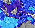 | 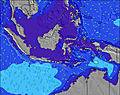 | 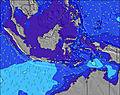 | 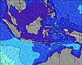 | ||||||||||||||
Wave Height (m) Direction Period (s) | SW 15 | SW 15 | SSW 14 | W 10 | W 10 | SW 16 | SSW 15 | SW 15 | SW 19 | SSW 17 | SSW 16 | SSW 16 | SSW 15 | SSW 18 | SSW 16 | SSW 16 | SSW 16 | SSW 15 | SSW 15 | SSW 16 | SSW 15 |
Wave Graph | |||||||||||||||||||||
893 | 869 | 700 | 1015 | 873 | 1208 | 1014 | 930 | 1268 | 2113 | 2002 | 1880 | 1698 | 2768 | 2818 | 2447 | 1933 | 1642 | 1516 | 1634 | 1382 | |
Wind (km/h) | |||||||||||||||||||||
Wind State on-shore cross-onshore cross-shore cross-offshore off-shore glassy | cross-on | cross | cross-off | cross-off | cross-off | cross-off | off | cross-off | cross-off | cross-off | cross-off | cross-off | cross-off | cross-off | off | cross-off | cross-off | cross-off | cross | glassy | glassy |
High Tide | 9:08PM0.67m | 9:00AM0.68m | 9:48PM0.68m | 9:34AM0.60m | 10:36PM0.67m | 10:15AM0.51m | 11:38PM0.66m | 11:14AM0.42m | 1:00AM0.66m | 1:01PM0.35m | 2:30AM0.69m | 3:04PM0.35m | 3:46AM0.76m | ||||||||
Low Tide | 2:49PM0.05m | 2:56AM0.17m | 3:16PM0.06m | 3:42AM0.20m | 3:48PM0.08m | 4:41AM0.24m | 4:26PM0.10m | 6:08AM0.28m | 5:18PM0.14m | 8:26AM0.26m | 6:37PM0.16m | 10:09AM0.20m | 8:19PM0.16m | ||||||||
6:31 | — | — | 6:31 | — | — | 6:31 | — | — | 6:30 | — | — | 6:30 | — | — | 6:30 | — | — | 6:30 | — | — | |
— | 6:38 | — | — | 6:38 | — | — | 6:38 | — | — | 6:38 | — | — | 6:38 | — | — | 6:38 | — | — | 6:37 | — | |
mm | 9 | 5 | 8 | 8 | 11 | 3 | 3 | 2 | 30 | 7 | 10 | 8 | 3 | — | — | 2 | 4 | 3 | — | 1 | — |
Temp °C | 25 | 25 | 26 | 26 | 26 | 26 | 28 | 27 | 26 | 27 | 25 | 26 | 27 | 27 | 27 | 28 | 29 | 27 | 28 | 28 | 27 |
Feels °C | 29 | 26 | 27 | 28 | 28 | 28 | 29 | 27 | 25 | 27 | 27 | 28 | 27 | 27 | 28 | 31 | 31 | 29 | 32 | 32 | 31 |
Swell 1 Height (m) Direction Period (s) | SW 15 | SW 15 | W 10 | W 10 | W 10 | W 10 | W 10 | WNW 9 | SW 19 | W 9 | SSW 16 | SSW 16 | SSW 15 | SSW 18 | SSW 16 | SSW 16 | SSW 16 | SSW 15 | SSW 15 | SSW 16 | SSW 15 |
893 | 869 | 687 | 1015 | 873 | 716 | 470 | 418 | 1268 | 650 | 2002 | 1880 | 1698 | 2768 | 2818 | 2447 | 1933 | 1642 | 1516 | 1634 | 1382 | |
Swell 2 Height (m) Direction Period (s) | S 8 | W 6 | SSW 14 | SSW 13 | SW 16 | SW 16 | SSW 15 | SW 15 | SSW 14 | SSW 17 | W 9 | W 9 | W 8 | W 9 | WNW 9 | WNW 10 | WNW 9 | WNW 9 | WNW 9 | WNW 9 | WNW 9 |
66 | 52 | 700 | 472 | 739 | 1208 | 1014 | 930 | 413 | 2113 | 533 | 335 | 228 | 210 | 143 | 159 | 153 | 149 | 126 | 126 | 94 | |
Swell 3 Height (m) Direction Period (s) | WNW 9 | S 8 | SW 18 | SW 16 | SSW 13 | S 16 | SW 22 | SW 20 | — | S 11 | S 12 | SSW 20 | SSW 19 | W 17 | WSW 7 | W 16 | SW 7 | SW 7 | SW 7 | WSW 7 | SW 7 |
15 | 35 | 194 | 610 | 295 | 5 | 118 | 400 | — | 10 | 11 | 225 | 584 | 6 | 21 | 5 | 18 | 16 | 23 | 35 | 27 | |
Wind waves Height (m) Direction Period (s) | W 5 | — | — | — | — | N 4 | — | N 4 | W 9 | — | — | — | — | — | — | — | — | — | — | — | — |
15 | — | — | — | — | 5 | — | 7 | 537 | — | — | — | — | — | — | — | — | — | — | — | — | |
Nearest Offshore or Glassy | |||||||||||||||||||||
Distance (km) | 167 | 1 | 1 | 1 | 1 | 1 | 0 | 17 | 313 | 17 | 1 | 1 | 1 | 17 | 0 | 0 | 1 | 0 | 10 | 0 | 0 |
Best forecast wave conditions in Nias | |||||||||||||||||||||
Best forecast wave conditions in Indonesia | |||||||||||||||||||||
Header Global | |||||||||||||||||||||
- Map Icons:
 Break
Break Live Wave Height (m)
 Live Wind Speed (km/h)
 Surf Rating (10 Max)
 Ocean Swells (m)
- Wind Speed (km/h)
Latest Updates


FREE! Surf-Forecast.com widget for your website
The surf report / weather widget below is available to embed on third party websites free of charge and provides a summary of our Lagundri-The Machine surf forecast. Simply grab the html code snippet that we provide and paste it into your own site. You can choose your preferred language and metric/imperial units for the surf forecast feed to suit users of your site. Click here to get the code.
Information about the Lagundri-The Machine Surf forecast
The above surf forecast table for Lagundri-The Machine provides essential information for determining whether the surfing conditions will be good over the next 16 days. A general guide to surfing at Lagundri-The Machine can be found by selecting the local surf guide option on the grey menu. Our Lagundri-The Machine surf forecast is unique since it includes wave energy (power) that defines the real feel of the surf rather than just the height or the period. If you surf the same spot (Lagundri-The Machine) regularly then make a mental note of the wave energy from the surf forecast table each time you go. Very soon you may start to choose your surf days based on the wave energy alone combined with our forecast of favourable offshore wind conditions. Our star ratings will help here and of course you will also find the usual wave height and period predictions on our surf forecasts as well as a full break down of the swell components under our advanced users option (to reveal that, click the little Einstein character under the tide times).
Further information to help with frequently asked questions about our surf forecast for Lagundri-The Machine may be found under the help tab on the top menu and also by moving your mouse over the question marks on the surf forecast table itself. Please always bear in mind that the forecast is for near-shore open water and local factors at each surf break influence the actual breaking wave height, such as the beach / reef profile, water depths offshore and shelter.
Are you planning a holiday in Nias? If you are looking for accommodation near Lagundri-The Machine, camping, hotels and holiday cottages in Nias, consider staying in Afia which is 91 km (57 miles) away.
 Nearest