

Surf Forecasts:

La Fonda surf forecast from 15 Jul 2026:
- Best quality surf: Monday 20 Jul, 2AM (local time) - 3ft (0.9m), 16s period, SW swell with glassy winds.
- Most powerful swell: Sunday 19 Jul, 8PM (local time) - 5ft (1.5m), 16s period, SSW swell with 1,180 kJ wave energy.
- Next surfable swell (1★+): Wednesday 15 Jul, 8PM (local time) - 2ft (0.6m), 16s period with SW swell.
Best Forecast Surf Conditions for La Fonda this week:
The surf forecast for La Fonda over the next 16 days: The first swell (rated 1 star or higher) is forecast to arrive on Wednesday (Jul 15) at 8PM. The primary swell is predicted to be 0.6m and 16s period with a secondary swell of 0.5m and 6s. The wind is predicted to be glassy as the swell arrives.
The most powerful waves expected at La Fonda in the next 16 days are 1.5m 16s and forecast to arrive on Sunday (Jul 19) at 8PM. Winds are predicted to be cross-onshore at the time the swell arrives. The largest open ocean swell (not directed at the beach) is 0.3m 3s period and expected on Saturday (Jul 18) at 5AM.
| Wave Type | Time (PDT) & Date | Wave Height & Period |
|---|---|---|
| Next good surf (1 star+) | 8PM (Wed 15th Jul) | 2ft (0.6m) 16s |
| Best Surf | 2AM (Mon 20th Jul) | 3ft (0.9m) 16s |
| Most Powerful | 8PM (Sun 19th Jul) | 5ft (1.5m) 16s |
Table - best surf conditions forecast for La Fonda over the next 16 days.
The Lowdown
Alright mates, Rusty here. Let’s break down what’s on offer at La Fonda.
We’re starting slow. The first few days from Wednesday the 15th through Thursday the 16th are small and junky. Swell is 2 ft to 4 ft from the SW and WNW, but the wind is onshore or cross-shore, and the energy is weak to moderate (256 to 359). Water temp is about average for the season.
Friday the 17th and Saturday the 18th pick up a bit of energy, with combined swell energy hitting 509 and 660, but it’s still marginal. Swell is from the SW at 2 ft to 3 ft, with a long period around 18 to 19 seconds. That’s proper groundswell, which means better shape, but the cross-onshore wind keeps it from being clean. The morning of Saturday the 18th has lighter winds, but it’s still cross-onshore, so expect a few bumps.
Into the next week, Sunday the 21st onward, the swell sticks around 3 ft to 4 ft from the SSW, with onshore or cross-onshore winds. The energy is moderate (647 to 1031). The real push comes on Saturday the 25th and Sunday the 26th, with swell heights at 6 ft to 6 ft from the SSW. That’s too big for beginners, and with a moderate breeze and cross-onshore wind, it’s choppy. The energy is strong (1605 to 2373), but the conditions are poor. This is more of a kite-surfing setup than a paddle-surfing one.
The best of the bunch is Tuesday the 28th afternoon. The swell is 5 ft from the SSW, with a period of 17 seconds, and the combined energy is strong at 1189. The wind is light onshore from the WSW, so it’s not glassy, but it’s the closest thing to a decent session in the whole 16 days.
No true standouts here. The break is very consistent, but the conditions are just not cooperating. If you’re keen, the 28th is your best bet, but don’t expect perfection.
Rusty.
Short Range ForecastMostly dry. Warm (max 26°C on Wed morning, min 20°C on Thu night). Wind will be generally light. | Days 5-7 Weather SummaryMostly dry. Warm (max 24°C on Sat afternoon, min 19°C on Sat night). Wind will be generally light. | ||||||||||||||||||||
Wednesday 15 | Thursday 16 | Friday 17 | Saturday 18 | Sunday 19 | Monday 20 | Tue 21 | |||||||||||||||
Night | AM | PM | Night | AM | PM | Night | AM | PM | Night | AM | PM | Night | AM | PM | Night | AM | PM | Night | AM | PM | |
Swell Height Map |  |  |  | 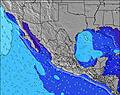 | 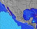 | 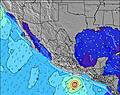 | 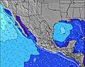 | 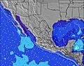 | |||||||||||||
Wave Height (m) Direction Period (s) | SW 18 | SW 17 | SW 16 | SW 16 | SW 16 | WNW 8 | SW 19 | SW 19 | WNW 18 | WNW 17 | SW 18 | SW 18 | S 12 | SW 17 | SW 17 | SW 16 | SW 16 | SSW 16 | SW 16 | SSW 15 | SSW 15 |
Wave Graph | |||||||||||||||||||||
249 | 148 | 165 | 251 | 122 | 194 | 227 | 231 | 182 | 166 | 432 | 375 | 387 | 493 | 482 | 397 | 358 | 441 | 587 | 632 | 474 | |
Wind (km/h) | |||||||||||||||||||||
Wind State on-shore cross-onshore cross-shore cross-offshore off-shore glassy | cross-on | on | on | glassy | cross | cross | cross-off | cross | cross | cross-off | cross-on | cross-on | glassy | on | on | glassy | cross-on | on | cross-on | on | on |
High Tide | 9:32PM2.49m | 11:15AM1.66m | 10:20PM2.39m | 11:56AM1.70m | 11:07PM2.20m | 12:38PM1.75m | 11:55PM1.96m | 1:20PM1.78m | 00:47AM1.69m | 2:04PM1.80m | 1:50AM1.44m | 2:51PM1.81m | 3:23AM1.24m | 3:42PM1.82m | |||||||
Low Tide | 4:45AM-0.12m | 4:08PM0.90m | 5:26AM-0.01m | 5:03PM0.89m | 6:05AM0.15m | 6:01PM0.90m | 6:42AM0.34m | 7:06PM0.92m | 7:17AM0.56m | 8:23PM0.92m | 7:51AM0.76m | 9:55PM0.87m | 8:28AM0.95m | ||||||||
— | 5:50 | — | — | 5:52 | — | — | 5:52 | — | — | 5:52 | — | — | 5:54 | — | — | 5:54 | — | — | 5:54 | — | |
— | — | 7:53 | — | — | 7:53 | — | — | 7:53 | — | — | 7:52 | — | — | 7:52 | — | — | 7:52 | — | — | 7:52 | |
mm | — | — | — | — | — | — | — | — | — | — | — | — | — | — | — | — | — | — | — | — | — |
Temp °C | 23 | 26 | 25 | 22 | 24 | 24 | 21 | 22 | 22 | 20 | 23 | 24 | 21 | 23 | 23 | 20 | 23 | 24 | 21 | 23 | 23 |
Feels °C | 23 | 27 | 26 | 24 | 24 | 24 | 21 | 22 | 22 | 20 | 23 | 23 | 22 | 23 | 23 | 20 | 22 | 23 | 21 | 22 | 23 |
Swell 1 Height (m) Direction Period (s) | SW 18 | SSW 12 | SW 16 | WNW 7 | WNW 8 | WNW 8 | WNW 9 | WNW 9 | WNW 8 | WNW 8 | SW 18 | S 11 | S 12 | S 11 | S 11 | S 12 | S 10 | SSW 16 | SW 16 | SSW 15 | SSW 15 |
249 | 119 | 165 | 43 | 110 | 194 | 208 | 172 | 127 | 80 | 432 | 195 | 387 | 342 | 279 | 397 | 171 | 441 | 587 | 632 | 474 | |
Swell 2 Height (m) Direction Period (s) | SSW 13 | SW 17 | WNW 5 | SW 16 | SW 16 | SW 16 | SW 19 | SW 19 | SW 14 | SW 14 | S 12 | SW 18 | WNW 16 | SW 17 | SW 17 | SW 16 | SW 16 | S 10 | S 9 | WNW 14 | S 9 |
98 | 148 | 16 | 251 | 122 | 119 | 227 | 231 | 132 | 132 | 177 | 375 | 201 | 493 | 482 | 367 | 358 | 120 | 59 | 80 | 39 | |
Swell 3 Height (m) Direction Period (s) | NW 9 | WNW 14 | S 12 | S 12 | SSW 12 | SSW 12 | SW 15 | SW 14 | WNW 18 | WNW 17 | WNW 8 | WNW 16 | WNW 8 | WNW 16 | WNW 16 | WNW 15 | WNW 15 | WNW 14 | WNW 14 | S 8 | WNW 14 |
20 | 41 | 75 | 73 | 47 | 46 | 104 | 102 | 182 | 166 | 51 | 206 | 25 | 196 | 188 | 243 | 125 | 118 | 81 | 12 | 61 | |
Wind waves Height (m) Direction Period (s) | WNW 4 | WNW 5 | — | — | — | — | — | S 3 | S 4 | S 3 | — | — | — | — | WNW 7 | — | WNW 5 | WNW 4 | WNW 5 | WNW 6 | WNW 6 |
9 | 13 | — | — | — | — | — | 4 | 4 | 1 | — | — | — | — | 17 | — | 8 | 20 | 22 | 49 | 73 | |
Nearest Offshore or Glassy | |||||||||||||||||||||
Distance (km) | 6 | 20 | 292 | 0 | 204 | 21 | 0 | 234 | 21 | 0 | 21 | 234 | 0 | 20 | 20 | 0 | 69 | 69 | 17 | 69 | 20 |
Best forecast wave conditions in Baja Norte | |||||||||||||||||||||
Best forecast wave conditions in Mexico | |||||||||||||||||||||
Header Global | |||||||||||||||||||||
- Map Icons:
 Break
Break Live Wave Height (m)
 Live Wind Speed (km/h)
 Surf Rating (10 Max)
 Ocean Swells (m)
- Wind Speed (km/h)


FREE! Surf-Forecast.com widget for your website
The surf report / weather widget below is available to embed on third party websites free of charge and provides a summary of our La Fonda surf forecast. Simply grab the html code snippet that we provide and paste it into your own site. You can choose your preferred language and metric/imperial units for the surf forecast feed to suit users of your site. Click here to get the code.
Information about the La Fonda Surf forecast
The above surf forecast table for La Fonda provides essential information for determining whether the surfing conditions will be good over the next 16 days. A general guide to surfing at La Fonda can be found by selecting the local surf guide option on the grey menu. Our La Fonda surf forecast is unique since it includes wave energy (power) that defines the real feel of the surf rather than just the height or the period. If you surf the same spot (La Fonda) regularly then make a mental note of the wave energy from the surf forecast table each time you go. Very soon you may start to choose your surf days based on the wave energy alone combined with our forecast of favourable offshore wind conditions. Our star ratings will help here and of course you will also find the usual wave height and period predictions on our surf forecasts as well as a full break down of the swell components under our advanced users option (to reveal that, click the little Einstein character under the tide times).
Further information to help with frequently asked questions about our surf forecast for La Fonda may be found under the help tab on the top menu and also by moving your mouse over the question marks on the surf forecast table itself. Please always bear in mind that the forecast is for near-shore open water and local factors at each surf break influence the actual breaking wave height, such as the beach / reef profile, water depths offshore and shelter.
La Fonda is 32 km (20 miles) from the city of Ensenada. If you plan a holiday in Baja Norte, look for hotels and other accommodation in Ensenada. Ensenada has rooms for a wide range of budgets as well as car hire and transport links.
 Nearest