- Forecast
- Maps
- Live
- Weather State
- Spot Information
Surf Forecasts:
Koe Koe surfForecast / Easter Island / Chile
Forecast update in hr min s Forecast update imminent
Koe Koe surf forecast is for near shore open water. Breaking waves will often be smaller at less exposed spots.
Today's Koe Koe sea temperature is
24.7° C
(Which is 1.8°C warmer than normal for this time of year)How big are the waves at Koe Koe today?
The current surf forecast for Koe Koe at 8PM is: 2.5m 14s primary swell from a Southwest direction and 1.2m 16s secondary swell from a South-southwest direction (forecast issued at 05:00pm May 09). The wind direction is predicted to be cross-onshore.
| Time (-06) & Date | Wave Height | Wave Period |
|---|---|---|
| Morning (09 May) | - | - |
| Afternoon (09 May) | 8ft (2.5m) | 14s |
| Evening (09 May) | 7.5ft (2.3m) | 14s |
Table - waves today at Koe Koe. (Swell directed towards the surf break)
Updates in hr min s Forecast update imminent
Short Range ForecastHeavy rain (total 20mm), heaviest during Sat night. Warm (max 21°C on Sat afternoon, min 19°C on Mon afternoon). Wind will be generally light. | ||||||||||||||||||||||||
Sat 9 | Sunday 10 | Monday 11 | Tue 12 | |||||||||||||||||||||
3 PM | 6 PM | 9 PM | 12 AM | 3 AM | 6 AM | 9 AM | 12 PM | 3 PM | 6 PM | 9 PM | 12 AM | 3 AM | 6 AM | 9 AM | 12 PM | 3 PM | 6 PM | 9 PM | 12 AM | 3 AM | 6 AM | 9 AM | 12 PM | |
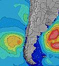
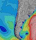
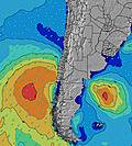
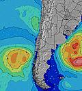
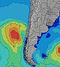
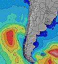
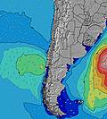
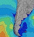
Swell Height Map | ||||||||||||||||||||||||
SW 14 | SW 14 | SW 14 | SW 14 | SW 14 | SW 14 | SW 14 | SW 14 | SW 14 | SW 14 | SW 14 | SW 14 | SW 13 | SW 13 | SW 13 | SW 13 | SW 13 | SW 13 | SW 13 | SSW 12 | SSW 13 | SSW 14 | SSW 14 | SSW 14 | |
2357 | 2855 | 1977 | 2763 | 2557 | 2166 | 2414 | 2485 | 2846 | 2717 | 2641 | 2380 | 2067 | 1811 | 1634 | 1413 | 1285 | 1112 | 1129 | 1039 | 1606 | 2427 | 2834 | 2867 | |
Wind (km/h) | ||||||||||||||||||||||||
off | cross | cross-on | cross-on | cross-on | cross-on | cross-on | cross-on | cross-on | cross-on | cross-on | cross-on | cross-on | cross-on | cross-on | cross | cross-off | cross-off | cross-off | off | off | off | off | cross-off | |
High Tide | 12:32PM0.75m | 1:10AM0.60m | 1:01PM0.74m | 1:37AM0.64m | 1:32PM0.72m | 2:10AM0.68m | ||||||||||||||||||
Low Tide | 7:09PM0.17m | 6:47AM0.25m | 7:31PM0.17m | 7:24AM0.24m | 7:56PM0.16m | 8:08AM0.24m | ||||||||||||||||||
— | — | — | — | — | 7:47 | — | — | — | — | — | — | — | 7:48 | — | — | — | — | — | — | — | 7:48 | — | — | |
— | 6:39 | — | — | — | — | — | — | — | 6:38 | — | — | — | — | — | — | — | 6:38 | — | — | — | — | — | 6:37 | |
2 | 2 | 2 | 2 | 3 | 4 | 1 | — | 1 | — | — | 1 | 1 | — | — | — | 1 | — | — | — | — | — | — | — | |
Temp °C | 21 | 21 | 21 | 21 | 21 | 20 | 20 | 20 | 21 | 21 | 21 | 20 | 20 | 20 | 20 | 20 | 19 | 19 | 19 | 20 | 20 | 21 | 21 | 21 |
23 | 21 | 19 | 20 | 19 | 19 | 21 | 20 | 21 | 21 | 20 | 19 | 18 | 17 | 18 | 19 | 18 | 19 | 18 | 18 | 17 | 18 | 18 | 17 | |
Swell 1 Height (m) Direction Period (s) | SW 14 | SW 14 | SW 14 | SW 14 | SW 14 | SW 14 | SW 14 | SW 14 | SW 14 | SW 14 | SW 14 | SW 14 | SW 13 | SW 13 | SW 13 | SW 13 | SW 13 | SW 13 | SW 13 | SSW 12 | SSW 13 | SSW 14 | SSW 14 | SSW 14 |
2357 | 2855 | 1977 | 2763 | 2557 | 2166 | 2414 | 2485 | 2846 | 2717 | 2641 | 2380 | 2067 | 1811 | 1634 | 1413 | 1285 | 1112 | 1129 | 1039 | 1606 | 2427 | 2834 | 2867 | |
Swell 2 Height (m) Direction Period (s) | SSW 16 | ENE 7 | SSW 16 | ENE 7 | ENE 7 | ENE 8 | ENE 8 | ENE 8 | ENE 8 | ENE 8 | ENE 8 | ENE 8 | ENE 8 | ENE 8 | ENE 8 | ENE 8 | ENE 8 | ENE 8 | ENE 8 | ENE 9 | ENE 9 | ENE 9 | NE 9 | NE 9 |
512 | 62 | 688 | 61 | 62 | 66 | 69 | 45 | 45 | 81 | 81 | 87 | 90 | 90 | 92 | 92 | 92 | 94 | 96 | 99 | 103 | 111 | 152 | 168 | |
Swell 3 Height (m) Direction Period (s) | ENE 7 | NW 16 | ENE 7 | NW 15 | NW 15 | NW 15 | NW 15 | ESE 8 | E 8 | NW 14 | NW 13 | NW 13 | NW 13 | NW 13 | NW 13 | NW 13 | NW 13 | NW 13 | NW 13 | S 13 | NW 12 | NW 12 | NNW 12 | NNW 12 |
40 | 63 | 57 | 75 | 104 | 75 | 75 | 20 | 29 | 32 | 46 | 45 | 44 | 44 | 44 | 44 | 44 | 27 | 27 | 90 | 23 | 23 | 14 | 14 | |
Wind waves Height (m) Direction Period (s) | — | — | — | SSW 5 | SSW 5 | S 5 | — | — | — | — | — | — | — | — | — | — | — | — | — | — | — | N 4 | — | N 5 |
— | — | — | 20 | 35 | 27 | — | — | — | — | — | — | — | — | — | — | — | — | — | — | — | 13 | — | 58 | |
Nearest Offshore or Glassy | ||||||||||||||||||||||||
Distance (km) | 0 | 9 | 3539 | 9 | 9 | 9 | 9 | 9 | 9 | 9 | 9 | 9 | 9 | 9 | 9 | 9 | 0 | 0 | 0 | 0 | 0 | 0 | 0 | 3559 |
Best forecast wave conditions in Easter Island | ||||||||||||||||||||||||
Best forecast wave conditions in Chile | ||||||||||||||||||||||||
Header Global | ||||||||||||||||||||||||
- Map Icons:
Break
Live Wave Height (m)
Live Wind Speed (km/h)
Surf Rating (10 Max)
Ocean Swells (m)
Wind Speed (km/h)


