

Surf Forecasts:

Gerpuk Bay - Inside Gerpuk surf forecast from 31 Jul 2026:
- Most powerful swell: Friday 7 Aug, 8AM (local time) - 8ft (2.5m), 17s period, SSW swell with 3,601 kJ wave energy.
Best Forecast Surf Conditions for Gerpuk Bay - Inside Gerpuk this week:
The most powerful waves expected at Gerpuk Bay - Inside Gerpuk in the next 16 days are 2.5m 17s and forecast to arrive on Friday (Aug 07) at 8AM. Winds are predicted to be onshore at the time the swell arrives.
| Wave Type | Time (WITA) & Date | Wave Height & Period |
|---|---|---|
| Next good surf (1 star+) | - | - |
| Best Surf | - | - |
| Most Powerful | 8AM (Fri 7th Aug) | 8ft (2.5m) 17s |
Table - best surf conditions forecast for Gerpuk Bay - Inside Gerpuk over the next 16 days.
The Lowdown
Alright, Rusty here again. Let’s break down the surf for the next couple of weeks at Gerpuk Bay - Inside Gerpuk.
We’ve got a bit of a wait. The first real shot at a surf doesn’t come until Sunday the 2nd of August. The problem is the wind is onshore from the SE at 9 mph that morning, so it’s not clean. But the swell is solid – 2.1m from the SSW with a 16-second period, so that’s proper groundswell energy. The combined energy is moderate to strong (2297). That’s a lot of juice for a beginner-friendly reef. The tide could mess with it a bit; the forecast says "questionable tide conditions", so you’ve got to read the banks. Water temp is 26°, right on the average for this time of year.
Moving into the start of the first week, from the 5th of August the wind really picks up – 16 to 19 mph out of the SE – and the swell is still pumping 1.8m to 2.3m. But the onshore wind chops it up bad. The combined energy gets over 3221 by the 6th, but with that fresh breeze and lumpy surface, it’s honestly looking more like a kite surfing day than a paddle session.
The second week is where the size shows up. By the 11th of August, we’re seeing 3.0m swell with a 17-second period and combined energy over 5000. That’s powerful, expert-only territory, but the wind is still cross-onshore at 13 to 16 mph. The absolute standout window is the 13th and 14th of August. Swell hits 3.0m to 3.5m from the SSW with a 17-second period, and the wind drops to 9 mph from the S or SSW, going cross-shore. That’s a big groundswell with much cleaner sideshore winds. The combined energy is huge – up to 7943 – so this is a serious wave. That’s your best chance for a proper session, but only if you’ve got the experience. After that, it’s back to bigger, messier conditions for the rest of the second week.
Bottom line: a few good days hidden in a lot of wind. If you can pick your time around the 13th and 14th of August, you’ve got a real standout. It’s far out, so don’t bank on it, but it looks tasty on paper.
Rusty.
Short Range ForecastMostly dry. Warm (max 26°C on Fri morning, min 23°C on Fri night). Winds decreasing (fresh winds from the SE on Fri afternoon, light winds from the E by Sun morning). | Days 4-6 Weather SummaryMostly dry. Warm (max 26°C on Mon morning, min 24°C on Mon morning). Winds increasing (light winds from the ENE on Mon morning, fresh winds from the SE by Wed afternoon). | ||||||||||||||||||||
Friday 31 | Saturday 1 | Sunday 2 | Monday 3 | Tuesday 4 | Wednesday 5 | Thursday 6 | |||||||||||||||
AM | PM | Night | AM | PM | Night | AM | PM | Night | AM | PM | Night | AM | PM | Night | AM | PM | Night | AM | PM | Night | |
Swell Height Map |  |  |  | 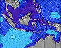 | 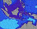 | 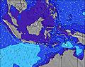 | 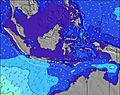 | ||||||||||||||
Wave Height (m) Direction Period (s) | SSW 17 | SSW 17 | SSW 16 | SSW 16 | SSW 17 | SSW 17 | SSW 16 | SSW 16 | SSW 16 | SSW 15 | SSW 15 | SSW 15 | SSW 14 | SSW 14 | SW 16 | SW 14 | SSW 15 | SSW 18 | SSW 17 | SSW 16 | SSW 16 |
Wave Graph | |||||||||||||||||||||
1146 | 975 | 1289 | 1155 | 1817 | 2001 | 2236 | 2431 | 2285 | 1409 | 1409 | 1447 | 1370 | 1258 | 767 | 1321 | 1206 | 3352 | 3156 | 2834 | 2936 | |
Wind (km/h) | |||||||||||||||||||||
Wind State on-shore cross-onshore cross-shore cross-offshore off-shore glassy | on | cross-on | on | cross-on | on | on | on | on | on | on | on | on | cross-on | cross-on | on | on | cross-on | on | on | cross-on | on |
High Tide | 11:07AM2.64m | 11:50PM2.37m | 11:37AM2.65m | 00:15AM2.47m | 12:08PM2.60m | 00:40AM2.54m | 12:38PM2.50m | 1:06AM2.58m | 1:10PM2.35m | 1:35AM2.58m | 1:44PM2.14m | 2:07AM2.54m | 2:24PM1.90m | 2:46AM2.45m | |||||||
Low Tide | 5:36PM0.18m | 5:35AM0.63m | 6:01PM0.18m | 6:07AM0.57m | 6:25PM0.22m | 6:40AM0.53m | 6:50PM0.30m | 7:14AM0.53m | 7:15PM0.42m | 7:52AM0.56m | 7:41PM0.56m | 8:37AM0.64m | 8:11PM0.73m | ||||||||
6:28 | — | — | 6:28 | — | — | 6:28 | — | — | 6:28 | — | — | 6:28 | — | — | 6:28 | — | — | 6:28 | — | — | |
— | 6:12 | — | — | 6:12 | — | — | 6:12 | — | — | 6:12 | — | — | 6:13 | — | — | 6:13 | — | — | 6:13 | — | |
mm | — | — | — | — | — | — | — | — | — | — | — | — | — | — | — | — | — | — | — | — | — |
Temp °C | 26 | 26 | 24 | 25 | 26 | 25 | 26 | 26 | 25 | 26 | 26 | 24 | 25 | 26 | 24 | 26 | 26 | 24 | 26 | 25 | 24 |
Feels °C | 27 | 24 | 23 | 26 | 27 | 27 | 27 | 26 | 27 | 27 | 25 | 25 | 26 | 25 | 25 | 25 | 24 | 22 | 24 | 22 | 22 |
Swell 1 Height (m) Direction Period (s) | SSW 17 | SSW 17 | SSW 16 | SSW 16 | SSW 17 | SSW 17 | SSW 16 | SSW 16 | SSW 16 | SSW 15 | SSW 15 | SSW 15 | SSW 14 | SSW 14 | SSW 13 | SW 14 | SSW 15 | SSW 18 | SSW 17 | SSW 16 | SSW 16 |
1146 | 975 | 1289 | 1155 | 1817 | 2001 | 2236 | 2431 | 2285 | 1409 | 1409 | 1447 | 1370 | 1258 | 659 | 1321 | 1206 | 3352 | 3156 | 2834 | 2936 | |
Swell 2 Height (m) Direction Period (s) | SSW 13 | SSW 13 | SE 6 | SE 6 | — | SE 6 | SE 6 | — | — | SE 7 | — | — | SE 6 | S 26 | SW 16 | SW 22 | SSW 20 | — | — | — | — |
421 | 390 | 66 | 38 | — | 40 | 23 | — | — | 65 | — | — | 38 | 13 | 767 | 229 | 698 | — | — | — | — | |
Swell 3 Height (m) Direction Period (s) | SW 24 | SW 22 | — | SSW 20 | — | — | — | — | — | — | — | — | — | — | SE 6 | SW 22 | — | — | — | — | — |
22 | 119 | — | 256 | — | — | — | — | — | — | — | — | — | — | 23 | 229 | — | — | — | — | — | |
Wind waves Height (m) Direction Period (s) | SE 6 | SE 6 | — | — | SE 7 | — | SE 6 | SE 5 | SE 7 | ESE 7 | SE 7 | SE 7 | — | SE 6 | SE 6 | SE 6 | SE 5 | SE 6 | SE 6 | SE 6 | SE 5 |
76 | 106 | — | — | 63 | — | 38 | 26 | 79 | 127 | 105 | 69 | — | 56 | 56 | 29 | 73 | 67 | 65 | 79 | 65 | |
Nearest Offshore or Glassy | |||||||||||||||||||||
Distance (km) | 11 | 42 | 11 | 11 | 11 | 11 | 11 | 22 | 11 | 12 | 42 | 11 | 11 | 42 | 12 | 43 | 42 | 30 | 43 | 43 | 30 |
Best forecast wave conditions in South Coast of Lombok | |||||||||||||||||||||
Best forecast wave conditions in Indonesia | |||||||||||||||||||||
Header Global | |||||||||||||||||||||
- Map Icons:
 Break
Break Live Wave Height (m)
 Live Wind Speed (km/h)
 Surf Rating (10 Max)
 Ocean Swells (m)
- Wind Speed (km/h)
Latest Updates


FREE! Surf-Forecast.com widget for your website
The surf report / weather widget below is available to embed on third party websites free of charge and provides a summary of our Gerpuk Bay - Inside Gerpuk surf forecast. Simply grab the html code snippet that we provide and paste it into your own site. You can choose your preferred language and metric/imperial units for the surf forecast feed to suit users of your site. Click here to get the code.
Information about the Gerpuk Bay - Inside Gerpuk Surf forecast
The above surf forecast table for Gerpuk Bay - Inside Gerpuk provides essential information for determining whether the surfing conditions will be good over the next 16 days. A general guide to surfing at Gerpuk Bay - Inside Gerpuk can be found by selecting the local surf guide option on the grey menu. Our Gerpuk Bay - Inside Gerpuk surf forecast is unique since it includes wave energy (power) that defines the real feel of the surf rather than just the height or the period. If you surf the same spot (Gerpuk Bay - Inside Gerpuk) regularly then make a mental note of the wave energy from the surf forecast table each time you go. Very soon you may start to choose your surf days based on the wave energy alone combined with our forecast of favourable offshore wind conditions. Our star ratings will help here and of course you will also find the usual wave height and period predictions on our surf forecasts as well as a full break down of the swell components under our advanced users option (to reveal that, click the little Einstein character under the tide times).
Further information to help with frequently asked questions about our surf forecast for Gerpuk Bay - Inside Gerpuk may be found under the help tab on the top menu and also by moving your mouse over the question marks on the surf forecast table itself. Please always bear in mind that the forecast is for near-shore open water and local factors at each surf break influence the actual breaking wave height, such as the beach / reef profile, water depths offshore and shelter.
Grupuk is 26 km (16 miles) from the city of Praya. If you plan a holiday in South Coast of Lombok, look for hotels and other accommodation in Praya. Praya has rooms for a wide range of budgets as well as car hire and transport links.
 Nearest