

Surf Forecasts:

Ekas-Outside surf forecast from 2 Aug 2026:
- Best quality surf: Monday 3 Aug, 8AM (local time) - 6ft (1.8m), 15s period, SSW swell with offshore winds.
- Most powerful swell: Friday 7 Aug, 5PM (local time) - 8ft (2.5m), 16s period, SSW swell with 3,681 kJ wave energy.
- Next surfable swell (1★+): Monday 3 Aug, 8AM (local time) - 6ft (1.8m), 15s period with SSW swell.
Best Forecast Surf Conditions for Ekas-Outside this week:
The surf forecast for Ekas-Outside over the next 16 days: The first swell (rated 1 star or higher) is forecast to arrive on Monday (Aug 03) at 8AM. The primary swell is predicted to be 1.8m and 15s period with a secondary swell of 0.9m and 7s. Another secondary swell of 1.4m and 7s is also forecast. The wind is predicted to be offshore as the swell arrives.
The most powerful waves expected at Ekas-Outside in the next 16 days are 2.5m 16s and forecast to arrive on Friday (Aug 07) at 5PM. Winds are predicted to be cross-offshore at the time the swell arrives. The largest open ocean swell (not directed at the beach) is 1.4m 6s period and expected on Thursday (Aug 06) at 5PM.
| Wave Type | Time (WITA) & Date | Wave Height & Period |
|---|---|---|
| Next good surf (1 star+) | 8AM (Mon 3rd Aug) | 6ft (1.8m) 15s |
| Best Surf | 8AM (Mon 3rd Aug) | 6ft (1.8m) 15s |
| Most Powerful | 5PM (Fri 7th Aug) | 8ft (2.5m) 16s |
Table - best surf conditions forecast for Ekas-Outside over the next 16 days.
The Lowdown
Alright, Rusty here. Let’s have a good look at what’s on offer for the next couple of weeks.
We’re starting this outlook on the 3rd of August, and straight away there’s some decent energy in the water. The main story is a long, consistent run of clean, cross-off winds from the southeast to south-southeast, and a solid SSW groundswell that’s going to stick around for a while. The water temperature is sitting at 80° and that’s about normal for the time of year, so no surprises there.
The pick of the bunch without a doubt is Ekas-Outside. This reef break is fairly exposed to the swell and it’s getting a persistent SSW swell with a very long period – we’re seeing periods of 15 to 18 seconds, sometimes even 22 seconds on the 14th of August. That’s proper groundswell, and it’s going to have some serious grunt behind it. The combined swell energy is strong to very strong throughout, with values like 1,643 on the 3rd of August morning, climbing over 3,000 on the 7th and 8th, and hitting a massive 5,707 on the 15th of August. That’s a lot of power in the water.
Now, for the first few days, from the 3rd to the 5th of August, we’re looking at 6 ft of swell. It’s clean, but the tide or something else is keeping it a bit marginal. Still, it’s surfable. The real standout starts to build from the 6th of August into the second week. The morning of the 10th of August has a solid 8 ft swell with a 18-second period and a combined energy of 4,143 – that’s a serious session if you can get it. And the 11th of August afternoon is even better, with 8 ft, 16-second period, and energy at 4,488. Winds are cross-off, so the waves will be holding their shape.
On the 14th of August afternoon, we see a 6 ft swell but with a very long 22-second period and energy of 4,210. That’s a groundswell that will wrap around the reef beautifully, but it’ll be a bit more selective – long period stuff tends to jack up and barrel on reef setups, so you’ll want to be on your game. The 15th of August sees the biggest numbers: 8 ft in the morning (energy 5,707) and 10 ft in the afternoon (energy 4,786). That 10 ft is only for experienced surfers – it’s well over 8 ft, so beginners should sit this one out. The wind is still cross-off, which is a huge plus, but at that size, it’s going to be a beast.
The winds stay in that cross-off zone – southeast to south-southeast, mostly 12 to 19 mph. That’s a moderate to fresh breeze, but it’s clean, so the waves won’t be blown out. The crowds at Ekas-Outside are listed as “sometimes”, so you might have a few others out, but it’s not a zoo.
The only real downside is that the entire forecast is marked as “marginal surf forecast or questionable tide conditions” – that’s a constant theme, so you’ll need to pay attention to the tide for the best windows. The swell is from the SSW, which is the optimum direction for this break, so that’s spot on.
For the second week, things stay solid but a bit more variable. The 12th and 13th of August drop back to 6 ft, with periods of 14 to 16 seconds, and energy around 1,500 to 1,900. Still good, but not the standout. The 14th of August has that 22-second spike, and the 15th is the biggest. The 16th of August through to the 18th of August sees the swell slowly dropping back to 5 ft to 7 ft, with periods of 13 to 16 seconds. It’s still clean, but the energy is backing off.
The absolute best on offer is the 10th of August morning and 11th of August afternoon, with the 15th of August morning being the big swell day for experts. But honestly, the whole run from the 6th of August to the 15th of August is pumping with strong, consistent groundswell and clean winds. If you can only pick one, aim for the morning of the 10th of August – 8 ft, 18-second period, energy 4,143, and cross-off wind. That’s a beauty.
Stay safe out there, and keep an eye on the tide.
Rusty.
Short Range ForecastMostly dry. Warm (max 27°C on Mon afternoon, min 23°C on Mon night). Wind will be generally light. | Days 4-6 Weather SummaryMostly dry. Warm (max 27°C on Thu afternoon, min 23°C on Thu night). Mainly fresh winds. | ||||||||||||||||||||
Monday 3 | Tuesday 4 | Wednesday 5 | Thursday 6 | Friday 7 | Saturday 8 | Sunday 9 | |||||||||||||||
AM | PM | Night | AM | PM | Night | AM | PM | Night | AM | PM | Night | AM | PM | Night | AM | PM | Night | AM | PM | Night | |
Swell Height Map |  |  |  | 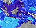 | 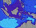 | 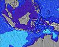 | 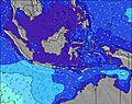 | ||||||||||||||
Wave Height (m) Direction Period (s) | SSW 15 | SSW 15 | SSW 15 | SSW 14 | SSW 14 | SSW 14 | SSW 15 | SW 15 | SW 19 | SSW 17 | SSW 17 | SSW 16 | SSW 17 | SSW 16 | SSW 16 | SSW 16 | SSW 16 | SSW 16 | SSW 16 | SSW 16 | SSW 15 |
Wave Graph | |||||||||||||||||||||
1297 | 1279 | 1314 | 1191 | 1159 | 690 | 1158 | 1088 | 2641 | 2642 | 2404 | 2206 | 3276 | 3681 | 3636 | 3278 | 2900 | 2359 | 2359 | 2096 | 1871 | |
Wind (km/h) | |||||||||||||||||||||
Wind State on-shore cross-onshore cross-shore cross-offshore off-shore glassy | cross-off | cross-off | cross-off | cross-off | cross-off | cross-off | cross-off | cross-off | off | cross-off | cross-off | cross-off | cross-off | cross-off | cross-off | cross-off | cross-off | cross-off | cross-off | cross-off | cross-off |
High Tide | 12:45PM2.08m | 1:20AM2.14m | 1:20PM1.92m | 1:49AM2.17m | 1:58PM1.72m | 2:23AM2.15m | 2:44PM1.49m | 3:06AM2.11m | 3:51PM1.26m | 4:06AM2.04m | 6:07PM1.12m | 5:33AM2.00m | 9:10PM1.23m | ||||||||
Low Tide | 7:06PM0.33m | 7:34AM0.58m | 7:29PM0.45m | 8:15AM0.59m | 7:51PM0.59m | 9:06AM0.64m | 8:15PM0.73m | 10:17AM0.70m | 8:40PM0.89m | 12:12PM0.70m | 9:11PM1.05m | 2:06PM0.55m | 11:55PM1.20m | ||||||||
6:28 | — | — | 6:28 | — | — | 6:26 | — | — | 6:26 | — | — | 6:26 | — | — | 6:26 | — | — | 6:26 | — | — | |
— | 6:12 | — | — | 6:12 | — | — | 6:12 | — | — | 6:12 | — | — | 6:12 | — | — | 6:12 | — | — | 6:13 | — | |
mm | — | — | — | — | — | — | — | — | — | — | — | — | — | — | — | — | — | — | — | — | — |
Temp °C | 26 | 27 | 25 | 26 | 27 | 25 | 26 | 26 | 25 | 26 | 27 | 25 | 26 | 27 | 24 | 26 | 26 | 24 | 26 | 26 | 24 |
Feels °C | 27 | 26 | 26 | 26 | 26 | 26 | 26 | 24 | 26 | 25 | 25 | 26 | 26 | 25 | 24 | 25 | 23 | 24 | 25 | 23 | 23 |
Swell 1 Height (m) Direction Period (s) | SSW 15 | SSW 15 | SSW 15 | SSW 14 | SSW 14 | SSW 14 | SSW 15 | SW 15 | SW 19 | SSW 17 | SSW 17 | SSW 16 | SSW 17 | SSW 16 | SSW 16 | SSW 16 | SSW 16 | SSW 16 | SSW 16 | SSW 16 | SSW 15 |
1297 | 1279 | 1314 | 1191 | 1159 | 690 | 1158 | 1088 | 2641 | 2642 | 2404 | 2206 | 3276 | 3681 | 3636 | 3278 | 2900 | 2359 | 2359 | 2096 | 1871 | |
Swell 2 Height (m) Direction Period (s) | SE 7 | SE 7 | SE 7 | SE 7 | SE 6 | SW 16 | SE 6 | SSW 20 | — | SE 7 | — | — | SE 6 | — | — | SE 6 | — | — | SE 6 | — | SW 26 |
118 | 84 | 59 | 47 | 51 | 527 | 35 | 530 | — | 54 | — | — | 40 | — | — | 46 | — | — | 46 | — | 26 | |
Swell 3 Height (m) Direction Period (s) | — | — | — | — | — | SW 24 | SSW 22 | — | — | — | — | — | — | — | — | — | — | — | — | — | — |
— | — | — | — | — | 22 | 183 | — | — | — | — | — | — | — | — | — | — | — | — | — | — | |
Wind waves Height (m) Direction Period (s) | ESE 7 | SE 7 | SE 7 | SE 7 | SE 7 | SE 6 | SE 6 | SE 6 | SE 6 | SE 7 | SE 6 | SE 6 | SE 6 | SE 5 | SE 6 | SE 6 | SE 5 | SE 5 | SE 6 | SE 5 | SE 5 |
228 | 131 | 112 | 82 | 97 | 60 | 85 | 89 | 43 | 99 | 119 | 65 | 70 | 93 | 43 | 74 | 93 | 45 | 69 | 65 | 50 | |
Nearest Offshore or Glassy | |||||||||||||||||||||
Distance (km) | 31 | 20 | 0 | 31 | 32 | 0 | 32 | 32 | 0 | 32 | 31 | 0 | 31 | 32 | 20 | 32 | 32 | 20 | 32 | 32 | 20 |
Best forecast wave conditions in South Coast of Lombok | |||||||||||||||||||||
Best forecast wave conditions in Indonesia | |||||||||||||||||||||
Header Global | |||||||||||||||||||||
- Map Icons:
 Break
Break Live Wave Height (m)
 Live Wind Speed (km/h)
 Surf Rating (10 Max)
 Ocean Swells (m)
- Wind Speed (km/h)
Latest Updates


FREE! Surf-Forecast.com widget for your website
The surf report / weather widget below is available to embed on third party websites free of charge and provides a summary of our Ekas-Outside surf forecast. Simply grab the html code snippet that we provide and paste it into your own site. You can choose your preferred language and metric/imperial units for the surf forecast feed to suit users of your site. Click here to get the code.
Information about the Ekas-Outside Surf forecast
The above surf forecast table for Ekas-Outside provides essential information for determining whether the surfing conditions will be good over the next 16 days. A general guide to surfing at Ekas-Outside can be found by selecting the local surf guide option on the grey menu. Our Ekas-Outside surf forecast is unique since it includes wave energy (power) that defines the real feel of the surf rather than just the height or the period. If you surf the same spot (Ekas-Outside) regularly then make a mental note of the wave energy from the surf forecast table each time you go. Very soon you may start to choose your surf days based on the wave energy alone combined with our forecast of favourable offshore wind conditions. Our star ratings will help here and of course you will also find the usual wave height and period predictions on our surf forecasts as well as a full break down of the swell components under our advanced users option (to reveal that, click the little Einstein character under the tide times).
Further information to help with frequently asked questions about our surf forecast for Ekas-Outside may be found under the help tab on the top menu and also by moving your mouse over the question marks on the surf forecast table itself. Please always bear in mind that the forecast is for near-shore open water and local factors at each surf break influence the actual breaking wave height, such as the beach / reef profile, water depths offshore and shelter.
Ekas-Outside is 29 km (18 miles) from the city of Praya. If you plan a holiday in South Coast of Lombok, look for hotels and other accommodation in Praya. Praya has rooms for a wide range of budgets as well as car hire and transport links.
 Nearest