

Surf Forecasts:

Gili Air-Pertama surf forecast from 19 Jul 2026:
- Best quality surf: Monday 20 Jul, 2PM (local time) - 3.5ft (1.0m), 17s period, SW swell with glassy winds.
- Most powerful swell: Monday 20 Jul, 2PM (local time) - 3.5ft (1.0m), 17s period, SW swell with 567 kJ wave energy.
- Next surfable swell (1★+): Monday 20 Jul, 2PM (local time) - 3.5ft (1.0m), 17s period with SW swell.
Best Forecast Surf Conditions for Gili Air-Pertama this week:
The surf forecast for Gili Air-Pertama over the next 16 days: The first swell (rated 1 star or higher) is forecast to arrive on Monday (Jul 20) at 2PM. The primary swell is predicted to be 1.0m and 17s period. The wind is predicted to be glassy as the swell arrives.
The most powerful waves expected at Gili Air-Pertama in the next 16 days are 1.0m 17s and forecast to arrive on Monday (Jul 20) at 2PM. Winds are predicted to be glassy at the time the swell arrives. The largest open ocean swell (not directed at the beach) is 0.3m 6s period and expected on Monday (Jul 20) at 11AM.
| Wave Type | Time (WITA) & Date | Wave Height & Period |
|---|---|---|
| Next good surf (1 star+) | 2PM (Mon 20th Jul) | 3.5ft (1.0m) 17s |
| Best Surf | 2PM (Mon 20th Jul) | 3.5ft (1.0m) 17s |
| Most Powerful | 2PM (Mon 20th Jul) | 3.5ft (1.0m) 17s |
Table - best surf conditions forecast for Gili Air-Pertama over the next 16 days.
The Lowdown
Alright folks, Rusty here. Let’s get into it for Gili Air-Pertama.
First up, this is a pretty quiet stretch for the reef. We’ve got a long, drawn-out run of small, choppy, and cross-on conditions that just won’t let up for the first week and a half. The first few days from Monday the 20th through to the end of the month are looking like a write-off. The swell is tiny, barely pushing 1ft to 2ft, and the wind is mostly cross-on from the SSE, churning it up into poor, choppy surf. There’s a bit of energy in the water early on – around 445 (moderate wave energy) on Monday the 20th morning – but the wind state kills it. You’re looking at a solid 10-day gap where the score is basically zero.
We do get a few glimmers of hope. Saturday the 25th morning has a glassy moment with a 2ft, 15-second groundswell from the SSW, but it’s still only surfable in a very ordinary way. Then again on Sunday the 26th afternoon and Monday the 27th, the wind goes glassy, but the swell drops right off to 0.6ft – 1ft. Not enough to get excited about.
The real chance comes in the first week of August. From Saturday the 1st right through to Sunday the 2nd, the stars finally align. The wind turns glassy, the swell lifts to 3ft – 3ft from the SW, with a period of 15 to 16 seconds, pushing combined energy up to 455 (moderate wave energy). This is the best on offer. Expect good, clean surf conditions on that reef. It’s a long-period groundswell, which is perfect for a reef setup like this, giving you proper shape and longer lulls between sets. The water temp is about average for the time of year, nothing unusual there.
Now, keep in mind this is an advanced, inconsistent reef break, and it can get crowded sometimes. It’s a tricky spot, but when it’s clean like this, it’s worth the paddle. The standout window is the weekend of the 1st and 2nd of August – that’s your time.
Rusty
Short Range ForecastLight rain (total 3mm), mostly falling on Sun night. Warm (max 27°C on Mon morning, min 24°C on Sun night). Wind will be generally light. | Days 5-7 Weather SummaryMostly dry. Warm (max 28°C on Sat afternoon, min 23°C on Wed night). Wind will be generally light. | ||||||||||||||||||
Monday 20 | Tuesday 21 | Wednesday 22 | Thursday 23 | Friday 24 | Saturday 25 | ||||||||||||||
Night | AM | PM | Night | AM | PM | Night | AM | PM | Night | AM | PM | Night | AM | PM | Night | AM | PM | Night | |
Swell Height Map |  |  |  |  | 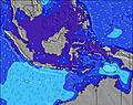 | 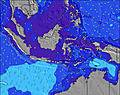 | 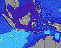 | ||||||||||||
Wave Height (m) Direction Period (s) | SSW 19 | SW 15 | SW 16 | SSW 16 | SW 14 | SW 14 | SW 14 | SSW 13 | SSW 13 | SSW 14 | SW 14 | SW 14 | SW 14 | SW 13 | SSW 13 | SSW 16 | SSW 15 | SSW 14 | SSW 14 |
Wave Graph | |||||||||||||||||||
238 | 322 | 496 | 419 | 301 | 206 | 197 | 116 | 113 | 133 | 52 | 51 | 51 | 44 | 66 | 87 | 121 | 120 | 74 | |
Wind (km/h) | |||||||||||||||||||
Wind State on-shore cross-onshore cross-shore cross-offshore off-shore glassy | cross-on | cross | cross-on | cross-on | cross-on | cross-on | cross-on | cross-on | cross-on | cross-on | cross-on | cross-on | cross-on | cross-on | cross-on | cross-on | glassy | cross-on | cross-on |
High Tide | 3:46AM1.41m | 3:10PM1.12m | 4:20AM1.44m | 4:40PM0.94m | 4:57AM1.46m | 7:58PM0.87m | 5:40AM1.47m | 6:29AM1.48m | 7:21AM1.50m | ||||||||||
Low Tide | 8:50PM0.50m | 10:02AM0.83m | 9:09PM0.65m | 11:35AM0.75m | 9:19PM0.78m | 1:12PM0.64m | 8:45PM0.87m | 2:26PM0.52m | 3:16PM0.41m | 3:55PM0.32m | |||||||||
— | 6:31 | — | — | 6:31 | — | — | 6:31 | — | — | 6:30 | — | — | 6:30 | — | — | 6:30 | — | — | |
6:12 | — | 6:12 | — | — | 6:13 | — | — | 6:13 | — | — | 6:13 | — | — | 6:13 | — | — | 6:13 | — | |
mm | 2 | — | 1 | — | — | — | — | — | — | — | — | — | — | — | — | — | — | — | — |
Temp °C | 25 | 27 | 26 | 25 | 27 | 26 | 24 | 27 | 27 | 24 | 27 | 27 | 24 | 26 | 26 | 25 | 27 | 28 | 25 |
Feels °C | 27 | 30 | 29 | 25 | 28 | 25 | 23 | 26 | 26 | 22 | 25 | 25 | 22 | 26 | 26 | 24 | 29 | 29 | 26 |
Swell 1 Height (m) Direction Period (s) | SW 13 | SW 15 | SW 16 | SSW 16 | SW 14 | SW 14 | SW 14 | SSW 13 | SSW 13 | SSW 14 | SSW 12 | SW 11 | SW 14 | SW 13 | SSW 13 | SSW 12 | SSW 15 | SSW 14 | SSW 14 |
140 | 322 | 496 | 419 | 301 | 206 | 197 | 116 | 113 | 133 | 52 | 29 | 51 | 44 | 66 | 87 | 121 | 120 | 74 | |
Swell 2 Height (m) Direction Period (s) | SSW 19 | SSW 18 | — | — | — | NE 6 | NE 6 | S 5 | SSW 16 | S 5 | SW 14 | SW 14 | SW 11 | SSW 10 | SSW 17 | SSW 16 | NE 6 | NE 6 | NE 7 |
238 | 123 | — | — | — | 1 | 1 | 1 | 26 | 1 | 51 | 51 | 29 | 19 | 55 | 85 | 1 | 1 | 2 | |
Swell 3 Height (m) Direction Period (s) | ENE 7 | — | — | — | — | S 20 | S 18 | NE 6 | — | — | — | SW 18 | S 20 | SSW 18 | SW 16 | W 18 | W 18 | SW 11 | SW 16 |
4 | — | — | — | — | 7 | 6 | 1 | — | — | — | 12 | 8 | 31 | 10 | 6 | 6 | 5 | 10 | |
Wind waves Height (m) Direction Period (s) | — | ENE 6 | ENE 7 | E 7 | ESE 6 | S 3 | SE 3 | SE 3 | S 3 | SE 3 | SE 3 | S 3 | SE 3 | SE 3 | S 3 | — | — | SSW 3 | — |
— | 8 | 9 | 8 | 8 | 4 | 2 | 2 | 5 | 2 | 2 | 5 | 1 | 2 | 2 | — | — | 1 | — | |
Nearest Offshore or Glassy | |||||||||||||||||||
Distance (km) | 66 | 79 | 79 | 47 | 79 | 80 | 47 | 79 | 80 | 47 | 80 | 80 | 47 | 79 | 80 | 47 | 0 | 80 | 47 |
Best forecast wave conditions in West Coast of Lombok | |||||||||||||||||||
Best forecast wave conditions in Indonesia | |||||||||||||||||||
Header Global | |||||||||||||||||||
- Map Icons:
 Break
Break Live Wave Height (m)
 Live Wind Speed (km/h)
 Surf Rating (10 Max)
 Ocean Swells (m)
- Wind Speed (km/h)


FREE! Surf-Forecast.com widget for your website
The surf report / weather widget below is available to embed on third party websites free of charge and provides a summary of our Gili Air-Pertama surf forecast. Simply grab the html code snippet that we provide and paste it into your own site. You can choose your preferred language and metric/imperial units for the surf forecast feed to suit users of your site. Click here to get the code.
Information about the Gili Air-Pertama Surf forecast
The above surf forecast table for Gili Air-Pertama provides essential information for determining whether the surfing conditions will be good over the next 16 days. A general guide to surfing at Gili Air-Pertama can be found by selecting the local surf guide option on the grey menu. Our Gili Air-Pertama surf forecast is unique since it includes wave energy (power) that defines the real feel of the surf rather than just the height or the period. If you surf the same spot (Gili Air-Pertama) regularly then make a mental note of the wave energy from the surf forecast table each time you go. Very soon you may start to choose your surf days based on the wave energy alone combined with our forecast of favourable offshore wind conditions. Our star ratings will help here and of course you will also find the usual wave height and period predictions on our surf forecasts as well as a full break down of the swell components under our advanced users option (to reveal that, click the little Einstein character under the tide times).
Further information to help with frequently asked questions about our surf forecast for Gili Air-Pertama may be found under the help tab on the top menu and also by moving your mouse over the question marks on the surf forecast table itself. Please always bear in mind that the forecast is for near-shore open water and local factors at each surf break influence the actual breaking wave height, such as the beach / reef profile, water depths offshore and shelter.
Gili Air-Pertama is 26 km (16 miles) from Mataram. If you plan a holiday in West Coast of Lombok, look for hotels and other accommodation in Mataram. Mataram has rooms for a wide range of budgets as well as car hire and transport links.
 Nearest