

Surf Forecasts:

Lacerations (Nusa Lembongan) surf forecast from 1 Aug 2026:
- Best quality surf: Sunday 2 Aug, 2PM (local time) - 6ft (1.9m), 17s period, SSW swell with offshore winds.
- Most powerful swell: Friday 7 Aug, 11PM (local time) - 8ft (2.5m), 16s period, SSW swell with 3,230 kJ wave energy.
- Next surfable swell (1★+): Sunday 2 Aug, 5AM (local time) - 4.5ft (1.4m), 16s period with SSW swell.
Best Forecast Surf Conditions for Lacerations (Nusa Lembongan) this week:
The surf forecast for Lacerations (Nusa Lembongan) over the next 16 days: The first swell (rated 1 star or higher) is forecast to arrive on Sunday (Aug 02) at 5AM. The primary swell is predicted to be 1.4m and 16s period with a secondary swell of 0.9m and 19s. Another secondary swell of 0.7m and 6s is also forecast. The wind is predicted to be offshore as the swell arrives.
The most powerful waves expected at Lacerations (Nusa Lembongan) in the next 16 days are 2.5m 16s and forecast to arrive on Friday (Aug 07) at 11PM. Winds are predicted to be cross-offshore at the time the swell arrives. The largest open ocean swell (not directed at the beach) is 1.3m 7s period and expected on Monday (Aug 03) at 2AM.
| Wave Type | Time (WITA) & Date | Wave Height & Period |
|---|---|---|
| Next good surf (1 star+) | 5AM (Sun 2nd Aug) | 4.5ft (1.4m) 16s |
| Best Surf | 2PM (Sun 2nd Aug) | 6ft (1.9m) 17s |
| Most Powerful | 11PM (Fri 7th Aug) | 8ft (2.5m) 16s |
Table - best surf conditions forecast for Lacerations (Nusa Lembongan) over the next 16 days.
The Lowdown
G’day, Rusty here. We’ve got a solid run of surf lining up at Lacerations (Nusa Lembongan), and it’s looking like a proper stretch for those who can handle a reef break. This spot is an advanced-only affair, and it’s inconsistent, so when it fires, you want to be on it. The water temp is about average for this time of year, nothing wild there.
The overall pattern is a long, persistent SSW swell, with offshore winds holding for most of the mornings. The combined swell energy is strong to very strong, with values mostly in the 1000 to 4000 range – that’s a lot of power in the water. The swell is coming from the SSW, which matches the optimum direction for this sheltered reef, so the setup is dialled.
Sunday, 2 August kicks things off with a 6 ft SSW swell, pumping at 17 seconds – that’s a long-period groundswell, meaning better shaped waves and more energy. The wind is light offshore from the ESE at 6 mph, glassy clean. Combined energy is 1759 – strong. This is a standout: clean, consistent in power, and perfect for experienced crew. The afternoon holds with a moderate offshore breeze, still clean.
Monday, 3 August and Tuesday, 4 August see the swell drop a touch to 5 ft and 5 ft, but the period stays long (14–15 seconds) and the wind remains offshore, light to gentle. Good, clean surf, but not as punchy as Sunday.
Wednesday, 5 August is a bit of a mixed bag – morning has some clouds and a moderate offshore breeze, swell 5 ft, energy a bit lower at 977 (moderate). The afternoon improves with a cleaner 4 ft and 15-second period, energy back up to 1308.
Thursday, 6 August is another standout. The swell jumps to 6 ft, 17-second period, and the energy hits 2159 – strong. Offshore wind at 12 mph, moderate but clean. This is excellent for experienced surfers.
Friday, 7 August is the biggest of the first week. Morning shows 7 ft, 17-second groundswell, energy at 3040 – very strong. Offshore wind, clean. This is borderline for experts only, as it’s over 8 ft? No, it’s 7 ft, so still in the expert zone but not too big. The afternoon gets a cross-off wind, so it’s still clean but not as perfectly offshore.
Saturday, 8 August stays solid with a 7 ft swell, 16-second period, energy 2573. Morning offshore, clean.
Sunday, 9 August has 7 ft swell with rain showers in the morning, but still offshore and clean. Energy 1982 – strong.
Monday, 10 August brings a shift: the swell drops to 5 ft but the period stretches to 18 seconds – very long period. This kind of groundswell can be a bit straight at beach breaks, but Lacerations is a reef, so it’ll handle it well. Morning is gentle offshore and clean. The afternoon gets a bigger 8 ft swell with cross-off wind, energy 3589, but the wind is cross-off, so it’s clean but not perfect.
Tuesday, 11 August is the biggest swell of the entire outlook: 10 ft in the morning, 16-second period, energy 4003 – very strong. This is well over 8 ft, so experts only. The wind is cross-off from the SSE at 9 mph, so it’s clean but not offshore. The afternoon drops to 8 ft, still clean.
Wednesday, 12 August through Saturday, 15 August sees a mix of 6 ft to 7 ft swells, with periods mostly 14–16 seconds, and offshore winds in the mornings. The energy stays strong, between 1130 and 2147. The afternoons often have cross-off winds, keeping it clean but not as glassy.
Sunday, 16 August and Monday, 17 August wind down: 5 ft to 5 ft, periods dropping to 14–15 seconds, energy falling to 873. The morning offshore wind holds, but the afternoons are cross-off and marginal.
Best on offer? Sunday 2 August morning for the cleanest, glassy start with a solid 6 ft, 17-second groundswell, and Friday 7 August morning for the biggest, cleanest swell of the first week. The Thursday 6 August morning is also a ripper. For the second week, Tuesday 11 August morning is huge but only for the brave, and Monday 10 August morning has that very long 18-second period on a clean reef – that’s a special wave.
Remember, this reef is inconsistent, so these windows are gold. The crowd situation at Lacerations is often busy, so expect company. Get in early.
Rusty.
Short Range ForecastMostly dry. Warm (max 27°C on Sun morning, min 24°C on Sat night). Wind will be generally light. | Days 5-7 Weather SummarySome drizzle, heaviest during Wed night. Warm (max 26°C on Wed morning, min 24°C on Thu night). Wind will be generally light. | ||||||||||||||||||
Sunday 2 | Monday 3 | Tuesday 4 | Wednesday 5 | Thursday 6 | Friday 7 | ||||||||||||||
Night | AM | PM | Night | AM | PM | Night | AM | PM | Night | AM | PM | Night | AM | PM | Night | AM | PM | Night | |
Swell Height Map |  |  |  |  | 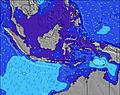 | 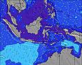 | 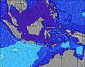 | ||||||||||||
Wave Height (m) Direction Period (s) | SSW 17 | SSW 17 | SSW 16 | SSW 16 | SSW 15 | SSW 14 | SSW 15 | SSW 14 | SSW 13 | SSW 16 | SSW 14 | SSW 15 | SSW 19 | SSW 17 | SSW 16 | SSW 16 | SSW 17 | SSW 16 | SSW 16 |
Wave Graph | |||||||||||||||||||
1438 | 1729 | 1708 | 1586 | 1024 | 899 | 1081 | 785 | 595 | 464 | 796 | 740 | 1982 | 1978 | 1777 | 1257 | 2934 | 2888 | 3230 | |
Wind (km/h) | |||||||||||||||||||
Wind State on-shore cross-onshore cross-shore cross-offshore off-shore glassy | off | off | off | off | off | off | off | off | off | off | off | off | off | off | off | off | off | cross-off | off |
High Tide | 00:41AM1.72m | 12:14PM1.92m | 1:04AM1.79m | 12:47PM1.79m | 1:29AM1.85m | 1:22PM1.63m | 1:57AM1.88m | 2:01PM1.44m | 2:30AM1.89m | 2:51PM1.22m | 3:13AM1.87m | 4:16PM1.01m | 4:15AM1.83m | ||||||
Low Tide | 6:21AM0.66m | 6:47PM0.25m | 6:58AM0.63m | 7:09PM0.35m | 7:39AM0.61m | 7:31PM0.46m | 8:26AM0.61m | 7:53PM0.58m | 9:24AM0.63m | 8:15PM0.71m | 10:46AM0.64m | 8:33PM0.84m | |||||||
— | 6:31 | — | — | 6:31 | — | — | 6:31 | — | — | 6:31 | — | — | 6:31 | — | — | 6:31 | — | — | |
6:15 | — | 6:15 | — | — | 6:15 | — | — | 6:15 | — | — | 6:16 | — | — | 6:16 | — | — | 6:16 | — | |
mm | — | — | — | — | — | — | — | — | — | — | — | — | 1 | — | — | — | — | — | 1 |
Temp °C | 25 | 27 | 27 | 25 | 26 | 27 | 25 | 26 | 26 | 25 | 26 | 26 | 25 | 26 | 26 | 25 | 26 | 26 | 25 |
Feels °C | 27 | 29 | 28 | 26 | 29 | 29 | 27 | 27 | 27 | 27 | 27 | 27 | 26 | 26 | 26 | 26 | 25 | 26 | 25 |
Swell 1 Height (m) Direction Period (s) | SSW 17 | SSW 17 | SSW 16 | SSW 16 | SSW 15 | SSW 14 | SSW 15 | SSW 14 | SSW 13 | SSW 16 | SSW 14 | SSW 15 | SSW 19 | SSW 17 | SSW 16 | SSW 16 | SSW 17 | SSW 16 | SSW 16 |
1438 | 1729 | 1708 | 1586 | 1024 | 899 | 1081 | 785 | 595 | 464 | 796 | 740 | 1982 | 1978 | 1777 | 1257 | 2934 | 2888 | 3230 | |
Swell 2 Height (m) Direction Period (s) | SE 6 | SE 6 | NE 7 | SE 7 | SE 7 | SE 7 | NE 7 | SE 7 | SW 16 | SW 13 | SSW 22 | SSW 20 | — | SE 6 | SSW 22 | SSW 19 | — | — | — |
40 | 30 | 9 | 82 | 86 | 118 | 14 | 86 | 381 | 245 | 181 | 455 | — | 69 | 45 | 539 | — | — | — | |
Swell 3 Height (m) Direction Period (s) | NE 7 | NE 7 | — | NE 7 | NE 7 | SSW 18 | — | SSW 14 | NE 8 | SE 6 | NE 7 | ENE 7 | — | — | — | — | — | — | — |
7 | 7 | — | 12 | 18 | 326 | — | 215 | 9 | 58 | 2 | 5 | — | — | — | — | — | — | — | |
Wind waves Height (m) Direction Period (s) | — | — | SE 6 | ESE 7 | — | ESE 7 | SE 7 | SE 7 | SE 7 | — | SE 6 | SE 6 | SE 6 | SE 6 | SE 6 | SE 6 | SE 6 | SE 6 | SE 6 |
— | — | 29 | 155 | — | 178 | 82 | 135 | 89 | — | 87 | 113 | 136 | 112 | 76 | 79 | 106 | 85 | 60 | |
Nearest Offshore or Glassy | |||||||||||||||||||
Distance (km) | 0 | 0 | 0 | 0 | 0 | 0 | 0 | 0 | 0 | 0 | 0 | 0 | 0 | 0 | 0 | 0 | 0 | 1 | 0 |
Best forecast wave conditions in Nusa Lembongan - Bali | |||||||||||||||||||
Best forecast wave conditions in Indonesia | |||||||||||||||||||
Header Global | |||||||||||||||||||
- Map Icons:
 Break
Break Live Wave Height (m)
 Live Wind Speed (km/h)
 Surf Rating (10 Max)
 Ocean Swells (m)
- Wind Speed (km/h)
Latest Updates


FREE! Surf-Forecast.com widget for your website
The surf report / weather widget below is available to embed on third party websites free of charge and provides a summary of our Lacerations (Nusa Lembongan) surf forecast. Simply grab the html code snippet that we provide and paste it into your own site. You can choose your preferred language and metric/imperial units for the surf forecast feed to suit users of your site. Click here to get the code.
Information about the Lacerations (Nusa Lembongan) Surf forecast
The above surf forecast table for Lacerations (Nusa Lembongan) provides essential information for determining whether the surfing conditions will be good over the next 16 days. A general guide to surfing at Lacerations (Nusa Lembongan) can be found by selecting the local surf guide option on the grey menu. Our Lacerations (Nusa Lembongan) surf forecast is unique since it includes wave energy (power) that defines the real feel of the surf rather than just the height or the period. If you surf the same spot (Lacerations (Nusa Lembongan)) regularly then make a mental note of the wave energy from the surf forecast table each time you go. Very soon you may start to choose your surf days based on the wave energy alone combined with our forecast of favourable offshore wind conditions. Our star ratings will help here and of course you will also find the usual wave height and period predictions on our surf forecasts as well as a full break down of the swell components under our advanced users option (to reveal that, click the little Einstein character under the tide times).
Further information to help with frequently asked questions about our surf forecast for Lacerations (Nusa Lembongan) may be found under the help tab on the top menu and also by moving your mouse over the question marks on the surf forecast table itself. Please always bear in mind that the forecast is for near-shore open water and local factors at each surf break influence the actual breaking wave height, such as the beach / reef profile, water depths offshore and shelter.
Lacerations (Nusa Lembongan) is 16 km (10 miles) from the city of Klungkung. If you plan a holiday in Nusa Lembongan - Bali, look for hotels and other accommodation in Klungkung. Klungkung has rooms for a wide range of budgets as well as car hire and transport links.
 Nearest