

Surf Forecasts:

How big are the waves at Garbanzo today (03 Aug):
- Morning surf: Morning surf (03 Aug, local time) - 3.5ft (1.1m), 8s period with SE swell.
- Afternoon surf: Afternoon surf (03 Aug, local time) - 3.5ft (1.1m), 8s period with SE swell.
- Evening surf: Evening surf (03 Aug, local time) - 3.5ft (1.0m), 7s period with ESE swell.
The current surf forecast for Garbanzo at 1PM is: 1.1m 8s primary swell from a Southeast direction (forecast issued at 07:00am August 03). The wind direction is predicted to be cross-onshore.
| Time (EDT) & Date | Wave Height | Wave Period |
|---|---|---|
| Morning (03 Aug) | 3.5ft (1.1m) | 8s |
| Afternoon (03 Aug) | 3.5ft (1.1m) | 8s |
| Evening (03 Aug) | 3.5ft (1.0m) | 7s |
Table - waves today at Garbanzo. (Swell directed towards the surf break)
Short Range ForecastHeavy rain (total 34mm), heaviest during Wed afternoon. Warm (max 29°C on Mon afternoon, min 28°C on Mon morning). Wind will be generally light. | |||||||||||||||||||||||
Monday 3 | Tuesday 4 | Wednesday 5 | |||||||||||||||||||||
5 AM | 8 AM | 11 AM | 2 PM | 5 PM | 8 PM | 11 PM | 2 AM | 5 AM | 8 AM | 11 AM | 2 PM | 5 PM | 8 PM | 11 PM | 2 AM | 5 AM | 8 AM | 11 AM | 2 PM | 5 PM | 8 PM | 11 PM | |
Swell Height Map |  | 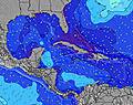 | 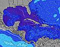 | 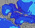 | 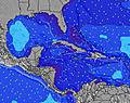 | 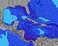 | 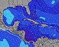 | 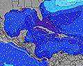 | 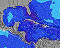 | ||||||||||||||
Wave Height (m) Direction Period (s) | SE 8 | SE 8 | SE 8 | SE 8 | SE 8 | ESE 7 | ESE 7 | ESE 7 | ESE 8 | ESE 8 | ESE 8 | ESE 8 | ESE 7 | ESE 7 | ESE 7 | ESE 7 | ESE 7 | ESE 7 | ESE 7 | ESE 7 | ESE 7 | ESE 7 | ESE 7 |
Wave Graph | |||||||||||||||||||||||
136 | 133 | 133 | 147 | 129 | 114 | 114 | 114 | 107 | 117 | 117 | 107 | 134 | 114 | 111 | 101 | 101 | 118 | 118 | 108 | 105 | 99 | 96 | |
Wind (km/h) | |||||||||||||||||||||||
Wind State on-shore cross-onshore cross-shore cross-offshore off-shore glassy | cross-on | cross-on | cross-on | cross-on | cross-on | cross-on | cross-on | cross-on | cross-on | cross-on | cross-on | cross-on | cross-on | on | on | on | on | on | on | on | on | cross-on | on |
High Tide | 11:47AM0.89m | 11:51PM0.84m | 12:37PM0.92m | 00:38AM0.79m | 1:31PM0.95m | ||||||||||||||||||
Low Tide | 5:29AM0.15m | 5:55PM0.24m | 6:08AM0.13m | 6:52PM0.25m | 6:53AM0.12m | 7:54PM0.25m | |||||||||||||||||
6:33 | — | — | — | — | — | — | — | 6:33 | — | — | — | — | — | — | — | 6:33 | — | — | — | — | — | — | |
— | — | — | — | 7:53 | — | — | — | — | — | — | — | 7:52 | — | — | — | — | — | — | — | 7:52 | — | — | |
mm | — | — | — | 1 | 2 | 2 | 2 | 1 | 2 | — | 1 | 3 | 4 | 2 | — | — | — | — | 1 | 1 | 6 | 4 | 1 |
Temp °C | 28 | 28 | 28 | 29 | 29 | 29 | 28 | 28 | 28 | 28 | 28 | 29 | 29 | 28 | 28 | 28 | 28 | 28 | 28 | 28 | 29 | 28 | 28 |
Feels °C | 30 | 29 | 29 | 29 | 30 | 32 | 30 | 29 | 29 | 28 | 29 | 30 | 31 | 30 | 30 | 29 | 30 | 29 | 28 | 29 | 30 | 30 | 29 |
Swell 1 Height (m) Direction Period (s) | N 7 | N 7 | N 7 | — | SE 8 | ESE 7 | ESE 7 | ESE 7 | ESE 8 | — | ESE 8 | ESE 8 | ESE 7 | ESE 7 | N 10 | N 10 | NE 10 | NE 9 | NE 9 | NE 9 | NE 9 | NE 9 | NE 9 |
1 | 1 | 1 | — | 129 | 114 | 114 | 114 | 107 | — | 117 | 107 | 134 | 114 | 2 | 2 | 4 | 3 | 3 | 3 | 3 | 3 | 3 | |
Swell 2 Height (m) Direction Period (s) | N 7 | — | — | — | — | — | SSW 4 | N 6 | — | — | — | — | — | — | — | — | — | — | — | — | — | — | — |
1 | — | — | — | — | — | 1 | 1 | — | — | — | — | — | — | — | — | — | — | — | — | — | — | — | |
Swell 3 Height (m) Direction Period (s) | — | — | — | — | — | — | N 6 | — | — | — | — | — | — | — | — | — | — | — | — | — | — | — | — |
— | — | — | — | — | — | 1 | — | — | — | — | — | — | — | — | — | — | — | — | — | — | — | — | |
Wind waves Height (m) Direction Period (s) | SE 8 | SE 8 | SE 8 | SE 8 | — | SSW 4 | — | — | SSW 4 | ESE 8 | — | SSW 4 | SSW 4 | — | ESE 7 | ESE 7 | ESE 7 | ESE 7 | ESE 7 | ESE 7 | ESE 7 | ESE 7 | ESE 7 |
136 | 133 | 133 | 147 | — | 3 | — | — | 1 | 117 | — | 1 | 3 | — | 111 | 101 | 101 | 118 | 118 | 108 | 105 | 99 | 96 | |
Nearest Offshore or Glassy | |||||||||||||||||||||||
Distance (km) | 895 | 548 | 548 | 548 | 591 | 603 | 908 | 548 | 377 | 377 | 377 | 377 | 26 | 493 | 548 | 548 | 548 | 548 | 548 | 1015 | 1075 | 895 | 548 |
Best forecast wave conditions in Great Abaco - Bahamas | |||||||||||||||||||||||
Best forecast wave conditions in Bahamas | |||||||||||||||||||||||
Header Global | |||||||||||||||||||||||
- Map Icons:
 Break
Break Live Wave Height (m)
 Live Wind Speed (km/h)
 Surf Rating (10 Max)
 Ocean Swells (m)
- Wind Speed (km/h)
Latest Updates


FREE! Surf-Forecast.com widget for your website
The surf report / weather widget below is available to embed on third party websites free of charge and provides a summary of our Garbanzo surf forecast. Simply grab the html code snippet that we provide and paste it into your own site. You can choose your preferred language and metric/imperial units for the surf forecast feed to suit users of your site. Click here to get the code.
 Nearest