
Surf Forecasts:

Bunbury Bay surf forecast from 2 Aug 2026:
- Best quality surf: Wednesday 5 Aug, 8PM (local time) - 10ft (3.0m), 16s period, W swell with cross-shore winds.
- Most powerful swell: Saturday 8 Aug, 5AM (local time) - 11ft (3.5m), 15s period, WSW swell with 5,614 kJ wave energy.
- Next surfable swell (1★+): Monday 3 Aug, 8AM (local time) - 3.5ft (1.1m), 15s period with WSW swell.
Best Forecast Surf Conditions for Bunbury Bay this week:
The surf forecast for Bunbury Bay over the next 16 days: The first swell (rated 1 star or higher) is forecast to arrive on Monday (Aug 03) at 8AM. The primary swell is predicted to be 1.1m and 15s period with a secondary swell of 0.4m and 4s. The wind is predicted to be cross-offshore as the swell arrives.
The most powerful waves expected at Bunbury Bay in the next 16 days are 3.5m 15s and forecast to arrive on Saturday (Aug 08) at 5AM. Winds are predicted to be cross-shore at the time the swell arrives.
| Wave Type | Time (AWST) & Date | Wave Height & Period |
|---|---|---|
| Next good surf (1 star+) | 8AM (Mon 3rd Aug) | 3.5ft (1.1m) 15s |
| Best Surf | 8PM (Wed 5th Aug) | 10ft (3.0m) 16s |
| Most Powerful | 5AM (Sat 8th Aug) | 11ft (3.5m) 15s |
Table - best surf conditions forecast for Bunbury Bay over the next 16 days.
The Lowdown
Alright, Rusty here. Let's break down what's going on at Bunbury Bay.
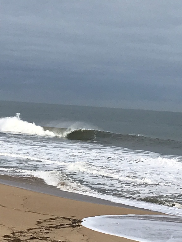
We're looking at a slow start, a few days of funky, messy surf. The water's at 62°F, which is a bit cooler than the average for this time of year, so you'll want a thicker wetsuit.
The first real sign of life is on Thursday, August 6th. The morning has a solid 8ft swell from the west, with a 16-second period. That's a lot of energy coming in (3262), and with a clean cross-shore wind, it'll be a bit lumpy but rideable. The afternoon gets a light offshore, cleaning things up. It's not a perfect forecast, but it's the best we've seen.
The real standout, the one you want to circle, is Tuesday, August 11th. The morning is a dream: 7ft of west-southwest swell with a 16-second period, and the wind is dead glassy. Zero wind. The water is flat. This is the closest we'll get to perfection in this window. Swell energy is at 2338, and the conditions are described as excellent for experienced surfers. This is your session.
Wednesday, August 12th is also a very good day, with a smaller 6ft west-southwest swell and a clean offshore breeze from the east-southeast. It's a bit more manageable in size, but still fantastic quality.
Then we get another top-shelf window on Thursday, August 13th. The afternoon here is a beauty: 7ft of west-southwest swell with a very long 20-second period, and a clean offshore wind from the east-southeast. The energy is a massive 3957 in the morning, dropping to 2983 in the afternoon, but the offshore wind will have it looking like a point break. This is big, powerful groundswell – best for a reef or a point, but it'll still be a sight at the beach.
Friday, August 14th also has a glassy afternoon with 8ft of west-southwest swell and a 16-second period. Excellent conditions for experienced surfers again.
The second week has some clean mornings with offshore winds, like Tuesday, August 18th, with a 7ft west swell and a clean offshore from the southeast, but nothing quite hits the heights of that 11th to 14th of August window. The swell stays in the 5ft to 8ft range, so it's mostly in the intermediate to expert zone.
Overall, Bunbury Bay has a few gems in this forecast. The start is a write-off, but from the 6th onwards, we start to get some decent windows. The 11th through the 14th is the prime time, with the 11th being the absolute pick. The energy is moderate to strong throughout that period, so don't sleep on it.
Rusty.
Short Range ForecastLight rain (total 9mm), mostly falling on Mon night. Very mild (max 17°C on Wed afternoon, min 10°C on Mon morning). Winds decreasing (fresh winds from the WNW on Mon night, light winds from the NW by Wed morning). | Days 4-6 Weather SummaryModerate rain (total 12mm), heaviest on Fri afternoon. Very mild (max 16°C on Thu afternoon, min 11°C on Fri night). Winds decreasing (fresh winds from the SW on Fri night, calm by Sat night). | ||||||||||||||||||||
Monday 3 | Tuesday 4 | Wednesday 5 | Thursday 6 | Friday 7 | Saturday 8 | Sunday 9 | |||||||||||||||
AM | PM | Night | AM | PM | Night | AM | PM | Night | AM | PM | Night | AM | PM | Night | AM | PM | Night | AM | PM | Night | |
Swell Height Map | 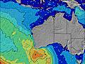 | 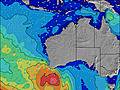 | 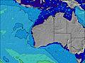 | 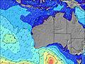 | 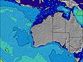 | 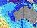 | 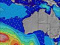 | ||||||||||||||
Wave Height (m) Direction Period (s) | W 15 | WSW 16 | W 21 | WSW 18 | W 17 | W 16 | W 16 | W 16 | W 16 | W 16 | W 16 | W 16 | W 15 | W 15 | WSW 15 | WSW 15 | WSW 16 | WSW 16 | WSW 16 | WSW 16 | WSW 15 |
Wave Graph | |||||||||||||||||||||
447 | 406 | 2704 | 2160 | 2559 | 1651 | 3263 | 3740 | 3881 | 3262 | 2259 | 2203 | 2513 | 3134 | 4861 | 4610 | 5319 | 4694 | 3277 | 2429 | 1499 | |
Wind (km/h) | |||||||||||||||||||||
Wind State on-shore cross-onshore cross-shore cross-offshore off-shore glassy | cross | cross | cross-on | cross-on | cross-on | on | cross-on | cross-on | cross | cross | on | cross | on | cross-on | cross | cross | cross | glassy | cross-on | cross-on | cross-on |
High Tide | 11:43AM0.76m | 00:50AM0.73m | 12:07PM0.66m | 1:22AM0.79m | 4:23PM0.51m | 2:11AM0.84m | 4:21AM0.88m | 5:42AM0.93m | 6:45AM0.98m | ||||||||||||
Low Tide | 6:06PM0.51m | 6:28AM0.60m | 6:05PM0.52m | 3:59PM0.51m | 3:22PM0.41m | 3:35PM0.32m | 4:00PM0.25m | 4:30PM0.21m | |||||||||||||
7:07 | — | — | 7:07 | — | — | 7:05 | — | — | 7:05 | — | — | 7:03 | — | — | 7:03 | — | — | 7:01 | — | — | |
— | 5:38 | — | — | 5:39 | — | — | 5:40 | — | — | 5:40 | — | — | 5:42 | — | — | 5:43 | — | — | 5:44 | — | |
mm | — | — | 8 | — | — | 1 | — | — | — | — | — | — | 4 | 5 | 3 | — | — | — | — | 2 | 3 |
Temp °C | 14 | 16 | 16 | 15 | 15 | 15 | 16 | 17 | 16 | 15 | 16 | 15 | 16 | 16 | 14 | 13 | 13 | 13 | 13 | 15 | 15 |
Feels °C | 10 | 12 | 13 | 11 | 11 | 12 | 13 | 14 | 14 | 12 | 13 | 14 | 12 | 12 | 8 | 6 | 6 | 9 | 11 | 11 | 11 |
Swell 1 Height (m) Direction Period (s) | W 15 | WSW 16 | — | WSW 18 | W 17 | W 16 | W 16 | W 16 | W 16 | W 16 | W 16 | W 16 | — | — | — | — | — | WSW 16 | WSW 16 | W 21 | WSW 15 |
447 | 406 | — | 2160 | 2559 | 1651 | 3263 | 3740 | 3881 | 3262 | 2259 | 2203 | — | — | — | — | — | 4694 | 3277 | 233 | 1499 | |
Swell 2 Height (m) Direction Period (s) | — | — | — | WNW 6 | — | — | — | — | — | — | — | — | — | — | — | — | — | — | — | NW 12 | WSW 19 |
— | — | — | 66 | — | — | — | — | — | — | — | — | — | — | — | — | — | — | — | 5 | 391 | |
Swell 3 Height (m) Direction Period (s) | — | — | — | — | — | — | — | — | — | — | — | — | — | — | — | — | — | — | — | — | NW 11 |
— | — | — | — | — | — | — | — | — | — | — | — | — | — | — | — | — | — | — | — | 5 | |
Wind waves Height (m) Direction Period (s) | N 4 | N 4 | W 21 | — | — | — | — | — | — | — | — | — | W 15 | W 15 | WSW 15 | WSW 15 | WSW 16 | — | — | WSW 16 | — |
14 | 22 | 2704 | — | — | — | — | — | — | — | — | — | 2513 | 3134 | 4861 | 4610 | 5319 | — | — | 2429 | — | |
Nearest Offshore or Glassy | |||||||||||||||||||||
Distance (km) | 119 | 119 | 246 | 321 | 246 | 213 | 85 | 222 | 1 | 104 | 84 | 1 | 246 | 367 | 1961 | 1627 | 2526 | 0 | 23 | 321 | 321 |
Best forecast wave conditions in Perth South Coast | |||||||||||||||||||||
Best forecast wave conditions in Australia | |||||||||||||||||||||
Header Global | |||||||||||||||||||||
- Map Icons:
 Break
Break Live Wave Height (m)
 Live Wind Speed (km/h)
 Surf Rating (10 Max)
 Ocean Swells (m)
- Wind Speed (km/h)
Latest Updates


FREE! Surf-Forecast.com widget for your website
The surf report / weather widget below is available to embed on third party websites free of charge and provides a summary of our Bunbury Bay surf forecast. Simply grab the html code snippet that we provide and paste it into your own site. You can choose your preferred language and metric/imperial units for the surf forecast feed to suit users of your site. Click here to get the code.
Information about the Bunbury Bay Surf forecast
The above surf forecast table for Bunbury Bay provides essential information for determining whether the surfing conditions will be good over the next 16 days. A general guide to surfing at Bunbury Bay can be found by selecting the local surf guide option on the grey menu. Our Bunbury Bay surf forecast is unique since it includes wave energy (power) that defines the real feel of the surf rather than just the height or the period. If you surf the same spot (Bunbury Bay) regularly then make a mental note of the wave energy from the surf forecast table each time you go. Very soon you may start to choose your surf days based on the wave energy alone combined with our forecast of favourable offshore wind conditions. Our star ratings will help here and of course you will also find the usual wave height and period predictions on our surf forecasts as well as a full break down of the swell components under our advanced users option (to reveal that, click the little Einstein character under the tide times).
Further information to help with frequently asked questions about our surf forecast for Bunbury Bay may be found under the help tab on the top menu and also by moving your mouse over the question marks on the surf forecast table itself. Please always bear in mind that the forecast is for near-shore open water and local factors at each surf break influence the actual breaking wave height, such as the beach / reef profile, water depths offshore and shelter.
Bunbury Bay is 3 km (2 miles) from the city of Bunbury. If you plan a holiday in Perth South Coast, look for hotels and other accommodation in Bunbury. Bunbury has rooms for a wide range of budgets as well as car hire and transport links.
 Nearest