

Surf Forecasts:

How big are the waves at Baorvco today (28 Jun):
- Morning surf: Morning surf (28 Jun, local time) - 3.5ft (1.0m), 6s period with ESE swell.
- Afternoon surf: Afternoon surf (28 Jun, local time) - 3.5ft (1.0m), 6s period with ESE swell.
- Evening surf: Evening surf (28 Jun, local time) - 3.5ft (1.1m), 6s period with ESE swell.
The current surf forecast for Baorvco at 1AM is: 1.4m 6s primary swell from a East-southeast direction (forecast issued at 07:00pm June 27). The wind direction is predicted to be cross-onshore.
| Time (AST) & Date | Wave Height | Wave Period |
|---|---|---|
| Morning (28 Jun) | 3.5ft (1.0m) | 6s |
| Afternoon (28 Jun) | 3.5ft (1.0m) | 6s |
| Evening (28 Jun) | 3.5ft (1.1m) | 6s |
Table - waves today at Baorvco. (Swell directed towards the surf break)
Updates in hr min s Forecast update imminent
Short Range ForecastLight rain (total 8mm), mostly falling on Sat night. Warm (max 28°C on Sun morning, min 26°C on Sat night). Wind will be generally light. | ||||||||||||||||||||||||
Sat 27 | Sunday 28 | Monday 29 | Tue 30 | |||||||||||||||||||||
5 PM | 8 PM | 11 PM | 2 AM | 5 AM | 8 AM | 11 AM | 2 PM | 5 PM | 8 PM | 11 PM | 2 AM | 5 AM | 8 AM | 11 AM | 2 PM | 5 PM | 8 PM | 11 PM | 2 AM | 5 AM | 8 AM | 11 AM | 2 PM | |
Swell Height Map |  |  |  |  |  |  |  |  | 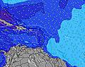 | |||||||||||||||
Wave Height (m) Direction Period (s) | ESE 6 | ESE 6 | ESE 6 | ESE 6 | ESE 6 | ESE 6 | ESE 6 | ESE 6 | ESE 6 | ESE 6 | ESE 6 | ESE 6 | E 7 | E 7 | E 7 | E 7 | ESE 7 | ESE 7 | ESE 7 | ESE 7 | SE 7 | ESE 6 | ESE 6 | SE 6 |
Wave Graph | ||||||||||||||||||||||||
146 | 193 | 161 | 122 | 90 | 77 | 49 | 68 | 71 | 94 | 114 | 140 | 212 | 212 | 75 | 61 | 123 | 123 | 123 | 123 | 103 | 121 | 74 | 97 | |
Wind (km/h) | ||||||||||||||||||||||||
Wind State on-shore cross-onshore cross-shore cross-offshore off-shore glassy | on | on | on | cross-on | cross-on | cross-on | on | on | on | cross-on | cross-on | cross-on | glassy | glassy | on | on | on | cross-on | cross-on | cross-on | cross-on | cross-on | cross-on | on |
High Tide | 10:08PM0.27m | 10:44PM0.27m | 11:19PM0.27m | |||||||||||||||||||||
Low Tide | 12:08PM-0.02m | 12:31PM-0.02m | 12:49PM-0.01m | |||||||||||||||||||||
— | — | — | — | 6:11 | — | — | — | — | — | — | — | 6:11 | — | — | — | — | — | — | — | 6:11 | — | — | — | |
7:22 | — | — | — | — | — | — | — | 7:22 | — | — | — | — | — | — | — | 7:22 | — | — | — | — | — | — | 7:22 | |
mm | — | — | 1 | 2 | 1 | 1 | — | — | — | — | — | — | — | — | — | — | — | — | — | 1 | 1 | 1 | — | — |
Temp °C | 29 | 27 | 27 | 26 | 26 | 26 | 28 | 28 | 28 | 27 | 26 | 26 | 26 | 27 | 28 | 28 | 28 | 27 | 27 | 26 | 26 | 27 | 28 | 28 |
Feels °C | 31 | 29 | 28 | 28 | 29 | 28 | 30 | 30 | 30 | 31 | 29 | 29 | 30 | 31 | 30 | 30 | 31 | 31 | 32 | 30 | 30 | 31 | 31 | 30 |
Swell 1 Height (m) Direction Period (s) | — | ESE 6 | — | — | ESE 8 | ESE 9 | ESE 7 | ESE 6 | ESE 10 | ESE 6 | ESE 10 | ESE 6 | ESE 7 | ESE 7 | SE 7 | SE 6 | ESE 7 | ESE 7 | ESE 7 | ESE 7 | SE 7 | SE 6 | ESE 6 | ESE 10 |
— | 161 | — | — | 24 | 25 | 29 | 68 | 19 | 94 | 10 | 140 | 163 | 142 | 75 | 60 | 123 | 123 | 123 | 123 | 103 | 83 | 74 | 9 | |
Swell 2 Height (m) Direction Period (s) | — | — | — | — | — | — | — | ESE 10 | ESE 10 | ESE 10 | — | E 10 | E 10 | E 10 | SE 11 | SE 11 | E 10 | SE 11 | SE 11 | SE 11 | ESE 10 | ESE 10 | ESE 10 | — |
— | — | — | — | — | — | — | 10 | 10 | 19 | — | 2 | 2 | 2 | 4 | 4 | 2 | 4 | 4 | 4 | 10 | 9 | 10 | — | |
Swell 3 Height (m) Direction Period (s) | — | — | — | — | — | — | — | — | — | — | — | — | — | — | — | — | — | — | — | — | — | — | — | — |
— | — | — | — | — | — | — | — | — | — | — | — | — | — | — | — | — | — | — | — | — | — | — | — | |
Wind waves Height (m) Direction Period (s) | ESE 6 | ESE 6 | ESE 6 | ESE 6 | ESE 6 | ESE 6 | ESE 6 | — | ESE 6 | — | ESE 6 | — | E 7 | E 7 | E 7 | E 7 | E 7 | — | — | — | — | ESE 6 | — | SE 6 |
146 | 193 | 161 | 122 | 90 | 77 | 49 | — | 71 | — | 114 | — | 212 | 212 | 70 | 61 | 61 | — | — | — | — | 121 | — | 97 | |
Nearest Offshore or Glassy | ||||||||||||||||||||||||
Distance (km) | 1029 | 156 | 116 | 111 | 156 | 111 | 416 | 540 | 676 | 402 | 111 | 99 | 0 | 0 | 416 | 540 | 459 | 424 | 116 | 88 | 88 | 156 | 416 | 815 |
Best forecast wave conditions in Caribbean Coast - Dominican Republic | ||||||||||||||||||||||||
Best forecast wave conditions in Dominican Republic | ||||||||||||||||||||||||
Header Global | ||||||||||||||||||||||||
- Map Icons:
 Break
Break Live Wave Height (m)
 Live Wind Speed (km/h)
 Surf Rating (10 Max)
 Ocean Swells (m)
- Wind Speed (km/h)


FREE! Surf-Forecast.com widget for your website
The surf report / weather widget below is available to embed on third party websites free of charge and provides a summary of our Baorvco surf forecast. Simply grab the html code snippet that we provide and paste it into your own site. You can choose your preferred language and metric/imperial units for the surf forecast feed to suit users of your site. Click here to get the code.
 Nearest