

Surf Forecasts:

How big are the waves at Aoura today (03 Aug):
- Afternoon surf: Afternoon surf (03 Aug, local time) - 5.5ft (1.7m), 16s period with ESE swell.
- Evening surf: Evening surf (03 Aug, local time) - 6.5ft (2.0m), 16s period with ESE swell.
The current surf forecast for Aoura at 8PM is: 2.0m 16s primary swell from a East-southeast direction and 0.6m 5s secondary swell from a East-northeast direction (forecast issued at 02:00pm August 03). The wind direction is predicted to be cross-shore.
| Time (JST) & Date | Wave Height | Wave Period |
|---|---|---|
| Morning (03 Aug) | - | - |
| Afternoon (03 Aug) | 5.5ft (1.7m) | 16s |
| Evening (03 Aug) | 6.5ft (2.0m) | 16s |
Table - waves today at Aoura. (Swell directed towards the surf break)
Short Range ForecastHeavy rain (total 36mm), heaviest during Mon night. Warm (max 30°C on Mon afternoon, min 27°C on Mon night). Winds increasing (light winds from the NE on Mon night, near gales from the NE by Thu morning). | ||||||||||||||||||||
Mon 3 | Tuesday 4 | Wednesday 5 | ||||||||||||||||||
12 PM | 3 PM | 6 PM | 9 PM | 12 AM | 3 AM | 6 AM | 9 AM | 12 PM | 3 PM | 6 PM | 9 PM | 12 AM | 3 AM | 6 AM | 9 AM | 12 PM | 3 PM | 6 PM | 9 PM | |
Swell Height Map |  |  |  | 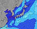 |  |  | 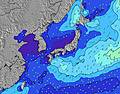 |  | ||||||||||||
Wave Height (m) Direction Period (s) | ESE 16 | ESE 16 | ESE 16 | ESE 16 | ESE 17 | ESE 17 | ESE 17 | E 17 | E 17 | ESE 17 | E 17 | E 17 | ESE 16 | ESE 16 | ESE 17 | ESE 16 | ESE 17 | ESE 18 | ESE 18 | ESE 17 |
Wave Graph | ||||||||||||||||||||
1318 | 1428 | 1916 | 1986 | 2548 | 3214 | 3527 | 3770 | 3879 | 4757 | 5493 | 5716 | 5392 | 6355 | 7348 | 8974 | 11810 | 14700 | 16796 | 17599 | |
Wind (km/h) | ||||||||||||||||||||
Wind State on-shore cross-onshore cross-shore cross-offshore off-shore glassy | cross | cross | cross | cross | cross-off | cross-off | cross-off | cross | cross | cross | cross | cross | cross | cross | cross | cross | cross | cross | cross | cross |
High Tide | 9:15PM1.99m | 9:21AM1.85m | 9:45PM1.97m | 10:16AM1.75m | ||||||||||||||||
Low Tide | 2:51PM0.54m | 3:23AM0.72m | 3:24PM0.72m | 4:09AM0.69m | 4:02PM0.92m | |||||||||||||||
— | — | — | — | — | 5:31 | — | — | — | — | — | — | — | 5:31 | — | — | — | — | — | — | |
— | — | 7:08 | — | — | — | — | — | — | — | 7:07 | — | — | — | — | — | — | — | 7:07 | — | |
mm | — | — | 2 | 4 | 2 | 2 | 2 | 3 | 3 | 2 | 1 | — | 1 | 1 | 1 | 1 | 2 | — | — | 1 |
Temp °C | 30 | 30 | 29 | 28 | 28 | 27 | 27 | 28 | 28 | 29 | 28 | 28 | 28 | 27 | 28 | 28 | 28 | 29 | 28 | 28 |
Feels °C | 31 | 32 | 32 | 31 | 32 | 29 | 29 | 30 | 30 | 31 | 30 | 30 | 30 | 27 | 29 | 27 | 27 | 28 | 27 | 27 |
Swell 1 Height (m) Direction Period (s) | ESE 16 | ESE 16 | ESE 16 | ESE 16 | ESE 17 | ESE 17 | ESE 17 | E 17 | E 17 | ESE 17 | E 17 | E 17 | ESE 16 | ESE 16 | ESE 17 | ESE 16 | ESE 17 | ESE 18 | ESE 18 | ESE 17 |
1318 | 1428 | 1916 | 1986 | 2548 | 3214 | 3527 | 3770 | 3879 | 4757 | 5493 | 5716 | 5392 | 6355 | 7348 | 8974 | 11810 | 14700 | 16796 | 17599 | |
Swell 2 Height (m) Direction Period (s) | ENE 15 | ENE 15 | S 7 | ENE 5 | ENE 6 | — | — | — | — | — | — | — | — | — | — | — | — | — | — | — |
42 | 42 | 4 | 23 | 82 | — | — | — | — | — | — | — | — | — | — | — | — | — | — | — | |
Swell 3 Height (m) Direction Period (s) | S 7 | S 7 | — | S 7 | S 12 | — | — | — | — | — | — | — | — | — | — | — | — | — | — | — |
4 | 4 | — | 4 | 3 | — | — | — | — | — | — | — | — | — | — | — | — | — | — | — | |
Wind waves Height (m) Direction Period (s) | NE 4 | NE 4 | ENE 5 | — | — | ENE 6 | ENE 7 | — | E 8 | E 8 | E 9 | E 9 | — | — | — | — | — | — | — | — |
12 | 14 | 25 | — | — | 110 | 220 | — | 316 | 439 | 603 | 635 | — | — | — | — | — | — | — | — | |
Nearest Offshore or Glassy | ||||||||||||||||||||
Distance (km) | 32 | 32 | 32 | 32 | 4 | 32 | 32 | 32 | 32 | 32 | 32 | 32 | 32 | 32 | 32 | 302 | 374 | 136 | 136 | 95 |
Best forecast wave conditions in Kyu Shu | ||||||||||||||||||||
Best forecast wave conditions in Japan | ||||||||||||||||||||
Header Global | ||||||||||||||||||||
- Map Icons:
 Break
Break Live Wave Height (m)
 Live Wind Speed (km/h)
 Surf Rating (10 Max)
 Ocean Swells (m)
- Wind Speed (km/h)
Latest Updates


FREE! Surf-Forecast.com widget for your website
The surf report / weather widget below is available to embed on third party websites free of charge and provides a summary of our Aoura surf forecast. Simply grab the html code snippet that we provide and paste it into your own site. You can choose your preferred language and metric/imperial units for the surf forecast feed to suit users of your site. Click here to get the code.
 Nearest