New Jersey Surf
Detailed New Jersey surf forecast maps and the latest eyeball surf report from local surfers in the region. Near-shore swell is shown on the map together with the surf forecast rating for spots in New Jersey. Find the best places to surf in offshore conditions by selecting the wind option on the forecast map. Windsurfers and kite surfers can also use this option to find more favorable cross-shore conditions in New Jersey. Our local Wavefinder indicates where some of the best conditions are likely to be found in New Jersey over the next 7 days. Surf photos from New Jersey and reviews of the best spots and surfing conditions have been provided by local surfers.
New Jersey Surf Forecast map for predicting the best wave and wind conditions across the region. For surfers, the map shows the most powerful swell tracking across near-shore open water and not the peak waves experienced by boats out at sea. Move your mouse over the ocean swell symbols or the surf breaks on the coastline to see a more detailed surf forecast including wave period and wind conditions. The forecast updates every 6 hours and most live weather reports update every hour. You can animate the New Jersey Surf map or show live wind and wave conditions as reported from wavebuoys and local weather stations. Surf breaks shown along the New Jersey coastline are also listed below.
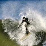
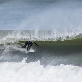
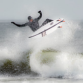
New Jersey Photos


New Jersey Wavefinder
Tuesday 21 | Wednesday 22 | Thursday 23 | Friday 24 | Saturday 25 | Sunday 26 | Monday 27 | |||||||||||||||
AM | PM | Night | AM | PM | Night | AM | PM | Night | AM | PM | Night | AM | PM | Night | AM | PM | Night | AM | PM | Night | |
Best forecast wave conditions in New Jersey | |||||||||||||||||||||
Wave Height (m) Direction Period (s) | SSE 5 | S 5 | S 7 | S 8 | S 8 | SSE 8 | SSE 8 | SSE 8 | S 8 | SE 7 | ESE 6 | SE 8 | ESE 7 | ESE 7 | ESE 7 | ESE 8 | ESE 8 | SE 8 | ESE 8 | ESE 8 | S 6 |
107 | 114 | 161 | 339 | 339 | 94 | 59 | 113 | 41 | 35 | 51 | 84 | 68 | 73 | 75 | 76 | 54 | 59 | 37 | 37 | 138 | |
Wind (km/h) | |||||||||||||||||||||
Wind State on-shore cross-onshore cross-shore cross-offshore off-shore glassy | cross-on | cross | cross-off | off | off | off | off | on | glassy | on | on | cross-on | cross-on | on | glassy | glassy | cross-on | cross-off | cross | cross-on | cross-on |
High Tide | 1:57PM1.44m | 2:08AM1.21m | 2:40PM1.39m | 3:49AM1.10m | 3:33PM1.40m | 3:55AM1.11m | 4:27PM1.41m | 4:55AM1.11m | 5:20PM1.43m | 5:50AM1.15m | 6:10PM1.47m | 6:39AM1.19m | 6:54PM1.51m | ||||||||
Low Tide | 8:10PM0.35m | 8:17AM0.28m | 9:48PM0.32m | 9:42AM0.27m | 10:07PM0.33m | 10:02AM0.33m | 10:57PM0.30m | 10:50AM0.32m | 11:44PM0.25m | 11:37AM0.30m | 00:30AM0.20m | 12:24PM0.27m | 1:14AM0.15m | ||||||||
mm | 3 | 4 | 7 | — | — | — | — | — | — | — | — | — | — | — | — | — | — | — | — | — | 2 |
Max °C | 25 | 26 | 23 | 26 | 29 | 27 | 21 | 23 | 22 | 22 | 22 | 22 | 21 | 22 | 21 | 23 | 24 | 25 | 26 | 25 | 24 |
Min °C | 24 | 26 | 22 | 22 | 27 | 20 | 20 | 23 | 21 | 21 | 22 | 21 | 21 | 22 | 20 | 20 | 24 | 20 | 21 | 25 | 24 |
Chill °C | 25 | 26 | 23 | 26 | 29 | 27 | 21 | 23 | 22 | 22 | 22 | 22 | 21 | 22 | 21 | 23 | 24 | 25 | 26 | 25 | 24 |
5:43 | — | — | 5:43 | — | — | 5:52 | — | — | 5:46 | — | — | 5:47 | — | — | 5:47 | — | — | 5:48 | — | — | |
— | 8:20 | — | — | 8:19 | — | — | 8:19 | — | — | 8:17 | — | — | 8:16 | — | — | 8:15 | — | — | 8:15 | — | |
Swell 1 Height (m) Direction Period (s) | E 12 | SE 12 | — | S 8 | S 8 | SSE 8 | SSE 8 | SSE 8 | S 8 | SE 7 | ESE 6 | SE 8 | ESE 7 | ESE 7 | ESE 7 | ESE 8 | ESE 8 | SE 8 | ESE 8 | ESE 8 | ESE 7 |
3 | 5 | — | 339 | 224 | 94 | 59 | 113 | 41 | 35 | 51 | 84 | 68 | 73 | 75 | 76 | 54 | 59 | 37 | 37 | 21 | |
Swell 2 Height (m) Direction Period (s) | — | — | — | — | — | — | SE 8 | ENE 5 | SE 7 | S 7 | S 7 | S 6 | — | S 6 | S 5 | S 7 | S 6 | S 6 | — | — | — |
— | — | — | — | — | — | 43 | 12 | 34 | 23 | 14 | 3 | — | 1 | 1 | 4 | 7 | 2 | — | — | — | |
Wind waves Height (m) Direction Period (s) | SSE 5 | S 5 | S 7 | — | S 8 | NNW 2 | NE 4 | E 5 | — | — | — | — | — | — | — | — | SSE 6 | SSW 3 | S 2 | S 4 | S 6 |
107 | 114 | 161 | — | 339 | 1 | 21 | 11 | — | — | — | — | — | — | — | — | 13 | 1 | 1 | 28 | 138 | |
Sea °C | 23 | 23 | 23 | 23 | 25 | 25 | 25 | 23 | 23 | 23 | 23 | 23 | 23 | 23 | 23 | 23 | 23 | 23 | 23 | 23 | 23 |
Diff °C | |||||||||||||||||||||
New Jersey Surf Breaks
New Jersey has lots of beach breaks and point breaks, the best time to surf here is fall/winter due to hurricane season, it has long beaches with lots of jetties and piers. Typically you get lots of tourists in the summer but the surfing areas are different from the swimming areas so it doesn't effect you, that much .....Joshua Morris
Plenty of facilities and a good road network will provide access to the beaches.
 Nearest