

Surf Forecasts:

Zaga (Koroni) surf forecast from 3 Aug 2026:
Best Forecast Surf Conditions for Zaga (Koroni) this week:
The largest open ocean swell (not directed at the beach) is 0.7m 4s period and expected on Wednesday (Aug 05) at 6PM.
The Lowdown
Alright folks, Rusty here. Let’s be straight with you – this next stretch is a tough one for anyone looking to paddle out. The charts are showing a whole lot of nothing for the foreseeable future, so I’m afraid we’re looking at a long, dry spell.
We’ve got Zaga (Koroni) on the books, but it’s a spot that rarely breaks anyway, and this forecast is about as quiet as it gets. The first hint of any ripple doesn’t show up until Tuesday morning, August 11th, and even then it’s a tiny 0.3 ft from the SE with a period of only 4 seconds – that’s basically a lake. The combined energy is a measly 1 (1), so weak it’s barely worth mentioning. The water is sitting at 81°, which is a touch warmer than normal for the time of year, but that’s about the only action here.
From now right through to that brief moment on August 11th, there’s zero swell. After that, it’s back to nothing again for the rest of the 16-day window. The wind does offer some glassy mornings, like Friday the 7th, Saturday the 8th, and a few mornings the following week, but without any swell, it’s just a flat, pretty surface. This is a blank run, plain and simple. The setup is a sheltered beach and point, so when it’s flat, it’s flat.
There is no standout here. The only thing to do is wait for the forecasts to change, because with a spot like this, it tends not to stay this poor forever.
Rusty.
Short Range ForecastMostly dry. Warm (max 33°C on Wed morning, min 25°C on Mon morning). Wind will be generally light. | Days 4-6 Weather SummaryMostly dry. Warm (max 33°C on Sat afternoon, min 26°C on Thu night). Wind will be generally light. | ||||||||||||||||||||
Monday 3 | Tuesday 4 | Wednesday 5 | Thursday 6 | Friday 7 | Saturday 8 | Sunday 9 | |||||||||||||||
AM | PM | Night | AM | PM | Night | AM | PM | Night | AM | PM | Night | AM | PM | Night | AM | PM | Night | AM | PM | Night | |
Swell Height Map | 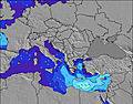 | 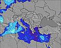 | 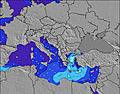 | 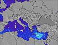 | 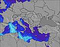 | 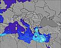 | 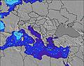 | ||||||||||||||
Wave Height (m) Direction Period (s) | — | WSW 2 | NW 2 | WNW 3 | WNW 3 | NW 4 | WNW 4 | WNW 4 | WNW 4 | W 4 | W 4 | WNW 4 | WNW 4 | WNW 4 | W 4 | WNW 4 | W 4 | W 4 | WNW 4 | W 4 | WNW 4 |
Wave Graph | |||||||||||||||||||||
0 | 0 | 0 | 0 | 0 | 0 | 0 | 0 | 0 | 0 | 0 | 0 | 0 | 0 | 0 | 0 | 0 | 0 | 0 | 0 | 0 | |
Wind (km/h) | |||||||||||||||||||||
Wind State on-shore cross-onshore cross-shore cross-offshore off-shore glassy | glassy | cross-off | off | off | cross-off | off | off | cross-off | off | off | cross-off | off | glassy | cross-off | off | off | cross-off | off | cross-off | cross-off | cross-off |
High Tide | 6:46PM0.09m | 7:45AM0.10m | 7:28PM0.08m | 8:37AM0.09m | 8:25PM0.07m | 9:58AM0.09m | 11:01PM0.06m | 11:45AM0.09m | 1:25AM0.06m | 1:04PM0.10m | 2:26AM0.07m | 2:01PM0.11m | 3:10AM0.08m | ||||||||
Low Tide | 1:18PM0.04m | 1:23AM0.02m | 2:13PM0.04m | 2:02AM0.03m | 3:28PM0.04m | 2:46AM0.04m | 5:21PM0.04m | 4:07AM0.04m | 7:17PM0.03m | 8:21PM0.02m | 7:28AM0.04m | 9:06PM0.01m | |||||||||
6:37 | — | — | 6:39 | — | — | 6:39 | — | — | 6:41 | — | — | 6:41 | — | — | 6:41 | — | — | 6:43 | — | — | |
— | 8:37 | — | — | 8:36 | — | — | 8:35 | — | — | 8:34 | — | — | 8:32 | — | — | 8:31 | — | — | 8:30 | — | |
mm | — | — | — | — | — | — | — | — | — | — | — | — | — | — | — | — | — | — | — | — | — |
Temp °C | 27 | 29 | 27 | 29 | 32 | 30 | 33 | 33 | 32 | 31 | 31 | 28 | 29 | 31 | 28 | 31 | 33 | 30 | 36 | 36 | 35 |
Feels °C | 27 | 28 | 27 | 28 | 29 | 29 | 32 | 30 | 31 | 29 | 31 | 31 | 29 | 30 | 30 | 31 | 32 | 29 | 35 | 36 | 35 |
Swell 1 Height (m) Direction Period (s) | — | — | — | WNW 3 | — | W 4 | W 4 | — | WNW 4 | W 4 | W 4 | W 4 | W 4 | W 4 | W 4 | WNW 4 | — | W 4 | WNW 4 | W 4 | WNW 4 |
— | — | — | 1 | — | 3 | 1 | — | 6 | 3 | 3 | 3 | 3 | 7 | 3 | 3 | — | 3 | 6 | 1 | 2 | |
Swell 2 Height (m) Direction Period (s) | — | — | — | — | — | — | — | — | — | — | — | — | — | — | — | — | — | — | — | W 6 | W 5 |
— | — | — | — | — | — | — | — | — | — | — | — | — | — | — | — | — | — | — | 1 | 1 | |
Swell 3 Height (m) Direction Period (s) | — | — | — | — | — | — | — | — | — | — | — | — | — | — | — | — | — | — | — | — | E 6 |
— | — | — | — | — | — | — | — | — | — | — | — | — | — | — | — | — | — | — | — | 1 | |
Wind waves Height (m) Direction Period (s) | — | WSW 2 | NW 2 | — | WNW 3 | NW 4 | WNW 4 | WNW 4 | — | — | — | WNW 4 | WNW 4 | WNW 4 | — | — | W 4 | — | — | W 4 | — |
— | 1 | 1 | — | 3 | 3 | 6 | 13 | — | — | — | 5 | 6 | 17 | — | — | 5 | — | — | 6 | — | |
Nearest Offshore or Glassy | |||||||||||||||||||||
Distance (km) | 2109 | 2409 | 2120 | 2109 | 2490 | 2120 | 2120 | 2289 | 2120 | 2120 | 2213 | 961 | 1228 | 2213 | 1228 | 1249 | 2618 | 1266 | 1266 | 2453 | 956 |
Best forecast wave conditions in Pelloponisos | |||||||||||||||||||||
Best forecast wave conditions in Greece | |||||||||||||||||||||
Header Global | |||||||||||||||||||||
- Map Icons:
 Break
Break Live Wave Height (m)
 Live Wind Speed (km/h)
 Surf Rating (10 Max)
 Ocean Swells (m)
- Wind Speed (km/h)
Latest Updates


FREE! Surf-Forecast.com widget for your website
The surf report / weather widget below is available to embed on third party websites free of charge and provides a summary of our Zaga (Koroni) surf forecast. Simply grab the html code snippet that we provide and paste it into your own site. You can choose your preferred language and metric/imperial units for the surf forecast feed to suit users of your site. Click here to get the code.
Information about the Zaga (Koroni) Surf forecast
The above surf forecast table for Zaga (Koroni) provides essential information for determining whether the surfing conditions will be good over the next 16 days. A general guide to surfing at Zaga (Koroni) can be found by selecting the local surf guide option on the grey menu. Our Zaga (Koroni) surf forecast is unique since it includes wave energy (power) that defines the real feel of the surf rather than just the height or the period. If you surf the same spot (Zaga (Koroni)) regularly then make a mental note of the wave energy from the surf forecast table each time you go. Very soon you may start to choose your surf days based on the wave energy alone combined with our forecast of favourable offshore wind conditions. Our star ratings will help here and of course you will also find the usual wave height and period predictions on our surf forecasts as well as a full break down of the swell components under our advanced users option (to reveal that, click the little Einstein character under the tide times).
Further information to help with frequently asked questions about our surf forecast for Zaga (Koroni) may be found under the help tab on the top menu and also by moving your mouse over the question marks on the surf forecast table itself. Please always bear in mind that the forecast is for near-shore open water and local factors at each surf break influence the actual breaking wave height, such as the beach / reef profile, water depths offshore and shelter.
 Nearest