

Surf Forecasts:

How big are the waves at Uatotoka today (30 Jun):
- Morning surf: Morning surf (30 Jun, local time) - 5ft (1.6m), 16s period with SSW swell.
- Afternoon surf: Afternoon surf (30 Jun, local time) - 7ft (2.1m), 15s period with SSW swell.
- Evening surf: Evening surf (30 Jun, local time) - 6ft (1.8m), 15s period with SSW swell.
The current surf forecast for Uatotoka at 8AM is: 1.8m 16s primary swell from a South-southwest direction and 1.4m 11s secondary swell from a South-southwest direction (forecast issued at 11:00pm June 29). The wind direction is predicted to be onshore.
| Time (+12) & Date | Wave Height | Wave Period |
|---|---|---|
| Morning (30 Jun) | 5ft (1.6m) | 16s |
| Afternoon (30 Jun) | 7ft (2.1m) | 15s |
| Evening (30 Jun) | 6ft (1.8m) | 15s |
Table - waves today at Uatotoka. (Swell directed towards the surf break)
Updates in hr min s Forecast update imminent
Short Range ForecastLight rain (total 2mm), mostly falling on Wed night. Warm (max 23°C on Wed afternoon, min 21°C on Wed night). Mainly fresh winds. | ||||||||||||||||||||||||
Tuesday 30 | Wednesday 1 | Thursday 2 | ||||||||||||||||||||||
9 PM | 12 AM | 3 AM | 6 AM | 9 AM | 12 PM | 3 PM | 6 PM | 9 PM | 12 AM | 3 AM | 6 AM | 9 AM | 12 PM | 3 PM | 6 PM | 9 PM | 12 AM | 3 AM | 6 AM | 9 AM | 12 PM | 3 PM | 6 PM | |
Swell Height Map |  | 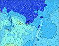 | 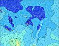 | 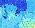 | 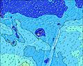 | 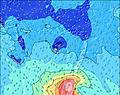 | 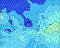 | 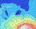 | 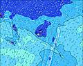 | |||||||||||||||
Wave Height (m) Direction Period (s) | SSW 17 | SSW 16 | SSW 16 | SSW 16 | SSW 16 | SSW 16 | SSW 15 | SSW 15 | SSW 15 | SSW 14 | SSW 14 | S 14 | S 14 | SSW 13 | SSE 11 | SSE 11 | SSE 10 | SSE 11 | SSW 16 | SSW 16 | SSW 15 | SSW 15 | SSE 11 | SSE 11 |
Wave Graph | ||||||||||||||||||||||||
848 | 2246 | 2343 | 2314 | 1273 | 1241 | 2055 | 1739 | 1409 | 1261 | 1895 | 1781 | 1788 | 1018 | 718 | 783 | 778 | 705 | 1108 | 1081 | 1014 | 962 | 1060 | 1102 | |
Wind (km/h) | ||||||||||||||||||||||||
Wind State on-shore cross-onshore cross-shore cross-offshore off-shore glassy | on | on | on | on | cross-on | cross-on | cross-on | cross-on | cross-on | cross-on | cross-on | cross-on | cross-on | cross-on | cross-on | cross-on | cross-on | cross-on | cross-on | cross-on | cross-on | cross-on | cross-on | cross-on |
High Tide | 6:41PM1.24m | 6:30AM1.45m | 7:23PM1.26m | 7:11AM1.45m | 8:04PM1.27m | 7:52AM1.44m | ||||||||||||||||||
Low Tide | 00:23AM0.48m | 1:06PM0.21m | 1:05AM0.47m | 1:46PM0.20m | 1:46AM0.48m | 2:25PM0.21m | ||||||||||||||||||
— | — | — | 6:41 | — | — | — | — | — | — | — | 6:41 | — | — | — | — | — | — | — | 6:41 | — | — | — | — | |
— | — | — | — | — | — | 5:40 | — | — | — | — | — | — | — | 5:40 | — | — | — | — | — | — | — | 5:40 | — | |
mm | — | — | — | — | — | — | — | — | — | — | — | — | — | — | — | — | — | — | — | 1 | 1 | — | — | — |
Temp °C | 22 | 22 | 22 | 22 | 22 | 22 | 22 | 22 | 22 | 22 | 22 | 22 | 22 | 22 | 23 | 22 | 23 | 22 | 22 | 21 | 22 | 22 | 22 | 22 |
Feels °C | 18 | 18 | 18 | 17 | 19 | 19 | 18 | 16 | 16 | 16 | 17 | 17 | 17 | 18 | 19 | 18 | 19 | 18 | 20 | 18 | 18 | 17 | 16 | 16 |
Swell 1 Height (m) Direction Period (s) | SSW 12 | SSW 16 | SSW 16 | SSW 16 | SSW 16 | SSW 16 | SSW 15 | SSW 15 | SSW 15 | SSW 14 | SSW 14 | S 14 | S 14 | SSW 13 | SSE 11 | SSE 11 | SSW 13 | SSE 11 | SSE 11 | SSE 11 | SSW 15 | SSW 15 | SSW 15 | SSW 15 |
701 | 2246 | 2343 | 2314 | 1273 | 1241 | 2055 | 1739 | 1409 | 1261 | 1895 | 1781 | 1788 | 1018 | 718 | 783 | 346 | 705 | 743 | 716 | 1014 | 962 | 949 | 924 | |
Swell 2 Height (m) Direction Period (s) | SSW 17 | SE 11 | SE 11 | ESE 11 | SSW 11 | SSW 11 | SE 10 | S 18 | SSW 20 | S 8 | S 8 | S 12 | SSE 12 | SSW 17 | SSW 13 | SSW 13 | SSW 16 | SSW 13 | SSW 16 | SSW 16 | SE 12 | SE 11 | S 18 | S 18 |
848 | 166 | 163 | 143 | 477 | 477 | 106 | 6 | 37 | 12 | 12 | 27 | 46 | 202 | 669 | 669 | 532 | 346 | 1108 | 1081 | 84 | 72 | 59 | 57 | |
Swell 3 Height (m) Direction Period (s) | SE 11 | S 20 | S 10 | S 10 | ESE 11 | SE 10 | S 9 | S 18 | S 17 | SSW 20 | SE 14 | S 9 | SE 14 | SE 10 | SSW 18 | SE 10 | S 21 | SSW 16 | SE 12 | SE 12 | S 19 | S 19 | ENE 8 | ENE 8 |
169 | 8 | 8 | 18 | 143 | 112 | 25 | 6 | 5 | 37 | 8 | 14 | 7 | 47 | 204 | 45 | 138 | 545 | 112 | 87 | 111 | 109 | 6 | 6 | |
Wind waves Height (m) Direction Period (s) | — | — | — | — | — | — | — | SE 10 | SSE 6 | SSE 6 | ESE 10 | SE 10 | SE 10 | SSE 11 | — | — | SSE 10 | — | — | — | SSE 10 | SSE 11 | SSE 11 | SSE 11 |
— | — | — | — | — | — | — | 245 | 182 | 200 | 67 | 79 | 47 | 523 | — | — | 778 | — | — | — | 731 | 778 | 1060 | 1102 | |
Nearest Offshore or Glassy | ||||||||||||||||||||||||
Distance (km) | 1762 | 733 | 1279 | 1279 | 1299 | 1300 | 1750 | 1756 | 1300 | 733 | 733 | 178 | 95 | 95 | 95 | 169 | 178 | 95 | 95 | 121 | 178 | 369 | 733 | 733 |
Best forecast wave conditions in Kadavu Passage | ||||||||||||||||||||||||
Best forecast wave conditions in Fiji | ||||||||||||||||||||||||
Header Global | ||||||||||||||||||||||||
- Map Icons:
 Break
Break Live Wave Height (m)
 Live Wind Speed (km/h)
 Surf Rating (10 Max)
 Ocean Swells (m)
- Wind Speed (km/h)


FREE! Surf-Forecast.com widget for your website
The surf report / weather widget below is available to embed on third party websites free of charge and provides a summary of our Uatotoka surf forecast. Simply grab the html code snippet that we provide and paste it into your own site. You can choose your preferred language and metric/imperial units for the surf forecast feed to suit users of your site. Click here to get the code.
 Nearest