

Surf Forecasts:

How big are the waves at Tumaco today (21 Jul):
- Morning surf: Morning surf (21 Jul, local time) - 1.5ft (0.4m), 13s period with SW swell.
- Afternoon surf: Afternoon surf (21 Jul, local time) - 1.5ft (0.4m), 13s period with SW swell.
- Evening surf: Evening surf (21 Jul, local time) - 1.5ft (0.4m), 13s period with SW swell.
The current surf forecast for Tumaco at 2AM is: 0.4m 14s primary swell from a Southwest direction and 0.7m 5s secondary swell from a West direction (forecast issued at 06:00pm July 20). The wind direction is predicted to be glassy.
| Time (-05) & Date | Wave Height | Wave Period |
|---|---|---|
| Morning (21 Jul) | 1.5ft (0.4m) | 13s |
| Afternoon (21 Jul) | 1.5ft (0.4m) | 13s |
| Evening (21 Jul) | 1.5ft (0.4m) | 13s |
Table - waves today at Tumaco. (Swell directed towards the surf break)
Short Range ForecastHeavy rain (total 33mm), heaviest during Tue night. Warm (max 27°C on Mon afternoon, min 25°C on Mon night). Wind will be generally light. | |||||||||||||||||||
Mon 20 | Tuesday 21 | Wednesday 22 | |||||||||||||||||
4 PM | 7 PM | 10 PM | 1 AM | 4 AM | 7 AM | 10 AM | 1 PM | 4 PM | 7 PM | 10 PM | 1 AM | 4 AM | 7 AM | 10 AM | 1 PM | 4 PM | 7 PM | 10 PM | |
Swell Height Map | 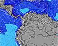 | 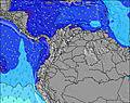 | 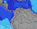 | 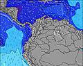 | 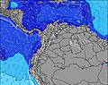 | 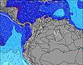 | 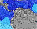 | ||||||||||||
Wave Height (m) Direction Period (s) | SW 13 | SW 14 | SW 14 | SW 14 | SW 14 | SW 14 | SW 13 | SW 13 | SW 13 | SW 13 | SW 13 | SW 13 | SW 13 | SW 13 | SW 12 | WNW 18 | WNW 18 | WNW 17 | WNW 17 |
Wave Graph | |||||||||||||||||||
46 | 51 | 52 | 52 | 51 | 49 | 45 | 44 | 44 | 44 | 43 | 43 | 42 | 40 | 38 | 62 | 61 | 59 | 57 | |
Wind (km/h) | |||||||||||||||||||
Wind State on-shore cross-onshore cross-shore cross-offshore off-shore glassy | cross | cross | glassy | glassy | glassy | cross-off | glassy | cross-on | cross-on | cross-on | cross-on | cross | cross | cross-off | cross-off | cross-off | cross | cross | cross |
High Tide | 8:24PM2.79m | 8:47AM2.93m | 9:16PM2.60m | 9:36AM2.73m | |||||||||||||||
Low Tide | 2:17PM0.55m | 2:29AM0.64m | 3:08PM0.69m | 3:19AM0.85m | 4:02PM0.82m | ||||||||||||||
— | — | — | — | 6:15 | — | — | — | — | — | — | — | 6:15 | — | — | — | — | — | — | |
6:28 | — | — | — | — | — | — | — | 6:28 | — | — | — | — | — | — | — | 6:28 | — | — | |
mm | — | 2 | 1 | — | — | — | — | — | — | — | — | 3 | 3 | 5 | 3 | 1 | — | 1 | 4 |
Temp °C | 27 | 26 | 26 | 25 | 25 | 25 | 26 | 27 | 27 | 26 | 26 | 26 | 25 | 25 | 26 | 27 | 27 | 26 | 26 |
Feels °C | 29 | 29 | 30 | 29 | 29 | 29 | 30 | 30 | 29 | 29 | 29 | 29 | 27 | 28 | 29 | 29 | 28 | 28 | 29 |
Swell 1 Height (m) Direction Period (s) | SW 13 | W 5 | W 5 | W 5 | W 5 | W 5 | W 5 | W 5 | SW 13 | SW 13 | SW 13 | SW 13 | SW 13 | SW 13 | SW 12 | SW 12 | SW 12 | SW 12 | WNW 17 |
46 | 37 | 37 | 27 | 19 | 19 | 13 | 13 | 44 | 44 | 43 | 43 | 42 | 40 | 38 | 37 | 37 | 36 | 57 | |
Swell 2 Height (m) Direction Period (s) | WNW 20 | SW 14 | SW 14 | SW 14 | SW 14 | SW 14 | SW 13 | SW 13 | WNW 19 | WNW 19 | WNW 18 | WNW 18 | WNW 18 | WNW 18 | WNW 18 | WNW 18 | WNW 18 | WNW 17 | SW 12 |
40 | 51 | 52 | 52 | 51 | 49 | 45 | 44 | 35 | 34 | 32 | 32 | 32 | 31 | 31 | 62 | 61 | 59 | 36 | |
Swell 3 Height (m) Direction Period (s) | NW 15 | WNW 20 | WNW 20 | WNW 20 | WNW 20 | WNW 19 | WNW 19 | WNW 19 | W 6 | W 13 | W 13 | W 13 | W 13 | W 13 | W 13 | NW 7 | W 12 | W 12 | W 12 |
8 | 39 | 38 | 37 | 37 | 37 | 36 | 35 | 1 | 3 | 14 | 14 | 14 | 14 | 3 | 2 | 3 | 3 | 3 | |
Wind waves Height (m) Direction Period (s) | W 5 | — | — | — | — | — | — | — | W 5 | W 5 | W 5 | W 4 | WSW 4 | WSW 4 | WSW 5 | WSW 5 | WSW 6 | WSW 6 | WSW 5 |
37 | — | — | — | — | — | — | — | 13 | 13 | 13 | 9 | 18 | 26 | 38 | 39 | 34 | 34 | 28 | |
Nearest Offshore or Glassy | |||||||||||||||||||
Distance (km) | 511 | 297 | 0 | 0 | 0 | 0 | 0 | 696 | 770 | 503 | 630 | 297 | 297 | 0 | 0 | 0 | 824 | 633 | 477 |
Best forecast wave conditions in Pacific Coast | |||||||||||||||||||
Best forecast wave conditions in Colombia | |||||||||||||||||||
Header Global | |||||||||||||||||||
- Map Icons:
 Break
Break Live Wave Height (m)
 Live Wind Speed (km/h)
 Surf Rating (10 Max)
 Ocean Swells (m)
- Wind Speed (km/h)


FREE! Surf-Forecast.com widget for your website
The surf report / weather widget below is available to embed on third party websites free of charge and provides a summary of our Tumaco surf forecast. Simply grab the html code snippet that we provide and paste it into your own site. You can choose your preferred language and metric/imperial units for the surf forecast feed to suit users of your site. Click here to get the code.
 Nearest