

Surf Forecasts:

Tropicana surf forecast from 1 Aug 2026:
- Most powerful swell: Wednesday 5 Aug, 8AM (local time) - 0.5ft (0.1m), 12s period, N swell with 3 kJ wave energy.
Best Forecast Surf Conditions for Tropicana this week:
The most powerful waves expected at Tropicana in the next 16 days are 0.1m 12s and forecast to arrive on Wednesday (Aug 05) at 8AM. Winds are predicted to be cross-offshore at the time the swell arrives. The largest open ocean swell (not directed at the beach) is 1.8m 7s period and expected on Thursday (Aug 06) at 11PM.
| Wave Type | Time (AST) & Date | Wave Height & Period |
|---|---|---|
| Next good surf (1 star+) | - | - |
| Best Surf | - | - |
| Most Powerful | 8AM (Wed 5th Aug) | 0.5ft (0.1m) 12s |
Table - best surf conditions forecast for Tropicana over the next 16 days.
The Lowdown
Alright folks, Rusty here. Let's look at what's on the table for the next couple of weeks.
Honestly, this is a tough one to write. The entire 16-day window is a flat, frustrating stretch for Tropicana. There's simply no decent surf on offer. The combined wave energy is stuck at zero for the vast majority of the period, and the few times a tiny bit of swell shows up, it's barely a ripple. From the 1st of August right through to the 16th, we're looking at a complete blank. The water temperature is sitting at a pretty normal 83°F, which is about what you'd expect for this time of year, but it won't help the fact that you're just bobbing around on a mirror.
The only real attempt at waves comes on Monday the 3rd of August, with a tiny 0.3ft swell from the north, but the energy is a measly (4). That's basically nothing. The wind is offshore, which is a positive, but there's no swell to clean up. The next few days are the same story – tiny 0.3ft pulses from the north with pitiful energy readings (2 or 5), all blown out by fresh to moderate winds. Despite the wind being offshore or cross-off, there's simply no wave to ride. While the wind is in the right direction, the lack of swell means the conditions are just clean and flat. Given the total lack of swell and consistent wind, this setup might be more interesting for kite surfing than paddle surfing, to be honest.
It's a bleak run, but this kind of flat spell happens. It won't last forever, and forecasts can change, but for now, keep your gear in the car and wait for the next pulse. The board stays dry this time.
Rusty.
Short Range ForecastLight rain (total 3mm), mostly falling on Sat night. Warm (max 28°C on Sat morning, min 26°C on Sat night). Mainly fresh winds. | Days 4-6 Weather SummaryMostly dry. Warm (max 28°C on Tue morning, min 27°C on Tue morning). Mainly fresh winds. | ||||||||||||||||||||
Saturday 1 | Sunday 2 | Monday 3 | Tuesday 4 | Wednesday 5 | Thursday 6 | Friday 7 | |||||||||||||||
AM | PM | Night | AM | PM | Night | AM | PM | Night | AM | PM | Night | AM | PM | Night | AM | PM | Night | AM | PM | Night | |
Swell Height Map |  |  |  | 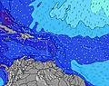 | 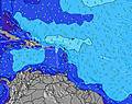 | 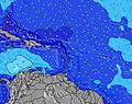 | 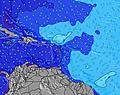 | ||||||||||||||
Wave Height (m) Direction Period (s) | ENE 8 | ENE 8 | ENE 8 | E 7 | ENE 7 | E 7 | E 7 | N 11 | N 10 | N 10 | N 10 | N 9 | N 9 | N 9 | N 11 | E 6 | E 7 | ENE 7 | ENE 7 | ENE 7 | E 7 |
Wave Graph | |||||||||||||||||||||
0 | 0 | 0 | 0 | 0 | 0 | 0 | 2 | 2 | 2 | 2 | 2 | 2 | 2 | 3 | 0 | 0 | 0 | 0 | 0 | 0 | |
Wind (km/h) | |||||||||||||||||||||
Wind State on-shore cross-onshore cross-shore cross-offshore off-shore glassy | cross-off | off | off | cross-off | off | off | off | off | off | cross-off | off | off | cross-off | off | cross-off | off | off | off | off | off | off |
High Tide | 5:40PM0.70m | 5:32AM0.73m | 6:09PM0.71m | 6:13AM0.68m | 6:40PM0.72m | 7:01AM0.63m | 7:17PM0.71m | 8:02AM0.56m | 8:02PM0.71m | 9:23AM0.51m | 9:00PM0.70m | 11:11AM0.49m | 10:14PM0.70m | ||||||||
Low Tide | 11:25AM0.16m | 11:32PM0.28m | 11:53AM0.20m | 00:15AM0.27m | 12:23PM0.24m | 1:03AM0.25m | 12:56PM0.28m | 2:01AM0.23m | 1:35PM0.32m | 3:13AM0.21m | 2:28PM0.36m | 4:35AM0.18m | 3:45PM0.40m | ||||||||
5:43 | — | — | 5:43 | — | — | 5:43 | — | — | 5:43 | — | — | 5:43 | — | — | 5:43 | — | — | 5:43 | — | — | |
— | 6:25 | — | — | 6:24 | — | — | 6:24 | — | — | 6:23 | — | — | 6:23 | — | — | 6:23 | — | — | 6:22 | — | |
mm | — | — | 3 | — | — | — | — | — | — | — | — | — | — | — | — | — | — | — | — | — | — |
Temp °C | 28 | 28 | 27 | 28 | 28 | 27 | 28 | 28 | 27 | 28 | 28 | 28 | 28 | 28 | 27 | 28 | 28 | 28 | 29 | 29 | 28 |
Feels °C | 30 | 29 | 28 | 27 | 28 | 27 | 28 | 28 | 26 | 29 | 28 | 28 | 27 | 27 | 25 | 25 | 26 | 26 | 28 | 28 | 27 |
Swell 1 Height (m) Direction Period (s) | ENE 8 | ENE 8 | E 12 | E 12 | E 12 | — | — | N 11 | E 11 | N 10 | E 12 | E 11 | ENE 10 | ENE 10 | ESE 9 | NE 7 | NNE 8 | NE 11 | NNE 10 | NNE 10 | NNE 10 |
169 | 165 | 3 | 3 | 3 | — | — | 2 | 2 | 2 | 3 | 2 | 10 | 19 | 8 | 14 | 11 | 4 | 10 | 10 | 18 | |
Swell 2 Height (m) Direction Period (s) | SSE 6 | SE 7 | E 12 | E 12 | E 12 | — | — | — | N 10 | — | N 10 | E 10 | E 10 | SE 10 | N 11 | NE 11 | NE 11 | — | — | — | — |
22 | 26 | 3 | 3 | 3 | — | — | — | 2 | — | 2 | 2 | 2 | 4 | 3 | 5 | 4 | — | — | — | — | |
Swell 3 Height (m) Direction Period (s) | — | E 12 | — | — | — | — | — | — | — | — | E 10 | N 9 | N 9 | N 9 | N 11 | — | — | — | — | — | — |
— | 3 | — | — | — | — | — | — | — | — | 2 | 2 | 2 | 2 | 3 | — | — | — | — | — | — | |
Wind waves Height (m) Direction Period (s) | — | — | ENE 8 | E 7 | ENE 7 | E 7 | E 7 | E 7 | ENE 7 | E 7 | E 6 | E 6 | E 6 | E 6 | E 6 | E 6 | E 7 | ENE 7 | ENE 7 | ENE 7 | E 7 |
— | — | 259 | 245 | 220 | 269 | 257 | 192 | 186 | 126 | 98 | 106 | 105 | 105 | 144 | 240 | 279 | 346 | 355 | 327 | 245 | |
Nearest Offshore or Glassy | |||||||||||||||||||||
Distance (km) | 10 | 23 | 767 | 850 | 850 | 325 | 622 | 823 | 325 | 247 | 823 | 263 | 622 | 622 | 263 | 850 | 850 | 410 | 850 | 263 | 263 |
Best forecast wave conditions in Barbados | |||||||||||||||||||||
Best forecast wave conditions in Barbados | |||||||||||||||||||||
Header Global | |||||||||||||||||||||
- Map Icons:
 Break
Break Live Wave Height (m)
 Live Wind Speed (km/h)
 Surf Rating (10 Max)
 Ocean Swells (m)
- Wind Speed (km/h)
Latest Updates


FREE! Surf-Forecast.com widget for your website
The surf report / weather widget below is available to embed on third party websites free of charge and provides a summary of our Tropicana surf forecast. Simply grab the html code snippet that we provide and paste it into your own site. You can choose your preferred language and metric/imperial units for the surf forecast feed to suit users of your site. Click here to get the code.
Information about the Tropicana Surf forecast
The above surf forecast table for Tropicana provides essential information for determining whether the surfing conditions will be good over the next 16 days. A general guide to surfing at Tropicana can be found by selecting the local surf guide option on the grey menu. Our Tropicana surf forecast is unique since it includes wave energy (power) that defines the real feel of the surf rather than just the height or the period. If you surf the same spot (Tropicana) regularly then make a mental note of the wave energy from the surf forecast table each time you go. Very soon you may start to choose your surf days based on the wave energy alone combined with our forecast of favourable offshore wind conditions. Our star ratings will help here and of course you will also find the usual wave height and period predictions on our surf forecasts as well as a full break down of the swell components under our advanced users option (to reveal that, click the little Einstein character under the tide times).
Further information to help with frequently asked questions about our surf forecast for Tropicana may be found under the help tab on the top menu and also by moving your mouse over the question marks on the surf forecast table itself. Please always bear in mind that the forecast is for near-shore open water and local factors at each surf break influence the actual breaking wave height, such as the beach / reef profile, water depths offshore and shelter.
Are you planning a holiday in Barbados? If you are looking for accommodation near Tropicana, camping, hotels and holiday cottages in Barbados, consider staying in Bridgetown which is 15 km (9 miles) away.
 Nearest