

Surf Forecasts:

How big are the waves at Torami today (04 Aug):
- Morning surf: Morning surf (04 Aug, local time) - 11ft (3.5m), 16s period with SE swell.
- Afternoon surf: Afternoon surf (04 Aug, local time) - 11ft (3.5m), 16s period with SE swell.
- Evening surf: Evening surf (04 Aug, local time) - 13ft (4.0m), 15s period with SE swell.
The current surf forecast for Torami at 4AM is: 3.0m 16s primary swell from a East-southeast direction and 1.1m 20s secondary swell from a Southeast direction, 1.8m 7s secondary swell from a East-northeast direction (forecast issued at 08:00pm August 03). The wind direction is predicted to be cross-onshore.
| Time (JST) & Date | Wave Height | Wave Period |
|---|---|---|
| Morning (04 Aug) | 11ft (3.5m) | 16s |
| Afternoon (04 Aug) | 11ft (3.5m) | 16s |
| Evening (04 Aug) | 13ft (4.0m) | 15s |
Table - waves today at Torami. (Swell directed towards the surf break)
Short Range ForecastMostly dry. Warm (max 29°C on Thu morning, min 22°C on Mon night). Mainly fresh winds. | ||||||||||||||||||
Mon 3 | Tuesday 4 | Wednesday 5 | ||||||||||||||||
6 PM | 9 PM | 12 AM | 3 AM | 6 AM | 9 AM | 12 PM | 3 PM | 6 PM | 9 PM | 12 AM | 3 AM | 6 AM | 9 AM | 12 PM | 3 PM | 6 PM | 9 PM | |
Swell Height Map |  |  | 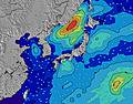 |  |  | 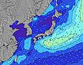 |  | |||||||||||
Wave Height (m) Direction Period (s) | SE 17 | SE 17 | SE 16 | ESE 16 | SE 16 | SE 16 | SE 16 | SE 16 | SE 16 | SE 15 | SE 16 | SE 15 | SE 15 | SE 15 | SE 16 | SE 15 | SSE 15 | SSE 15 |
Wave Graph | ||||||||||||||||||
3275 | 3586 | 3569 | 4523 | 5748 | 6018 | 6149 | 6286 | 6265 | 6552 | 7056 | 6780 | 6675 | 7046 | 7334 | 6719 | 5845 | 5270 | |
Wind (km/h) | ||||||||||||||||||
Wind State on-shore cross-onshore cross-shore cross-offshore off-shore glassy | cross-on | cross-on | cross-on | cross-on | cross-on | cross-on | cross-on | cross-on | cross-on | cross-on | cross-on | cross | cross | cross | cross-on | cross-on | cross-on | cross-on |
High Tide | 7:15PM1.44m | 7:22AM1.25m | 7:38PM1.44m | 8:23AM1.15m | 8:04PM1.43m | |||||||||||||
Low Tide | 1:30AM0.56m | 1:15PM0.56m | 2:18AM0.49m | 1:44PM0.72m | ||||||||||||||
— | — | — | 4:48 | — | — | — | — | — | — | — | 4:48 | — | — | — | — | — | — | |
6:40 | — | — | — | — | — | — | — | 6:39 | — | — | — | — | — | — | — | 6:38 | — | |
mm | — | — | — | — | — | — | — | — | — | — | — | — | — | — | — | — | — | — |
Temp °C | 24 | 24 | 23 | 23 | 22 | 24 | 24 | 25 | 24 | 23 | 23 | 22 | 22 | 23 | 25 | 26 | 26 | 25 |
Feels °C | 23 | 23 | 22 | 21 | 20 | 21 | 21 | 23 | 22 | 22 | 22 | 21 | 21 | 22 | 25 | 27 | 28 | 28 |
Swell 1 Height (m) Direction Period (s) | SE 17 | SE 17 | SE 16 | ESE 16 | SE 16 | SE 16 | SE 16 | SE 16 | SE 16 | SE 15 | SE 16 | SE 15 | SE 15 | SE 15 | SE 16 | SE 15 | SSE 15 | SSE 15 |
3275 | 3586 | 3569 | 4523 | 5748 | 6018 | 6149 | 6286 | 6265 | 6552 | 7056 | 6780 | 6675 | 7046 | 7334 | 6719 | 5845 | 5270 | |
Swell 2 Height (m) Direction Period (s) | E 14 | E 14 | E 14 | SE 20 | E 14 | E 14 | E 13 | E 13 | E 13 | E 13 | E 13 | E 13 | ENE 13 | ENE 12 | ENE 12 | — | E 18 | E 17 |
62 | 59 | 59 | 999 | 59 | 57 | 55 | 54 | 53 | 86 | 86 | 85 | 55 | 50 | 44 | — | 24 | 24 | |
Swell 3 Height (m) Direction Period (s) | — | — | — | — | — | E 13 | — | — | — | — | — | — | E 18 | E 18 | — | — | — | E 17 |
— | — | — | — | — | 92 | — | — | — | — | — | — | 25 | 25 | — | — | — | 23 | |
Wind waves Height (m) Direction Period (s) | ENE 7 | ENE 7 | ENE 7 | ENE 7 | ENE 7 | ENE 7 | ENE 7 | ENE 7 | ENE 7 | ENE 7 | — | NE 7 | — | — | — | — | E 10 | — |
216 | 217 | 229 | 343 | 352 | 443 | 387 | 387 | 376 | 339 | — | 322 | — | — | — | — | 592 | — | |
Nearest Offshore or Glassy | ||||||||||||||||||
Distance (km) | 218 | 218 | 564 | 218 | 218 | 566 | 218 | 65 | 566 | 566 | 566 | 564 | 564 | 564 | 564 | 65 | 65 | 18 |
Best forecast wave conditions in Chiba | ||||||||||||||||||
Best forecast wave conditions in Japan | ||||||||||||||||||
Header Global | ||||||||||||||||||
- Map Icons:
 Break
Break Live Wave Height (m)
 Live Wind Speed (km/h)
 Surf Rating (10 Max)
 Ocean Swells (m)
- Wind Speed (km/h)
Latest Updates


FREE! Surf-Forecast.com widget for your website
The surf report / weather widget below is available to embed on third party websites free of charge and provides a summary of our Torami surf forecast. Simply grab the html code snippet that we provide and paste it into your own site. You can choose your preferred language and metric/imperial units for the surf forecast feed to suit users of your site. Click here to get the code.
 Nearest