

Surf Forecasts:

Todasana surf forecast from 27 Jul 2026:
- Best quality surf: Friday 31 Jul, 5AM (local time) - 6ft (1.9m), 8s period, ENE swell with cross-offshore winds.
- Most powerful swell: Thursday 30 Jul, 8PM (local time) - 6ft (1.8m), 8s period, NE swell with 428 kJ wave energy.
- Next surfable swell (1★+): Monday 27 Jul, 11PM (local time) - 3ft (0.9m), 5s period with ENE swell.
Best Forecast Surf Conditions for Todasana this week:
The surf forecast for Todasana over the next 16 days: The first swell (rated 1 star or higher) is forecast to arrive on Monday (Jul 27) at 11PM. The primary swell is predicted to be 0.9m and 5s period with a secondary swell of 0.2m and 8s. The wind is predicted to be cross-offshore as the swell arrives.
The most powerful waves expected at Todasana in the next 16 days are 1.8m 8s and forecast to arrive on Thursday (Jul 30) at 8PM. Winds are predicted to be cross-shore at the time the swell arrives.
| Wave Type | Time (-04) & Date | Wave Height & Period |
|---|---|---|
| Next good surf (1 star+) | 11PM (Mon 27th Jul) | 3ft (0.9m) 5s |
| Best Surf | 5AM (Fri 31st Jul) | 6ft (1.9m) 8s |
| Most Powerful | 8PM (Thu 30th Jul) | 6ft (1.8m) 8s |
Table - best surf conditions forecast for Todasana over the next 16 days.
The Lowdown
Alright folks, Rusty here. Let’s get into it. We’ve got a long stretch ahead, but it’s a tough one for Todasana. This reef and point setup is exposed to the NNE swell, but the wind is just not playing ball. The entire 16-day window is a mess of cross-onshore and choppy conditions, with not a single recommended session. The first surf potential is virtually non-existent right from Monday, July 27th.
The swell is small to moderate, starting around 3 ft and building to 6 ft by July 30th. The combined energy climbs from a weak 66 to a moderate 322 by Thursday the 30th, but it’s all wind-affected junk. The period is short at 6 to 8 seconds, so it’s weak, windswell energy. The water temp is a pleasant 80°, which is just about average for the time of year, so that’s one small comfort. But that’s where the good news ends.
The best-looking energy on paper comes in around Thursday, July 30th, with 6 ft of swell from the ENE (322 energy), and again on Friday, August 7th, with another 6 ft shot (279 energy), and then Saturday, August 8th with 6 ft (310 energy). But every single day, the wind is from the E or ENE at 12 to 16 mph, putting it firmly cross-on or cross-shore, ruining any chance of a clean face. The swell direction is ENE, which is not the optimum NNE for the spot, so it’s not even wrapping in well.
The break is fairly consistent, but with crowds sometimes, the conditions are so poor it won’t matter. The setup is a reef and point, but with this much chop, you’re looking at a bumpy, frustrating paddle. None of these days are worth paddling out for a surfer. Honestly, with the consistent cross-onshore wind and the moderate chop, this stretch looks more interesting for a kite surfer than a paddle surfer. A blank run like this is a bit of a bummer, but it happens. Forecasts can change.
Rusty
Short Range ForecastLight rain (total 8mm), mostly falling on Wed night. Warm (max 31°C on Mon afternoon, min 25°C on Mon night). Wind will be generally light. | Days 4-6 Weather SummaryModerate rain (total 10mm), heaviest on Fri afternoon. Warm (max 31°C on Sat morning, min 25°C on Thu night). Wind will be generally light. | ||||||||||||||||||||
Monday 27 | Tuesday 28 | Wednesday 29 | Thursday 30 | Friday 31 | Saturday 1 | Sunday 2 | |||||||||||||||
AM | PM | Night | AM | PM | Night | AM | PM | Night | AM | PM | Night | AM | PM | Night | AM | PM | Night | AM | PM | Night | |
Swell Height Map | 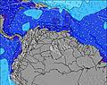 | 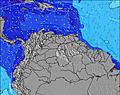 | 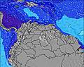 | 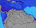 | 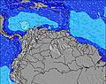 | 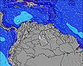 | 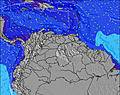 | ||||||||||||||
Wave Height (m) Direction Period (s) | ENE 6 | ENE 6 | ENE 5 | ENE 6 | ENE 6 | NE 6 | ENE 6 | NE 7 | NE 7 | ENE 8 | NE 8 | ENE 8 | ENE 8 | ENE 8 | ENE 7 | ENE 7 | ENE 7 | NE 6 | ENE 7 | NE 7 | NE 7 |
Wave Graph | |||||||||||||||||||||
49 | 57 | 49 | 70 | 57 | 47 | 106 | 100 | 183 | 322 | 400 | 425 | 327 | 294 | 202 | 180 | 127 | 123 | 120 | 131 | 194 | |
Wind (km/h) | |||||||||||||||||||||
Wind State on-shore cross-onshore cross-shore cross-offshore off-shore glassy | cross-on | cross-on | cross | cross-on | cross-on | cross | cross-on | cross-on | cross-off | cross-on | cross-on | cross | cross | cross-on | cross | cross | cross-on | cross-off | cross-on | cross-on | cross |
High Tide | 11:24PM0.39m | 00:04AM0.39m | 00:44AM0.39m | 1:21AM0.37m | 1:57AM0.34m | 5:29PM0.23m | 2:33AM0.30m | 5:40PM0.27m | 2:00AM0.25m | ||||||||||||
Low Tide | 8:10AM0.01m | 8:44AM0.02m | 9:16AM0.04m | 9:41AM0.07m | 9:53AM0.09m | 9:51AM0.12m | 8:18PM0.22m | 9:47AM0.13m | 9:41PM0.22m | ||||||||||||
6:13 | — | — | 6:13 | — | — | 6:13 | — | — | 6:13 | — | — | 6:13 | — | — | 6:13 | — | — | 6:13 | — | — | |
— | 6:50 | — | — | 6:50 | — | — | 6:50 | — | — | 6:50 | — | — | 6:49 | — | — | 6:49 | — | — | 6:49 | — | |
mm | — | 1 | 1 | — | — | — | — | 1 | 5 | — | 1 | 1 | — | 3 | 2 | — | 2 | 1 | — | — | — |
Temp °C | 30 | 31 | 26 | 29 | 29 | 26 | 29 | 29 | 26 | 29 | 30 | 26 | 28 | 28 | 26 | 31 | 29 | 26 | 30 | 31 | 26 |
Feels °C | 31 | 32 | 29 | 31 | 30 | 29 | 30 | 31 | 28 | 31 | 31 | 29 | 29 | 30 | 29 | 32 | 32 | 29 | 31 | 32 | 28 |
Swell 1 Height (m) Direction Period (s) | NE 8 | ENE 8 | ENE 5 | ENE 6 | ENE 6 | NE 6 | ENE 6 | NE 7 | NE 7 | — | — | ENE 8 | — | — | ENE 7 | ENE 7 | ENE 7 | NE 6 | ENE 7 | — | NE 7 |
15 | 7 | 49 | 70 | 57 | 47 | 106 | 100 | 183 | — | — | 425 | — | — | 202 | 180 | 127 | 123 | 120 | — | 194 | |
Swell 2 Height (m) Direction Period (s) | NE 8 | — | ENE 8 | ENE 9 | ENE 8 | — | — | — | — | — | — | — | — | — | — | — | — | — | — | — | — |
2 | — | 6 | 7 | 7 | — | — | — | — | — | — | — | — | — | — | — | — | — | — | — | — | |
Swell 3 Height (m) Direction Period (s) | — | — | — | — | — | — | — | — | — | — | — | — | — | — | — | — | — | — | — | — | — |
— | — | — | — | — | — | — | — | — | — | — | — | — | — | — | — | — | — | — | — | — | |
Wind waves Height (m) Direction Period (s) | ENE 6 | ENE 6 | — | — | — | — | — | — | — | ENE 8 | NE 8 | — | ENE 8 | ENE 8 | — | — | — | — | — | NE 7 | — |
49 | 57 | — | — | — | — | — | — | — | 322 | 400 | — | 327 | 294 | — | — | — | — | — | 131 | — | |
Nearest Offshore or Glassy | |||||||||||||||||||||
Distance (km) | 29 | 800 | 13 | 105 | 536 | 13 | 58 | 29 | 0 | 58 | 58 | 13 | 58 | 58 | 13 | 29 | 29 | 0 | 58 | 29 | 13 |
Best forecast wave conditions in Caracas | |||||||||||||||||||||
Best forecast wave conditions in Venezuela | |||||||||||||||||||||
Header Global | |||||||||||||||||||||
- Map Icons:
 Break
Break Live Wave Height (m)
 Live Wind Speed (km/h)
 Surf Rating (10 Max)
 Ocean Swells (m)
- Wind Speed (km/h)


FREE! Surf-Forecast.com widget for your website
The surf report / weather widget below is available to embed on third party websites free of charge and provides a summary of our Todasana surf forecast. Simply grab the html code snippet that we provide and paste it into your own site. You can choose your preferred language and metric/imperial units for the surf forecast feed to suit users of your site. Click here to get the code.
Information about the Todasana Surf forecast
The above surf forecast table for Todasana provides essential information for determining whether the surfing conditions will be good over the next 16 days. A general guide to surfing at Todasana can be found by selecting the local surf guide option on the grey menu. Our Todasana surf forecast is unique since it includes wave energy (power) that defines the real feel of the surf rather than just the height or the period. If you surf the same spot (Todasana) regularly then make a mental note of the wave energy from the surf forecast table each time you go. Very soon you may start to choose your surf days based on the wave energy alone combined with our forecast of favourable offshore wind conditions. Our star ratings will help here and of course you will also find the usual wave height and period predictions on our surf forecasts as well as a full break down of the swell components under our advanced users option (to reveal that, click the little Einstein character under the tide times).
Further information to help with frequently asked questions about our surf forecast for Todasana may be found under the help tab on the top menu and also by moving your mouse over the question marks on the surf forecast table itself. Please always bear in mind that the forecast is for near-shore open water and local factors at each surf break influence the actual breaking wave height, such as the beach / reef profile, water depths offshore and shelter.
Todasana is 20 km (12 miles) from the city of Guatire. If you plan a holiday in Caracas, look for hotels and other accommodation in Guatire. Guatire has rooms for a wide range of budgets as well as car hire and transport links.
 Nearest