

Surf Forecasts:

Table Rock surf forecast from 1 Aug 2026:
- Most powerful swell: Saturday 1 Aug, 8PM (local time) - 3ft (0.9m), 6s period, ENE swell with 65 kJ wave energy.
Best Forecast Surf Conditions for Table Rock this week:
The most powerful waves expected at Table Rock in the next 16 days are 0.9m 6s and forecast to arrive on Saturday (Aug 01) at 8PM. Winds are predicted to be offshore at the time the swell arrives. The largest open ocean swell (not directed at the beach) is 1.1m 4s period and expected on Friday (Aug 07) at 2PM.
| Wave Type | Time (AST) & Date | Wave Height & Period |
|---|---|---|
| Next good surf (1 star+) | - | - |
| Best Surf | - | - |
| Most Powerful | 8PM (Sat 1st Aug) | 3ft (0.9m) 6s |
Table - best surf conditions forecast for Table Rock over the next 16 days.
The Lowdown
G’day, Rusty here. Look, I’ve gotta be straight with you – the next 16 days are a bit of a drought for proper surf at Table Rock. The swell just isn’t delivering anything worthwhile. It’s a real shame, because this spot is a reef setup that can handle a bit of north in the swell, but we’re stuck with tiny, weak waves the whole way through.
The water’s sitting at a warm 84°, which is about average for this time of year, so at least a dip won’t be a shock to the system.
Alright, let’s run through it. Saturday the 1st and Sunday the 2nd of August, we’re looking at ankle-to-knee-high stuff from the NE, with a short period around 6-7 seconds. The combined energy is weak, barely hitting 33 (33) on Saturday morning. Winds are mostly cross-off or offshore, so the surface will be clean, but there’s just no push to get a ride.
This pattern sticks around for the whole first week. Monday the 3rd through to Friday the 7th, it’s the same story – tiny waves, 1ft to 2ft, short period, and energy readings that never break 52 (52). The best bit of wind we see is on Wednesday the 5th and Thursday the 6th, with glassy conditions in the mornings, but it’s like a swimming pool with a ripple. Not worth paddling out for.
The second week isn’t any better. Saturday the 8th of August kicks off with a 2ft NE swell, still weak at 36 (36) energy. By Sunday the 11th, the swell height just touches 3ft on Tuesday morning, but the period is still a short 6 seconds, and the energy is only 83 (83). That’s barely enough to get your fins wet. Winds stay mostly cross-off, so it’s clean, but the wave quality is just poor.
From Tuesday the 12th onwards, the swell drops off a cliff. We’re looking at 0.3ft to 0.7ft junk for the rest of the run, with energy readings that fall to single digits. It’s basically a flat spell. There’s a gap of several days here where there’s no real recommendation.
Honestly, if you’re determined to get on the water, the consistent offshore winds and clean conditions might make this more interesting for a kite surfer than a paddle surfer, but for a traditional surf, you’re better off waiting for a new swell to show up. The forecasts can change, and it rarely stays this poor for long, so keep an eye on it.
Rusty.
Short Range ForecastModerate rain (total 19mm), heaviest on Sun afternoon. Warm (max 29°C on Sat afternoon, min 26°C on Sat morning). Wind will be generally light. | Days 4-6 Weather SummaryModerate rain (total 11mm), heaviest on Wed afternoon. Warm (max 29°C on Tue morning, min 25°C on Thu night). Wind will be generally light. | ||||||||||||||||||||
Saturday 1 | Sunday 2 | Monday 3 | Tuesday 4 | Wednesday 5 | Thursday 6 | Friday 7 | |||||||||||||||
AM | PM | Night | AM | PM | Night | AM | PM | Night | AM | PM | Night | AM | PM | Night | AM | PM | Night | AM | PM | Night | |
Swell Height Map |  |  |  | 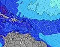 | 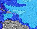 | 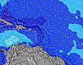 | 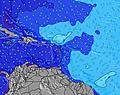 | ||||||||||||||
Wave Height (m) Direction Period (s) | NE 7 | NE 5 | NE 6 | NE 7 | NE 6 | NE 6 | NE 6 | NE 5 | NE 6 | NE 6 | NE 4 | NE 5 | NE 5 | NE 4 | NE 5 | NE 6 | NE 5 | NE 6 | NE 7 | NNE 9 | NNE 9 |
Wave Graph | |||||||||||||||||||||
31 | 0 | 32 | 25 | 15 | 20 | 19 | 0 | 21 | 21 | 0 | 16 | 9 | 8 | 14 | 11 | 28 | 38 | 31 | 8 | 8 | |
Wind (km/h) | |||||||||||||||||||||
Wind State on-shore cross-onshore cross-shore cross-offshore off-shore glassy | cross-off | cross | cross-off | off | cross-off | cross-off | cross-off | cross-off | cross-off | cross-off | cross | cross-off | glassy | glassy | cross-off | glassy | cross-off | cross-off | cross-off | cross-off | cross-off |
High Tide | 10:03AM0.37m | 10:27PM0.48m | 10:48AM0.40m | 11:00PM0.44m | 11:36AM0.42m | 11:34PM0.40m | 12:29PM0.44m | 00:10AM0.36m | 1:26PM0.46m | 00:54AM0.31m | 2:30PM0.47m | 1:49AM0.28m | 3:36PM0.49m | 2:55AM0.27m | |||||||
Low Tide | 4:02PM0.10m | 4:56AM0.12m | 4:51PM0.13m | 5:26AM0.10m | 5:45PM0.15m | 5:57AM0.08m | 6:47PM0.17m | 6:34AM0.06m | 7:56PM0.18m | 7:20AM0.04m | 9:11PM0.18m | 8:16AM0.02m | 10:26PM0.18m | ||||||||
6:05 | — | — | 6:05 | — | — | 6:07 | — | — | 6:07 | — | — | 6:07 | — | — | 6:07 | — | — | 6:07 | — | — | |
— | 7:02 | — | — | 7:02 | — | — | 7:01 | — | — | 7:01 | — | — | 7:00 | — | — | 7:00 | — | — | 7:00 | — | |
mm | — | 4 | 3 | 1 | 9 | 1 | — | 1 | — | — | 1 | 1 | — | 6 | 2 | — | 1 | — | — | — | — |
Temp °C | 28 | 29 | 28 | 29 | 29 | 29 | 29 | 29 | 28 | 29 | 29 | 27 | 28 | 29 | 28 | 29 | 29 | 28 | 29 | 29 | 27 |
Feels °C | 31 | 31 | 29 | 32 | 32 | 31 | 32 | 31 | 30 | 32 | 32 | 28 | 32 | 33 | 31 | 33 | 31 | 31 | 31 | 31 | 27 |
Swell 1 Height (m) Direction Period (s) | S 5 | S 5 | NE 6 | NE 7 | NE 6 | NE 6 | NE 6 | S 6 | NE 6 | NE 6 | S 5 | S 5 | NE 5 | NE 5 | NE 5 | NE 6 | S 5 | NE 6 | NE 7 | NNE 9 | NNE 9 |
2 | 2 | 32 | 25 | 15 | 20 | 19 | 3 | 21 | 21 | 2 | 2 | 9 | 4 | 14 | 11 | 2 | 38 | 31 | 8 | 8 | |
Swell 2 Height (m) Direction Period (s) | NNE 5 | — | S 5 | S 6 | S 5 | S 6 | S 6 | S 8 | S 6 | S 5 | S 9 | S 9 | S 5 | S 5 | S 5 | S 5 | NE 10 | S 8 | NNE 9 | S 9 | S 5 |
2 | — | 2 | 2 | 5 | 6 | 3 | 1 | 2 | 2 | 1 | 2 | 2 | 2 | 2 | 2 | 4 | 5 | 8 | 6 | 2 | |
Swell 3 Height (m) Direction Period (s) | — | — | — | — | ENE 8 | — | — | — | S 8 | S 9 | — | S 8 | N 9 | N 11 | N 8 | NE 10 | S 8 | NNE 9 | S 8 | NE 9 | S 9 |
— | — | — | — | 6 | — | — | — | 1 | 1 | — | 1 | 2 | 3 | 1 | 4 | 1 | 8 | 5 | 3 | 6 | |
Wind waves Height (m) Direction Period (s) | NE 7 | NE 5 | — | — | — | — | — | NE 5 | — | — | NE 4 | NE 5 | — | NE 4 | — | — | NE 5 | — | — | NE 5 | NE 5 |
31 | 43 | — | — | — | — | — | 47 | — | — | 31 | 16 | — | 8 | — | — | 28 | — | — | 72 | 31 | |
Nearest Offshore or Glassy | |||||||||||||||||||||
Distance (km) | 138 | 638 | 13 | 13 | 866 | 13 | 467 | 865 | 59 | 557 | 865 | 117 | 467 | 13 | 117 | 866 | 866 | 50 | 866 | 638 | 217 |
Best forecast wave conditions in Puerto Rico | |||||||||||||||||||||
Best forecast wave conditions in Puerto Rico | |||||||||||||||||||||
Header Global | |||||||||||||||||||||
- Map Icons:
 Break
Break Live Wave Height (m)
 Live Wind Speed (km/h)
 Surf Rating (10 Max)
 Ocean Swells (m)
- Wind Speed (km/h)
Latest Updates


FREE! Surf-Forecast.com widget for your website
The surf report / weather widget below is available to embed on third party websites free of charge and provides a summary of our Table Rock surf forecast. Simply grab the html code snippet that we provide and paste it into your own site. You can choose your preferred language and metric/imperial units for the surf forecast feed to suit users of your site. Click here to get the code.
Information about the Table Rock Surf forecast
The above surf forecast table for Table Rock provides essential information for determining whether the surfing conditions will be good over the next 16 days. A general guide to surfing at Table Rock can be found by selecting the local surf guide option on the grey menu. Our Table Rock surf forecast is unique since it includes wave energy (power) that defines the real feel of the surf rather than just the height or the period. If you surf the same spot (Table Rock) regularly then make a mental note of the wave energy from the surf forecast table each time you go. Very soon you may start to choose your surf days based on the wave energy alone combined with our forecast of favourable offshore wind conditions. Our star ratings will help here and of course you will also find the usual wave height and period predictions on our surf forecasts as well as a full break down of the swell components under our advanced users option (to reveal that, click the little Einstein character under the tide times).
Further information to help with frequently asked questions about our surf forecast for Table Rock may be found under the help tab on the top menu and also by moving your mouse over the question marks on the surf forecast table itself. Please always bear in mind that the forecast is for near-shore open water and local factors at each surf break influence the actual breaking wave height, such as the beach / reef profile, water depths offshore and shelter.
Table Rock is 9 km (6 miles) from the city of Aguadilla. If you plan a holiday in Puerto Rico, look for hotels and other accommodation in Aguadilla. Aguadilla has rooms for a wide range of budgets as well as car hire and transport links.
 Nearest