

Surf Forecasts:

How big are the waves at Pelle a Tarte today (27 Jul):
- Morning surf: Morning surf (27 Jul, local time) - 3.5ft (1.1m), 8s period with ENE swell.
- Afternoon surf: Afternoon surf (27 Jul, local time) - 3.5ft (1.0m), 8s period with ENE swell.
- Evening surf: Evening surf (27 Jul, local time) - 3.5ft (1.1m), 8s period with ENE swell.
The current surf forecast for Pelle a Tarte at 3PM is: 1.0m 8s primary swell from a East-northeast direction (forecast issued at 07:00am July 27). An open ocean swell of 0.3m 9s is not directed at the surf break, a second open ocean swell of 0.4m 9s is not directed at the surf break. The wind direction is predicted to be cross-offshore.
| Time (AST) & Date | Wave Height | Wave Period |
|---|---|---|
| Morning (27 Jul) | 3.5ft (1.1m) | 8s |
| Afternoon (27 Jul) | 3.5ft (1.0m) | 8s |
| Evening (27 Jul) | 3.5ft (1.1m) | 8s |
Table - waves today at Pelle a Tarte. (Swell directed towards the surf break)
Short Range ForecastHeavy rain (total 20mm), heaviest during Mon morning. Warm (max 28°C on Mon afternoon, min 26°C on Tue night). Mainly fresh winds. | |||||||||||||||||||||||
Monday 27 | Tuesday 28 | Wednesday 29 | |||||||||||||||||||||
5 AM | 8 AM | 11 AM | 2 PM | 5 PM | 8 PM | 11 PM | 2 AM | 5 AM | 8 AM | 11 AM | 2 PM | 5 PM | 8 PM | 11 PM | 2 AM | 5 AM | 8 AM | 11 AM | 2 PM | 5 PM | 8 PM | 11 PM | |
Swell Height Map |  |  |  |  |  |  |  | 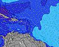 |  | ||||||||||||||
Wave Height (m) Direction Period (s) | ENE 8 | ENE 8 | ENE 8 | ENE 8 | ENE 8 | ENE 8 | ENE 8 | ENE 8 | E 6 | ENE 7 | E 8 | E 8 | E 7 | E 7 | E 7 | E 7 | E 8 | E 8 | E 8 | E 8 | E 8 | E 8 | E 8 |
Wave Graph | |||||||||||||||||||||||
142 | 142 | 138 | 142 | 119 | 135 | 151 | 223 | 151 | 180 | 217 | 212 | 209 | 264 | 343 | 392 | 475 | 537 | 573 | 643 | 659 | 650 | 727 | |
Wind (km/h) | |||||||||||||||||||||||
Wind State on-shore cross-onshore cross-shore cross-offshore off-shore glassy | cross-off | cross-off | cross-off | cross-off | cross-off | cross-off | cross-off | cross-off | cross-off | cross-off | cross-off | cross-off | cross-off | cross-off | cross-off | cross-off | cross-off | cross-off | cross-off | cross-off | cross-off | cross-off | cross-off |
High Tide | 3:58PM0.42m | 2:09AM0.56m | 4:19PM0.44m | 2:49AM0.58m | 4:40PM0.46m | ||||||||||||||||||
Low Tide | 8:56AM0.08m | 8:03PM0.34m | 9:29AM0.08m | 8:45PM0.33m | 10:00AM0.08m | 9:24PM0.32m | |||||||||||||||||
5:45 | — | — | — | — | — | — | — | 5:45 | — | — | — | — | — | — | — | 5:45 | — | — | — | — | — | — | |
— | — | — | — | 6:34 | — | — | — | — | — | — | — | 6:34 | — | — | — | — | — | — | — | 6:34 | — | — | |
mm | 1 | 1 | 2 | — | — | — | — | 1 | — | — | 1 | 2 | 2 | 2 | 2 | 2 | 2 | 2 | 1 | — | — | — | — |
Temp °C | 27 | 27 | 27 | 28 | 28 | 27 | 27 | 27 | 27 | 27 | 28 | 28 | 27 | 27 | 27 | 27 | 26 | 27 | 27 | 28 | 27 | 27 | 27 |
Feels °C | 30 | 29 | 29 | 30 | 30 | 28 | 28 | 27 | 27 | 27 | 28 | 28 | 27 | 27 | 27 | 28 | 26 | 27 | 26 | 27 | 26 | 26 | 26 |
Swell 1 Height (m) Direction Period (s) | ENE 8 | ENE 8 | ENE 8 | ESE 9 | SE 9 | ESE 9 | SE 9 | — | SE 8 | ESE 9 | SE 9 | SE 8 | ESE 8 | NE 10 | NE 10 | — | — | — | — | — | — | — | — |
142 | 142 | 138 | 16 | 21 | 16 | 20 | — | 18 | 8 | 19 | 18 | 7 | 4 | 4 | — | — | — | — | — | — | — | — | |
Swell 2 Height (m) Direction Period (s) | SE 9 | SE 9 | ESE 9 | ESE 9 | ESE 9 | — | — | — | — | — | — | — | — | — | — | — | — | — | — | — | — | — | — |
21 | 21 | 16 | 31 | 32 | — | — | — | — | — | — | — | — | — | — | — | — | — | — | — | — | — | — | |
Swell 3 Height (m) Direction Period (s) | — | — | — | — | — | — | — | — | — | — | — | — | — | — | — | — | — | — | — | — | — | — | — |
— | — | — | — | — | — | — | — | — | — | — | — | — | — | — | — | — | — | — | — | — | — | — | |
Wind waves Height (m) Direction Period (s) | — | — | — | ENE 8 | ENE 8 | ENE 8 | ENE 8 | ENE 8 | E 6 | ENE 7 | E 8 | E 8 | E 7 | E 7 | E 7 | E 7 | E 8 | E 8 | E 8 | E 8 | E 8 | E 8 | E 8 |
— | — | — | 142 | 119 | 135 | 151 | 223 | 151 | 180 | 217 | 212 | 209 | 264 | 343 | 392 | 475 | 537 | 573 | 643 | 659 | 650 | 727 | |
Nearest Offshore or Glassy | |||||||||||||||||||||||
Distance (km) | 0 | 0 | 0 | 241 | 241 | 241 | 571 | 405 | 448 | 702 | 400 | 400 | 315 | 745 | 315 | 444 | 444 | 735 | 806 | 806 | 782 | 735 | 507 |
Best forecast wave conditions in Martinique | |||||||||||||||||||||||
Best forecast wave conditions in Martinique | |||||||||||||||||||||||
Header Global | |||||||||||||||||||||||
- Map Icons:
 Break
Break Live Wave Height (m)
 Live Wind Speed (km/h)
 Surf Rating (10 Max)
 Ocean Swells (m)
- Wind Speed (km/h)


FREE! Surf-Forecast.com widget for your website
The surf report / weather widget below is available to embed on third party websites free of charge and provides a summary of our Pelle a Tarte surf forecast. Simply grab the html code snippet that we provide and paste it into your own site. You can choose your preferred language and metric/imperial units for the surf forecast feed to suit users of your site. Click here to get the code.
 Nearest