

Surf Forecasts:

How big are the waves at Peaking today (04 Aug):
- Morning surf: Morning surf (04 Aug, local time) - 3.5ft (1.1m), 12s period with SW swell.
- Afternoon surf: Afternoon surf (04 Aug, local time) - 4.5ft (1.4m), 12s period with SW swell.
- Evening surf: Evening surf (04 Aug, local time) - 4.5ft (1.4m), 12s period with SW swell.
The current surf forecast for Peaking at 4AM is: 1.1m 13s primary swell from a Southwest direction and 0.8m 12s secondary swell from a Southeast direction, 0.9m 5s secondary swell from a South-southwest direction (forecast issued at 12:00am August 04). The wind direction is predicted to be cross-onshore.
| Time (+13) & Date | Wave Height | Wave Period |
|---|---|---|
| Morning (04 Aug) | 3.5ft (1.1m) | 12s |
| Afternoon (04 Aug) | 4.5ft (1.4m) | 12s |
| Evening (04 Aug) | 4.5ft (1.4m) | 12s |
Table - waves today at Peaking. (Swell directed towards the surf break)
Short Range ForecastMostly dry. Warm (max 21°C on Mon night, min 20°C on Tue morning). Mainly strong winds. | ||||||||||||||||||||||||
Tuesday 4 | Wednesday 5 | Thursday 6 | ||||||||||||||||||||||
1 AM | 4 AM | 7 AM | 10 AM | 1 PM | 4 PM | 7 PM | 10 PM | 1 AM | 4 AM | 7 AM | 10 AM | 1 PM | 4 PM | 7 PM | 10 PM | 1 AM | 4 AM | 7 AM | 10 AM | 1 PM | 4 PM | 7 PM | 10 PM | |
Swell Height Map | 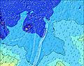 | 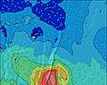 | 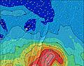 | 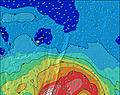 | 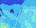 | 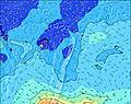 | 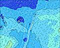 | 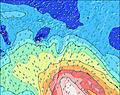 |  | |||||||||||||||
Wave Height (m) Direction Period (s) | SW 13 | SW 13 | SW 13 | SW 12 | SW 12 | SW 12 | SW 12 | SW 12 | SW 12 | S 12 | S 11 | S 11 | S 10 | S 10 | S 12 | SW 17 | S 11 | S 11 | SSE 11 | SSE 11 | SW 16 | SW 16 | SW 16 | SW 16 |
Wave Graph | ||||||||||||||||||||||||
380 | 424 | 405 | 380 | 590 | 590 | 580 | 514 | 505 | 604 | 643 | 610 | 461 | 470 | 594 | 487 | 831 | 694 | 718 | 743 | 421 | 421 | 299 | 295 | |
Wind (km/h) | ||||||||||||||||||||||||
Wind State on-shore cross-onshore cross-shore cross-offshore off-shore glassy | cross | cross-on | cross-on | cross-on | cross | cross | cross | cross-off | cross-off | cross-off | cross-off | cross-off | cross-off | cross-off | cross-off | cross-off | cross-off | cross-off | cross-off | cross-off | cross-off | cross-off | cross-off | cross-off |
High Tide | 10:43PM1.07m | 11:00AM1.02m | 11:29PM1.09m | 11:53AM1.00m | 00:19AM1.11m | 12:51PM0.99m | ||||||||||||||||||
Low Tide | 4:54AM0.29m | 5:08PM0.26m | 5:46AM0.27m | 5:56PM0.27m | 6:42AM0.24m | 6:50PM0.27m | ||||||||||||||||||
— | — | 7:03 | — | — | — | — | — | — | — | 7:01 | — | — | — | — | — | — | — | 7:01 | — | — | — | — | — | |
— | — | — | — | — | 6:21 | — | — | — | — | — | — | — | 6:21 | — | — | — | — | — | — | — | 6:22 | — | — | |
mm | — | — | — | — | — | — | — | — | — | — | — | — | — | — | — | — | — | — | — | — | — | — | — | — |
Temp °C | 21 | 21 | 21 | 21 | 20 | 21 | 20 | 21 | 21 | 21 | 21 | 21 | 21 | 21 | 21 | 21 | 21 | 20 | 21 | 21 | 21 | 21 | 21 | 21 |
Feels °C | 18 | 18 | 18 | 17 | 16 | 17 | 16 | 18 | 18 | 18 | 18 | 18 | 18 | 17 | 16 | 16 | 17 | 15 | 16 | 15 | 15 | 14 | 15 | 14 |
Swell 1 Height (m) Direction Period (s) | SW 13 | SW 13 | SW 13 | SW 12 | SW 12 | SW 12 | SW 12 | SW 12 | SW 12 | S 12 | S 11 | S 11 | S 10 | S 10 | S 12 | S 11 | SW 17 | SW 16 | SW 16 | SW 16 | SW 16 | SW 16 | SW 16 | SW 16 |
380 | 424 | 405 | 380 | 590 | 590 | 580 | 514 | 480 | 604 | 643 | 610 | 461 | 470 | 594 | 205 | 470 | 448 | 437 | 427 | 421 | 421 | 299 | 295 | |
Swell 2 Height (m) Direction Period (s) | SE 12 | SE 12 | SE 12 | S 15 | S 14 | SSW 14 | S 13 | SSW 13 | S 12 | SW 12 | SW 11 | SW 11 | SW 11 | SW 18 | SW 18 | SW 17 | ENE 8 | S 15 | S 14 | S 14 | S 11 | S 15 | S 15 | S 15 |
164 | 167 | 137 | 209 | 264 | 317 | 355 | 499 | 505 | 376 | 205 | 145 | 150 | 375 | 510 | 487 | 21 | 109 | 140 | 98 | 112 | 209 | 209 | 224 | |
Swell 3 Height (m) Direction Period (s) | ENE 8 | ENE 8 | ENE 8 | SE 12 | SE 12 | E 8 | E 8 | E 8 | E 8 | SW 19 | SW 19 | SW 18 | SW 18 | SW 12 | SSE 10 | ENE 8 | ENE 14 | ENE 8 | ENE 8 | SSW 17 | S 16 | S 11 | S 11 | S 11 |
48 | 50 | 51 | 112 | 110 | 31 | 45 | 33 | 34 | 184 | 293 | 328 | 388 | 112 | 104 | 21 | 82 | 21 | 20 | 93 | 127 | 79 | 82 | 58 | |
Wind waves Height (m) Direction Period (s) | SSW 5 | SSW 5 | SSW 5 | SSW 5 | — | — | — | — | — | — | — | — | — | — | — | S 9 | S 11 | S 11 | SSE 11 | SSE 11 | SSE 6 | SE 7 | SE 6 | SE 6 |
28 | 32 | 33 | 44 | — | — | — | — | — | — | — | — | — | — | — | 372 | 831 | 694 | 718 | 743 | 225 | 261 | 201 | 287 | |
Nearest Offshore or Glassy | ||||||||||||||||||||||||
Distance (km) | 582 | 582 | 582 | 282 | 604 | 604 | 604 | 604 | 604 | 934 | 282 | 282 | 282 | 282 | 1515 | 1515 | 1515 | 1515 | 1515 | 1515 | 934 | 2116 | 2116 | 2116 |
Best forecast wave conditions in Tonga Vava'u | ||||||||||||||||||||||||
Best forecast wave conditions in Tonga | ||||||||||||||||||||||||
Header Global | ||||||||||||||||||||||||
- Map Icons:
 Break
Break Live Wave Height (m)
 Live Wind Speed (km/h)
 Surf Rating (10 Max)
 Ocean Swells (m)
- Wind Speed (km/h)
Latest Updates


FREE! Surf-Forecast.com widget for your website
The surf report / weather widget below is available to embed on third party websites free of charge and provides a summary of our Peaking surf forecast. Simply grab the html code snippet that we provide and paste it into your own site. You can choose your preferred language and metric/imperial units for the surf forecast feed to suit users of your site. Click here to get the code.
 Nearest