

Surf Forecasts:

Las Cuevas surf forecast from 18 Jul 2026:
- Best quality surf: Tuesday 21 Jul, 3AM (local time) - 1.5ft (0.5m), 8s period, SSE swell with glassy winds.
- Most powerful swell: Sunday 19 Jul, 9AM (local time) - 3ft (0.9m), 10s period, SSW swell with 160 kJ wave energy.
- Next surfable swell (1★+): Tuesday 21 Jul, 3AM (local time) - 1.5ft (0.5m), 8s period with SSE swell.
Best Forecast Surf Conditions for Las Cuevas this week:
The surf forecast for Las Cuevas over the next 16 days: The first swell (rated 1 star or higher) is forecast to arrive on Tuesday (Jul 21) at 3AM. The primary swell is predicted to be 0.5m and 8s period with a secondary swell of 0.4m and 6s. The wind is predicted to be glassy as the swell arrives.
The most powerful waves expected at Las Cuevas in the next 16 days are 0.9m 10s and forecast to arrive on Sunday (Jul 19) at 9AM. Winds are predicted to be cross-onshore at the time the swell arrives. The largest open ocean swell (not directed at the beach) is 0.6m 3s period and expected on Saturday (Jul 25) at 3AM.
| Wave Type | Time (-03) & Date | Wave Height & Period |
|---|---|---|
| Next good surf (1 star+) | 3AM (Tue 21st Jul) | 1.5ft (0.5m) 8s |
| Best Surf | 3AM (Tue 21st Jul) | 1.5ft (0.5m) 8s |
| Most Powerful | 9AM (Sun 19th Jul) | 3ft (0.9m) 10s |
Table - best surf conditions forecast for Las Cuevas over the next 16 days.
The Lowdown
G'day, Rusty here. Look, I've been staring at the charts for your area, and I gotta be straight with you – it's a bit of a tough stretch. The next week and a half is mostly a write-off for anything decent, but there's a little glimmer of hope right at the end of the forecast period worth keeping an eye on.
Let's talk about Las Cuevas. This is a reef break, so it can handle a bit of direction, but man, the conditions are just not playing ball. The water is currently sitting at 51°F, which is a whopping 4°F warmer than usual for this time of year – that's seriously unusual.
We kick off on Saturday, 18 July, with a tiny 3ft east swell and a period of 10 seconds. The wind is on it from the SSE, and the combined energy is a weak 136. It's just poor surf. That theme carries right through the weekend and into the middle of the week. Everything is small, choppy, and cross-onshore. There's a moment on Tuesday morning, 21 July, where the wind goes glassy, but the swell is only 2ft with a combined energy of just 68. It's surfable, but only just.
From Wednesday, 22 July, through to the end of the month, it's a real mixed bag of tiny, wonky swells and messy winds. The 25th of July has a 25 mph cross-offshore wind, but that's just howling, and the swell is a pathetic 1ft. Not worth paddling out for.
The real kicker comes on Wednesday, 29 July. We get a pulse of swell from the SSE at 8ft, but it's a short period of 8 seconds. The combined energy jumps to 588, which is moderate, but the wind is light cross-onshore, making it look messy. It's a "marginal" call. At 8ft, it's pushing into the territory where it's not for beginners, and the wind is not helping.
The standout for the whole 16 days is Thursday, 30 July. The swell from the S drops a touch to 5ft, but the period stretches out to a nice 11 seconds, giving it some proper groundswell punch. The combined energy is a solid 656 (moderate), and the wind swings around to the NNW at 16 mph, which is offshore. That's a clean, offshore line-up. The forecast says "expect very good surf conditions" and I believe it. The water is still that warm anomaly, but the waves will be the best we've seen. This is the one session to aim for.
After that, the swell fades back into the 3ft to 4ft range for the first few days of August, with clean conditions on Sunday, 2 August, but nothing that will get your heart racing like that Thursday.
The rest of the window is a lot of "poor surf conditions" and "clean" but tiny waves. It's a long wait for that one day, but it's the only real opportunity on the table.
Rusty.
Short Range ForecastMostly dry. Very mild (max 10°C on Sat morning, min 7°C on Sun night). Wind will be generally light. | Days 4-6 Weather SummaryMostly dry. Mild temperatures (max 9°C on Tue afternoon, min 6°C on Wed night). Wind will be generally light. | ||||||||||||||||||||
Saturday 18 | Sunday 19 | Monday 20 | Tuesday 21 | Wednesday 22 | Thursday 23 | Friday 24 | |||||||||||||||
AM | PM | Night | AM | PM | Night | AM | PM | Night | AM | PM | Night | AM | PM | Night | AM | PM | Night | AM | PM | Night | |
Swell Height Map |  |  | 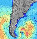 | 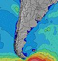 | 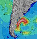 | 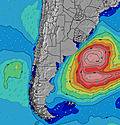 | 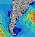 | ||||||||||||||
Wave Height (m) Direction Period (s) | E 10 | E 10 | E 10 | SSW 10 | S 9 | S 9 | S 8 | S 8 | S 8 | S 8 | E 10 | E 10 | S 6 | SSE 6 | S 8 | S 8 | S 8 | S 8 | S 8 | S 8 | NE 6 |
Wave Graph | |||||||||||||||||||||
117 | 117 | 96 | 160 | 142 | 97 | 86 | 63 | 42 | 34 | 29 | 48 | 61 | 100 | 66 | 50 | 66 | 92 | 88 | 43 | 80 | |
Wind (km/h) | |||||||||||||||||||||
Wind State on-shore cross-onshore cross-shore cross-offshore off-shore glassy | on | cross-on | on | cross-on | cross-on | cross-on | cross-on | cross-on | cross | glassy | cross-on | on | on | cross-on | cross | cross-off | cross-off | cross-off | cross-off | cross-off | off |
High Tide | 10:17AM1.03m | 10:24PM1.44m | 11:06AM1.06m | 11:19PM1.32m | 11:54AM1.09m | 00:13AM1.20m | 12:42PM1.11m | 1:10AM1.08m | 1:28PM1.12m | 2:10AM0.98m | 2:15PM1.12m | 3:12AM0.91m | 3:03PM1.11m | ||||||||
Low Tide | 4:43PM0.32m | 5:47AM0.11m | 5:40PM0.30m | 6:29AM0.19m | 6:35PM0.30m | 7:09AM0.29m | 7:30PM0.30m | 7:46AM0.39m | 8:23PM0.31m | 8:21AM0.47m | 9:17PM0.32m | 8:55AM0.54m | 10:13PM0.32m | ||||||||
8:02 | — | — | 8:02 | — | — | 8:00 | — | — | 8:00 | — | — | 8:00 | — | — | 7:58 | — | — | 7:58 | — | — | |
— | 5:51 | — | — | 5:52 | — | — | 5:52 | — | — | 5:52 | — | — | 5:53 | — | — | 5:54 | — | — | 5:55 | — | |
mm | — | — | — | — | — | — | — | — | — | — | — | — | — | — | — | — | — | — | — | — | 5 |
Temp °C | 10 | 10 | 9 | 8 | 8 | 8 | 7 | 8 | 8 | 8 | 9 | 8 | 7 | 7 | 7 | 8 | 9 | 9 | 11 | 12 | 11 |
Feels °C | 6 | 6 | 4 | 2 | 3 | 3 | 3 | 5 | 5 | 6 | 5 | 3 | 1 | 3 | 3 | 2 | 3 | 5 | 7 | 8 | 6 |
Swell 1 Height (m) Direction Period (s) | E 10 | E 10 | E 10 | SSW 10 | S 9 | ESE 5 | S 8 | S 8 | S 8 | S 8 | SSW 7 | E 10 | E 9 | ENE 9 | SE 5 | S 8 | S 8 | S 8 | S 8 | S 8 | S 10 |
117 | 117 | 96 | 160 | 142 | 45 | 86 | 63 | 42 | 34 | 17 | 48 | 40 | 26 | 39 | 50 | 66 | 92 | 88 | 43 | 80 | |
Swell 2 Height (m) Direction Period (s) | S 12 | S 12 | S 11 | E 10 | E 10 | S 9 | E 6 | E 6 | E 6 | SSE 7 | E 10 | SSE 7 | SE 8 | S 9 | S 8 | E 9 | E 8 | E 8 | E 8 | SSE 12 | ENE 9 |
11 | 11 | 9 | 73 | 50 | 97 | 31 | 18 | 22 | 21 | 29 | 9 | 11 | 26 | 66 | 38 | 35 | 22 | 12 | 30 | 8 | |
Swell 3 Height (m) Direction Period (s) | S 7 | S 10 | S 8 | — | — | E 10 | E 10 | E 10 | E 10 | ESE 6 | SSE 7 | SSW 7 | S 10 | ENE 9 | E 9 | SE 5 | SSE 9 | SE 10 | SSE 12 | E 8 | SE 12 |
1 | 2 | 6 | — | — | 31 | 31 | 30 | 30 | 13 | 20 | 9 | 8 | 45 | 14 | 6 | 8 | 4 | 15 | 6 | 5 | |
Wind waves Height (m) Direction Period (s) | S 4 | SSE 4 | SSE 5 | ESE 5 | SE 5 | — | — | — | — | — | — | — | S 6 | SSE 6 | — | — | — | NE 3 | NE 4 | ENE 5 | NE 6 |
7 | 20 | 36 | 37 | 33 | — | — | — | — | — | — | — | 61 | 100 | — | — | — | 2 | 12 | 39 | 69 | |
Nearest Offshore or Glassy | |||||||||||||||||||||
Distance (km) | 95 | 95 | 95 | 95 | 429 | 95 | 20 | 18 | 14 | 0 | 926 | 549 | 95 | 95 | 14 | 0 | 18 | 18 | 18 | 18 | 0 |
Best forecast wave conditions in Provincia de Buenos Aires | |||||||||||||||||||||
Best forecast wave conditions in Argentina | |||||||||||||||||||||
Header Global | |||||||||||||||||||||
- Map Icons:
 Break
Break Live Wave Height (m)
 Live Wind Speed (km/h)
 Surf Rating (10 Max)
 Ocean Swells (m)
- Wind Speed (km/h)


FREE! Surf-Forecast.com widget for your website
The surf report / weather widget below is available to embed on third party websites free of charge and provides a summary of our Las Cuevas surf forecast. Simply grab the html code snippet that we provide and paste it into your own site. You can choose your preferred language and metric/imperial units for the surf forecast feed to suit users of your site. Click here to get the code.
Information about the Las Cuevas Surf forecast
The above surf forecast table for Las Cuevas provides essential information for determining whether the surfing conditions will be good over the next 16 days. A general guide to surfing at Las Cuevas can be found by selecting the local surf guide option on the grey menu. Our Las Cuevas surf forecast is unique since it includes wave energy (power) that defines the real feel of the surf rather than just the height or the period. If you surf the same spot (Las Cuevas) regularly then make a mental note of the wave energy from the surf forecast table each time you go. Very soon you may start to choose your surf days based on the wave energy alone combined with our forecast of favourable offshore wind conditions. Our star ratings will help here and of course you will also find the usual wave height and period predictions on our surf forecasts as well as a full break down of the swell components under our advanced users option (to reveal that, click the little Einstein character under the tide times).
Further information to help with frequently asked questions about our surf forecast for Las Cuevas may be found under the help tab on the top menu and also by moving your mouse over the question marks on the surf forecast table itself. Please always bear in mind that the forecast is for near-shore open water and local factors at each surf break influence the actual breaking wave height, such as the beach / reef profile, water depths offshore and shelter.
Are you planning a holiday in Provincia de Buenos Aires? If you are looking for accommodation near Las Cuevas, camping, hotels and holiday cottages in Provincia de Buenos Aires, consider staying in Mar del Plata which is 26 km (16 miles) away. Alternatively, find information about places to stay and car hire in Quequen which is 95 km (59 miles) away
 Nearest