

Surf Forecasts:

La Saladita surf forecast from 3 Aug 2026:
- Best quality surf: Thursday 6 Aug, 9PM (local time) - 2.5ft (0.7m), 18s period, SSW swell with glassy winds.
- Most powerful swell: Saturday 8 Aug, 6AM (local time) - 4ft (1.2m), 16s period, SSW swell with 724 kJ wave energy.
- Next surfable swell (1★+): Monday 3 Aug, 6AM (local time) - 3ft (0.9m), 14s period with SSW swell.
Best Forecast Surf Conditions for La Saladita this week:
The surf forecast for La Saladita over the next 16 days: The first swell (rated 1 star or higher) is forecast to arrive on Monday (Aug 03) at 6AM. The primary swell is predicted to be 0.9m and 14s period with a secondary swell of 0.5m and 13s. The wind is predicted to be cross-offshore as the swell arrives.
The most powerful waves expected at La Saladita in the next 16 days are 1.2m 16s and forecast to arrive on Saturday (Aug 08) at 6AM. Winds are predicted to be cross-offshore at the time the swell arrives.
| Wave Type | Time (CST) & Date | Wave Height & Period |
|---|---|---|
| Next good surf (1 star+) | 6AM (Mon 3rd Aug) | 3ft (0.9m) 14s |
| Best Surf | 9PM (Thu 6th Aug) | 2.5ft (0.7m) 18s |
| Most Powerful | 6AM (Sat 8th Aug) | 4ft (1.2m) 16s |
Table - best surf conditions forecast for La Saladita over the next 16 days.
The Lowdown
Alright folks, Rusty here, checking in on the surf for the next couple of weeks. We’ve got some real nice, clean conditions on the horizon, so let’s get into it.
The overall pattern is looking pretty sweet. We’re not talking about any massive, churning swell, but a steady, consistent run of clean, waist-to-shoulder-high groundswell with plenty of those morning glass-offs we all live for. The water is sitting right around average for the time of year, so no need to worry about a surprise warm or cold spike.
The best of the best is hands down the morning of Friday the 7th. We’re looking at a clean 3ft SSW groundswell with a long 18-second period pouring into the point. The wind is a light cross-offshore breeze, making for some seriously clean lines. The wave energy is building nicely too, hitting 693 (moderate energy). It’s a classic La Saladita morning.
Before that, we have a few solid sessions to warm up. Monday morning, the 3rd, is a great start to the week. Glassy conditions with a 3ft SSW swell, 14-second period, and 312 (moderate energy) on offer. The waves will be small but clean and fun. Tuesday morning, the 4th, is a bit smaller at 2ft, but still glassy with the same SSW direction. Wednesday and Thursday mornings also have that glassy, clean feel with 2ft and 3ft swells respectively.
Now, that Friday morning, the 7th, is the real standout. That 18-second period swell is a proper groundswell, and at a point break like this, it’s going to wrap in beautifully. The wave energy is up to 693 and the light cross-off wind is what dreams are made of. It’s going to be a magical morning.
Saturday the 8th morning is another beauty. A bit bigger at 4ft, still from the SSW, with a 16-second period and a light cross-off breeze. The energy is up to 819 (moderate energy). It’s going to be a punchy, fun wave. Sunday the 9th morning is glassy again with a 4ft SSW swell, and the 14-second period will keep things nice and lined up.
Monday the 10th is a bit of a mixed bag with a risk of thunderstorms and a cross-shore wind, but the swell is still there. The real takeaway is the Tuesday morning, the 11th. We’re back to glassy conditions with a 3ft SW groundswell and that long 18-second period again. The energy is 778 (moderate energy). It’s a fantastic session.
Wednesday the 12th and Thursday the 13th mornings are also clean and fun, with 3ft and 3ft swells respectively. The Friday the 14th morning is a little bigger, 4ft, with a clean cross-off breeze and a 18-second period. The energy is up to 963 (moderate energy), so it’ll have some push.
The final standout is Saturday the 15th morning. Dead flat calm, glassy, with a 4ft SW groundswell and a 16-second period. The energy is 845 (moderate energy). It’s a big, clean, powerful day at the point. After that, we have a few more clean mornings on the 16th, 17th, and 18th, with smaller swells, but still plenty of fun to be had.
So, keep your eyes on those mornings. The setup is prime for La Saladita. The break is known to get crowded, especially on these good days, so get out there early. The period is long, so it’s a proper groundswell that will wrap around the point perfectly. It’s going to be a good run.
Rusty.
Short Range ForecastLight rain (total 4mm), mostly falling on Sun night. Warm (max 31°C on Tue morning, min 27°C on Sun night). Wind will be generally light. | Days 5-7 Weather SummaryHeavy rain (total 22mm), heaviest during Thu night. Warm (max 31°C on Fri afternoon, min 25°C on Thu night). Wind will be generally light. | ||||||||||||||||||
Monday 3 | Tuesday 4 | Wednesday 5 | Thursday 6 | Friday 7 | Saturday 8 | ||||||||||||||
Night | AM | PM | Night | AM | PM | Night | AM | PM | Night | AM | PM | Night | AM | PM | Night | AM | PM | Night | |
Swell Height Map |  |  |  |  | 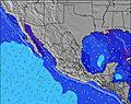 | 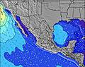 | 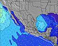 | ||||||||||||
Wave Height (m) Direction Period (s) | SSW 13 | SSW 14 | SW 12 | SSW 13 | SSW 12 | SSW 12 | SSW 12 | SW 15 | SW 14 | SW 14 | SW 13 | SSW 18 | SSW 18 | SSW 18 | SSW 16 | SSW 16 | SSW 16 | SSW 15 | SSW 14 |
Wave Graph | |||||||||||||||||||
212 | 232 | 159 | 198 | 103 | 85 | 96 | 134 | 130 | 125 | 173 | 214 | 214 | 480 | 566 | 627 | 596 | 530 | 508 | |
Wind (km/h) | |||||||||||||||||||
Wind State on-shore cross-onshore cross-shore cross-offshore off-shore glassy | glassy | glassy | on | glassy | glassy | on | glassy | glassy | on | glassy | glassy | on | glassy | cross-off | on | cross-off | cross-off | on | glassy |
High Tide | 9:00AM0.55m | 7:46PM0.47m | 8:52AM0.62m | 7:20PM0.44m | 8:56AM0.69m | 6:52PM0.44m | 9:07AM0.74m | 6:49PM0.47m | 9:25AM0.78m | 7:07PM0.51m | 9:48AM0.80m | 7:34PM0.56m | |||||||
Low Tide | 2:21AM0.33m | 3:12PM0.41m | 1:34AM0.30m | 3:24PM0.40m | 1:19AM0.23m | 3:25PM0.41m | 1:25AM0.15m | 3:24PM0.42m | 1:44AM0.05m | 3:27PM0.44m | 2:11AM-0.03m | 3:35PM0.45m | 2:42AM-0.08m | ||||||
— | 6:26 | — | — | 6:26 | — | — | 6:26 | — | — | 6:26 | — | — | 6:26 | — | — | 6:26 | — | — | |
— | — | 7:20 | — | — | 7:19 | — | — | 7:19 | — | — | 7:17 | — | — | 7:17 | — | — | 7:16 | — | |
mm | 1 | — | — | 1 | 1 | 1 | — | — | — | 1 | — | — | 21 | — | — | — | — | — | — |
Temp °C | 29 | 30 | 30 | 28 | 31 | 30 | 29 | 31 | 31 | 28 | 30 | 30 | 29 | 30 | 31 | 28 | 31 | 31 | 29 |
Feels °C | 35 | 34 | 35 | 34 | 35 | 35 | 35 | 35 | 34 | 33 | 34 | 34 | 35 | 33 | 33 | 33 | 33 | 33 | 33 |
Swell 1 Height (m) Direction Period (s) | SSW 13 | SSW 14 | SW 12 | SSW 13 | SSW 12 | SSW 12 | SSW 12 | S 9 | S 9 | S 9 | SW 13 | SW 13 | SW 13 | SSW 18 | SSW 16 | SSW 16 | SSW 16 | SSW 15 | SSW 14 |
212 | 232 | 159 | 198 | 103 | 85 | 96 | 56 | 57 | 52 | 173 | 208 | 196 | 480 | 566 | 627 | 596 | 530 | 508 | |
Swell 2 Height (m) Direction Period (s) | W 7 | SW 13 | SSE 12 | SW 16 | S 8 | S 8 | S 8 | SW 15 | SW 14 | SW 14 | S 9 | SSW 18 | SSW 18 | SW 12 | SW 12 | SW 12 | SW 12 | S 12 | S 8 |
26 | 56 | 46 | 91 | 33 | 28 | 32 | 134 | 130 | 125 | 53 | 214 | 214 | 181 | 118 | 144 | 114 | 99 | 31 | |
Swell 3 Height (m) Direction Period (s) | SW 14 | W 9 | SW 16 | SW 12 | SW 16 | SW 12 | SW 15 | SSW 12 | SW 11 | SW 11 | SW 20 | S 8 | S 8 | S 8 | S 8 | S 12 | SSE 12 | SW 11 | SW 11 |
54 | 24 | 93 | 37 | 90 | 35 | 76 | 56 | 32 | 31 | 98 | 50 | 34 | 32 | 33 | 108 | 109 | 43 | 59 | |
Wind waves Height (m) Direction Period (s) | — | — | — | — | — | — | — | — | — | — | — | — | — | — | — | — | — | — | — |
— | — | — | — | — | — | — | — | — | — | — | — | — | — | — | — | — | — | — | |
Nearest Offshore or Glassy | |||||||||||||||||||
Distance (km) | 0 | 0 | 731 | 0 | 0 | 111 | 0 | 0 | 504 | 0 | 0 | 708 | 0 | 0 | 351 | 0 | 0 | 504 | 0 |
Best forecast wave conditions in Guerrero | |||||||||||||||||||
Best forecast wave conditions in Mexico | |||||||||||||||||||
Header Global | |||||||||||||||||||
- Map Icons:
 Break
Break Live Wave Height (m)
 Live Wind Speed (km/h)
 Surf Rating (10 Max)
 Ocean Swells (m)
- Wind Speed (km/h)
Latest Updates


FREE! Surf-Forecast.com widget for your website
The surf report / weather widget below is available to embed on third party websites free of charge and provides a summary of our La Saladita surf forecast. Simply grab the html code snippet that we provide and paste it into your own site. You can choose your preferred language and metric/imperial units for the surf forecast feed to suit users of your site. Click here to get the code.
Information about the La Saladita Surf forecast
The above surf forecast table for La Saladita provides essential information for determining whether the surfing conditions will be good over the next 16 days. A general guide to surfing at La Saladita can be found by selecting the local surf guide option on the grey menu. Our La Saladita surf forecast is unique since it includes wave energy (power) that defines the real feel of the surf rather than just the height or the period. If you surf the same spot (La Saladita) regularly then make a mental note of the wave energy from the surf forecast table each time you go. Very soon you may start to choose your surf days based on the wave energy alone combined with our forecast of favourable offshore wind conditions. Our star ratings will help here and of course you will also find the usual wave height and period predictions on our surf forecasts as well as a full break down of the swell components under our advanced users option (to reveal that, click the little Einstein character under the tide times).
Further information to help with frequently asked questions about our surf forecast for La Saladita may be found under the help tab on the top menu and also by moving your mouse over the question marks on the surf forecast table itself. Please always bear in mind that the forecast is for near-shore open water and local factors at each surf break influence the actual breaking wave height, such as the beach / reef profile, water depths offshore and shelter.
La Saladita is 33 km (20 miles) from the city of Zihuatanejo. If you plan a holiday in Guerrero, look for hotels and other accommodation in Zihuatanejo. Zihuatanejo has rooms for a wide range of budgets as well as car hire and transport links.
 Nearest