

Surf Forecasts:

Kovalam surf forecast from 13 Jul 2026:
- Most powerful swell: Monday 20 Jul, 5AM (local time) - 4.5ft (1.4m), 10s period, WNW swell with 394 kJ wave energy.
Best Forecast Surf Conditions for Kovalam this week:
The most powerful waves expected at Kovalam in the next 16 days are 1.4m 10s and forecast to arrive on Monday (Jul 20) at 5AM. Winds are predicted to be cross-offshore at the time the swell arrives.
| Wave Type | Time (IST) & Date | Wave Height & Period |
|---|---|---|
| Next good surf (1 star+) | - | - |
| Best Surf | - | - |
| Most Powerful | 5AM (Mon 20th Jul) | 4.5ft (1.4m) 10s |
Table - best surf conditions forecast for Kovalam over the next 16 days.
G’day, I’m Rusty. Let’s have a look at what’s on offer at Kovalam… and straight up, I’ll be honest with you – it’s a rough stretch ahead. The whole 16-day window is a tough one for paddle surfers here. The wind is stuck in a stubborn cross-shore pattern from the WNW, blowing at 12 to 19 mph, and that’s putting a nasty cross-chop on the surface. The swell direction is mostly cross to the exposed SW-facing beach, which is never ideal. The water temp is sitting at about 80°, which is about normal for this time of year, so no surprises there.
The first real chance of anything worth paddling out for doesn’t show up until the afternoon of Monday the 21st of July, and even then, it’s just a marginal call. The swell pushes up to 3 ft from the SSW with a period of 15 seconds – that’s a long-period groundswell, which can be a bit tricky on a beach break like Kovalam, tending to throw too straight. The combined energy is moderate (640), but the wind is still cross-shore, making it lumpy. Not exactly a glowing recommendation.
Things freshen up a bit on Wednesday the 22nd of July. The afternoon brings a 5 ft swell from the WNW with a 10-second period, and the combined energy jumps to strong (1160). But again, the wind is cross-shore and the surf is still only marginal. It’s a little bigger, sure, but it’s not clean. The best day on offer is Friday the 24th of July in the morning. Swell is 5 ft from the WNW with an 11-second period, combined energy very strong at 1348, and the wind is still cross-shore. That’s about as good as it gets – and that’s not saying much. The waves will be punchy, but the chop will be a headache.
After that, the swell drops back and the conditions stay poor, with the wind never letting up. There’s a long gap of several days with no real recommendations after the 24th. For a beginner break like Kovalam, anything over 5 ft starts to get a bit much, and the cross-shore wind makes it really messy. If you’re a kite surfer, this setup is far more interesting than for paddle surfing – consistent cross-breeze and decent wave energy. For the rest of us, it’s a waiting game. Forecasts can change, and this spot is inconsistent, so a blank run like this is more normal for the area. Keep an eye on it, but don’t hold your breath.
Rusty.
Short Range ForecastMostly dry. Warm (max 29°C on Mon morning, min 24°C on Wed night). Mainly fresh winds. | Days 4-6 Weather SummaryMostly dry. Warm (max 28°C on Thu morning, min 24°C on Fri night). Mainly fresh winds. | ||||||||||||||||||||
Monday 13 | Tuesday 14 | Wednesday 15 | Thursday 16 | Friday 17 | Saturday 18 | Sunday 19 | |||||||||||||||
AM | PM | Night | AM | PM | Night | AM | PM | Night | AM | PM | Night | AM | PM | Night | AM | PM | Night | AM | PM | Night | |
Swell Height Map | 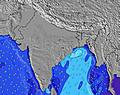 | 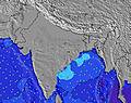 | 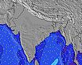 | 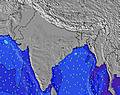 | 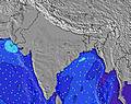 | 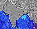 | 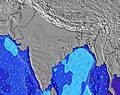 | ||||||||||||||
Wave Height (m) Direction Period (s) | W 9 | SSW 12 | SSW 12 | SSW 11 | SSW 11 | SSW 11 | SW 16 | SW 15 | SW 16 | SW 14 | SW 14 | W 10 | SW 14 | SW 14 | W 10 | W 9 | W 9 | W 10 | W 9 | W 9 | WNW 10 |
Wave Graph | |||||||||||||||||||||
215 | 169 | 196 | 180 | 173 | 173 | 158 | 145 | 155 | 203 | 167 | 184 | 169 | 130 | 181 | 170 | 205 | 267 | 175 | 140 | 386 | |
Wind (km/h) | |||||||||||||||||||||
Wind State on-shore cross-onshore cross-shore cross-offshore off-shore glassy | cross | cross | cross | cross | cross | cross | cross | cross | cross | cross | cross | cross-off | cross | cross | cross | cross | cross | cross | cross | cross | cross-off |
High Tide | 1:01PM0.75m | 00:22AM0.38m | 1:41PM0.78m | 1:24AM0.44m | 2:16PM0.80m | 2:17AM0.51m | 2:49PM0.80m | 3:05AM0.57m | 3:19PM0.79m | 3:52AM0.61m | 3:48PM0.75m | 4:37AM0.63m | 4:14PM0.71m | 5:22AM0.63m | |||||||
Low Tide | 8:03PM0.27m | 6:15AM0.06m | 8:22PM0.22m | 7:09AM0.06m | 8:47PM0.17m | 7:57AM0.08m | 9:14PM0.13m | 8:41AM0.11m | 9:42PM0.09m | 9:22AM0.17m | 10:12PM0.07m | 10:02AM0.23m | 10:42PM0.06m | ||||||||
6:09 | — | — | 6:09 | — | — | 6:09 | — | — | 6:11 | — | — | 6:11 | — | — | 6:11 | — | — | 6:11 | — | — | |
— | 6:45 | — | — | 6:45 | — | — | 6:45 | — | — | 6:45 | — | — | 6:45 | — | — | 6:44 | — | — | 6:44 | — | |
mm | — | — | — | — | — | — | — | — | — | — | — | — | — | — | — | — | — | — | — | — | — |
Temp °C | 29 | 29 | 27 | 29 | 29 | 27 | 28 | 29 | 26 | 28 | 28 | 26 | 28 | 28 | 26 | 28 | 28 | 26 | 28 | 28 | 26 |
Feels °C | 28 | 27 | 28 | 28 | 28 | 28 | 27 | 27 | 27 | 28 | 27 | 27 | 27 | 26 | 27 | 28 | 26 | 27 | 28 | 27 | 26 |
Swell 1 Height (m) Direction Period (s) | SSW 11 | SSW 12 | SSW 12 | SSW 11 | SSW 11 | SSW 11 | SSW 11 | SSW 11 | W 8 | S 10 | S 10 | W 9 | S 10 | W 10 | W 10 | SW 14 | S 9 | W 9 | S 9 | W 9 | W 10 |
157 | 169 | 196 | 180 | 173 | 173 | 158 | 119 | 89 | 108 | 106 | 94 | 92 | 92 | 181 | 123 | 38 | 170 | 56 | 140 | 220 | |
Swell 2 Height (m) Direction Period (s) | SW 21 | SW 20 | SW 19 | SW 18 | SW 17 | SW 16 | SW 16 | SW 15 | S 11 | SW 14 | SW 14 | S 10 | W 9 | SW 14 | SW 14 | S 9 | SW 13 | S 9 | SW 13 | S 9 | S 9 |
70 | 136 | 126 | 109 | 104 | 163 | 155 | 145 | 112 | 203 | 167 | 96 | 64 | 130 | 118 | 36 | 109 | 37 | 83 | 56 | 53 | |
Swell 3 Height (m) Direction Period (s) | SE 9 | SE 9 | SE 8 | SE 8 | — | — | — | — | SW 16 | W 10 | W 9 | SW 14 | SW 14 | S 10 | S 10 | — | — | SW 13 | SW 23 | SW 13 | SW 12 |
3 | 3 | 11 | 3 | — | — | — | — | 155 | 16 | 42 | 155 | 169 | 66 | 65 | — | — | 85 | 21 | 79 | 72 | |
Wind waves Height (m) Direction Period (s) | W 9 | W 5 | W 7 | W 7 | W 7 | W 7 | W 7 | W 8 | W 8 | W 8 | W 8 | W 10 | W 4 | W 5 | W 5 | W 9 | W 9 | W 10 | W 9 | W 4 | WNW 10 |
215 | 95 | 135 | 131 | 159 | 127 | 108 | 138 | 142 | 89 | 114 | 184 | 13 | 39 | 47 | 170 | 205 | 267 | 175 | 25 | 386 | |
Nearest Offshore or Glassy | |||||||||||||||||||||
Distance (km) | 506 | 561 | 120 | 508 | 802 | 561 | 506 | 561 | 561 | 506 | 576 | 127 | 506 | 561 | 127 | 508 | 127 | 561 | 506 | 561 | 120 |
Best forecast wave conditions in Kerala | |||||||||||||||||||||
Best forecast wave conditions in India | |||||||||||||||||||||
Header Global | |||||||||||||||||||||
- Map Icons:
 Break
Break Live Wave Height (m)
 Live Wind Speed (km/h)
 Surf Rating (10 Max)
 Ocean Swells (m)
- Wind Speed (km/h)


FREE! Surf-Forecast.com widget for your website
The surf report / weather widget below is available to embed on third party websites free of charge and provides a summary of our Kovalam surf forecast. Simply grab the html code snippet that we provide and paste it into your own site. You can choose your preferred language and metric/imperial units for the surf forecast feed to suit users of your site. Click here to get the code.
Information about the Kovalam Surf forecast
The above surf forecast table for Kovalam provides essential information for determining whether the surfing conditions will be good over the next 16 days. A general guide to surfing at Kovalam can be found by selecting the local surf guide option on the grey menu. Our Kovalam surf forecast is unique since it includes wave energy (power) that defines the real feel of the surf rather than just the height or the period. If you surf the same spot (Kovalam) regularly then make a mental note of the wave energy from the surf forecast table each time you go. Very soon you may start to choose your surf days based on the wave energy alone combined with our forecast of favourable offshore wind conditions. Our star ratings will help here and of course you will also find the usual wave height and period predictions on our surf forecasts as well as a full break down of the swell components under our advanced users option (to reveal that, click the little Einstein character under the tide times).
Further information to help with frequently asked questions about our surf forecast for Kovalam may be found under the help tab on the top menu and also by moving your mouse over the question marks on the surf forecast table itself. Please always bear in mind that the forecast is for near-shore open water and local factors at each surf break influence the actual breaking wave height, such as the beach / reef profile, water depths offshore and shelter.
Kovalam is 12 km (7 miles) from the city of Neyyattinkara. If you plan a holiday in Kerala, look for hotels and other accommodation in Neyyattinkara. Neyyattinkara has rooms for a wide range of budgets as well as car hire and transport links.
 Nearest